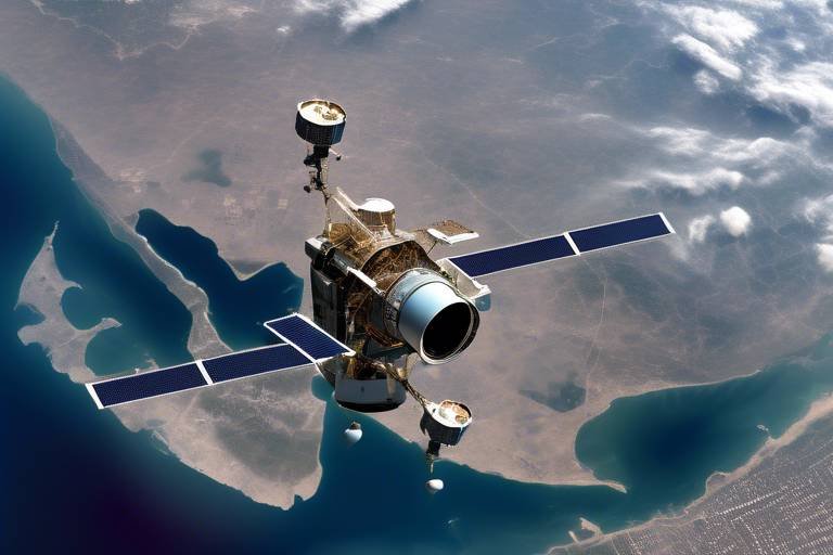
How Satellites Support Operational Effectiveness in Defense
In today's rapidly evolving battlefield, satellites have become indispensable tools that enhance the operational effectiveness of defense forces worldwide. Imagine a vast chessboard where every move is critical; satellites serve as the eyes in the sky, providing crucial information that can turn the tide of a conflict. They facilitate communication, surveillance, navigation, and intelligence gathering, all of which are vital for making informed decisions and ensuring mission success. In this article, we will delve into how these orbiting marvels empower defense operations and help maintain national security.
One of the most significant contributions of satellites to defense operations is their ability to provide robust communication channels. In the heat of battle, military units must maintain seamless connectivity to share real-time information and coordinate their actions effectively. Think of it like a well-rehearsed symphony; each musician must be in perfect harmony with the others to create a beautiful performance. Satellites enable this harmony, ensuring that every unit—whether on land, sea, or in the air—can communicate without interruption. This capability is critical for mission success, allowing for quick decision-making and a unified response to emerging threats.
Surveillance and reconnaissance are other areas where satellites excel. Equipped with advanced imaging and monitoring technologies, these satellites offer a comprehensive view of the battlefield. They allow defense forces to gather intelligence on enemy movements and assess battlefield conditions effectively. Imagine trying to navigate a maze without a map; satellites provide that essential map, illuminating paths that would otherwise remain hidden. With the ability to collect data continuously, satellites ensure that defense agencies have up-to-date information, which is essential for tactical planning and operational adjustments in dynamic environments.
Continuous data collection is one of the standout features of modern satellites. They provide defense agencies with real-time updates on various aspects of the battlefield, from troop movements to environmental changes. This constant flow of information is akin to having a live feed of the battlefield, enabling commanders to make informed decisions on the fly. The ability to adapt and respond to changing conditions is crucial in any military operation, and satellites make this possible.
Modern satellites are equipped with high-resolution cameras that capture detailed images of terrain and assets. This technology aids in strategic assessments, enhancing situational awareness for ground forces. Imagine being able to zoom in on a specific area from space; that’s the power of high-resolution imaging. It allows military planners to analyze landscapes, identify potential threats, and devise strategies that can lead to mission success.
Furthermore, multispectral satellites can detect various wavelengths, allowing for the identification of specific targets and environmental conditions. This capability is crucial for effective reconnaissance missions, as it enables defense forces to see beyond the visible spectrum. Just like a painter uses different colors to create depth in a landscape, multispectral sensing adds layers of information that can be critical for operational planning.
Another vital function of satellites is their role in Global Positioning Systems (GPS). GPS technology enables precise navigation, which is essential for troop movements, mission planning, and ensuring the accuracy of guided munitions. Imagine trying to find your way in a foreign city without a map or GPS; it would be chaotic! In military operations, precision is everything, and satellites provide the necessary guidance to ensure that every move is calculated and effective.
Satellites also play a crucial role in intelligence gathering. They provide critical information on enemy capabilities, troop deployments, and potential threats. This intelligence is essential for strategic planning and allows military leaders to stay one step ahead of their adversaries. Just like a detective piecing together clues to solve a mystery, defense agencies rely on satellite data to form a complete picture of the operational landscape.
By intercepting and analyzing electronic communications, satellites contribute to signal intelligence (SIGINT). This enhances situational awareness and enables informed decision-making in defense operations. Imagine having the ability to listen in on an enemy's plans; that’s the advantage SIGINT provides. It allows for proactive measures rather than reactive ones, giving defense forces the upper hand.
Moreover, satellites deliver geospatial intelligence (GEOINT) through mapping and analysis of geographic data. This information supports mission planning and operational effectiveness by providing commanders with essential visualizations. Just like a navigator uses maps to chart a course, military leaders use GEOINT to plan their strategies effectively.
Finally, satellites facilitate joint operations among allied forces by ensuring interoperability and communication. In complex operational environments, the ability to coordinate efforts and share situational awareness is invaluable. Think of it as a team sport; every player must work together seamlessly to achieve victory. Satellites make this collaboration possible, allowing for a unified approach to defense challenges.
- How do satellites enhance military communication? Satellites provide robust channels for real-time information sharing, ensuring that military units can coordinate effectively during operations.
- What role do satellites play in surveillance? They offer advanced imaging and monitoring capabilities, allowing for comprehensive surveillance and intelligence gathering on enemy movements.
- How does GPS technology benefit defense operations? GPS enables precise navigation for troop movements and mission planning, ensuring accuracy in military operations.
- What is the significance of signal intelligence? SIGINT allows defense forces to intercept and analyze enemy communications, enhancing situational awareness and decision-making.
- How do satellites support joint operations? They ensure interoperability and communication among allied forces, facilitating coordinated efforts in complex environments.
Enhanced Communication
In the fast-paced world of defense operations, communication is the backbone that supports every mission. Imagine a bustling battlefield where every second counts; the ability to communicate effectively can make the difference between success and failure. This is where satellites come into play, providing robust communication channels that ensure seamless connectivity among military units. Whether it's coordinating troop movements, sharing intelligence, or relaying commands from command centers, satellites enable real-time information sharing that is critical for mission success.
With satellites, military units can maintain constant communication, even in the most remote areas where traditional communication methods may falter. This capability is especially vital during joint operations involving multiple branches of the military or allied forces. The integration of satellite communication systems allows for a unified command structure, where every participant has access to the same information, thereby enhancing operational effectiveness.
Moreover, the advancements in satellite technology have led to the development of secure communication channels. These channels safeguard sensitive information from interception, ensuring that only authorized personnel can access critical data. Here’s a quick overview of how satellite communication enhances operational effectiveness:
| Feature | Benefit |
|---|---|
| Real-Time Connectivity | Enables immediate sharing of information and orders, reducing response times. |
| Global Coverage | Ensures communication capabilities in remote and hostile environments. |
| Secure Channels | Protects sensitive data from enemy interception. |
| Interoperability | Facilitates joint operations among different military branches and allied forces. |
In addition to these features, satellite communication systems are equipped with advanced technologies that enhance their functionality. For instance, the use of data compression techniques allows for the transmission of large amounts of information without overwhelming bandwidth limitations. This means that everything from video feeds to detailed maps can be shared in real-time, providing commanders with a comprehensive view of the battlefield.
Furthermore, satellites also support mobile communication, which is crucial for units on the move. With portable satellite communication devices, soldiers can maintain contact with their command centers and fellow troops, regardless of their location. This capability not only boosts morale but also ensures that everyone is on the same page, which is essential for executing complex maneuvers.
In conclusion, the role of satellites in enhancing communication within defense operations cannot be overstated. They provide the necessary infrastructure for seamless, secure, and real-time communication, which is vital for mission success. As technology continues to evolve, we can expect even more innovative solutions that will further strengthen the communication capabilities of military forces around the globe.
Surveillance and Reconnaissance
In the realm of defense, are the eyes and ears of military operations. Imagine being in a dark room without any light; you would struggle to navigate, right? Now, think of how satellites illuminate the battlefield, providing a clear view of enemy movements and environmental conditions. These advanced systems are equipped with state-of-the-art imaging and monitoring capabilities that allow defense forces to gather crucial intelligence. The ability to see what’s happening on the ground from thousands of miles above is not just a technological marvel; it’s a game-changer in military strategy.
One of the most compelling features of satellite technology is its real-time data collection. This continuous stream of information is invaluable for tactical planning. For instance, when a military operation is underway, commanders need to make split-second decisions based on the latest intelligence. Satellites facilitate this by providing up-to-the-minute updates about troop movements, weather conditions, and potential threats. The importance of having this information at your fingertips cannot be overstated, as it directly influences the success of missions.
Modern satellites are equipped with high-resolution cameras that can capture detailed images of terrain and enemy assets. Think of it as having a magnifying glass that reveals the smallest details. These images are not just pretty pictures; they are critical for strategic assessments, allowing ground forces to understand the battlefield landscape better. For example, the clarity of these images can help identify potential ambush points or safe zones, enhancing the situational awareness of troops on the ground.
Another fascinating aspect of satellite technology is multispectral sensing. This capability enables satellites to detect various wavelengths of light, which can be instrumental in identifying specific targets and assessing environmental conditions. Imagine being able to see through the fog of war; that’s what multispectral satellites do. They can differentiate between various materials, such as vegetation and metal, which is crucial for effective reconnaissance missions. This technology ensures that military planners have all the data they need to make informed decisions.
To make sense of the vast amounts of data collected, advanced data visualization and analysis tools are employed. These tools transform raw satellite data into actionable intelligence. For instance, by using Geographic Information Systems (GIS), analysts can create detailed maps that visualize troop movements, supply routes, and potential threats. This visual representation of data not only aids in planning but also enhances communication among military units, ensuring everyone is on the same page.
Moreover, satellites do not operate in isolation; they integrate seamlessly with other military technologies. For instance, drones and ground-based sensors can relay information back to satellites, creating a comprehensive surveillance network. This interconnectedness allows for a holistic view of the operational environment, further enhancing the effectiveness of defense strategies. It’s like having a well-coordinated team where everyone knows their role and works together to achieve a common goal.
In summary, the role of satellites in is indispensable. They provide a level of insight and situational awareness that is crucial for modern military operations. As technology continues to evolve, the capabilities of satellites will only expand, making them an even more vital component of defense strategies worldwide.
- What are the main functions of satellites in defense?
Satellites primarily support communication, surveillance, navigation, and intelligence gathering, enhancing overall operational effectiveness. - How do satellites improve situational awareness?
By providing real-time data and high-resolution imagery, satellites enable commanders to make informed decisions based on current battlefield conditions. - What is multispectral sensing?
Multispectral sensing allows satellites to detect different wavelengths of light, helping in identifying specific targets and environmental conditions. - How does satellite technology integrate with other military systems?
Satellites work in conjunction with drones and ground-based sensors to create a comprehensive surveillance network for better operational planning.
Real-Time Data Collection
In today's fast-paced and ever-changing battlefield, the ability to collect real-time data is not just an advantage; it's a necessity. Satellites serve as the backbone of this data collection process, continuously transmitting vital information that informs defense strategies and operational decisions. Imagine being in a high-stakes game where every second counts; that's the reality for military commanders who rely on timely and accurate data to make critical choices. With satellites overhead, they can monitor enemy movements, assess environmental conditions, and adjust their tactics on the fly.
One of the standout features of satellite technology is its capability to gather data from various sources, providing a comprehensive picture of the operational landscape. For instance, satellites can collect imagery data, signals intelligence, and even environmental data. This multifaceted approach ensures that decision-makers are not left in the dark. Here are some key aspects of real-time data collection through satellites:
- Continuous Monitoring: Satellites are in a constant state of observation, which means they can provide updates on troop movements and changes in the battlefield environment almost instantaneously.
- Data Fusion: By integrating various types of data, such as visual imagery and electronic signals, satellites can create a more complete and actionable intelligence picture.
- Automated Alerts: Advanced algorithms allow satellites to detect anomalies and send alerts to commanders, enabling them to react swiftly to potential threats.
Moreover, the integration of satellite data with ground-based systems enhances operational effectiveness. For example, when a satellite detects unusual activity in a specific area, ground forces can be directed to investigate further. This synergy between satellite surveillance and ground operations creates a dynamic feedback loop, improving situational awareness and response times.
To illustrate the importance of real-time data collection, consider the following table that highlights the types of data collected and their applications:
| Data Type | Application |
|---|---|
| Imagery Data | Assessing enemy positions and terrain analysis |
| Signals Intelligence (SIGINT) | Intercepting enemy communications for strategic insights |
| Environmental Data | Understanding weather conditions that could impact operations |
In conclusion, the ability to collect real-time data through satellite technology is a game-changer for defense operations. It not only enhances situational awareness but also empowers military leaders to make informed decisions that can significantly influence the outcome of missions. As technology continues to evolve, the role of satellites in real-time data collection will undoubtedly become even more critical, ensuring that defense forces remain one step ahead in an increasingly complex operational environment.
Q: How do satellites collect real-time data?
A: Satellites utilize various sensors and imaging technologies to continuously gather data, which is then transmitted back to military command centers for analysis.
Q: What types of data can satellites provide?
A: Satellites can provide imagery data, signals intelligence, environmental data, and more, all of which are crucial for effective military operations.
Q: How does real-time data collection improve military operations?
A: Real-time data collection enhances situational awareness, allows for swift decision-making, and improves coordination among military units, ultimately leading to greater mission success.
High-Resolution Imaging
High-resolution imaging has revolutionized the way defense forces conduct reconnaissance and gather intelligence. With the ability to capture stunningly detailed images from space, modern satellites are equipped with advanced cameras that provide a clear view of the battlefield. Imagine having the capability to see every detail of a military installation or enemy troop movement from hundreds of miles away; this is the power of high-resolution imaging. It allows commanders to assess situations with unprecedented clarity, enabling them to make informed decisions that can significantly impact the outcome of missions.
The importance of high-resolution imaging cannot be overstated. For instance, during military operations, having access to detailed images can help in identifying potential threats and understanding the terrain. This capability allows military planners to devise strategies that minimize risks and maximize effectiveness. High-resolution images can reveal:
- Enemy positions and movements
- Infrastructure and logistical routes
- Geographical features that may influence operations
- Changes in enemy deployments over time
Moreover, the integration of high-resolution imaging with other technologies enhances its effectiveness. When combined with artificial intelligence and machine learning, these images can be analyzed rapidly to provide actionable insights. For example, algorithms can detect changes in patterns or identify unusual activities, alerting defense personnel to potential threats before they escalate.
In addition, the use of high-resolution imaging extends beyond immediate military applications. It plays a vital role in humanitarian missions, disaster response, and environmental monitoring. By providing detailed imagery of affected areas, defense forces can assess damage and coordinate relief efforts more effectively. This versatility highlights the multifaceted benefits of high-resolution imaging in both defense and civilian contexts.
In conclusion, high-resolution imaging is a game-changer for defense operations. It empowers military leaders with critical information that enhances situational awareness and operational effectiveness. As technology continues to evolve, we can only expect these imaging capabilities to become even more sophisticated, providing defense forces with unparalleled advantages in the field.
- What is high-resolution imaging? High-resolution imaging refers to the ability of satellites to capture detailed images of the Earth's surface, providing critical information for military and civilian applications.
- How does high-resolution imaging benefit defense operations? It enhances situational awareness, allows for better strategic planning, and helps identify potential threats by providing clear visuals of enemy movements and terrain.
- Can high-resolution imaging be used for non-military purposes? Yes, it is also used in humanitarian missions, disaster response, and environmental monitoring, showcasing its versatility beyond defense.
- What technologies enhance high-resolution imaging? The integration of artificial intelligence and machine learning allows for rapid analysis of images, improving the ability to detect changes and identify threats.
Multispectral Sensing
Multispectral sensing represents a groundbreaking advancement in satellite technology that significantly enhances reconnaissance capabilities. By utilizing sensors that capture data across multiple wavelengths of light, these satellites can provide a rich tapestry of information that is crucial for military operations. Imagine being able to see not just the visible spectrum, but also infrared and ultraviolet light—this capability allows defense forces to detect objects and conditions that would otherwise remain hidden. For instance, multispectral sensors can identify camouflaged vehicles or even monitor vegetation health, which can indicate enemy movement or supply routes.
One of the most powerful aspects of multispectral sensing is its ability to analyze environmental conditions. For example, these sensors can detect changes in soil moisture or temperature, giving military planners insights into potential obstacles or advantages on the battlefield. This level of detail is invaluable, as it allows for more informed decisions regarding troop movements and resource allocation. By understanding the terrain and environmental factors, commanders can devise strategies that maximize their operational effectiveness.
Furthermore, the data collected through multispectral sensing can be integrated with other intelligence sources to create a comprehensive operational picture. This integration is where the magic happens—when you combine high-resolution imagery with environmental data, you get a multidimensional view that enhances situational awareness. For example, if a satellite detects an increase in infrared signatures in a specific area, military analysts can correlate that with troop movements or supply chain activities, leading to quicker and more accurate responses.
To better illustrate the capabilities of multispectral sensing, consider the following table that outlines the different wavelengths utilized and their applications:
| Wavelength Range | Application |
|---|---|
| Visible Light | Identifying objects and assessing terrain |
| Infrared | Detecting heat signatures, such as vehicles or personnel |
| Ultraviolet | Monitoring environmental conditions and detecting chemical agents |
In summary, multispectral sensing is not just a technological marvel; it's a game-changer for defense operations. By providing a detailed and nuanced understanding of the battlefield, it empowers military leaders to make informed decisions that can mean the difference between mission success and failure. As we continue to advance in satellite technology, the potential for multispectral sensing to transform military intelligence and operational effectiveness is boundless.
- What is multispectral sensing? - It is a technology that captures data across multiple wavelengths of light, providing detailed information about objects and environmental conditions.
- How does multispectral sensing improve military operations? - By offering insights into hidden objects, environmental factors, and troop movements, it enhances situational awareness and decision-making.
- Can multispectral data be integrated with other intelligence sources? - Yes, combining multispectral data with other types of intelligence creates a comprehensive operational picture for military planners.
Global Positioning Systems (GPS)
Global Positioning Systems (GPS) have revolutionized the way military operations are conducted. Imagine a world where troops can navigate through treacherous terrain with pinpoint accuracy, where every maneuver is calculated down to the last meter. GPS technology provides that level of precision, allowing for seamless troop movements and mission planning. This is not just about getting from point A to point B; it’s about doing so efficiently and effectively, minimizing the risk of getting lost or ambushed. With GPS, military units can coordinate their movements in real-time, ensuring that they are always one step ahead of the enemy.
The functionality of GPS extends beyond just navigation. In the heat of battle, every second counts, and having the ability to accurately position assets—whether they are ground troops, vehicles, or aerial support—can make all the difference. This technology allows for the integration of various platforms, creating a cohesive operational picture that enhances situational awareness. For example, a soldier on the ground can relay their exact coordinates to a commanding officer, who can then deploy air support or reinforcements with incredible accuracy.
Moreover, GPS plays a critical role in the effectiveness of guided munitions. When launching precision strikes, knowing the exact location of both the target and friendly forces is vital. GPS-guided weapons can strike with remarkable accuracy, reducing collateral damage and increasing mission success rates. In essence, GPS not only helps in navigating but also in delivering decisive blows to enemy positions.
To further illustrate the importance of GPS in defense operations, consider the following key points:
- Enhanced Navigation: Troops can navigate challenging environments without traditional maps, reducing the chances of disorientation.
- Real-Time Coordination: Units can communicate their positions, allowing for synchronized movements and operations.
- Improved Targeting: Guided munitions can be deployed with high accuracy, ensuring that strikes hit their intended targets.
In conclusion, the integration of Global Positioning Systems into military operations has transformed how defense forces operate. This technology not only enhances navigation but also contributes to strategic planning and execution, ultimately leading to greater operational effectiveness. As warfare continues to evolve, the reliance on GPS will only increase, making it an indispensable tool in modern defense.
Q1: How does GPS work in military operations?
A1: GPS works by using a network of satellites that transmit signals to GPS receivers on the ground. These receivers calculate their exact location based on the time it takes for signals to arrive from multiple satellites.
Q2: What are the advantages of using GPS in defense?
A2: The advantages include enhanced navigation and positioning accuracy, real-time coordination among units, improved targeting capabilities for munitions, and overall increased operational effectiveness.
Q3: Can GPS be jammed or spoofed?
A3: Yes, GPS signals can be jammed or spoofed, which is why military forces often use additional navigational aids and backup systems to ensure reliability in critical situations.
Intelligence Gathering
In the realm of defense operations, stands as a cornerstone of strategic success. Satellites play a crucial role in this process, offering a wealth of information that can significantly influence military decisions. Imagine a chess game where every move is visible to you before your opponent makes it; that’s the kind of advantage satellites provide. They deliver critical insights into enemy capabilities, troop deployments, and potential threats, creating a comprehensive picture that is essential for effective planning.
One of the most significant aspects of intelligence gathering through satellites is the ability to intercept and analyze electronic communications. This process, known as Signal Intelligence (SIGINT), involves capturing signals from various sources, including radios, phones, and other communication devices. By decoding these signals, defense agencies can gain a deeper understanding of enemy intentions and capabilities. For instance, if a satellite picks up chatter about troop movements or logistical support, that information can be invaluable for anticipating enemy actions and adjusting strategies accordingly.
Moreover, satellites contribute to Geospatial Intelligence (GEOINT), which involves mapping and analyzing geographic data. This type of intelligence is crucial for mission planning and operational effectiveness. With the help of satellites, commanders can visualize terrain, identify key locations, and assess environmental conditions that may affect operations. For example, a satellite image showing the layout of a city can help military planners devise effective entry and exit strategies, ensuring that troops are not caught off guard.
To illustrate the impact of intelligence gathering through satellites, consider the following table that highlights key types of intelligence and their contributions:
| Type of Intelligence | Description | Impact on Operations |
|---|---|---|
| Signal Intelligence (SIGINT) | Intercepts electronic communications to analyze enemy movements and plans. | Enhances situational awareness and informs decision-making. |
| Geospatial Intelligence (GEOINT) | Provides detailed maps and geographic data for operational planning. | Supports strategic assessments and improves mission effectiveness. |
In addition to SIGINT and GEOINT, the integration of real-time data collection capabilities further amplifies the effectiveness of intelligence gathering. Satellites can continuously monitor various areas, feeding back critical information that allows defense agencies to adapt quickly to changing situations. This is particularly vital in dynamic environments where threats can emerge unexpectedly. The ability to receive up-to-date intelligence means that military leaders can make informed decisions almost instantaneously, significantly increasing the chances of mission success.
Ultimately, the fusion of satellite technology with intelligence gathering creates a powerful tool for defense operations. It enables a proactive approach to military strategy, where commanders are not merely reacting to threats but are instead positioned to anticipate and counteract them. As we continue to advance technologically, the role of satellites in intelligence gathering will only become more pronounced, further enhancing operational effectiveness and ensuring that our defense forces remain one step ahead.
- What is the primary role of satellites in intelligence gathering?
Satellites provide critical information on enemy capabilities, troop movements, and potential threats, aiding in strategic planning. - How does Signal Intelligence (SIGINT) work?
SIGINT involves intercepting and analyzing electronic communications to enhance situational awareness. - What is Geospatial Intelligence (GEOINT)?
GEOINT involves mapping and analyzing geographic data to support mission planning and operational effectiveness.
Signal Intelligence (SIGINT)
Signal Intelligence, commonly referred to as SIGINT, is a critical component of modern defense operations. It involves the interception and analysis of electronic communications, which can include anything from radio transmissions to satellite communications. Imagine being able to listen in on the conversations of your enemy or monitor their movements without them even knowing. This is the power of SIGINT, and it provides defense agencies with invaluable insights that can shape the outcome of missions.
One of the main advantages of SIGINT is its ability to enhance situational awareness. By capturing signals from various sources, defense forces can gain a clearer picture of the battlefield. This real-time data allows commanders to make informed decisions quickly, ensuring that they stay one step ahead of potential threats. For instance, if a military unit can intercept enemy communications indicating a planned attack, they can adjust their strategies accordingly, potentially thwarting the enemy's plans before they even begin.
Furthermore, SIGINT plays a vital role in identifying enemy capabilities. By analyzing the types of communication equipment and frequencies used by adversaries, defense agencies can assess their technological prowess and operational readiness. This information is crucial for strategic planning, as it helps military leaders understand what they are up against and devise appropriate countermeasures. In this sense, SIGINT acts like a magnifying glass, revealing details that might otherwise remain hidden in the chaos of conflict.
To illustrate the significance of SIGINT in defense operations, consider the following table that highlights key aspects of its application:
| Aspect | Description |
|---|---|
| Interception | Capturing enemy communications to gather intelligence. |
| Analysis | Examining intercepted signals to derive actionable insights. |
| Strategic Planning | Using SIGINT data to inform military strategies and operations. |
| Countermeasures | Developing responses based on the capabilities and intentions of adversaries. |
In addition to its direct applications, SIGINT also supports other intelligence disciplines, such as Geospatial Intelligence (GEOINT) and Human Intelligence (HUMINT). By providing a comprehensive view of the operational environment, SIGINT enhances the effectiveness of these other intelligence sources, creating a more holistic understanding of the battlefield.
In conclusion, the role of Signal Intelligence in defense operations cannot be overstated. It not only provides critical insights into enemy activities but also enhances overall situational awareness and strategic planning. As technology continues to evolve, the importance of SIGINT will only grow, making it an indispensable tool for modern military operations.
- What is Signal Intelligence (SIGINT)?
It is the interception and analysis of electronic communications to gather intelligence. - How does SIGINT enhance situational awareness?
By providing real-time data on enemy communications, allowing for informed decision-making. - What types of communications are intercepted in SIGINT?
It includes radio transmissions, satellite communications, and other electronic signals. - Why is SIGINT important for strategic planning?
It helps military leaders understand enemy capabilities and plan countermeasures effectively.
Geospatial Intelligence (GEOINT)
Geospatial Intelligence, often abbreviated as GEOINT, is a critical component of modern defense operations, providing commanders with vital insights that enhance operational effectiveness. By harnessing the power of satellite imagery and geographic information systems (GIS), GEOINT allows military leaders to visualize the battlefield in intricate detail. This capability is not merely about observing the terrain; it’s about understanding it. Imagine trying to navigate a dense forest without a map or compass; that’s the challenge military forces face without GEOINT. The data collected through satellites gives them the tools to make informed decisions, strategize effectively, and adapt to rapidly changing conditions.
One of the standout features of GEOINT is its ability to integrate various data sources, creating a comprehensive picture of the operational environment. For instance, by combining satellite imagery with data from drones and ground sensors, military planners can achieve a level of situational awareness that was previously unimaginable. This integration allows for the identification of key terrain features, enemy positions, and logistical routes, which are essential for mission planning. In essence, GEOINT transforms raw data into actionable intelligence, enabling forces to anticipate enemy movements and adjust their strategies accordingly.
Moreover, the applications of GEOINT extend beyond mere surveillance. It plays a pivotal role in targeting and mission planning. By analyzing geographic data, military analysts can identify high-value targets and assess the potential impact of various tactical options. For example, a high-resolution satellite image can reveal the layout of an enemy base, allowing commanders to devise a plan that maximizes effectiveness while minimizing risks. This level of detail is crucial when lives are on the line and success hinges on precise execution.
To illustrate the significance of GEOINT in modern military operations, consider the following table that outlines its key benefits:
| Benefit | Description |
|---|---|
| Enhanced Situational Awareness | Provides a comprehensive view of the battlefield, helping commanders make informed decisions. |
| Improved Targeting | Enables precise identification of targets and assessment of potential impacts. |
| Operational Planning | Facilitates the development of effective strategies by analyzing terrain and enemy positions. |
| Risk Mitigation | Helps in identifying threats and minimizing risks to personnel and assets. |
In conclusion, the role of Geospatial Intelligence in defense operations cannot be overstated. It is a powerful tool that empowers military leaders with the information they need to navigate complex environments and make strategic decisions. As technology continues to advance, the capabilities of GEOINT will only improve, further enhancing its importance in ensuring mission success.
- What is Geospatial Intelligence (GEOINT)?
GEOINT is the collection and analysis of geographic data to support military operations and decision-making.
- How does GEOINT enhance military operations?
It provides detailed imagery and data that improve situational awareness, targeting, and operational planning.
- What technologies are used in GEOINT?
GEOINT utilizes satellite imagery, GIS, drones, and various data analytics tools to gather and analyze information.
- Why is GEOINT important for mission success?
It allows military forces to anticipate enemy movements, assess battlefield conditions, and make informed strategic decisions.
Support for Joint Operations
In the complex theater of modern warfare, the ability to coordinate effectively among various military branches and allied forces is paramount. This is where satellites step in as a game-changer, facilitating joint operations that can significantly enhance operational effectiveness. Imagine a symphony orchestra where every musician must be in perfect harmony; satellites act as the conductor, ensuring that all units are synchronized and working towards a common goal. With robust satellite communication systems, military forces can share real-time information, enabling them to respond swiftly to changing circumstances on the battlefield.
One of the most significant advantages of satellite support in joint operations is the enhanced interoperability it provides. Different military branches, each with its own communication systems and protocols, can seamlessly integrate their operations through satellite links. This interoperability allows for a unified command structure, where information flows freely and quickly between air, land, and naval forces. For instance, a naval fleet can receive real-time intelligence from ground forces, while air units can provide aerial support based on the latest battlefield data. Such a cohesive approach not only improves the efficiency of operations but also increases the likelihood of mission success.
Moreover, satellites enable shared situational awareness, which is critical in joint operations. When multiple forces are engaged in a single mission, understanding the overall battlefield dynamics becomes essential. Satellites provide comprehensive surveillance data that can be accessed by all participating units, allowing them to visualize enemy movements, assess terrain conditions, and plan their strategies accordingly. This shared information creates a common operational picture, reducing the chances of miscommunication or friendly fire incidents.
The integration of satellite technology also allows for the execution of complex maneuvers that were previously impossible. For example, during multinational exercises, forces from different countries can coordinate airstrikes, troop movements, and logistical support in real-time, thanks to satellite communications. This capability not only enhances operational effectiveness but also builds trust and camaraderie among allied forces, which is vital for long-term partnerships in defense.
In summary, the support for joint operations provided by satellites is not just about communication; it's about creating a cohesive and responsive military force. By ensuring interoperability, enhancing situational awareness, and enabling complex coordination, satellites play a vital role in modern defense strategies. As military operations continue to evolve, the reliance on satellite technology will only grow stronger, paving the way for more effective and unified defense efforts across the globe.
- How do satellites enhance communication in joint military operations?
Satellites provide robust communication channels that enable real-time information sharing among various military branches, ensuring seamless coordination and operational effectiveness. - What is the role of satellites in surveillance during joint operations?
Satellites offer advanced imaging capabilities that allow for comprehensive surveillance, helping defense forces gather intelligence on enemy movements and assess battlefield conditions effectively. - Can satellites improve the accuracy of military operations?
Yes, satellites enable precise navigation through GPS technology, which is crucial for troop movements and ensuring the accuracy of guided munitions. - What benefits do satellites provide for allied forces?
Satellites facilitate interoperability and communication among allied forces, allowing for coordinated efforts and shared situational awareness in complex operational environments.
Frequently Asked Questions
- How do satellites enhance communication in defense operations?
Satellites provide robust communication channels that ensure seamless connectivity among military units. This enables real-time information sharing and coordination during operations, which is absolutely critical for mission success. With satellites, troops can communicate instantly, no matter where they are on the globe, making it easier to respond to changing situations.
- What role do satellites play in surveillance and reconnaissance?
Satellites are equipped with advanced imaging and monitoring capabilities that allow defense forces to gather intelligence on enemy movements and assess battlefield conditions effectively. They can continuously collect data, providing up-to-date information essential for tactical planning and operational adjustments in dynamic environments.
- How does GPS technology utilized by satellites benefit military operations?
Global Positioning Systems (GPS) enabled by satellites provide precise navigation, which is vital for troop movements, mission planning, and ensuring the accuracy of guided munitions. This technology allows military forces to navigate accurately in unfamiliar terrains, enhancing operational effectiveness.
- What is the significance of intelligence gathering through satellites?
Satellites play a crucial role in intelligence gathering by providing critical information on enemy capabilities, troop deployments, and potential threats. This information is essential for strategic planning and helps commanders make informed decisions to ensure mission success.
- How do satellites support joint operations among allied forces?
Satellites facilitate joint operations by ensuring interoperability and communication among allied forces. They allow for coordinated efforts and shared situational awareness in complex operational environments, making it easier for different military branches to work together effectively.