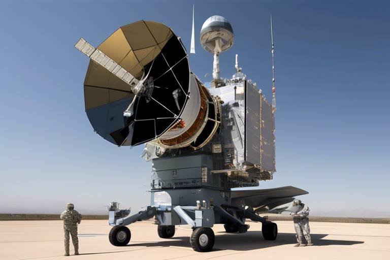
How Satellites Enhance Military Strategy Development
In today's fast-paced world, the dynamics of warfare have transformed dramatically, and at the heart of this evolution lies the **pivotal role of satellites**. These high-tech marvels orbiting our planet are not just for GPS navigation or weather forecasting; they have become indispensable tools in the realm of military strategy. Imagine a chess game where every piece on the board is constantly monitored and analyzed – that’s how modern military operations function with the aid of satellite technology. This article delves into how satellites enhance **situational awareness**, **intelligence gathering**, and **operational planning** for defense forces around the globe.
One of the most significant contributions of satellites is the provision of **satellite imagery**, which serves as a crucial component of visual intelligence. Think of it as having a bird's-eye view of the battlefield, allowing military strategists to assess terrain, monitor enemy movements, and plan operations with remarkable precision. This capability not only enhances decision-making in the field but also transforms how military leaders approach **tactical planning**. The ability to visualize the landscape and anticipate enemy actions can be the difference between success and failure in military operations.
In the chaos of warfare, effective communication is vital. This is where **communication satellites** come into play, facilitating real-time communication among military units. Imagine trying to coordinate a complex dance without being able to see your partners – it would be nearly impossible! Communication satellites ensure that all units are on the same page, enabling coordinated efforts during operations. They provide secure channels that are essential for **strategic command and control**, ensuring that critical information flows seamlessly from the top brass to the front lines.
The integrity and security of data transmitted via satellites are paramount, especially in military contexts. Advanced encryption methods protect sensitive military communications from interception and cyber threats. Just like a vault secures valuable treasures, these encryption techniques safeguard crucial information from prying eyes. Without robust security measures, the risk of data breaches could jeopardize entire operations.
Various encryption techniques are employed to safeguard military satellite communications. These include:
- Symmetric Encryption: This method uses the same key for both encryption and decryption, making it fast and efficient.
- Asymmetric Encryption: In contrast, this technique uses a pair of keys – a public key for encryption and a private key for decryption, enhancing security.
By utilizing these methods, military forces ensure that only authorized personnel can access critical information, maintaining operational integrity.
Despite advancements in encryption, satellites are not immune to vulnerabilities. They face threats from hacking attempts and electronic warfare, necessitating ongoing improvements in security measures and protocols. Just as a fortress must continually reinforce its walls against siege, military satellites must adapt to the evolving landscape of cyber threats.
The availability of satellite data significantly influences strategic planning. With access to real-time intelligence, military leaders can devise effective tactics and allocate resources efficiently. Imagine trying to navigate a maze blindfolded; satellite data acts as the guiding light, illuminating the path forward. This capability allows for more informed decision-making, ultimately leading to greater operational success.
Another critical aspect of satellite technology is **Geospatial Intelligence (GEOINT)**. Derived from satellite data, GEOINT provides insights into geographic features, enabling informed decision-making for mission success. This intelligence is not just about maps; it encompasses a vast array of data that can be analyzed to understand the terrain and environment in which military operations take place.
GEOINT applications are diverse, ranging from mission planning to disaster response. Military forces can adapt to changing environments, enhancing operational effectiveness. For instance, in the aftermath of a natural disaster, GEOINT can help assess damage and coordinate relief efforts, demonstrating its versatility beyond traditional military applications.
Combining GEOINT with other intelligence sources, such as **signals intelligence (SIGINT)** and **human intelligence (HUMINT)**, creates a comprehensive picture of the battlefield. This integration improves situational awareness and strategic foresight, allowing military leaders to anticipate enemy actions and respond effectively. It’s like piecing together a puzzle; every piece of intelligence adds clarity to the overall picture.
The future of military satellites is bright, with emerging technologies set to revolutionize their capabilities. Innovations like miniaturization and artificial intelligence are transforming how military strategies are developed and executed. Imagine a satellite that can analyze data in real-time and provide instant feedback to commanders on the ground – this is not just a dream but a rapidly approaching reality. As these technologies evolve, they will undoubtedly enhance the effectiveness of military operations, ensuring that defense forces remain one step ahead of potential adversaries.
- How do satellites improve military strategy? Satellites provide real-time data and imagery that enhance situational awareness and decision-making.
- What types of encryption are used in military satellite communications? Military satellites utilize symmetric and asymmetric encryption to secure communications.
- What is Geospatial Intelligence (GEOINT)? GEOINT is intelligence derived from satellite data that provides insights into geographic features for informed decision-making.
- How do communication satellites facilitate military operations? They ensure secure and real-time communication among military units, allowing for coordinated efforts during operations.
The Role of Satellite Imagery
When it comes to modern military strategy, satellite imagery is nothing short of a game changer. Imagine having a bird's-eye view of the battlefield, where every movement and change in terrain can be monitored in real-time. This capability allows military strategists to not only assess the landscape but also to gain a profound understanding of enemy movements. The precision offered by satellite imagery is akin to having a detailed roadmap when navigating through a complex maze. It enhances decision-making in the field, allowing commanders to make informed choices based on the latest visual data.
One of the most significant advantages of satellite imagery is its ability to provide high-resolution images that can reveal minute details. This level of detail is crucial for identifying enemy positions, supply routes, and potential ambush sites. Furthermore, with advancements in technology, satellites can now capture images in various spectrums, such as infrared and radar, which can penetrate clouds and provide visibility even in poor weather conditions. This versatility means that military operations can proceed without being hindered by environmental factors.
Moreover, the integration of satellite imagery with geospatial analysis tools has transformed how military operations are planned. Commanders can use sophisticated software to analyze terrain features, assess risks, and simulate various scenarios. This kind of analysis helps in crafting strategies that are not only effective but also adaptable to changing situations on the ground. For instance, if an enemy is spotted moving towards a critical location, military leaders can quickly adjust their plans based on the latest satellite data.
In addition to tactical advantages, satellite imagery plays a crucial role in intelligence gathering. It allows for the monitoring of large areas over extended periods, which is invaluable for understanding enemy capabilities and intentions. By analyzing patterns of movement and changes in infrastructure, military strategists can anticipate potential threats and respond proactively. This capability is particularly important in today’s fast-paced military environment, where the element of surprise can make or break an operation.
However, the use of satellite imagery is not without its challenges. The sheer volume of data generated can be overwhelming, requiring robust systems to process and analyze this information efficiently. Additionally, there are concerns about data accuracy and potential misinterpretations that could lead to flawed strategic decisions. To mitigate these risks, military organizations invest heavily in training personnel to interpret satellite data accurately and in developing advanced algorithms that can assist in data analysis.
In conclusion, satellite imagery is a cornerstone of modern military strategy, providing unparalleled situational awareness and enabling precise operational planning. As technology continues to evolve, the capabilities of satellite systems will only expand, further enhancing their role in military operations. The future promises even more sophisticated imagery techniques, ensuring that military forces remain a step ahead in the ever-changing landscape of warfare.
Communication Satellites in Warfare
In the realm of modern warfare, communication satellites have emerged as the backbone of military operations. Imagine a vast battlefield where every second counts, and decisions must be made in the blink of an eye. This is where these satellites come into play, ensuring that military units can communicate effectively, regardless of their location. By providing real-time data and secure communication channels, they facilitate a level of coordination that was once unimaginable. In essence, communication satellites are like the nervous system of the military, transmitting vital information that keeps everything running smoothly.
These satellites enable forces to maintain contact with each other, share intelligence, and execute operations with remarkable precision. For instance, during a complex military operation, a commander can receive updates from ground troops, aerial surveillance, and even intelligence from allied forces, all thanks to the seamless connectivity provided by communication satellites. This real-time communication is essential for strategic command and control, allowing leaders to make informed decisions based on the latest available data.
Moreover, the importance of secure communication cannot be overstated. In the chaotic environment of warfare, the last thing military leaders want is for their plans to be intercepted by adversaries. This is where advanced encryption methods come into play. By using sophisticated algorithms, military communications are shielded from potential threats, ensuring that only authorized personnel can access sensitive information. Just as a bank uses encryption to protect your financial data, the military employs similar techniques to safeguard its communications.
The integrity and security of data transmitted via communication satellites are paramount. Military operations rely heavily on accurate and timely information, and any breach can lead to catastrophic consequences. To combat this, various encryption techniques are utilized, including both symmetric and asymmetric encryption. These methods serve as a digital fortress, protecting crucial communications from interception and cyber threats.
Here’s a brief overview of the types of encryption commonly used:
| Encryption Type | Description |
|---|---|
| Symmetric Encryption | Uses the same key for both encryption and decryption, making it fast but requiring secure key management. |
| Asymmetric Encryption | Utilizes a pair of keys – a public key for encryption and a private key for decryption, enhancing security but being slower. |
Despite these advanced measures, challenges in satellite security persist. Hackers and adversaries continuously develop new methods to exploit vulnerabilities, making it crucial for military forces to stay one step ahead. This ongoing cat-and-mouse game necessitates constant improvements in security protocols and technologies.
Some of the key challenges faced in satellite security include:
- Increased sophistication of hacking techniques.
- Potential vulnerabilities in satellite hardware and software.
- Threats from electronic warfare tactics aimed at disrupting communication signals.
In conclusion, communication satellites are indispensable in modern military strategy. They not only facilitate critical communication among units but also enhance operational effectiveness through secure and reliable data transmission. As technology continues to evolve, the role of these satellites will likely expand, further transforming the landscape of military operations.
Data Transmission and Security
In the realm of modern warfare, the integrity and security of data transmitted via satellites are not just important—they are paramount. As military operations become increasingly reliant on real-time data, the risk of interception and cyber threats looms larger than ever. Imagine a chess game where your opponent can see your every move; that’s the level of vulnerability military forces face without robust security measures in place. The stakes are high, and any breach could lead to catastrophic consequences.
To combat these threats, advanced encryption methods are employed to protect sensitive military communications. These techniques act as a digital fortress, ensuring that only authorized personnel can access critical information. The two main types of encryption used in military satellite communications are:
- Symmetric Encryption: This method uses the same key for both encryption and decryption, making it fast and efficient. However, the challenge lies in securely sharing the key among authorized users.
- Asymmetric Encryption: Utilizing a pair of keys—a public key for encryption and a private key for decryption—this method enhances security by eliminating the need to share a single key. It’s like having a locked mailbox; anyone can drop in a letter (encrypt), but only you have the key to read it (decrypt).
Despite these sophisticated encryption methods, the landscape of satellite security is not without its challenges. Satellites are increasingly vulnerable to hacking attempts and electronic warfare tactics, which can disrupt communication and compromise sensitive data. Military strategists must continually adapt and improve security measures and protocols to stay one step ahead of potential threats. This ongoing battle between security and vulnerability underscores the need for constant innovation in satellite technology.
As we look to the future, it’s clear that the integration of artificial intelligence and machine learning will play a significant role in enhancing satellite security. These technologies can analyze data patterns, detect anomalies, and respond to threats in real-time, creating a more resilient defense against cyber intrusions. Just as a skilled detective pieces together clues to solve a mystery, AI will help military forces identify and neutralize threats before they can cause harm.
- What is the importance of encryption in military satellite communications? Encryption is crucial as it protects sensitive data from interception and ensures that only authorized personnel can access critical information.
- What are the main types of encryption used? The two main types are symmetric and asymmetric encryption, each with its own strengths and weaknesses.
- What challenges do military satellites face regarding security? Military satellites face vulnerabilities from hacking attempts, electronic warfare, and the need for constant improvements in security protocols.
- How is AI expected to improve satellite security? AI can analyze data patterns and detect anomalies, allowing for real-time responses to potential threats, making military communications more secure.
Types of Encryption Used
When it comes to safeguarding military communications transmitted via satellites, encryption acts as a fortress, ensuring that sensitive information remains inaccessible to unauthorized entities. There are primarily two types of encryption techniques employed in military satellite communications: symmetric encryption and asymmetric encryption. Each of these methods has its unique strengths and applications, making them essential tools in the realm of military strategy.
Symmetric encryption is like having a single key that locks and unlocks a door. In this method, the same key is used for both encryption and decryption. This means that both the sender and the receiver must possess the same key to communicate securely. The advantage of symmetric encryption lies in its speed and efficiency, which is crucial during military operations where time is of the essence. However, the challenge arises in securely sharing the key without it being intercepted by adversaries.
On the other hand, asymmetric encryption employs a pair of keys: a public key and a private key. The public key can be shared openly, allowing anyone to encrypt a message intended for the owner of the private key. This method enhances security because the private key never needs to be shared, significantly reducing the risk of interception. However, asymmetric encryption is generally slower than symmetric encryption, which can be a drawback in high-stakes military environments.
To provide a clearer understanding, here’s a simple comparison table:
| Type of Encryption | Key Usage | Speed | Security Level |
|---|---|---|---|
| Symmetric Encryption | Single Key | Fast | Moderate |
| Asymmetric Encryption | Public and Private Key Pair | Slower | High |
Despite the advantages of these encryption methods, military communications via satellites face persistent threats from cyberattacks and electronic warfare. Therefore, the military continuously invests in enhancing encryption technologies. This includes adopting advanced algorithms and methods like quantum encryption, which promises unprecedented security levels. As technology evolves, so too does the need for robust encryption to protect the integrity of military operations.
- What is the primary purpose of encryption in military satellites?
Encryption serves to protect sensitive military communications from interception and unauthorized access, ensuring operational security. - How does symmetric encryption differ from asymmetric encryption?
Symmetric encryption uses a single key for both encryption and decryption, whereas asymmetric encryption uses a pair of keys (public and private). - What are some emerging trends in encryption technology?
Emerging trends include quantum encryption and advanced algorithms that offer enhanced security against cyber threats.
Challenges in Satellite Security
This article explores the pivotal role satellites play in modern military strategy, enhancing situational awareness, intelligence gathering, and operational planning for defense forces around the globe.
Satellite imagery provides crucial visual intelligence, allowing military strategists to assess terrain, monitor enemy movements, and plan operations with precision, ultimately enhancing decision-making in the field.
Communication satellites facilitate real-time communication among military units, ensuring coordinated efforts during operations. They enable secure channels that are vital for strategic command and control.
The integrity and security of data transmitted via satellites are paramount. Advanced encryption methods protect sensitive military communications from interception and cyber threats.
Various encryption techniques, including symmetric and asymmetric encryption, are employed to safeguard military satellite communications, ensuring that only authorized personnel can access critical information.
Despite advancements in encryption, satellites face numerous vulnerabilities that can compromise their effectiveness. One of the most pressing challenges is the risk of hacking attempts. Cybercriminals and hostile nations are continuously developing new methods to breach satellite systems. This makes it essential for military organizations to stay one step ahead, constantly updating their security protocols.
Another significant concern is electronic warfare. This involves the use of jamming and spoofing techniques to disrupt satellite communications. In a conflict, an adversary may attempt to render military satellites ineffective by overwhelming their signals or sending false information. Such tactics can create chaos on the battlefield, making it crucial for military strategists to develop countermeasures.
Additionally, the physical security of satellite ground stations is vital. These facilities are often located in accessible areas, making them potential targets for sabotage or direct attacks. To mitigate these risks, military forces must implement robust security measures, including surveillance and rapid response teams, to protect these critical assets.
In summary, the challenges in satellite security are multifaceted and require a comprehensive approach that includes:
- Continuous updates to encryption and security protocols
- Development of countermeasures against electronic warfare
- Enhanced physical security for ground stations
By addressing these challenges head-on, military forces can maintain the integrity and functionality of their satellite systems, which are essential for modern warfare.
The availability of satellite data significantly influences strategic planning, enabling military leaders to devise effective tactics and allocate resources efficiently based on real-time intelligence.
Geospatial Intelligence, derived from satellite data, plays a crucial role in military operations, providing insights into geographic features and enabling informed decision-making for mission success.
GEOINT applications range from mission planning to disaster response, allowing military forces to adapt to changing environments and enhance operational effectiveness.
Combining GEOINT with signals intelligence (SIGINT) and human intelligence (HUMINT) creates a comprehensive picture of the battlefield, improving situational awareness and strategic foresight.
Emerging technologies, such as miniaturization and artificial intelligence, are set to revolutionize military satellites, enhancing their capabilities and transforming how military strategies are developed and executed.
- What is the primary function of military satellites?
Military satellites primarily provide communication, reconnaissance, and navigation capabilities to enhance operational effectiveness. - How do satellites improve situational awareness?
Satellites offer real-time data and imagery, allowing military leaders to monitor enemy movements and assess battlefield conditions effectively. - What are the main threats to satellite security?
The main threats include hacking, electronic warfare, and physical attacks on ground stations. - How is data from satellites protected?
Data is protected using advanced encryption methods and secure communication protocols.
Impact on Strategic Planning
The availability of satellite data has fundamentally transformed the landscape of military strategy development. Imagine being in a chess game where you can see your opponent's every move before they make it. This is the kind of advantage that modern military forces gain through the use of satellites. By providing real-time intelligence, these technological marvels allow military leaders to devise effective tactics and allocate resources efficiently. The integration of satellite data into strategic planning ensures that decisions are based on accurate, up-to-date information, which is crucial in fast-paced military environments.
One of the most significant impacts of satellite data on strategic planning is the enhanced situational awareness it provides. Military leaders can monitor enemy movements, assess terrain, and identify potential threats from a vantage point that was previously unimaginable. This level of insight enables them to anticipate enemy actions and respond proactively. For instance, during operations, commanders can utilize satellite imagery to determine the best routes for troop movements, identify choke points, and even predict weather patterns that could affect operations. The result? Operations are not just reactive but strategically proactive, leading to higher success rates.
Moreover, the integration of satellite data into planning processes allows for a more efficient allocation of resources. By having a clear picture of the battlefield, military strategists can prioritize their assets where they are most needed. This means that every soldier, aircraft, and piece of equipment is deployed with purpose, maximizing operational effectiveness. For example, if satellite intelligence indicates a sudden buildup of enemy forces in one area, resources can be swiftly redirected to counter this threat. This agility in resource management is a game changer in military strategy.
In addition, the use of satellites fosters collaboration among various branches of the military. With a shared view of the battlefield, ground forces, air support, and naval units can coordinate their efforts more effectively. This joint operation capability is essential in modern warfare, where multiple units must work together seamlessly to achieve a common goal. The integration of satellite data not only enhances communication but also builds trust among units, as everyone is working from the same information base.
To illustrate the profound impact of satellite data on strategic planning, consider the following table that highlights key advantages:
| Advantage | Description |
|---|---|
| Enhanced Situational Awareness | Real-time monitoring of enemy movements and terrain analysis. |
| Efficient Resource Allocation | Prioritization of assets based on accurate intelligence. |
| Improved Coordination | Seamless collaboration among different military branches. |
| Proactive Decision-Making | Ability to anticipate enemy actions and respond accordingly. |
In conclusion, the impact of satellite data on strategic planning is undeniable. It provides military leaders with the tools they need to make informed decisions, allocate resources wisely, and operate with a level of coordination that is essential for success in modern warfare. As technology continues to evolve, the role of satellites in military strategy will only become more critical, paving the way for innovations that could redefine the very nature of military operations.
- How do satellites improve military communication?
Satellites facilitate real-time communication among military units, ensuring that all parties are synchronized during operations. This secure communication is vital for effective command and control.
- What types of data do military satellites collect?
Military satellites collect various types of data, including imagery for terrain assessment, signals intelligence for communication monitoring, and geospatial data for operational planning.
- Are military satellites vulnerable to cyber threats?
Yes, despite advanced encryption techniques, military satellites face vulnerabilities from hacking attempts and electronic warfare, necessitating continuous improvements in security measures.
- How does geospatial intelligence enhance military operations?
Geospatial intelligence provides insights into geographic features, allowing military forces to adapt to changing environments and enhance operational effectiveness.
Geospatial Intelligence (GEOINT)
is a critical component of modern military operations, providing a wealth of information that enhances decision-making and operational effectiveness. At its core, GEOINT involves the collection, analysis, and dissemination of geospatial information, which includes imagery, maps, and other data related to the Earth's surface. This intelligence enables military leaders to understand the terrain, assess potential threats, and plan missions with unparalleled accuracy.
The integration of satellite imagery with advanced analytical tools allows for a detailed understanding of geographic features, which is essential for successful military operations. Imagine trying to navigate a complex maze without knowing its layout; that's akin to military strategists operating without GEOINT. With it, they can visualize the battlefield, identify key terrain features, and anticipate how these elements will affect troop movements and engagements.
One of the most significant applications of GEOINT is in mission planning. By analyzing satellite data, military strategists can determine the best routes for troop movements, identify potential ambush points, and establish advantageous positions. This level of insight can mean the difference between mission success and failure. Furthermore, GEOINT is not limited to offensive operations; it also plays a vital role in disaster response. For example, after a natural disaster, military forces can use GEOINT to assess damage, coordinate relief efforts, and ensure the safety of both personnel and civilians.
To illustrate the impact of GEOINT, consider the following table that highlights its various applications in military operations:
| Application | Description |
|---|---|
| Mission Planning | Utilizing satellite imagery to strategize troop movements and identify terrain advantages. |
| Disaster Response | Assessing damage and coordinating humanitarian efforts after natural disasters. |
| Surveillance | Monitoring enemy movements and activities through real-time satellite imagery. |
| Targeting | Identifying and assessing potential targets before engagement. |
Moreover, the integration of GEOINT with other intelligence sources, such as signals intelligence (SIGINT) and human intelligence (HUMINT), creates a comprehensive picture of the battlefield. This fusion of data enhances situational awareness, allowing military leaders to make informed decisions based on a holistic understanding of the operational environment. The synergy between these intelligence types is akin to putting together pieces of a puzzle; each piece contributes to a clearer picture of the challenges and opportunities present.
As technology continues to advance, the capabilities of GEOINT are set to evolve even further. Innovations in satellite technology, such as improved resolution and faster data processing, will enable military forces to gain insights that were previously unimaginable. This continuous evolution ensures that GEOINT remains a cornerstone of military strategy, providing the necessary tools to adapt to the ever-changing landscape of warfare.
- What is GEOINT? Geospatial Intelligence (GEOINT) refers to the collection and analysis of geospatial information, including imagery and maps, to support military operations.
- How does GEOINT enhance military operations? GEOINT provides critical insights into terrain and enemy movements, aiding in mission planning and operational effectiveness.
- What technologies are used in GEOINT? Technologies such as satellite imagery, remote sensing, and analytical software are commonly used to gather and analyze geospatial information.
Applications of GEOINT
Geospatial Intelligence (GEOINT) is not just a buzzword; it’s a game-changer in military operations. Imagine having the ability to visualize the battlefield from above, assessing not only the terrain but also the movements of troops and equipment. This is where GEOINT comes into play, providing military strategists with a powerful tool to enhance operational effectiveness and decision-making.
One of the most significant applications of GEOINT is in mission planning. Before any operation, military leaders need a comprehensive understanding of the area where they will be deploying their forces. GEOINT allows them to analyze geographic features, such as mountains, rivers, and urban environments, which can all impact the success of a mission. With high-resolution satellite images, decision-makers can identify potential obstacles and advantageous positions, ultimately leading to more informed strategies.
Another critical application is in disaster response. When natural disasters strike, military forces often play a vital role in humanitarian assistance and disaster relief. GEOINT enables these forces to quickly assess the extent of damage and identify areas in need of immediate support. For instance, after an earthquake, satellite imagery can reveal the most affected regions, helping to prioritize rescue and relief efforts effectively.
Furthermore, GEOINT is indispensable in surveillance and reconnaissance. Continuous monitoring of specific areas allows military units to gather intelligence on enemy movements and activities. This real-time information is crucial for adjusting tactics and responding to threats swiftly. As military operations evolve, the ability to adapt based on current data can mean the difference between success and failure.
Additionally, GEOINT plays a role in force protection. By analyzing satellite data, military leaders can identify potential threats to their personnel and assets. This proactive approach helps in devising strategies to mitigate risks and ensure the safety of troops deployed in hostile environments.
In summary, the applications of GEOINT extend far beyond simple mapping. From mission planning to disaster response, surveillance, and force protection, its impact on military operations is profound. With the ever-evolving landscape of warfare, leveraging GEOINT effectively is not just an advantage; it's a necessity for modern military forces.
- What is GEOINT?
GEOINT, or Geospatial Intelligence, refers to the collection, analysis, and visualization of geographic information to support military operations and decision-making.
- How does GEOINT improve mission planning?
By providing detailed satellite imagery and analysis of terrain and enemy movements, GEOINT allows military leaders to devise more effective strategies before deploying forces.
- Can GEOINT be used for disaster response?
Absolutely! GEOINT is crucial in assessing damage and prioritizing aid during natural disasters, helping military forces respond quickly and efficiently.
- What role does GEOINT play in surveillance?
GEOINT enables continuous monitoring of specific areas, allowing military units to gather intelligence on enemy activities and adjust their tactics accordingly.
Integration with Other Intelligence Sources
In the complex landscape of modern warfare, integration of various intelligence sources is not just beneficial; it's essential. Military operations today rely heavily on a combination of satellite data, signals intelligence (SIGINT), and human intelligence (HUMINT) to create a comprehensive battlefield picture. By merging these different types of intelligence, military leaders can gain a 360-degree view of their operational environment, allowing for more informed decision-making.
Imagine a puzzle where each piece represents a different intelligence source. When you only have one piece, the picture remains unclear. However, when you combine the satellite imagery that reveals geographical features, SIGINT that intercepts enemy communications, and HUMINT that provides insights from on-ground personnel, the full picture emerges. This integration enhances situational awareness and boosts strategic foresight, making it possible to anticipate enemy actions and react swiftly.
Moreover, the integration process can be visualized through a systematic approach. Here’s a simplified table illustrating how these intelligence types work together:
| Intelligence Type | Function | Contribution to Strategy |
|---|---|---|
| Satellite Imagery | Provides visual data on terrain and enemy positions | Informs tactical planning and resource allocation |
| Signals Intelligence (SIGINT) | Intercepts communications to gather information | Uncovers enemy intentions and capabilities |
| Human Intelligence (HUMINT) | Gathers information from personnel on the ground | Offers context and insights that data alone cannot provide |
This synergy not only improves the effectiveness of military operations but also enhances the overall safety of personnel involved. For example, during a mission, if satellite data indicates an enemy presence in a specific area, SIGINT can confirm if the enemy is planning an attack, while HUMINT can provide real-time updates on troop movements. This level of integration transforms raw data into actionable intelligence, allowing military strategists to devise plans that are both innovative and effective.
In conclusion, the integration of satellite data with other intelligence sources is a game-changer in military strategy development. It empowers defense forces to operate with greater precision and adaptability, ultimately leading to higher success rates in missions. As technology continues to evolve, the methods of integration will likely become even more sophisticated, paving the way for a new era in military operations.
- What is the role of satellite imagery in military operations?
Satellite imagery provides crucial visual intelligence that helps military strategists assess terrain and monitor enemy movements. - How does SIGINT contribute to military strategy?
SIGINT intercepts enemy communications, offering insights into their intentions and capabilities, which is vital for planning. - What is the importance of integrating different intelligence sources?
Integration allows for a comprehensive understanding of the battlefield, enhancing situational awareness and strategic decision-making. - What future trends are expected in military satellites?
Emerging technologies like miniaturization and artificial intelligence are set to revolutionize military satellites, enhancing their capabilities significantly.
Future Trends in Military Satellites
This article explores the pivotal role satellites play in modern military strategy, enhancing situational awareness, intelligence gathering, and operational planning for defense forces around the globe.
Satellite imagery provides crucial visual intelligence, allowing military strategists to assess terrain, monitor enemy movements, and plan operations with precision, ultimately enhancing decision-making in the field.
Communication satellites facilitate real-time communication among military units, ensuring coordinated efforts during operations. They enable secure channels that are vital for strategic command and control.
The integrity and security of data transmitted via satellites are paramount. Advanced encryption methods protect sensitive military communications from interception and cyber threats.
Various encryption techniques, including symmetric and asymmetric encryption, are employed to safeguard military satellite communications, ensuring that only authorized personnel can access critical information.
Despite advancements in encryption, satellites face vulnerabilities from hacking attempts and electronic warfare, necessitating ongoing improvements in security measures and protocols.
The availability of satellite data significantly influences strategic planning, enabling military leaders to devise effective tactics and allocate resources efficiently based on real-time intelligence.
Geospatial Intelligence, derived from satellite data, plays a crucial role in military operations, providing insights into geographic features and enabling informed decision-making for mission success.
GEOINT applications range from mission planning to disaster response, allowing military forces to adapt to changing environments and enhance operational effectiveness.
Combining GEOINT with signals intelligence (SIGINT) and human intelligence (HUMINT) creates a comprehensive picture of the battlefield, improving situational awareness and strategic foresight.
As we look ahead, the landscape of military satellites is on the brink of a significant transformation. Emerging technologies, such as miniaturization and artificial intelligence, are set to revolutionize the capabilities of these critical assets. Miniaturization allows for the development of smaller, more agile satellites that can be deployed in swarms, providing enhanced coverage and flexibility. Imagine a constellation of tiny satellites working together like a flock of birds, each contributing to a larger mission while being able to maneuver independently to adapt to real-time situations.
Artificial intelligence is another game-changer, enabling satellites to process vast amounts of data autonomously. This means that instead of waiting for human operators to analyze satellite imagery, AI algorithms can quickly identify patterns, detect anomalies, and even predict potential threats. The speed at which decisions can be made will drastically improve, allowing military forces to respond with unprecedented agility.
Furthermore, the integration of hyperspectral imaging and advanced sensors will enhance the ability to gather detailed information across various spectrums, providing insights that were previously unattainable. This multi-dimensional data collection will empower military strategists to make more informed decisions, ensuring that every operation is backed by robust intelligence.
However, with these advancements come challenges. The need for enhanced cybersecurity measures will become more critical as satellites become more interconnected. To illustrate this, consider a table below that summarizes the anticipated future trends and their implications:
| Trend | Description | Implications |
|---|---|---|
| Miniaturization | Development of smaller, agile satellites | Increased coverage, flexibility, and cost-effectiveness |
| Artificial Intelligence | Autonomous data processing and analysis | Faster decision-making and threat detection |
| Hyperspectral Imaging | Advanced sensors for detailed information gathering | Enhanced situational awareness and operational effectiveness |
| Cybersecurity Enhancements | Improved security protocols for satellite communications | Protection against hacking and electronic warfare |
In conclusion, the future of military satellites is bright, with innovations promising to enhance their effectiveness in warfare. As technology evolves, so too will the strategies that military forces employ, ensuring that they remain one step ahead of potential threats.
- What is the primary function of military satellites?
Military satellites primarily provide communication, reconnaissance, and intelligence gathering to support defense operations. - How does AI improve satellite operations?
AI enhances satellite operations by enabling faster data analysis, allowing for real-time decision-making and threat detection. - What challenges do military satellites face?
Military satellites face challenges such as cybersecurity threats, electronic warfare, and the need for continuous advancements in technology.
Frequently Asked Questions
- What is the role of satellites in military strategy?
Satellites play a crucial role in military strategy by enhancing situational awareness, intelligence gathering, and operational planning. They provide real-time data that helps military leaders make informed decisions and respond effectively to threats.
- How does satellite imagery benefit military operations?
Satellite imagery offers vital visual intelligence that allows military strategists to assess terrain, monitor enemy movements, and plan operations with precision. This capability ultimately enhances decision-making in the field and increases the likelihood of mission success.
- What types of communication do military satellites facilitate?
Military satellites facilitate real-time communication among various military units, ensuring that all personnel are coordinated during operations. They provide secure channels for strategic command and control, which is essential for effective military engagement.
- How is data security maintained in military satellite communications?
The integrity and security of data transmitted via military satellites are maintained through advanced encryption methods. Techniques such as symmetric and asymmetric encryption ensure that sensitive communications are protected from interception and cyber threats.
- What challenges do military satellites face regarding security?
Despite advancements in encryption, military satellites face vulnerabilities from hacking attempts and electronic warfare. This necessitates ongoing improvements in security measures and protocols to safeguard sensitive information and maintain operational effectiveness.
- What is Geospatial Intelligence (GEOINT) and its significance?
Geospatial Intelligence (GEOINT) is derived from satellite data and plays a critical role in military operations. It provides insights into geographic features and helps military leaders make informed decisions, which is vital for mission success.
- How is GEOINT used in military applications?
GEOINT applications range from mission planning to disaster response. It allows military forces to adapt to changing environments and enhances operational effectiveness by providing timely and relevant information.
- How do military satellites integrate with other intelligence sources?
Military satellites integrate with other intelligence sources, such as signals intelligence (SIGINT) and human intelligence (HUMINT), to create a comprehensive picture of the battlefield. This integration improves situational awareness and strategic foresight.
- What future trends are expected in military satellites?
Emerging technologies, such as miniaturization and artificial intelligence, are expected to revolutionize military satellites. These advancements will enhance their capabilities and transform how military strategies are developed and executed.