How Satellite Technology Aids in Humanitarian Military Missions
In today's world, the intersection of technology and humanitarian efforts has become increasingly vital, especially in military missions aimed at providing relief in crisis situations. Satellite technology stands as a beacon of hope, illuminating pathways for efficient communication, coordination, and logistics. Imagine being in a disaster-stricken area where traditional means of communication have failed; this is where satellites come into play, bridging the gap and ensuring that help reaches those in need swiftly and effectively. This article delves into the multifaceted role of satellite technology in enhancing the effectiveness and efficiency of humanitarian military missions, shedding light on its applications, benefits, and the challenges that accompany its use.
When a humanitarian crisis strikes, the clock is ticking. Satellite communication acts as the backbone for real-time data exchange, enabling military personnel to coordinate humanitarian efforts seamlessly. It's like having a high-tech lifeline that connects various teams on the ground with command centers miles away. This technology allows for the rapid dissemination of crucial information, ensuring that every decision made is informed and timely. For instance, during natural disasters, communication satellites can provide updates on weather conditions, road accessibility, and the status of affected populations. The result? Enhanced operational efficiency that can save lives.
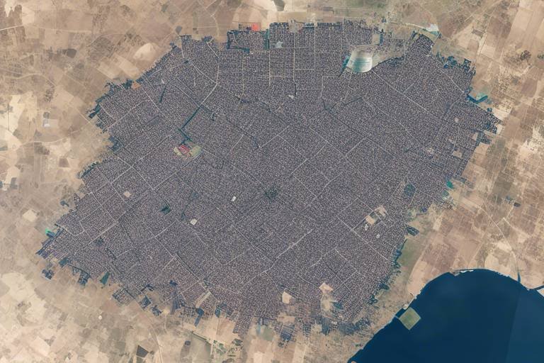
Another critical component of satellite technology in humanitarian missions is geospatial intelligence. This involves the use of satellite imagery and mapping tools to gather vital information for planning and executing missions. Imagine trying to navigate a maze without a map; that’s what humanitarian workers face without geospatial data. Satellite imagery allows organizations to assess affected areas accurately, identifying needs and prioritizing resources effectively. For example, high-resolution images can reveal damage to infrastructure, helping teams plan their interventions strategically.
Effective disaster response relies heavily on accurate information and coordination among various organizations. Here, satellite technology shines by supporting collaboration during humanitarian crises. With the ability to provide a bird’s-eye view of the disaster zone, satellite systems enable different agencies to synchronize their efforts. It’s like conducting an orchestra, where each player knows their part and timing, leading to a harmonious response that maximizes impact.
One of the standout features of satellite technology is its capability for real-time monitoring. This allows for continuous assessment of disaster-affected regions, providing timely data that is crucial for decision-making processes. Imagine being able to track the progression of a flood or the movement of a wildfire from space; this is the power of satellites. The information gathered not only helps in immediate response efforts but also aids in long-term recovery planning.
Collaboration is key in humanitarian missions, and data sharing among agencies is enhanced significantly through satellite technology. By utilizing shared satellite data, organizations can pool resources, avoid duplication of efforts, and ensure that aid is delivered where it’s most needed. This synergy is essential in a landscape where time is of the essence. The more efficiently agencies can work together, the more lives can be saved.
Logistics play a vital role in the success of humanitarian missions. Without proper logistics, even the best-planned missions can falter. Here, satellite technology optimizes supply chain management, ensuring the timely delivery of aid. By tracking shipments and monitoring conditions on the ground, military personnel can adjust their strategies dynamically. It’s akin to having a GPS for humanitarian efforts, guiding resources to their destinations without unnecessary delays.
Despite its numerous benefits, the utilization of satellite technology in humanitarian missions is not without its challenges. Issues such as cost, accessibility, and technical limitations can hinder its effectiveness. Understanding these challenges is crucial for organizations looking to integrate satellite solutions into their humanitarian efforts.
One of the most significant barriers to implementing satellite technology is financial constraints. Funding is often limited, and organizations may struggle to allocate resources for expensive satellite systems. This financial burden can restrict the ability to harness the full potential of satellite technology, ultimately impacting mission success.
Moreover, technical limitations can also pose challenges. Issues such as data accuracy and satellite coverage can significantly affect the effectiveness of satellite technology in humanitarian missions. For instance, if satellite imagery is not high-resolution enough, critical details may be missed, leading to misguided efforts. Organizations must navigate these technical hurdles to ensure that satellite technology serves its intended purpose effectively.
- What is satellite technology? Satellite technology refers to the use of satellites to provide services such as communication, navigation, and earth observation.
- How does satellite technology aid humanitarian missions? It facilitates real-time communication, enhances geospatial intelligence, and improves logistics and supply chain management.
- What are the challenges of using satellite technology? Challenges include financial constraints, technical limitations, and accessibility issues.
The Role of Satellite Communication
Satellite communication serves as the backbone of modern humanitarian military missions, enabling real-time data exchange that is crucial during crises. Imagine being in a situation where every second counts—whether it’s a natural disaster or a conflict zone. The ability to communicate instantly can mean the difference between life and death. With satellite technology, military personnel can coordinate humanitarian efforts effectively, ensuring that aid reaches those who need it most without delay.
In times of disaster, traditional communication methods often fail due to damaged infrastructure. This is where satellites shine. They operate independently of ground-based systems, providing a reliable means of communication. Military teams can transmit critical information, such as the locations of affected populations, available resources, and logistical needs, through satellite links. This capability not only enhances operational efficiency but also fosters collaboration among various agencies involved in the humanitarian response.
Furthermore, satellite communication allows for the integration of various technologies that improve situational awareness. For instance, live video feeds from satellites can provide real-time insights into the conditions on the ground. This information is invaluable for decision-making, as it allows commanders to adjust their strategies based on the latest data. Here’s how satellite communication enhances operational efficiency:
| Benefits of Satellite Communication | Description |
|---|---|
| Real-Time Data Exchange | Facilitates immediate sharing of information among teams. |
| Infrastructure Independence | Operates without relying on damaged ground communication systems. |
| Enhanced Collaboration | Enables multiple organizations to work together seamlessly. |
| Improved Situational Awareness | Provides live updates and insights for better decision-making. |
Moreover, satellite communication is not just about sending messages; it's about creating a network of support. It connects military personnel with humanitarian organizations, local governments, and international agencies, allowing for a coordinated response that maximizes resources and minimizes waste. When various entities work in sync, the impact of their efforts multiplies, leading to faster recovery and relief for those affected.
In conclusion, the role of satellite communication in humanitarian military missions cannot be overstated. It is a vital tool that enhances operational efficiency, fosters collaboration, and ultimately saves lives. As we continue to face complex humanitarian crises around the world, leveraging satellite technology will be essential in ensuring that aid reaches those in need swiftly and effectively.
Geospatial Intelligence and Mapping
In today's fast-paced world, the importance of geospatial intelligence and mapping cannot be overstated, especially when it comes to humanitarian military missions. This technology acts as a powerful tool that provides a comprehensive view of the affected areas, enabling military personnel and humanitarian organizations to make informed decisions. Imagine trying to navigate through a dense fog without a map; that's what humanitarian efforts would look like without geospatial intelligence. With satellite imagery, organizations can see beyond the chaos, identifying the most critical needs and planning their interventions accordingly.
One of the most significant advantages of using satellite imagery is the ability to assess damage in real-time. For instance, after a natural disaster like an earthquake or hurricane, the immediate aftermath can be overwhelming. Geospatial intelligence allows teams to quickly analyze the extent of the destruction, pinpointing areas that require urgent assistance. This capability is not just about seeing where the damage is; it's about understanding the landscape, the population density, and the infrastructure that may have been affected. With this information, organizations can prioritize their resources effectively, ensuring that help reaches those who need it the most.
Moreover, mapping tools integrated with satellite data offer a visual representation that is invaluable for planning humanitarian missions. These tools can include 3D terrain models, which help in understanding the geographical challenges that aid workers might face. For example, if a region is mountainous, it may be difficult to transport supplies, and this knowledge can shape the logistics of the mission. By utilizing these advanced mapping tools, teams can strategize their routes, allocate resources more efficiently, and ultimately save lives.
Effective disaster response relies heavily on accurate and timely information. This is where satellite technology truly shines, supporting coordination among various organizations during humanitarian crises. When multiple agencies are involved, having a unified source of information is crucial. Satellite data can serve as a common platform for all parties, ensuring that everyone is on the same page. Think of it as a conductor leading an orchestra; without that guidance, the music would become a chaotic cacophony.
In many cases, humanitarian missions involve collaboration between governments, NGOs, and international organizations. The ability to share geospatial data in real-time allows for seamless communication and operational efficiency. For instance, if one organization identifies a shelter that needs supplies, others can quickly respond, mobilizing resources and personnel to that location. This kind of coordinated effort is vital for maximizing impact and minimizing duplication of efforts, ultimately leading to a more successful mission.
Real-time monitoring through satellites is another game-changer for humanitarian missions. Imagine being able to observe disaster-affected regions continuously, gathering data that informs decision-making processes. This capability is essential for adapting strategies as situations evolve on the ground. For example, if a flood is receding, organizations can monitor the changes in water levels and assess when it is safe to send in aid. Timeliness is everything in disaster response, and with satellite technology, the flow of information can be as rapid as the unfolding events.
Collaboration is key in humanitarian responses, and satellite data sharing enhances these cooperative efforts. By leveraging a common platform for data exchange, organizations can build a more comprehensive picture of the crisis. This shared understanding leads to better resource allocation and strategic planning. The ability to visualize the data through maps and imagery makes it easier for agencies to communicate their needs and coordinate their actions effectively. In essence, it's about creating a network of support that is as resilient as the communities they aim to help.
In conclusion, geospatial intelligence and mapping are indispensable tools in the realm of humanitarian military missions. They not only enhance operational efficiency but also foster collaboration among various organizations, ultimately leading to more effective and timely responses to crises. As technology continues to evolve, we can expect even greater advancements in how we use satellite data to save lives and support those in need.
- What is geospatial intelligence? Geospatial intelligence refers to the collection and analysis of imagery and geospatial information to support decision-making in various fields, including humanitarian missions.
- How does satellite technology improve disaster response? Satellite technology provides real-time data and imagery, allowing for better assessment of disaster-affected areas and more effective coordination among responding agencies.
- What are the challenges of using satellite technology in humanitarian missions? Challenges include financial constraints, technical limitations, and issues with data accuracy and satellite coverage that can impact mission effectiveness.
Disaster Response Coordination
When disaster strikes, the clock starts ticking, and every second counts. Effective disaster response hinges on accurate and timely information, which is where satellite technology comes into play. Imagine a vast area devastated by a natural calamity—roads are blocked, communication lines are down, and traditional means of gathering information are rendered useless. In such scenarios, satellites act like a lifeline, providing a bird's-eye view of the affected regions. This capability allows military personnel and humanitarian organizations to coordinate their efforts seamlessly, ensuring that help reaches those in need as quickly as possible.
Coordination among various organizations is crucial during humanitarian crises. Satellite technology enables this collaboration by offering a centralized platform for data sharing. For instance, multiple agencies can access real-time satellite imagery, which helps in identifying the most affected areas. This shared understanding fosters a sense of unity and purpose, as everyone is literally on the same page. The ability to visualize the disaster zone also aids in determining the immediate needs of the population, whether it’s food, medical supplies, or shelter.
Furthermore, satellite communication systems facilitate direct contact between ground teams and command centers. This means that as new information comes in—such as changing weather conditions or the emergence of new hazards—military and humanitarian leaders can quickly adapt their strategies. The integration of satellite data into operational plans is akin to having a GPS while navigating through a dense fog; it cuts through uncertainty and provides clear directions for action.
However, the effectiveness of disaster response coordination through satellites is not without its challenges. As organizations strive to implement these technologies, they must also contend with potential discrepancies in data interpretation and the need for training personnel to utilize these tools effectively. To overcome these hurdles, continuous collaboration and training are essential. Organizations can benefit from regular workshops and simulations that prepare teams to use satellite technology efficiently in real-world scenarios.
In conclusion, satellite technology is a game-changer for disaster response coordination. It transforms chaos into order, enabling military and humanitarian organizations to work together more effectively. By leveraging real-time data and imagery, these entities not only improve their operational efficiency but also enhance their ability to save lives during critical moments. As we continue to innovate and harness the power of satellites, the future of humanitarian military missions looks brighter than ever.
- How does satellite technology improve disaster response? Satellite technology provides real-time data and imagery, helping organizations coordinate their efforts effectively and make informed decisions.
- What are the main challenges of using satellite technology in humanitarian missions? The primary challenges include financial constraints, technical limitations, and the need for proper training to utilize the technology effectively.
- Can satellite technology be used during all types of disasters? Yes, satellite technology can be utilized during various disasters, including natural calamities like earthquakes, floods, and hurricanes, as well as man-made crises.
Real-Time Monitoring
In the chaotic aftermath of a disaster, having the ability to monitor the situation in real-time can be the difference between life and death. through satellite technology allows humanitarian organizations to continuously assess the conditions in disaster-affected regions. Imagine a bird's-eye view of a sprawling landscape, where every movement, every change is captured and relayed back to decision-makers instantaneously. This capability not only enhances situational awareness but also streamlines the decision-making process, enabling rapid responses to emerging needs.
For instance, when a natural disaster strikes, satellite imagery can provide crucial data about the extent of the damage. This information is vital for understanding the scale of the crisis and prioritizing areas that require immediate assistance. Additionally, real-time data allows organizations to track the movement of displaced populations, which is essential for delivering aid effectively. How incredible is it that we can now see the impact of a hurricane or earthquake from space and respond accordingly?
Moreover, the integration of satellite technology with other tools such as drones and ground sensors creates a comprehensive monitoring system. This synergy enhances the accuracy of the data collected, allowing for better planning and resource allocation. For example, satellite data can be used to identify regions that are still inaccessible by land, ensuring that aid is directed to the right locations. With this level of insight, humanitarian efforts can be both efficient and effective, reducing the time it takes to get help to those in need.
However, it’s important to note that while satellite technology offers incredible benefits, it also comes with its own set of challenges. For example, reliance on satellite data can sometimes lead to information overload. Humanitarian workers may find themselves sifting through vast amounts of data, making it challenging to pinpoint the most critical areas of need. This is why training and proper data analysis tools are essential to ensure that information is translated into actionable strategies.
In conclusion, real-time monitoring through satellite technology is revolutionizing the way humanitarian missions are conducted. It not only improves the speed and effectiveness of responses but also empowers organizations to make informed decisions based on accurate and timely data. As we continue to advance in this digital age, the potential for satellite technology to save lives and alleviate suffering in crisis situations becomes increasingly significant.
- How does real-time monitoring work? Real-time monitoring uses satellite technology to capture and transmit data about disaster-affected areas, allowing for immediate assessment and response.
- What are the main benefits of using satellite technology in humanitarian missions? The main benefits include enhanced situational awareness, improved coordination among agencies, and timely delivery of aid.
- What challenges does satellite technology face in humanitarian efforts? Challenges include financial constraints, technical limitations, and the potential for information overload.
Data Sharing Among Agencies
In the realm of humanitarian military missions, is not just a luxury; it’s a necessity. Imagine trying to navigate a dense fog without a compass. That’s what it’s like for organizations involved in disaster relief when they lack timely and accurate data. Satellite technology serves as the beacon, illuminating paths for various agencies to collaborate effectively. When multiple organizations—be it NGOs, government bodies, or international organizations—come together, the ability to share data becomes a powerful tool in their arsenal.
One of the most significant advantages of satellite technology is its capacity to provide real-time data. This means that agencies can access the same information almost instantaneously, allowing for a synchronized response to crises. For instance, when a natural disaster strikes, agencies can utilize satellite imagery to assess the extent of the damage, identify affected populations, and determine the most critical needs. This level of coordination is crucial because it helps avoid duplication of efforts and ensures that resources are allocated where they are needed most.
Moreover, the integration of satellite data into a centralized platform can facilitate seamless communication between agencies. Imagine a scenario where one organization is providing medical assistance, while another is focused on delivering food and shelter. By sharing data, they can coordinate their efforts, ensuring that the medical team is aware of the locations of shelters and that food supplies are directed to areas with medical facilities. This synergy not only enhances operational efficiency but also maximizes the impact of humanitarian efforts.
However, effective data sharing is not without its challenges. Agencies often operate on different systems, which can create barriers to information exchange. To overcome this, many organizations are investing in interoperable platforms that allow different systems to communicate. For example, a centralized database that aggregates satellite data can serve as a common ground for all participating agencies. This way, everyone is on the same page, and critical information can flow freely.
In conclusion, is pivotal for the success of humanitarian military missions. By leveraging satellite technology, organizations can enhance their collaborative efforts, streamline operations, and ultimately save more lives. It’s like a well-orchestrated symphony where each instrument plays its part, creating a harmonious response to the challenges posed by disasters.
- What is the role of satellite technology in humanitarian missions?
Satellite technology provides crucial data for communication, mapping, and logistics, enabling agencies to respond effectively to crises. - How does data sharing improve humanitarian efforts?
Data sharing ensures that all agencies involved have access to the same information, allowing for coordinated responses and efficient resource allocation. - What challenges do agencies face when sharing data?
Agencies may encounter issues such as incompatible systems, data accuracy, and financial constraints that hinder effective data sharing.
Logistics and Supply Chain Management
When it comes to humanitarian missions, logistics and supply chain management are the backbone of effective response efforts. Imagine a well-oiled machine where every gear turns smoothly, ensuring that aid reaches those in dire need without delay. This is precisely what satellite technology facilitates in the realm of humanitarian aid. By providing real-time data and communication capabilities, satellites help organizations coordinate their supply chains with unprecedented efficiency.
In disaster-stricken areas, the challenge of getting supplies to those who need them the most can be daunting. Roads may be impassable, and traditional communication methods can fail. Here, satellite technology shines like a beacon, offering solutions that ensure timely delivery of essential goods. For instance, GPS tracking systems powered by satellites enable aid organizations to monitor the movement of supplies in real time. This capability allows them to adjust routes and make informed decisions regarding logistics, ensuring that no resources are wasted and that aid reaches the affected populations swiftly.
Moreover, satellite imagery plays a crucial role in planning logistics. By analyzing satellite maps, organizations can identify the most affected areas and prioritize their efforts accordingly. This is especially important in large-scale disasters where the extent of damage may not be immediately visible. By utilizing geospatial data, humanitarian agencies can create detailed logistics plans that consider factors such as accessibility and resource availability. The result? A well-coordinated response that maximizes impact.
To illustrate the effectiveness of satellite technology in logistics, consider the following table showcasing various applications:
| Application | Description |
|---|---|
| Real-Time Tracking | Utilizing GPS to monitor the movement of aid supplies. |
| Route Optimization | Analyzing satellite data to find the quickest routes to delivery points. |
| Resource Allocation | Using geospatial intelligence to prioritize aid distribution based on need. |
However, it’s not just about getting supplies from point A to point B. Effective logistics also involves collaboration among various organizations. Satellite technology fosters this collaboration by enabling seamless data sharing among agencies. When different organizations can access the same satellite data, it creates a unified approach to disaster response. This synergy is crucial, as it allows for better resource management and reduces the chances of duplication of efforts. In essence, satellite technology transforms a potentially chaotic situation into a synchronized operation where every player knows their role and responsibilities.
In conclusion, logistics and supply chain management in humanitarian missions are greatly enhanced by satellite technology. By providing real-time tracking, optimizing routes, and facilitating collaboration, satellites empower organizations to deliver aid more effectively. As we continue to face natural disasters and humanitarian crises, the importance of these technological advancements cannot be overstated. They not only save time and resources but, most importantly, they save lives.
- How does satellite technology improve logistics in humanitarian missions?
Satellite technology enhances logistics by providing real-time tracking, optimizing delivery routes, and facilitating data sharing among organizations. - What role does satellite imagery play in disaster response?
Satellite imagery helps in assessing damage, identifying affected areas, and prioritizing resource allocation during humanitarian crises. - Are there any challenges in using satellite technology for logistics?
Yes, challenges include financial constraints, technical limitations, and the need for specialized training to interpret satellite data effectively.
Challenges in Satellite Utilization
While satellite technology has revolutionized the way humanitarian military missions are conducted, it is not without its challenges. One of the primary hurdles is the financial constraints that many organizations face. Implementing advanced satellite systems can be a costly endeavor, often requiring significant investment in both technology and training. For instance, the cost of launching a satellite, maintaining its operations, and ensuring that personnel are adequately trained to utilize the data effectively can quickly add up, making it a daunting task for many non-profit organizations and military units operating on tight budgets.
Moreover, the technical limitations of satellite technology can also pose serious challenges. Not all regions of the world are equally served by satellite coverage, which can lead to gaps in data collection, especially in remote or conflict-affected areas. Additionally, the accuracy of satellite data can sometimes be compromised due to various factors such as atmospheric conditions, which can distort signals and lead to misinterpretation of the information. This can be particularly problematic in humanitarian missions where precise data is crucial for effective response and resource allocation.
Furthermore, the complexity of data integration from multiple satellite sources can create additional challenges. Humanitarian missions often rely on a variety of data points from different satellites, and integrating this information into a cohesive and actionable format can be a monumental task. Organizations must invest in sophisticated software and skilled personnel to analyze and interpret the data effectively. This necessity can stretch already limited resources even thinner, complicating the mission's overall efficiency.
To illustrate the challenges faced in satellite utilization, consider the following table that outlines some of the common issues and their impacts:
| Challenge | Description | Impact on Missions |
|---|---|---|
| Financial Constraints | High costs of satellite technology and training | Limited operational capacity and resource allocation |
| Technical Limitations | Inconsistent coverage and data accuracy issues | Potential misinterpretation of critical data |
| Data Integration | Difficulty in merging information from various sources | Increased complexity and potential delays in response |
In addition to these challenges, there are also regulatory and bureaucratic hurdles that can impede the swift deployment of satellite technology for humanitarian purposes. Different countries have varying regulations regarding satellite operations, which can complicate international missions. Navigating these legal landscapes requires time and expertise, potentially delaying critical aid delivery when every moment counts.
In conclusion, while satellite technology offers immense potential for enhancing humanitarian military missions, it is essential to acknowledge and address the challenges associated with its utilization. By understanding these obstacles, organizations can better prepare themselves to navigate the complexities of satellite technology and ultimately improve their humanitarian efforts.
- What are the primary benefits of using satellite technology in humanitarian missions?
Satellite technology provides real-time communication, geospatial intelligence, and enhanced coordination among agencies, making it invaluable in crisis situations. - How do financial constraints affect the use of satellite technology?
Many organizations struggle with the high costs associated with satellite technology, which can limit their ability to implement these systems effectively. - What technical limitations should organizations be aware of?
Issues like inconsistent satellite coverage and data accuracy can hinder the effectiveness of satellite technology in humanitarian efforts.
Financial Constraints
When it comes to humanitarian military missions, one of the most significant hurdles organizations face is . Imagine trying to build a house without enough bricks; that’s what it feels like for many organizations attempting to integrate satellite technology into their operations. The cost of satellite services can be astronomical, often leaving smaller NGOs and even some government agencies scrambling to find funding sources. The reality is that while satellite technology can enhance mission effectiveness, the financial burden can be overwhelming.
Many organizations are often caught in a vicious cycle where the need for advanced technology is clear, but the funds to acquire and maintain such technology are lacking. This can lead to a situation where only larger organizations with deep pockets can afford to utilize these vital resources, leaving smaller entities to rely on outdated methods that may not be as effective. The disparity in funding can create a gap in the quality of humanitarian response in various regions, where the need is often greatest.
Furthermore, the costs associated with satellite technology are not limited to just the initial investment. Ongoing operational expenses, such as data subscriptions and maintenance fees, can add up quickly. Organizations must also consider the cost of training personnel to effectively use satellite tools, which is another financial burden that can be prohibitive. In many cases, the return on investment for these technologies is difficult to measure, leading to hesitance from potential funders who may not see the immediate benefits.
To illustrate the financial challenges, consider the following table that outlines some of the typical costs associated with satellite technology in humanitarian missions:
| Cost Category | Estimated Cost |
|---|---|
| Satellite Service Subscription | $10,000 - $100,000 per year |
| Equipment Purchase | $5,000 - $50,000 |
| Training Personnel | $1,000 - $20,000 |
| Data Analysis Software | $2,000 - $30,000 |
As we can see, the financial landscape can be daunting for organizations. To combat these challenges, many are exploring innovative solutions such as public-private partnerships and seeking grants specifically aimed at technology integration. These strategies can help bridge the financial gap, allowing more organizations to access the satellite technology they need to effectively respond to humanitarian crises.
Ultimately, addressing financial constraints is essential for maximizing the potential of satellite technology in humanitarian missions. Without adequate funding, the gap between those who can afford cutting-edge tools and those who cannot will continue to widen, potentially leaving the most vulnerable populations without the support they desperately need.
- What are the main costs associated with satellite technology? The main costs include service subscriptions, equipment purchases, training personnel, and data analysis software.
- How can organizations overcome financial constraints? Organizations can explore public-private partnerships, seek specific grants, and collaborate with larger entities to share resources.
- Why is satellite technology important for humanitarian missions? Satellite technology provides real-time data, enhances communication, and improves logistical planning, making humanitarian responses more effective.
Technical Limitations
While satellite technology has revolutionized the way humanitarian missions are conducted, it is not without its . These challenges can significantly affect the overall effectiveness of satellite systems in crisis situations. One major limitation is data accuracy. In many instances, the information gathered from satellites may not be entirely precise, leading to misinterpretations that could hinder effective decision-making. For example, satellite imagery can sometimes be outdated or unable to capture rapid changes in a disaster-stricken area, causing organizations to act on incomplete or incorrect information.
Another significant hurdle is the coverage limitations of satellites. While many areas are well-covered, there are still remote locations where satellite signals are weak or nonexistent. This can create a frustrating gap in communication that can delay aid delivery. In humanitarian missions, every second counts, and having a reliable connection is essential for coordinating efforts. If a satellite cannot reach a certain area, it can leave teams operating in the dark, both figuratively and literally!
Moreover, the bandwidth limitations can also pose a challenge. During major disasters, the demand for satellite communication can skyrocket, leading to congestion. Imagine trying to make an important phone call during a massive event where everyone is trying to reach out at the same time; it can be incredibly frustrating. Similarly, if multiple agencies are trying to use the same satellite resources, they may experience slow data transfer rates or even complete communication blackouts, which can severely impact the efficiency of humanitarian operations.
Additionally, the cost of satellite technology can be a barrier for many organizations. High-quality satellite systems often come with hefty price tags, and not all humanitarian organizations have the necessary funding to invest in them. This financial constraint can limit the ability of these organizations to utilize the latest technology, leaving them reliant on older, less effective systems. It’s a bit like trying to navigate a modern city with a paper map; you can manage, but it’s not the most efficient way to find your way around.
In conclusion, while satellite technology offers incredible potential for enhancing humanitarian missions, it is essential to recognize and address these . By understanding these challenges, organizations can work towards finding solutions that not only improve data accuracy and coverage but also ensure that financial constraints do not hinder the vital work they do. The road ahead may be challenging, but with innovation and collaboration, the future of satellite technology in humanitarian efforts can be bright.
- What are the main technical limitations of satellite technology in humanitarian missions?
The main limitations include data accuracy, coverage limitations, bandwidth constraints, and high costs.
- How does data accuracy affect humanitarian missions?
Inaccurate data can lead to misinterpretations, hindering effective decision-making and potentially delaying aid delivery.
- Why is bandwidth a concern during disasters?
During major disasters, the demand for satellite communication increases, which can cause congestion and slow data transfer rates.
- Are there affordable satellite options for humanitarian organizations?
While many high-quality satellite systems are expensive, there are some affordable options available, though they may come with limitations.
Frequently Asked Questions
- How does satellite technology improve communication during humanitarian missions?
Satellite technology enhances communication by providing real-time data exchange, which is crucial for coordinating efforts among military personnel and humanitarian organizations. This means that teams can share updates and information instantly, making it easier to respond effectively to crises.
- What role does geospatial intelligence play in humanitarian missions?
Geospatial intelligence, through satellite imagery and mapping tools, offers vital insights for planning humanitarian missions. It helps assess affected areas, identify needs, and prioritize resources, ensuring that aid reaches those who need it most.
- How does satellite technology assist in disaster response coordination?
Satellite technology supports disaster response coordination by providing accurate and timely information about the situation on the ground. This facilitates collaboration among various organizations, ensuring that efforts are synchronized and more effective.
- Why is real-time monitoring important in humanitarian efforts?
Real-time monitoring allows organizations to continuously assess disaster-affected regions, which is critical for informed decision-making. It helps teams understand the evolving situation and adjust their strategies accordingly, ultimately leading to better outcomes.
- How does data sharing among agencies enhance humanitarian responses?
Data sharing among agencies fosters collaboration and improves the overall efficiency of humanitarian responses. By accessing shared satellite data, organizations can coordinate their efforts more effectively, reducing duplication and ensuring that aid is delivered where it’s needed most.
- What challenges do organizations face when using satellite technology?
Organizations often encounter challenges such as financial constraints, technical limitations, and issues with data accuracy. These factors can hinder the effective implementation of satellite technology in humanitarian missions, making it essential to address these barriers for successful outcomes.
- How do financial constraints affect the use of satellite technology?
Funding is a significant barrier to implementing satellite technology in humanitarian efforts. Many organizations struggle to secure the necessary resources to integrate these advanced solutions, which can limit their ability to respond effectively to crises.
- What are some technical limitations of satellite technology?
Technical limitations can include issues like inadequate satellite coverage, data accuracy problems, and the complexity of interpreting satellite data. These challenges can impact the overall effectiveness of satellite technology in supporting humanitarian missions.