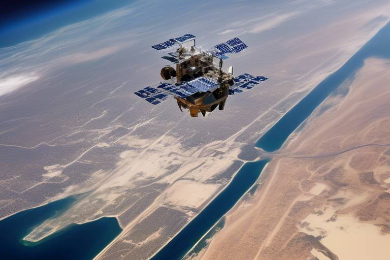
How Satellites Enhance Maritime Situational Awareness
In today's fast-paced world, where the oceans serve as highways for global trade and leisure, understanding what's happening on the water is more critical than ever. Enter satellites—a technological marvel that acts like a watchful eye, constantly surveying the vast expanses of our seas. These floating sentinels play a critical role in enhancing maritime situational awareness, ensuring that both commercial and recreational vessels operate safely and efficiently. Imagine navigating through a bustling city without any traffic signals or signs; that’s how chaotic maritime navigation would be without the insights provided by satellite technology.
Satellites are equipped with sophisticated sensors and imaging capabilities that allow them to monitor vessel movements, weather patterns, and potential hazards. By providing real-time data, they significantly reduce the risk of accidents and enhance navigation safety. For instance, consider a fishing trawler navigating through foggy waters. With satellite data, the crew can access information about nearby vessels, weather conditions, and any obstacles in their path, allowing them to make informed decisions that keep them safe.
The impact of satellites goes beyond just safety; they also contribute to maritime security. In an age where piracy and illegal fishing can threaten livelihoods and national security, satellites provide a way to monitor suspicious activities from thousands of miles above the Earth. This capability is invaluable for coast guards and naval forces, enabling them to respond swiftly to potential threats. In essence, satellites transform the maritime domain from a chaotic and unpredictable environment into a more manageable and safer space.
As we delve deeper into the technologies that satellites employ, we uncover a fascinating world of innovation. From synthetic aperture radar (SAR) that can see through clouds and darkness to optical imaging that captures stunningly detailed pictures of the ocean surface, these tools allow for comprehensive surveillance. This level of detail is crucial for maritime authorities who need to keep tabs on everything from shipping lanes to environmental changes.
In summary, satellites are not just a technological luxury; they are a necessity for modern maritime operations. They provide a wealth of information that enhances situational awareness, ensuring that those who traverse our oceans do so safely and securely. As we continue to explore the capabilities of satellite technology, we will uncover even more ways they can revolutionize maritime practices.
- How do satellites improve maritime safety?
Satellites enhance maritime safety by providing real-time data on vessel movements, weather conditions, and potential hazards, which helps in reducing the risk of accidents. - What technologies do satellites use for maritime monitoring?
Key technologies include synthetic aperture radar (SAR) and optical imaging, which offer high-resolution images and real-time data for effective monitoring. - What is the role of GPS in maritime operations?
GPS technology allows for precise location tracking of vessels, facilitating better navigation and coordination in busy waterways. - What challenges does GPS face?
GPS can experience signal loss in adverse weather or urban canyons, which is why backup systems are necessary for reliable navigation. - How can predictive analytics improve maritime situational awareness?
Predictive analytics help anticipate maritime risks and trends, enabling stakeholders to proactively address potential issues before they escalate.
The Role of Satellites in Maritime Safety
In the vast and often unpredictable expanse of our oceans, ensuring maritime safety is of paramount importance. This is where satellites come into play, acting as the vigilant eyes in the sky that monitor and relay crucial information about maritime activities. By providing essential data, satellites significantly enhance the safety of vessels navigating through busy shipping lanes, treacherous waters, and unpredictable weather conditions. Imagine a world where every ship is constantly aware of its surroundings, equipped with real-time information that can prevent accidents before they happen. That's the power of satellite technology!
One of the primary ways satellites contribute to maritime safety is through the monitoring of vessel movements. Satellites track the position and speed of ships, allowing maritime authorities to maintain an overview of all activities in their jurisdiction. This capability is particularly vital in areas with high traffic, such as the Strait of Malacca or the English Channel, where the potential for collisions is significantly heightened. With satellite data, authorities can identify vessels that are deviating from their planned routes or behaving suspiciously, enabling timely interventions.
Moreover, satellites are instrumental in monitoring weather conditions. They provide real-time updates on storms, fog, and other hazardous weather phenomena that could pose risks to navigation. For instance, when a sudden storm brews, satellite imagery can alert vessels to take precautionary measures, such as altering their course or seeking safe harbor. This proactive approach to weather monitoring can mean the difference between a safe journey and a catastrophic incident at sea.
Another critical aspect of maritime safety is the identification of potential hazards in the water. Satellites equipped with advanced sensors can detect oil spills, debris, and other environmental threats that could endanger vessels. By providing this information, satellites enable ships to avoid these hazards, ensuring safer passage. In fact, the integration of satellite data with other maritime technologies, such as Automatic Identification Systems (AIS), creates a comprehensive safety net that enhances situational awareness for all maritime stakeholders.
In summary, the role of satellites in maritime safety cannot be overstated. They not only enhance the monitoring of vessel movements and weather conditions but also help identify potential hazards that could threaten navigation. As technology continues to evolve, the integration of satellite data with other maritime systems will only improve safety measures, ensuring that our oceans remain safe for both commercial shipping and recreational boating.
Satellite Technologies Used in Maritime Monitoring
When we think about the vastness of our oceans and the multitude of vessels traversing them, it's easy to feel a bit overwhelmed. How do we keep track of everything happening on the water? Enter satellite technologies, the unsung heroes of maritime monitoring. These advanced systems are not just high-tech gadgets; they are essential tools that provide critical data to enhance safety and security on the seas. Among the most notable technologies are Synthetic Aperture Radar (SAR) and optical imaging, each offering unique capabilities that complement one another in the quest for maritime situational awareness.
SAR technology is particularly remarkable. Unlike traditional radar, which can be limited by weather conditions and visibility, SAR operates by sending out microwave signals that bounce off the surface of the water. This means that it can produce high-resolution images of vessels and other objects regardless of whether it's day or night, or even if there's heavy cloud cover. Imagine being able to see through a storm! This capability is crucial for monitoring illegal fishing activities, detecting oil spills, and tracking the movement of large cargo ships, thus ensuring compliance with international regulations.
On the other hand, optical imaging provides a different perspective. Utilizing visible light, these satellite systems capture stunning images of the maritime environment. While they may not be as effective in poor weather, they excel during clear conditions, allowing for detailed assessments of port activities and coastal infrastructure. This combination of SAR and optical imaging creates a robust monitoring system that can adapt to various conditions and requirements.
To further illustrate the impact of these technologies, consider the following table that highlights their key features:
| Technology | Key Features | Applications |
|---|---|---|
| Synthetic Aperture Radar (SAR) |
|
|
| Optical Imaging |
|
|
In addition to SAR and optical imaging, there are other technologies that play a vital role in maritime monitoring. For example, Global Positioning Systems (GPS) and Automated Identification Systems (AIS) work in tandem with satellite data to provide real-time tracking and identification of vessels. With GPS, vessels can pinpoint their exact location, while AIS allows for the automatic transmission of information such as course and speed. This integration of technologies creates a comprehensive picture of maritime activities, enabling authorities to respond swiftly to any incidents or irregularities.
As we look to the future, the evolution of these satellite technologies promises even greater advancements in maritime monitoring. Innovations such as miniaturized satellites and the integration of artificial intelligence will enhance data collection and analysis, making it easier than ever to maintain safety and security on our oceans. So next time you hear about satellites, remember that they're not just floating in space; they're actively working to keep our waters safe and secure!
Q: How do satellites help in maritime safety?
A: Satellites provide essential data regarding vessel movements, weather conditions, and potential hazards, significantly reducing the risk of accidents and improving navigation.
Q: What are the main satellite technologies used in maritime monitoring?
A: The primary technologies include Synthetic Aperture Radar (SAR) and optical imaging, along with GPS and AIS systems for tracking and identification.
Q: Can satellite data be used during bad weather?
A: Yes, SAR technology can operate in all weather conditions, allowing for effective monitoring even during storms or poor visibility.
Q: How does AI integrate with satellite data?
A: AI can enhance the analysis of satellite data, improving the accuracy and speed of maritime situational assessments for better decision-making.
Global Positioning Systems (GPS)
The advent of has revolutionized the way we navigate our oceans. Imagine sailing through densely packed waterways without a worry in the world, knowing exactly where you are at all times. That’s the power of GPS! It provides precise location tracking of vessels, which is essential not just for commercial shipping but also for recreational boating enthusiasts. With GPS, mariners can pinpoint their location anywhere on the globe, making navigation safer and more efficient.
In busy maritime environments, where every second counts, the ability to determine a vessel's exact position is crucial. GPS technology allows for real-time updates, which means that sailors can make informed decisions on the fly. For example, if a storm suddenly rolls in, a captain can quickly adjust their course to avoid treacherous waters. This capability is akin to having a personal guide in the vast ocean, steering you clear of potential dangers.
Furthermore, the integration of GPS into maritime operations has led to significant improvements in route planning and fuel efficiency. Vessels can now avoid congested areas, which not only saves time but also reduces fuel consumption. This is particularly important in an era where environmental concerns are at the forefront of maritime operations. By optimizing routes, vessels contribute to lower emissions, aligning with global efforts to protect our oceans.
However, it's important to recognize that while GPS is an invaluable tool, it is not without its challenges. For instance, in adverse weather conditions or urban canyons, GPS signals can become weak or even lost entirely. This is where backup systems come into play, ensuring that mariners are never left adrift. Just as a sailor would carry extra sails in case of a sudden gust, having alternative navigation methods is essential for safety.
In summary, GPS technology stands as a cornerstone of modern maritime navigation. Its ability to provide accurate real-time data enhances not only the safety of vessels but also the efficiency of maritime operations. As we continue to advance technologically, the reliance on GPS will only grow, making it imperative for mariners to understand both its capabilities and limitations.
- What is GPS and how does it work? GPS is a satellite-based navigation system that provides location and time information anywhere on Earth. It works by triangulating signals from multiple satellites.
- Are there alternatives to GPS for maritime navigation? Yes, alternatives include traditional methods like dead reckoning, radar, and other satellite systems such as GLONASS or Galileo.
- What are the limitations of GPS? GPS can be affected by physical obstructions, atmospheric conditions, and interference, which may lead to signal loss or inaccuracies.
- How does GPS improve maritime safety? By providing real-time location tracking, GPS helps vessels avoid collisions and navigate safely through busy waterways.
Benefits of GPS in Maritime Operations
The integration of GPS technology into maritime operations has transformed the way vessels navigate and communicate on the water. Imagine trying to sail a ship through a busy harbor without knowing exactly where you are or where other vessels are located—sounds chaotic, right? That’s why GPS is a game-changer. It provides real-time positioning data that is crucial for safe navigation and operational efficiency.
One of the most significant benefits of GPS is enhanced route planning. With precise location tracking, vessels can chart the most efficient paths to their destinations, which not only saves time but also conserves fuel. This is especially important in today’s world, where fuel costs can significantly impact a shipping company’s bottom line. Furthermore, by avoiding congested areas, vessels can minimize the risk of collisions, ensuring the safety of both crew and cargo.
Another key advantage is the ability to monitor weather conditions in real-time. GPS systems can integrate with weather data, allowing mariners to adjust their routes based on changing conditions. This capability is critical for avoiding storms and other hazardous weather, ultimately enhancing the safety of maritime operations. For example, a vessel can receive alerts about adverse weather conditions and reroute before encountering dangerous situations, much like a driver using a GPS to avoid traffic jams.
Moreover, GPS technology facilitates better communication between vessels and maritime authorities. With accurate positioning information, authorities can monitor vessel movements and provide guidance or assistance as needed. This is particularly beneficial in emergency situations where quick responses are essential. Imagine a situation where a vessel is in distress; with GPS, rescue operations can be initiated promptly, significantly increasing the chances of saving lives.
However, it’s essential to recognize that while GPS offers numerous benefits, it’s not without its challenges. The reliance on GPS can lead to vulnerabilities, such as susceptibility to signal loss in adverse weather conditions or urban canyons. To mitigate these risks, it’s crucial for maritime operators to have backup systems in place, ensuring that navigation remains reliable even when GPS signals are compromised.
In conclusion, the benefits of GPS in maritime operations are undeniable. From improving route planning and fuel efficiency to enhancing safety and communication, GPS technology is an invaluable tool for modern mariners. As we continue to advance in technology, the integration of GPS will only become more sophisticated, further revolutionizing how we navigate our waters.
- What is GPS and how does it work in maritime operations?
GPS, or Global Positioning System, is a satellite-based navigation system that allows users to determine their exact location (latitude, longitude, and altitude) anywhere on Earth. In maritime operations, GPS is used for route planning, navigation, and monitoring vessel movements.
- What are the limitations of GPS in maritime navigation?
While GPS is highly reliable, it can face limitations such as signal loss in dense urban areas or during severe weather conditions. This necessitates the use of backup navigation systems to ensure safety and reliability.
- How does GPS enhance maritime safety?
GPS enhances maritime safety by providing real-time location data, allowing vessels to avoid collisions, navigate efficiently, and respond quickly to emergencies.
Challenges of GPS Reliance
While GPS technology has undeniably transformed the maritime industry, making navigation smoother and more efficient, it isn't without its challenges. One of the most significant issues is signal loss. This can occur due to various factors, such as adverse weather conditions, which can obscure satellite signals, or in urban canyons, where tall buildings block the line of sight to satellites. Imagine trying to get directions in a dense city where your GPS keeps losing signal—frustrating, right? The same applies to vessels navigating through narrow straits or busy ports.
Moreover, the reliance on GPS can lead to a false sense of security. Many mariners may become overly dependent on GPS systems, neglecting traditional navigation skills and tools. This is akin to a chef who relies solely on a microwave; while it's convenient, it can lead to a lack of fundamental cooking skills. If a vessel's GPS fails, the crew may find themselves ill-prepared to navigate using charts or compass methods, which are crucial in emergencies.
Another challenge is the vulnerability to interference. GPS signals can be susceptible to jamming or spoofing, where malicious actors deliberately disrupt or falsify signals. This can have dire consequences, leading vessels off course or into dangerous waters. In fact, there have been documented cases where vessels have been misled due to such interference, raising serious concerns about maritime security.
To mitigate these challenges, it is essential for maritime operators to have backup systems in place. This could include traditional navigation tools, as well as alternative technologies such as Inertial Navigation Systems (INS) or Celestial Navigation. By combining multiple navigation methods, mariners can ensure they remain on course, even when faced with GPS failures.
Ultimately, while GPS is a powerful tool in enhancing maritime operations, it is crucial to recognize its limitations. A balanced approach that combines GPS with traditional navigation methods will not only improve safety but also empower mariners with the necessary skills to navigate effectively in any situation.
- What should I do if my GPS fails while at sea?
If your GPS fails, rely on traditional navigation methods such as charts, compasses, and celestial navigation. Always ensure you have backup systems in place.
- Can GPS be jammed?
Yes, GPS signals can be jammed or spoofed, which is why it's important to have alternative navigation methods ready.
- How can I improve my vessel's navigation safety?
Integrate multiple navigation systems, regularly train your crew on traditional navigation techniques, and stay informed about potential environmental challenges.
Automated Identification Systems (AIS)
Automated Identification Systems, commonly known as AIS, have transformed the way maritime situational awareness is achieved. This technology is like a digital lighthouse, guiding vessels through the murky waters of busy shipping lanes. By enabling vessels to automatically transmit their position, course, and speed, AIS significantly enhances the visibility of maritime traffic. Imagine being able to see not just your own ship but also every other vessel in the vicinity, all thanks to a simple yet powerful system that operates in real-time.
AIS works by broadcasting a vessel's information, which includes its name, type, dimensions, and even its destination. This data is transmitted via VHF radio frequencies and can be received by other vessels, as well as shore-based monitoring stations. The result? A comprehensive picture of maritime traffic that is crucial for avoiding collisions and ensuring safe navigation. This system is particularly vital in congested waterways where the risk of accidents is heightened.
One of the most impressive aspects of AIS is its ability to provide real-time updates. This means that maritime authorities can monitor vessel movements continuously, allowing for quick responses to any anomalies. For instance, if a vessel deviates from its planned route or stops unexpectedly, authorities can investigate the situation promptly. This level of situational awareness is invaluable for maintaining safety and security on the seas.
Moreover, AIS is not just beneficial for large commercial vessels; it also plays a crucial role in the safety of recreational boats. By equipping smaller vessels with AIS transponders, boaters can be more easily detected by larger ships, reducing the likelihood of accidents. This integration of technology across different types of vessels creates a safer maritime environment for everyone.
It's important to note that while AIS significantly enhances maritime situational awareness, it is not without its limitations. For example, vessels that are not equipped with AIS or are operating in areas with poor reception can create gaps in the data. Additionally, the system relies on the honesty of vessel operators to transmit accurate information. Despite these challenges, the benefits of AIS far outweigh its drawbacks, making it an essential tool in modern maritime operations.
In conclusion, the implementation of Automated Identification Systems has revolutionized maritime situational awareness. By providing real-time data and enhancing visibility of vessel movements, AIS is a game-changer for both maritime authorities and individual boaters. As technology continues to evolve, we can expect even more advancements in AIS capabilities, further improving safety and efficiency in our oceans.
- What is AIS?
AIS stands for Automated Identification System, a technology that allows vessels to automatically transmit their position, course, and speed to improve maritime safety. - How does AIS work?
AIS operates by broadcasting a vessel's information via VHF radio frequencies, which can be received by other vessels and shore-based monitoring stations. - Is AIS mandatory for all vessels?
While AIS is mandatory for large commercial vessels, smaller recreational boats can also benefit from using AIS transponders for safety. - What are the limitations of AIS?
AIS relies on vessels being equipped with the system and transmitting accurate data. Gaps in coverage can occur in areas with poor reception or among non-equipped vessels.
Data Integration and Analysis
In the ever-evolving world of maritime operations, data integration and analysis have become paramount for enhancing situational awareness. By merging satellite data with other vital information sources, such as Automated Identification Systems (AIS) and radar, maritime authorities can achieve a comprehensive view of the maritime environment. This integration allows for a more holistic understanding of vessel movements, potential hazards, and environmental conditions, ultimately leading to better decision-making and more effective response strategies.
Imagine navigating a busy harbor without knowing the exact positions of nearby vessels. It would be like trying to drive through a crowded city blindfolded! However, with integrated data systems that utilize satellite imagery alongside AIS data, maritime operators can visualize real-time traffic, making informed decisions swiftly. The synergy between these technologies not only enhances safety but also improves operational efficiency.
Moreover, the integration of satellite data facilitates the identification of patterns and trends that may not be immediately apparent. For instance, by analyzing historical data alongside current satellite feeds, maritime authorities can identify recurring congestion zones or areas prone to piracy. This predictive capability is vital for preemptive action, allowing authorities to deploy resources effectively and mitigate risks before they escalate into emergencies.
To illustrate the impact of data integration, consider the following table that summarizes the benefits:
| Data Source | Benefits |
|---|---|
| Satellite Imagery | High-resolution images of maritime traffic and environmental conditions |
| AIS | Real-time vessel tracking and automatic position reporting |
| Radar | Detection of nearby vessels and obstacles, especially in poor visibility |
| Weather Data | Forecasting and monitoring of weather conditions affecting navigation |
Furthermore, the ability to process this data in real-time is a game changer. When an incident occurs, such as a vessel collision or a distress call, the immediate availability of integrated data allows for rapid response. Search and rescue operations can be coordinated more effectively, as authorities can visualize the situation and deploy assets to the exact location of the incident. This immediate processing capability not only saves time but can also save lives.
As we look ahead, the potential for predictive analytics in maritime situational awareness is incredibly promising. By leveraging machine learning algorithms and big data analytics, stakeholders can anticipate maritime risks and trends. This proactive approach can significantly reduce the likelihood of accidents and enhance overall maritime safety.
In conclusion, the integration and analysis of satellite data with other maritime information systems is not just a technological advancement; it's a vital necessity for ensuring safety and security on the high seas. As we continue to develop these technologies, the maritime industry will undoubtedly become more resilient and responsive to the challenges it faces.
- What is maritime situational awareness?
Maritime situational awareness refers to the ability to perceive and understand the maritime environment, including vessel movements, weather conditions, and potential hazards. - How do satellites improve maritime safety?
Satellites provide real-time data on vessel positions and environmental conditions, enabling better navigation and incident response. - What technologies are used in maritime monitoring?
Key technologies include synthetic aperture radar (SAR), optical imaging, GPS, and Automated Identification Systems (AIS). - Why is data integration important?
Data integration allows for a comprehensive view of maritime operations, improving decision-making and response strategies.
Real-time Data Processing
In the fast-paced world of maritime operations, has become a game-changer. Imagine navigating through a bustling harbor or across open seas, where every second counts. With the help of satellite technology, maritime authorities and vessel operators can now access crucial information almost instantaneously. This capability not only enhances situational awareness but also significantly improves response times during emergencies.
When a maritime incident occurs, such as a collision or a vessel in distress, the ability to process satellite data in real-time allows for immediate action. For instance, satellites equipped with advanced imaging technology can detect changes in a vessel's position or speed, alerting authorities to potential problems before they escalate. This rapid response capability is vital for search and rescue operations, where every minute can mean the difference between life and death.
Furthermore, the integration of various data sources, including Automatic Identification Systems (AIS) and radar information, enhances the overall picture of maritime activity. By combining these datasets, analysts can create a comprehensive view of the situation, identifying not just the location of a distress signal but also the surrounding vessels, weather conditions, and navigational hazards. This multifaceted approach enables maritime authorities to make informed decisions quickly.
To illustrate the impact of real-time data processing, consider the following table that highlights key advantages:
| Advantage | Description |
|---|---|
| Immediate Response | Allows for swift action during emergencies, increasing the chances of successful interventions. |
| Enhanced Collaboration | Facilitates communication between various maritime agencies, improving coordination during incidents. |
| Improved Safety | Reduces the risk of accidents by providing timely information about potential hazards. |
| Data-Driven Decisions | Empowers authorities to make informed choices based on the latest available information. |
Moreover, advancements in technology have made it possible to process vast amounts of data quickly. With the rise of cloud computing and advanced algorithms, maritime organizations can analyze satellite data in real-time, leading to more accurate predictions and assessments of maritime conditions. This technological evolution is akin to having a high-tech crystal ball, where stakeholders can foresee potential issues and address them proactively.
In conclusion, real-time data processing is reshaping how maritime operations are conducted. By leveraging satellite technology, authorities can enhance their situational awareness, respond to incidents more effectively, and ultimately ensure safer seas for everyone involved. As we continue to embrace these advancements, the future of maritime safety looks brighter than ever.
- What is real-time data processing in maritime operations?
Real-time data processing refers to the ability to analyze and act on data as it is received, allowing for immediate responses to maritime incidents. - How do satellites contribute to maritime safety?
Satellites provide critical data on vessel movements, weather conditions, and potential hazards, improving navigation and reducing accident risks. - What technologies are used for real-time data processing?
Technologies such as cloud computing, advanced algorithms, and integration of multiple data sources like AIS and radar are utilized for efficient real-time processing. - Why is rapid response important in maritime incidents?
Rapid response can significantly increase the chances of successful rescue operations and minimize damage during maritime emergencies.
Predictive Analytics in Maritime Situational Awareness
Imagine standing on the deck of a ship, gazing out at the vast ocean, with the knowledge that hidden patterns and trends are swirling beneath the surface, waiting to be uncovered. Predictive analytics in maritime situational awareness acts as a powerful lens, allowing us to see beyond the immediate horizon and anticipate potential challenges before they become crises. By harnessing the vast amounts of data collected from various sources, including satellites, Automated Identification Systems (AIS), and weather forecasts, predictive analytics enables maritime authorities and operators to make informed decisions that enhance safety and operational efficiency.
At its core, predictive analytics involves the use of statistical algorithms and machine learning techniques to analyze historical data and identify trends. In the maritime domain, this means looking at patterns in vessel movements, traffic congestion, weather conditions, and even piracy incidents. By applying these insights, stakeholders can forecast potential risks and devise strategies to mitigate them. For example, if data reveals an increase in vessel traffic in a specific area, authorities can proactively implement measures to prevent collisions or congestion.
Moreover, predictive analytics can significantly improve the response time during emergencies. For instance, if a vessel sends out a distress signal, predictive models can analyze the surrounding maritime traffic and environmental conditions to determine the most efficient rescue route. This capability not only saves time but can also be the difference between life and death in critical situations.
Here’s a breakdown of how predictive analytics enhances maritime situational awareness:
- Risk Assessment: By analyzing historical data, predictive models can identify high-risk areas and times, allowing for better resource allocation and preventive measures.
- Traffic Management: Predictive analytics can forecast traffic patterns, enabling authorities to manage congested waterways more effectively.
- Environmental Monitoring: By predicting weather patterns and oceanographic conditions, vessels can avoid hazardous situations, ensuring safer navigation.
As we look to the future, the integration of predictive analytics with artificial intelligence (AI) holds tremendous potential. AI can enhance the accuracy of predictions by continuously learning from new data inputs, adapting to changing conditions, and providing real-time insights. This dynamic approach allows for smarter decision-making, whether it’s rerouting vessels to avoid storms or optimizing shipping routes for fuel efficiency.
In summary, the role of predictive analytics in maritime situational awareness cannot be overstated. It transforms raw data into actionable insights, empowering maritime stakeholders to anticipate challenges and respond effectively. As technology continues to advance, the synergy between predictive analytics, AI, and satellite data will redefine how we navigate the seas, making maritime operations safer and more efficient than ever before.
Q1: What is predictive analytics in maritime situational awareness?
Predictive analytics involves using data analysis techniques to forecast potential risks and trends in maritime operations, enhancing decision-making and operational safety.
Q2: How does predictive analytics improve safety at sea?
By analyzing historical data and identifying patterns, predictive analytics helps anticipate risks such as collisions, congestion, and adverse weather conditions, allowing for proactive measures to be taken.
Q3: Can predictive analytics be integrated with other technologies?
Yes, predictive analytics can be combined with technologies like artificial intelligence and satellite data to enhance the accuracy and speed of maritime situational assessments.
Q4: What are some examples of predictive analytics applications in maritime operations?
Applications include risk assessment, traffic management, and environmental monitoring, all aimed at improving safety and operational efficiency.
Future Trends in Satellite Technology
The future of satellite technology is not just bright; it's positively dazzling! As we look ahead, we can expect a transformation in how we perceive and utilize maritime situational awareness. One of the most exciting trends is the emergence of small satellites and satellite constellations. These innovative technologies promise to provide more frequent and detailed coverage of global maritime activities, which is a game-changer for safety and efficiency at sea.
Small satellites, often referred to as CubeSats, are compact, cost-effective, and capable of delivering high-quality data. Their size and affordability allow for the deployment of numerous satellites in a constellation, which can significantly enhance data collection capabilities. Imagine a swarm of tiny satellites orbiting the Earth, each collecting vital information about maritime movements, weather patterns, and potential hazards. This collective intelligence can lead to improved situational awareness, ultimately making our oceans safer.
Additionally, the integration of artificial intelligence (AI) with satellite data analysis is another trend that is set to revolutionize maritime operations. AI can sift through vast amounts of data at lightning speed, identifying patterns and anomalies that might go unnoticed by human analysts. With this capability, maritime authorities can make smarter, quicker decisions, whether it's rerouting vessels to avoid storms or responding to emergencies with precision. As we harness the power of AI, the potential for proactive maritime safety measures becomes limitless.
Moreover, advancements in miniaturization are not just about making satellites smaller; they also involve enhancing their capabilities. Future satellites will likely be equipped with cutting-edge sensors that can monitor everything from ocean temperatures to pollution levels. This wealth of data will be invaluable for environmental monitoring and compliance with international regulations. It’s like having a digital eye in the sky, ensuring that our oceans remain healthy and navigable.
As we embrace these technological advancements, it's also crucial to consider the implications for data integration and analysis. The future will see a seamless amalgamation of satellite data with other maritime technologies, such as Automatic Identification Systems (AIS) and radar systems. This holistic approach will enable maritime authorities to create a comprehensive picture of maritime activities, enhancing decision-making processes and response strategies.
In summary, the future of satellite technology in maritime situational awareness is poised for remarkable growth and innovation. With small satellites, AI integration, and enhanced data capabilities, we are on the brink of a new era in maritime safety and efficiency. The ocean is a vast and unpredictable place, but with these advancements, we can navigate it with greater confidence and foresight.
- What are small satellites, and how do they benefit maritime operations?
Small satellites, or CubeSats, are compact and cost-effective. They can be deployed in large numbers to provide frequent and detailed coverage of maritime activities, enhancing situational awareness. - How does AI improve maritime situational awareness?
AI can analyze vast datasets quickly, identifying patterns and anomalies that assist maritime authorities in making informed decisions, thus improving safety and operational efficiency. - What role does data integration play in maritime safety?
Integrating satellite data with other sources like AIS and radar creates a comprehensive picture of maritime activities, leading to better decision-making and response strategies.
Advancements in Miniaturization
The world of satellite technology is undergoing a remarkable transformation, primarily driven by . Imagine a time when satellites were massive, expensive, and challenging to deploy. Now, thanks to innovative engineering and technology, we are witnessing the rise of small satellites, also known as CubeSats and smallsats. These compact satellites have the potential to revolutionize maritime situational awareness by providing more frequent and detailed data without the hefty price tag of traditional satellites.
Miniaturization has enabled the deployment of multiple satellites in constellations, which can cover vast areas of the ocean with unparalleled efficiency. This means that instead of relying on a single large satellite that may only pass over a specific region a few times a day, maritime authorities can now access near real-time data from a network of smaller satellites that continuously monitor maritime activities. The implications for maritime safety and security are profound.
For instance, small satellites equipped with advanced sensors can track vessels in crowded shipping lanes, monitor illegal fishing activities, and even detect environmental hazards like oil spills. The ability to gather high-resolution data from multiple angles allows for a more comprehensive understanding of what is happening on the water. In addition, these satellites can be launched in groups, significantly reducing the time and cost associated with getting them into orbit.
Another exciting aspect of miniaturization is the cost-effectiveness it brings to satellite production and deployment. Traditional satellites can cost hundreds of millions of dollars, while small satellites can be built and launched for a fraction of that cost. This democratization of satellite technology opens the door for a wider array of stakeholders, including smaller nations and private companies, to participate in maritime monitoring efforts. As a result, we can expect a more robust and diversified approach to maritime situational awareness moving forward.
Moreover, the miniaturization of satellite technology is not just about size; it's also about functionality. These small satellites can be equipped with cutting-edge technologies such as synthetic aperture radar (SAR) and optical imaging, which were once reserved for larger, more expensive satellites. This means that small satellites can deliver high-quality data that was previously unimaginable at such a low cost.
In conclusion, the advancements in miniaturization are reshaping the landscape of maritime situational awareness. With the proliferation of small satellites and their enhanced capabilities, we are on the brink of a new era where maritime safety and security can be monitored more effectively than ever before. As we continue to innovate and push the boundaries of what is possible, the future of maritime monitoring looks incredibly promising.
- What are small satellites? Small satellites, often referred to as CubeSats or smallsats, are compact and cost-effective satellites designed for various applications, including maritime monitoring.
- How do small satellites improve maritime situational awareness? They provide frequent and high-resolution data, allowing for better tracking of vessels and monitoring of maritime activities.
- What technologies are used in small satellites? Small satellites can be equipped with technologies like synthetic aperture radar (SAR) and optical imaging to enhance data collection capabilities.
- Are small satellites more affordable than traditional satellites? Yes, small satellites are significantly less expensive to produce and launch, making satellite technology more accessible.
Integration with Artificial Intelligence
As we dive deeper into the ocean of technology, one of the most exciting developments is the integration of Artificial Intelligence (AI) with satellite data analysis for maritime situational awareness. Imagine having a virtual assistant that not only processes vast amounts of data but also learns from it, adapting to new patterns and anomalies in real-time. This is precisely what AI brings to the table, revolutionizing how we monitor and manage our oceans.
AI algorithms can analyze satellite data at lightning speed, identifying trends and anomalies that would typically take humans much longer to detect. For instance, AI can recognize unusual vessel behavior that might indicate illegal fishing or smuggling activities. By processing historical data alongside real-time satellite imagery, AI can create predictive models that anticipate potential maritime risks before they escalate into serious incidents.
One of the key benefits of integrating AI into maritime operations is its ability to enhance decision-making. With AI's predictive analytics, maritime authorities can make informed choices based on data-driven insights rather than gut feelings or outdated information. This not only improves the efficiency of operations but also significantly boosts safety in busy maritime environments. For example, AI can help determine the safest routes for vessels by analyzing weather patterns, traffic density, and even potential hazards like underwater obstacles.
Moreover, AI can automate routine tasks, allowing human operators to focus on more complex decision-making processes. This automation can lead to faster response times in emergencies. When a distress signal is detected, AI can quickly analyze the situation, assess the nearest available rescue resources, and suggest the best course of action, all within seconds. The difference between a successful rescue and a tragic outcome can often hinge on those critical moments saved.
However, integrating AI into maritime operations isn't without its challenges. For one, there are concerns about data privacy and security. As we connect more systems and share data across platforms, ensuring that sensitive information remains protected becomes paramount. Additionally, there is a need for robust training data to teach AI systems how to recognize and interpret various maritime scenarios accurately. The more data we feed into these systems, the smarter they become.
In conclusion, the integration of AI with satellite technology is paving the way for a new era in maritime situational awareness. By leveraging the strengths of both technologies, we can create a safer, more efficient maritime environment. As we sail into the future, the collaboration between AI and satellite data will undoubtedly play a crucial role in safeguarding our oceans and enhancing global maritime operations.
- What is the role of AI in maritime situational awareness?
AI enhances maritime situational awareness by analyzing vast amounts of satellite data quickly, identifying trends, predicting risks, and automating decision-making processes. - How does AI improve decision-making in maritime operations?
AI provides data-driven insights that help authorities make informed decisions, improving efficiency and safety in busy maritime environments. - What challenges are associated with integrating AI in maritime systems?
Challenges include data privacy concerns, the need for robust training data, and ensuring the accuracy of AI interpretations in various maritime scenarios.
Frequently Asked Questions
- How do satellites improve maritime safety?
Satellites enhance maritime safety by providing real-time data on vessel movements, weather conditions, and potential hazards. This critical information helps reduce the risk of accidents and improves navigation, ensuring safer journeys for both commercial and recreational vessels.
- What satellite technologies are commonly used in maritime monitoring?
Key satellite technologies used in maritime monitoring include Synthetic Aperture Radar (SAR) and optical imaging. These technologies offer high-resolution images and real-time data, which are essential for effective situational awareness in maritime environments.
- How does GPS technology benefit maritime operations?
GPS technology enables precise location tracking of vessels, which is crucial for navigation in busy waterways. It enhances route planning, fuel efficiency, and safety by allowing vessels to avoid congested areas and navigate more efficiently.
- What challenges come with relying on GPS?
While GPS offers many advantages, it can pose challenges such as signal loss in adverse weather conditions or urban canyons. This necessitates the implementation of backup systems to ensure reliable navigation when GPS signals are compromised.
- What is the role of AIS in maritime situational awareness?
Automated Identification Systems (AIS) play a crucial role by enabling vessels to automatically transmit their position, course, and speed. This information improves situational awareness for maritime authorities and nearby vessels, facilitating safer navigation.
- How does data integration enhance maritime decision-making?
Combining satellite data with other sources, such as AIS and radar, provides a comprehensive view of maritime situations. This integration enhances analysis capabilities, enabling better decision-making and more effective response strategies for maritime authorities.
- What is the significance of real-time data processing in maritime operations?
Real-time processing of satellite data allows for immediate responses to maritime incidents, significantly improving the effectiveness of search and rescue operations and maritime law enforcement. Quick access to accurate data is crucial in emergencies.
- How can predictive analytics help in maritime situational awareness?
Utilizing predictive analytics allows stakeholders to anticipate maritime risks and trends. By identifying potential issues before they escalate, authorities can proactively address challenges, ultimately enhancing maritime safety and security.
- What are the future trends in satellite technology for maritime awareness?
Emerging satellite technologies, such as small satellites and constellations, are set to revolutionize maritime situational awareness. These advancements promise more frequent and detailed coverage of global maritime activities, improving overall monitoring capabilities.
- How does the miniaturization of satellites impact maritime monitoring?
The miniaturization of satellite technology allows for cost-effective deployment of multiple satellites. This enhances data collection capabilities, leading to improved situational awareness in maritime environments and facilitating more comprehensive monitoring.
- What role does artificial intelligence play in satellite data analysis?
Integrating artificial intelligence with satellite data analysis can significantly improve the accuracy and speed of maritime situational assessments. This enables smarter decision-making for maritime operations and enhances safety measures.