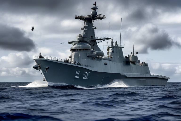
The Role of Satellites in Protecting Military Assets
In today's fast-paced world, where every second counts, the role of satellites in military operations cannot be overstated. Imagine a chess game where each piece has the ability to communicate, observe, and strategize in real-time—this is the reality of modern warfare, thanks to advanced satellite technology. Satellites act as the eyes and ears of military forces, providing critical intelligence that enhances operational effectiveness and safeguards valuable assets. With the ability to gather data from vast distances, they play a pivotal role in ensuring that troops are well-informed and prepared for any situation. This article delves into how satellites enhance military capabilities, improve communication, and provide essential intelligence for asset protection.
At the heart of military operations lies the satellite communication system, a lifeline that ensures secure and reliable communication channels. These systems are not just about sending messages; they are about creating a cohesive network that enables seamless coordination among troops. Imagine being in a vast battlefield where every soldier needs to be on the same page—satellite communications make that possible. They facilitate the sharing of crucial information, allowing military leaders to make informed decisions swiftly. With the potential for real-time updates, these systems significantly enhance operational effectiveness, ensuring that every action taken is well-informed and strategic.
Surveillance and reconnaissance are critical components of military strategy, and satellites equipped with advanced imaging technology are the backbone of these operations. They provide essential capabilities that allow military forces to monitor enemy movements and gather vital intelligence. Think of these satellites as hawks soaring high above, watching every move below. Their ability to capture detailed images of the terrain and infrastructure is invaluable for assessing potential threats and planning military operations effectively. This is where Earth observation satellites come into play.
Earth observation satellites utilize high-resolution imaging to capture detailed views of the battlefield. This information is like a treasure map for military strategists, guiding them in their decision-making processes. By analyzing these images, military leaders can identify key locations, assess infrastructure vulnerabilities, and anticipate enemy strategies. The detailed data gathered from these satellites is crucial for effective planning and execution of military operations, ensuring that every move is calculated and strategic.
In the realm of military operations, conditions are rarely perfect. That’s where infrared and radar imaging technologies come into play, enhancing the ability to detect and track targets under various circumstances. Whether it’s the cover of night or adverse weather conditions, these technologies ensure that military forces maintain situational awareness. Imagine trying to find a needle in a haystack; infrared and radar imaging are the powerful magnets that help pinpoint that needle, providing critical information that keeps military operations running smoothly.
One of the most significant advancements in military satellite technology is the capability for real-time data transmission. This means that military leaders can receive immediate updates on battlefield conditions, allowing for rapid decision-making. In the heat of battle, every second counts, and the ability to access real-time information can be the difference between success and failure. This flow of information is essential for maintaining operational momentum and responding to evolving situations on the ground.
No discussion about military satellites would be complete without mentioning GPS technology. This technology is integral to modern military operations, providing precise navigation and timing for troops and equipment. Think of GPS as a digital compass that not only guides soldiers but also enhances mission accuracy. It allows for effective coordination of movements, ensuring that every unit reaches its destination safely and on time.
Satellites also play a crucial role in threat detection and mitigation. By continuously monitoring potential adversaries' activities, they assist in identifying missile launches, troop movements, and other military threats. This capability is vital for national defense and response strategies, ensuring that military forces are always one step ahead of potential threats.
Missile early warning systems, powered by satellite data, are essential for detecting missile launches and providing timely alerts to military forces. This capability is akin to having a smoke detector in your home; it gives you the early warning needed to take action before it's too late. In an age where missile threats are ever-present, these systems are a cornerstone of national defense.
As military operations become increasingly reliant on satellite technology, robust cybersecurity measures are essential. Protecting military communications and data from potential cyber threats is paramount. Just as you lock your doors at night to keep your home safe, ensuring the integrity of satellite systems is critical for operational security. Cybersecurity in satellite operations is not just an option; it's a necessity.
The future of military satellites promises exciting advancements, including miniaturization, increased bandwidth, and enhanced resilience against threats. These trends are set to further strengthen military capabilities and asset protection. As technology evolves, so too will the methods by which military forces utilize satellites to their advantage.
Emerging technologies such as artificial intelligence and machine learning are set to revolutionize satellite operations. These innovations will enhance data analysis and improve decision-making processes in military contexts. Imagine having a highly intelligent assistant that can sift through mountains of data in seconds—this is the future of military intelligence.
Lastly, international collaboration in satellite technology development and intelligence sharing is becoming increasingly important. Joint efforts among allied nations can enhance collective security and improve responses to global threats. Just as a team of superheroes works together to combat evil, nations must unite to ensure a safer world through shared satellite capabilities.
- How do military satellites enhance communication?
Military satellites provide secure communication channels that allow troops to coordinate effectively and share vital information in real-time. - What role do satellites play in surveillance?
Satellites equipped with advanced imaging technology enable military forces to monitor enemy movements and gather crucial intelligence for strategic planning. - Why is GPS important for military operations?
GPS technology provides precise navigation and timing, enhancing mission accuracy and coordination among troops. - What are missile early warning systems?
These systems utilize satellite data to detect missile launches and provide timely alerts, which are essential for national defense. - How is cybersecurity addressed in military satellite operations?
Robust cybersecurity measures are implemented to protect military communications and data from potential cyber threats.
Satellite Communication Systems
When it comes to military operations, communication is key. Imagine a high-stakes chess game where each move can mean the difference between victory and defeat. In this scenario, satellite communication systems act as the invisible hand guiding the players, ensuring that every piece is in sync and ready to make its move. These systems are not just technological marvels; they are lifelines that connect troops in the field with command centers thousands of miles away. By providing secure and reliable communication channels, satellites enhance operational effectiveness and ensure that vital information is shared seamlessly.
One of the standout features of satellite communication systems is their ability to function in remote and challenging environments. Whether troops are deployed in dense jungles, arid deserts, or even mountainous terrains, these systems ensure that they remain connected. This connectivity is crucial for coordination, allowing different units to share real-time updates on mission status, troop movements, and even potential threats. Without this ability to communicate effectively, military operations could be severely hampered, leading to confusion and costly mistakes.
Furthermore, satellite communication systems are equipped with advanced encryption technologies that safeguard sensitive information. In a world where cyber threats are increasingly prevalent, the security of military communications cannot be overstated. By utilizing sophisticated encryption methods, these systems protect data from potential interception and hacking attempts, ensuring that only authorized personnel have access to critical information. This layer of security is essential for maintaining operational integrity and protecting national interests.
To illustrate the importance of satellite communication systems, consider the following table that outlines their key features and benefits:
| Feature | Benefit |
|---|---|
| Real-time Communication | Enhances coordination and decision-making during operations. |
| Global Coverage | Ensures connectivity in remote and hostile environments. |
| Secure Encryption | Protects sensitive military information from cyber threats. |
| Data Transmission | Facilitates sharing of intelligence and operational updates. |
In summary, satellite communication systems are the backbone of modern military operations. They provide the necessary infrastructure for secure, reliable communication, enabling troops to operate effectively in various environments. As technology continues to evolve, we can expect these systems to become even more sophisticated, further enhancing the military's ability to protect its assets and maintain operational readiness.
Surveillance and Reconnaissance
When it comes to military operations, are not just buzzwords; they are the backbone of strategic planning and execution. Imagine trying to navigate through a dense fog without a map or a compass—this is akin to conducting military operations without real-time intelligence. Satellites equipped with advanced imaging technology are like the eyes in the sky, providing critical data that enables military forces to monitor enemy movements, assess potential threats, and gather vital intelligence.
These satellites are not just passive observers; they actively collect and transmit data that can dramatically influence the outcome of military engagements. For instance, they utilize various imaging techniques to capture high-resolution images of enemy installations, troop concentrations, and even logistics routes. This information is invaluable for commanders on the ground who rely on accurate and timely data to make informed decisions. The ability to see the battlefield from above transforms the way military operations are planned and executed.
Earth observation satellites are at the forefront of this technological revolution. They utilize high-resolution imaging capabilities to capture detailed views of terrain and infrastructure. These satellites can provide imagery that reveals not just the physical landscape but also the activities occurring within it. For example, they can help identify changes in enemy positions or the construction of new military facilities, which could indicate an impending attack.
Moreover, these satellites can operate in various electromagnetic spectrums, which allows them to gather information during both day and night. The integration of infrared and radar imaging technologies enhances their capabilities even further. Infrared imaging can detect heat signatures from vehicles and personnel, while radar imaging can penetrate cloud cover and adverse weather conditions. This multi-faceted approach ensures that military leaders maintain situational awareness, regardless of environmental challenges.
One of the most significant advantages of modern military satellites is their ability to facilitate real-time data transmission. Imagine a football game where the coach has immediate access to every play, every movement of the opposing team—this is what real-time data provides to military strategists. Instant updates on battlefield conditions allow commanders to adapt their strategies on the fly, making rapid decisions that can mean the difference between success and failure in a mission.
With the integration of satellite data into command and control systems, military forces can analyze the battlefield dynamically. This capability not only enhances operational effectiveness but also minimizes risks to personnel and equipment. In a world where seconds can determine the outcome of a conflict, the ability to receive and act upon real-time intelligence is invaluable.
In conclusion, the role of satellites in surveillance and reconnaissance cannot be overstated. They serve as a force multiplier, enhancing military capabilities and providing the critical intelligence necessary for safeguarding assets. As technology advances, the potential for even greater capabilities in this domain continues to grow, promising a future where military operations are more informed, agile, and effective.
- How do satellites improve military surveillance?
Satellites provide high-resolution imagery and real-time data, allowing military forces to monitor enemy movements and gather essential intelligence. - What technologies are used in military satellites?
Military satellites use various technologies, including infrared and radar imaging, to enhance their surveillance capabilities under different conditions. - How does real-time data transmission benefit military operations?
Real-time data transmission allows commanders to receive immediate updates on battlefield conditions, enabling rapid decision-making and adaptive strategies.
Earth Observation Satellites
Earth observation satellites are the unsung heroes of modern military operations, providing a bird's-eye view of the battlefield and beyond. These satellites are equipped with high-resolution imaging technology that captures detailed snapshots of the Earth's surface, revealing critical information about terrain, infrastructure, and even enemy movements. Imagine being able to see the lay of the land from space; it’s like having a tactical map that updates in real-time!
One of the most significant advantages of earth observation satellites is their ability to gather intelligence without the need for boots on the ground. This capability allows military planners to assess potential threats and devise strategies without exposing their forces to unnecessary risks. For instance, when planning an operation, commanders can utilize satellite imagery to identify key locations, such as supply routes or enemy fortifications. This foresight can mean the difference between success and failure in military engagements.
Furthermore, earth observation satellites are not just limited to visual imaging. They also employ various sensors that can capture data across different wavelengths, including infrared and radar. This multi-spectral approach allows military forces to detect activities that might otherwise go unnoticed. For example, infrared sensors can identify heat signatures, making it easier to locate hidden vehicles or troop formations, even in challenging conditions like darkness or poor weather.
In addition to their surveillance capabilities, these satellites also play a pivotal role in disaster response and humanitarian missions. When natural disasters strike, such as earthquakes or floods, earth observation satellites can provide critical data to aid in rescue operations and resource allocation. This dual-use functionality highlights the importance of these satellites in both military and civilian contexts, showcasing their versatility and value.
To give you a clearer picture of how earth observation satellites operate, let’s look at some key features:
| Feature | Description |
|---|---|
| Resolution | High-resolution imaging allows for detailed analysis of terrain and structures. |
| Multi-Spectral Imaging | Captures data across various wavelengths, enhancing detection capabilities. |
| Real-Time Updates | Provides immediate intelligence for timely decision-making. |
| Global Coverage | Can monitor any location on Earth, ensuring comprehensive surveillance. |
In summary, earth observation satellites are a cornerstone of modern military strategy, enabling forces to maintain a competitive edge through enhanced situational awareness and intelligence gathering. As technology continues to evolve, the capabilities of these satellites will only expand, further solidifying their role in safeguarding military assets and ensuring operational success.
- What are earth observation satellites used for?
They are primarily used for surveillance, reconnaissance, and intelligence gathering, but they also assist in disaster response and humanitarian missions. - How do these satellites capture images?
Earth observation satellites utilize various imaging technologies, including optical, infrared, and radar sensors, to capture detailed images of the Earth's surface. - What advantages do earth observation satellites provide to military operations?
They offer real-time intelligence, enhanced situational awareness, and the ability to monitor enemy movements without putting troops at risk. - Are earth observation satellites only used by the military?
No, while they play a crucial role in military operations, they are also used for environmental monitoring, disaster management, and urban planning.
Infrared and Radar Imaging
When it comes to modern military operations, technologies are nothing short of revolutionary. Imagine being able to see through the fog of war, literally! These advanced imaging systems allow military forces to detect and track targets under a variety of challenging conditions, such as during the night or in adverse weather. This capability is akin to having a superpower that enhances situational awareness and ensures that no movement goes unnoticed.
Infrared imaging works by detecting the heat emitted by objects, which means it can identify vehicles, personnel, and even missile launches based on their thermal signatures. On the other hand, radar imaging sends out radio waves that bounce back from objects, allowing military analysts to create detailed maps of the terrain and identify potential threats. The combination of these technologies is like having a multi-faceted lens through which military leaders can view the battlefield.
Let’s consider a scenario: a military unit is operating in a region where visibility is severely limited due to heavy rain or fog. Traditional visual reconnaissance methods would struggle, but with , commanders can still gather critical intelligence. This technology not only enhances the ability to track enemy movements but also allows for effective planning and execution of countermeasures.
Moreover, the integration of these imaging technologies into satellite systems means that real-time data can be transmitted back to command centers. This rapid flow of information is essential for making timely decisions that can alter the course of operations. The ability to see and understand the battlefield in real-time is a game-changer, providing military forces with a significant advantage over adversaries who may still rely on more traditional methods.
In summary, infrared and radar imaging technologies are essential components of modern military strategy. They enhance the ability to maintain situational awareness, improve target detection capabilities, and facilitate informed decision-making. As technology continues to advance, we can expect even greater improvements in these imaging systems, further solidifying their role in protecting military assets.
- What is the primary function of infrared imaging in military operations?
Infrared imaging primarily detects heat emitted by objects, allowing military forces to identify targets even in low visibility conditions. - How does radar imaging differ from infrared imaging?
Radar imaging uses radio waves to detect objects and create terrain maps, while infrared imaging relies on thermal signatures. - Can these technologies be used simultaneously?
Yes, integrating both infrared and radar imaging provides a comprehensive view of the battlefield, enhancing situational awareness. - What are the future trends in infrared and radar imaging?
Future trends include advancements in resolution, miniaturization of equipment, and improved data processing capabilities, driven by artificial intelligence.
Real-time Data Transmission
In the fast-paced world of military operations, serves as the backbone of effective decision-making and operational success. Imagine being in a high-stakes game where every second counts; that's exactly what military leaders face on the battlefield. When satellites relay information instantaneously, they provide a crucial edge that can mean the difference between victory and defeat. This capability allows commanders to make informed decisions based on the most current battlefield conditions, ensuring that they can adapt their strategies on the fly.
Real-time data transmission enables the military to receive immediate updates from various sources, including surveillance satellites, ground sensors, and airborne reconnaissance. Here are some key benefits of this technology:
- Enhanced Situational Awareness: With real-time data, military personnel can visualize the battlefield in real-time, allowing for a clearer understanding of troop movements and enemy positions.
- Quick Response Times: Immediate access to intelligence enables rapid deployment of forces and resources, which is essential for seizing tactical advantages.
- Improved Coordination: Multiple units can operate in sync, sharing vital information that helps streamline operations and reduce the risk of friendly fire.
Moreover, the integration of advanced technologies, such as artificial intelligence and machine learning, is pushing the boundaries of what real-time data transmission can achieve. These technologies analyze incoming data streams, identifying patterns and anomalies that might otherwise go unnoticed. This not only enhances the speed of decision-making but also increases the accuracy of predictions regarding enemy movements or potential threats.
As military operations become more complex, the need for robust communication systems that can handle vast amounts of data becomes increasingly critical. The challenges posed by electronic warfare and potential disruptions from adversaries necessitate that military satellites are equipped with cutting-edge security measures to protect the integrity of transmitted data. In essence, real-time data transmission is not just about speed; it's also about ensuring that the information is secure and reliable.
In conclusion, the ability to transmit data in real-time is a game-changer for military operations. It empowers commanders with the information they need to make quick, informed decisions, ultimately enhancing operational effectiveness and safeguarding military assets on the ground.
- What is real-time data transmission in military operations?
Real-time data transmission refers to the immediate relay of information from satellites and other sources to military leaders, allowing for prompt decision-making. - How does real-time data improve military effectiveness?
It enhances situational awareness, enables quick response times, and improves coordination among units. - What technologies support real-time data transmission?
Technologies such as artificial intelligence, machine learning, and advanced satellite communication systems play a crucial role. - Why is cybersecurity important for real-time data transmission?
Ensuring the integrity and security of transmitted data is vital to prevent adversaries from intercepting or manipulating critical information.
Global Positioning Systems (GPS)
The advent of has dramatically transformed military operations, making them more precise and efficient than ever before. Imagine a world where troops can navigate through challenging terrains with pinpoint accuracy, avoiding potential hazards and reaching their objectives seamlessly. This is the reality that GPS technology brings to the table, serving as a lifeline for modern military forces. With its ability to provide real-time location data, GPS enhances mission planning and execution in ways that were once unimaginable.
At its core, GPS is a satellite-based navigation system that allows military personnel to determine their exact location anywhere on the planet. This is achieved through a network of satellites orbiting the Earth, which send signals to GPS receivers on the ground. By triangulating these signals, the receivers can calculate their precise coordinates. The implications of this technology are vast, as it not only aids in navigation but also plays a crucial role in coordinating troop movements and logistics.
One of the most significant advantages of GPS is its ability to improve operational efficiency. For instance, consider a scenario where a military unit is tasked with a reconnaissance mission in unfamiliar territory. With GPS, the unit can receive real-time updates on their location, ensuring they stay on course and avoid enemy detection. This level of situational awareness is vital for the success of military operations.
Moreover, GPS technology is not just limited to ground troops. It extends its benefits to air and naval forces as well. Aircraft can utilize GPS for precise navigation and targeting, while naval vessels can chart their courses accurately across vast oceans. This interconnectedness enhances the overall effectiveness of military operations, allowing for seamless collaboration among different branches of the armed forces.
However, as beneficial as GPS is, it’s essential to recognize the potential vulnerabilities that come with its use. As military reliance on GPS increases, so does the risk of adversaries attempting to jam or spoof GPS signals. To counter these threats, the military is investing in advanced technologies and alternative navigation systems that can operate independently of GPS. This proactive approach ensures that military operations remain resilient, even in the face of potential electronic warfare.
In conclusion, are a cornerstone of modern military strategy, providing unparalleled navigational capabilities that enhance mission success. As technology continues to evolve, the military will undoubtedly find new ways to leverage GPS to protect assets and maintain a strategic advantage on the battlefield. The future of GPS in military operations looks promising, with ongoing advancements aimed at improving accuracy, resilience, and security.
- What is GPS and how does it work? GPS is a satellite-based navigation system that provides accurate location information by triangulating signals from multiple satellites.
- How does GPS enhance military operations? GPS improves navigation, coordination, and situational awareness, allowing military forces to execute missions more effectively.
- What are the vulnerabilities of GPS? GPS can be susceptible to jamming and spoofing, which can disrupt military operations. Therefore, alternative navigation methods are being developed.
- Is GPS used by all branches of the military? Yes, GPS technology is utilized by ground, air, and naval forces to enhance operational efficiency and effectiveness.
Threat Detection and Mitigation
In the ever-evolving landscape of military operations, the role of satellites in cannot be overstated. These technological marvels act as the eyes in the sky, constantly monitoring activities that could pose risks to national security. Imagine a vast ocean where potential threats could be lurking beneath the surface; satellites are the vigilant lifeguards, scanning the horizon for any signs of danger. By leveraging satellite technology, military forces can effectively identify and respond to threats before they escalate.
One of the primary functions of military satellites is to monitor the activities of potential adversaries. This includes tracking troop movements, naval deployments, and even detecting missile launches. With the capability to capture high-resolution imagery, satellites provide a comprehensive view of the battlefield, allowing military strategists to make informed decisions. For instance, when a satellite detects unusual troop concentrations near a border, it can trigger a series of assessments and preparations, ensuring that forces are ready to respond swiftly.
Moreover, the integration of missile early warning systems has transformed the way military forces approach threat detection. These systems utilize satellite data to detect missile launches in real-time, providing critical alerts that can be the difference between effective defense and catastrophic loss. The speed at which information travels through these systems is akin to a lightning bolt, striking with urgency and precision. This capability is vital not only for immediate response strategies but also for long-term national defense planning.
Another crucial aspect of threat detection is the ability to analyze data from various sources. Satellites collect vast amounts of information, which can be processed using advanced algorithms and artificial intelligence. This data analysis helps military leaders identify patterns and predict potential threats. For example, if satellite imagery shows a sudden increase in military vehicles at a training facility, analysts can assess whether this is a routine exercise or a precursor to a more aggressive maneuver. The insights gained from such analyses are invaluable for strategic planning.
As we delve deeper into the realm of satellite technology, we must also consider the importance of cybersecurity measures. With military operations increasingly reliant on satellite communications, protecting these systems from cyber threats is paramount. A successful cyberattack could compromise sensitive data and disrupt communication channels, leading to disastrous consequences on the battlefield. Therefore, robust cybersecurity protocols are essential to safeguard military communications and maintain operational integrity.
In summary, the role of satellites in threat detection and mitigation is multifaceted and critical to modern military operations. They provide real-time intelligence, enhance situational awareness, and enable timely responses to emerging threats. As technology continues to advance, the capabilities of military satellites will only improve, ensuring that armed forces remain one step ahead of potential adversaries.
- How do satellites detect missile launches? Satellites equipped with infrared sensors can detect the heat signature from missile launches, allowing for early warning and rapid response.
- What role does cybersecurity play in satellite operations? Cybersecurity is crucial for protecting satellite communications and data from potential cyber threats, ensuring operational security.
- Can satellites provide real-time data during military operations? Yes, satellites can transmit real-time data, allowing military leaders to make timely decisions based on current battlefield conditions.
- How does satellite imagery assist in strategic planning? High-resolution satellite imagery allows military strategists to assess terrain, monitor enemy movements, and plan operations effectively.
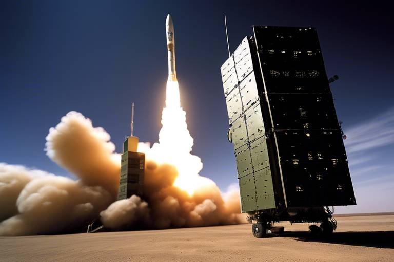
Missile Early Warning Systems
Missile early warning systems (MEWS) are crucial components of modern military defense strategies. They serve as the first line of defense against potential missile threats, providing timely alerts that can be the difference between effective response and catastrophic consequences. Imagine a world where a missile is launched, and within moments, military forces are alerted, enabling them to take preemptive actions. This is the power of MEWS, and it relies heavily on advanced satellite technology to function effectively.
At the heart of these systems are satellites equipped with sophisticated sensors designed to detect the heat signatures of missile launches. These satellites are strategically placed in orbit to cover vast areas and can monitor multiple regions simultaneously. When a missile is launched, the sensors pick up the infrared radiation emitted during the launch, allowing for rapid detection. This information is then transmitted back to command centers on Earth, where military leaders can assess the situation and respond accordingly. The speed of this process is vital; as the saying goes, "time is of the essence," and in military operations, every second counts.
Moreover, the integration of satellite data with ground-based radar systems enhances the accuracy of threat assessments. By combining information from various sources, military analysts can create a comprehensive picture of the battlefield. This synergy not only improves situational awareness but also aids in the development of effective countermeasures. For instance, if a missile is detected, military forces can determine its trajectory and potential targets, allowing them to deploy defensive systems or evacuate at-risk areas.
The following table illustrates the key components and functionalities of missile early warning systems:
| Component | Functionality |
|---|---|
| Satellites | Monitor missile launches via infrared sensors |
| Ground Stations | Receive and analyze data from satellites |
| Command Centers | Coordinate military responses based on threat assessments |
| Defensive Systems | Engage and neutralize incoming threats |
As we look to the future, the evolution of missile early warning systems is closely tied to advancements in technology. Innovations such as artificial intelligence and machine learning are expected to play a significant role in enhancing the speed and accuracy of threat detection. These technologies can analyze vast amounts of data in real time, identifying patterns and anomalies that might indicate a missile launch. This capability will not only improve response times but also reduce the likelihood of false alarms—an essential factor in maintaining military readiness and preventing unnecessary escalations.
In conclusion, missile early warning systems are indispensable in safeguarding national security. They exemplify the intersection of technology and military strategy, showcasing how satellites can provide critical intelligence that protects military assets and civilian populations alike. As threats evolve, so too must our systems, ensuring that we remain one step ahead in the ever-changing landscape of global security.
- What is a missile early warning system?
It is a military system that detects missile launches and provides timely alerts to military forces.
- How do satellites contribute to missile early warning systems?
Satellites use advanced sensors to detect heat signatures from missile launches and transmit this data to command centers.
- What technologies are being integrated into missile early warning systems?
Emerging technologies such as artificial intelligence and machine learning are being integrated to enhance detection and response capabilities.
Cybersecurity Measures
In today's digital battlefield, where information is as valuable as ammunition, are paramount for military operations. As military forces increasingly rely on satellite technology for communication, navigation, and intelligence, the risk of cyber threats has escalated. These threats not only jeopardize sensitive data but can also compromise entire missions. Therefore, establishing robust cybersecurity protocols is essential to safeguard military assets.
One of the primary strategies to enhance cybersecurity is the implementation of encryption techniques. By encrypting data transmitted via satellite, military communications can be shielded from unauthorized access. This means that even if an adversary intercepts the signals, the information remains unreadable without the proper decryption keys. Additionally, utilizing multi-factor authentication for accessing satellite systems adds another layer of security, ensuring that only authorized personnel can interact with critical systems.
Moreover, constant monitoring of satellite networks is crucial. This involves deploying advanced anomaly detection systems that can identify unusual patterns of behavior that may indicate a cyber attack. By leveraging artificial intelligence, military cybersecurity teams can analyze vast amounts of data in real time, allowing them to respond swiftly to potential threats. This proactive approach is vital in maintaining operational security and ensuring that communication lines remain open and secure.
Another significant aspect of cybersecurity measures is training personnel. Military staff must be well-versed in identifying phishing attempts, social engineering tactics, and other cyber threats. Regular training sessions can empower personnel to recognize and report suspicious activities, thereby creating a culture of vigilance within the ranks. This human element, combined with technological defenses, forms a robust barrier against cyber intrusions.
Furthermore, collaboration with international partners can enhance cybersecurity efforts. By sharing intelligence and best practices, allied nations can fortify their defenses against common threats. This collaboration can take the form of joint exercises, where military units simulate cyber attack scenarios, allowing them to refine their response strategies and improve overall readiness.
In conclusion, as military operations become increasingly intertwined with technology, the importance of cybersecurity cannot be overstated. By implementing comprehensive measures that encompass encryption, monitoring, personnel training, and international collaboration, military forces can protect their satellite communications and ensure the integrity of their operations. The battlefield may have changed, but the need for strategic defense remains as critical as ever.
- What are the main threats to military satellite communications?
Military satellite communications face threats from cyber attacks, jamming, and interception of signals. - How does encryption protect military data?
Encryption scrambles data, making it unreadable to unauthorized users and protecting sensitive information during transmission. - Why is personnel training important in cybersecurity?
Training helps military personnel recognize and respond to cyber threats, reducing the risk of successful attacks. - What role does international collaboration play in cybersecurity?
International collaboration allows nations to share intelligence, best practices, and resources, enhancing collective security against cyber threats.
Future Trends in Military Satellites
The future of military satellites is not just a glimpse into the next decade; it’s a fascinating journey into a realm where technology meets strategy in unprecedented ways. As we stand on the brink of this new era, several key trends are emerging that promise to revolutionize how military operations are conducted. One of the most significant advancements is the miniaturization of satellite technology. Smaller satellites can be launched in swarms, allowing for more comprehensive coverage and faster deployment. Imagine a fleet of tiny satellites working together, like a school of fish, darting through the skies to gather data and relay it back to command centers. This not only enhances situational awareness but also reduces the costs associated with traditional satellite launches.
Another exciting trend is the increase in bandwidth capabilities. With the growing demand for data in military operations, having the ability to transmit vast amounts of information quickly is crucial. Enhanced bandwidth means that real-time video feeds, intelligence reports, and communication can flow seamlessly, ensuring that military leaders are always in the loop, no matter where they are. This is akin to upgrading from a dial-up connection to fiber optic; the difference in speed and efficiency is monumental.
Furthermore, the resilience of military satellites against threats is becoming a focal point. As adversaries develop counter-space capabilities, the military must ensure that its satellite systems can withstand these challenges. This involves not just physical hardening but also incorporating advanced cybersecurity measures to protect against hacking and jamming attempts. The integrity of satellite data is paramount, and failure to secure these systems could lead to catastrophic consequences in military operations.
Emerging technologies such as artificial intelligence (AI) and machine learning are also set to transform how satellites operate. These technologies can analyze vast amounts of data at lightning speed, identifying patterns and anomalies that human analysts might miss. For instance, AI can help in predicting enemy movements based on historical data, providing military strategists with a significant edge. Imagine having a smart assistant that not only keeps track of your schedule but also predicts potential risks based on your past activities—this is the future of military intelligence.
Lastly, international collaboration in satellite technology is becoming increasingly important. As global threats evolve, so too must our responses. By sharing intelligence and satellite resources, allied nations can create a more formidable defense network. This collaboration can take many forms, from joint satellite missions to shared data platforms, enhancing collective security and improving response times to emerging threats. Think of it as a united front, where nations pool their resources to face common challenges, much like superheroes teaming up to combat a villain.
In summary, the future trends in military satellites are gearing up to create a more agile, responsive, and secure military landscape. With advancements in technology, the integration of AI, and the importance of international partnerships, the military satellite systems of tomorrow will be far more capable than those of today. The question is not just what these satellites will do, but how they will redefine the very nature of military operations in an increasingly complex world.
- What are the main benefits of miniaturizing military satellites?
Miniaturization allows for more satellites to be launched at once, improving coverage and reducing costs while enabling faster deployment. - How does AI enhance military satellite operations?
AI helps in analyzing large datasets quickly, identifying patterns, and predicting enemy movements, which can significantly aid strategic planning. - Why is international collaboration important for military satellites?
Collaborating with allied nations enhances collective security, improves response times to threats, and allows for shared resources and intelligence.
Emerging Technologies
As we look towards the future, the landscape of military satellite operations is set to undergo a profound transformation, largely driven by . Innovations such as artificial intelligence (AI) and machine learning (ML) are at the forefront of this evolution, promising to enhance the capabilities and effectiveness of military satellites in unprecedented ways. Imagine a scenario where satellites can not only gather data but also analyze it in real-time, identifying patterns and making predictions that can inform military strategies. This is not just a dream; it is becoming a reality as these technologies continue to develop.
AI and ML can process vast amounts of data far more efficiently than human analysts. They can sift through imagery captured by satellites, detecting changes in terrain, identifying potential threats, and even recognizing enemy movements with remarkable accuracy. This level of analysis allows military leaders to make informed decisions quickly, significantly increasing operational effectiveness.
Moreover, the integration of autonomous systems into satellite technology is another exciting trend. These systems can operate independently, reducing the need for constant human oversight. For instance, a fleet of small satellites could be deployed to monitor a specific area, each one communicating with the others to create a comprehensive picture of the battlefield. This level of coordination and autonomy could revolutionize how military operations are conducted.
Another critical aspect of emerging technologies is the miniaturization of satellite components. Smaller, lighter satellites can be deployed more easily and cost-effectively, allowing for a larger constellation of satellites in orbit. This increase in quantity can lead to enhanced coverage and redundancy, ensuring that military operations are supported even if some satellites are compromised.
| Technology | Description | Impact on Military Operations |
|---|---|---|
| Artificial Intelligence | Machine systems that can learn and adapt from data. | Improved data analysis and threat detection. |
| Machine Learning | A subset of AI focused on pattern recognition. | Enhanced predictive capabilities for strategic planning. |
| Autonomous Systems | Self-operating satellite systems. | Reduced need for human intervention, increased efficiency. |
| Miniaturization | Development of smaller satellite components. | Cost-effective deployment and increased satellite numbers. |
In addition to these advancements, the use of blockchain technology is also gaining traction within military satellite operations. Blockchain can provide a secure and transparent method for managing satellite communications and data transactions. This is particularly important as the military faces increasing threats from cyber attacks. By utilizing blockchain, military forces can enhance the integrity and security of their satellite systems, ensuring that sensitive information remains protected.
As these technologies continue to develop and integrate into military satellite operations, the potential for improved situational awareness and strategic advantage becomes clear. The ability to gather, analyze, and act upon data in real-time will not only enhance military effectiveness but also ensure that nations can respond swiftly to emerging threats. The future of military satellites is bright, and it is powered by innovation and collaboration.
- What are the key benefits of using AI in military satellite operations?
AI enhances data processing speed and accuracy, allowing for quicker and more informed decision-making. - How does miniaturization impact satellite deployment?
Smaller satellites can be launched more cost-effectively and in greater numbers, improving coverage and resilience. - What role does blockchain play in military satellite security?
Blockchain provides a secure framework for managing communications and data, protecting against cyber threats. - Can autonomous systems operate without human oversight?
Yes, autonomous systems can perform tasks independently, but human oversight is still essential for critical decisions.
International Collaboration
In an era where global threats can emerge from anywhere, in military satellite technology has become more crucial than ever. Nations are increasingly recognizing that by pooling resources, expertise, and intelligence, they can significantly enhance their defense capabilities. Think of it like a team of superheroes joining forces; each one brings unique powers to the table, making them far more effective against formidable villains.
Countries are not just sharing satellite data; they are also collaborating on the development of advanced satellite systems. For instance, joint missions can lead to the creation of satellites equipped with cutting-edge technology that no single nation could afford or develop independently. This collaboration can take many forms, including:
- Joint Satellite Programs: Countries work together to design, launch, and operate satellites that serve mutual interests.
- Data Sharing Agreements: Nations establish protocols for sharing satellite imagery and intelligence, enhancing situational awareness.
- Training and Development: Military personnel from allied nations can engage in joint training exercises to better understand satellite operations and capabilities.
Moreover, the importance of alliances, such as NATO, cannot be overstated. These partnerships facilitate not only the sharing of satellite data but also the integration of various military assets. Imagine a vast network of eyes in the sky, all working in concert to monitor threats and provide real-time intelligence. This level of coordination can be a game-changer in military operations, allowing nations to respond more swiftly and effectively to emerging challenges.
However, international collaboration is not without its challenges. Issues such as data security and the potential for technological espionage raise concerns among nations. Countries must navigate these challenges carefully to ensure that their collaborative efforts do not compromise national security. Establishing trust and transparency among allies is essential, akin to building a bridge where both sides must feel secure in crossing.
As we look to the future, the trend of international collaboration in military satellite operations is likely to grow. With advancements in technology and the increasing complexity of global threats, countries will need to work together more than ever. By combining forces, they can create a more robust defense infrastructure that not only protects their own assets but also contributes to global stability.
- Why is international collaboration important in military satellite operations? International collaboration allows nations to share resources and intelligence, enhancing their collective defense capabilities.
- What are some examples of international collaboration? Joint satellite programs, data sharing agreements, and joint training exercises are common forms of collaboration.
- What challenges do nations face in collaborating on satellite technology? Issues such as data security, technological espionage, and the need for trust and transparency can complicate international collaboration.
Frequently Asked Questions
- How do satellites enhance military communication?
Satellites provide secure and reliable communication channels that are crucial for military operations. They enable troops to coordinate effectively, share vital information, and maintain operational effectiveness even in remote or hostile environments.
- What role do satellites play in surveillance and reconnaissance?
Satellites equipped with advanced imaging technology offer essential surveillance and reconnaissance capabilities. They allow military forces to monitor enemy movements, gather intelligence, and improve strategic planning, significantly enhancing decision-making processes.
- What is the significance of Earth observation satellites?
Earth observation satellites capture high-resolution images of terrain and infrastructure, which are crucial for assessing potential threats and planning military operations. This detailed information helps military leaders make informed decisions based on accurate data.
- How does GPS technology benefit military operations?
GPS technology provides precise navigation and timing for troops and equipment, which enhances mission accuracy and coordination. It ensures that military forces can move effectively and reach their objectives with minimal errors.
- What are missile early warning systems?
Missile early warning systems utilize satellite data to detect missile launches and alert military forces in real-time. This capability is vital for national defense, enabling timely responses to potential threats and enhancing overall security.
- Why are cybersecurity measures important for military satellites?
With the increasing reliance on satellite technology, robust cybersecurity measures are essential to protect military communications and data. Ensuring the integrity of satellite systems is critical for operational security, safeguarding sensitive information from cyber threats.
- What future trends are expected in military satellites?
The future of military satellites includes advancements such as miniaturization, increased bandwidth, and enhanced resilience against threats. These trends will further strengthen military capabilities and improve asset protection in an evolving global landscape.
- How are emerging technologies impacting satellite operations?
Emerging technologies like artificial intelligence and machine learning are set to revolutionize satellite operations. These innovations will enhance data analysis, improve decision-making processes, and enable military forces to respond more effectively to various situations.
- What is the importance of international collaboration in satellite technology?
International collaboration in satellite technology development and intelligence sharing is increasingly vital. Joint efforts among allied nations can enhance collective security, improve responses to global threats, and foster a more secure future for all.