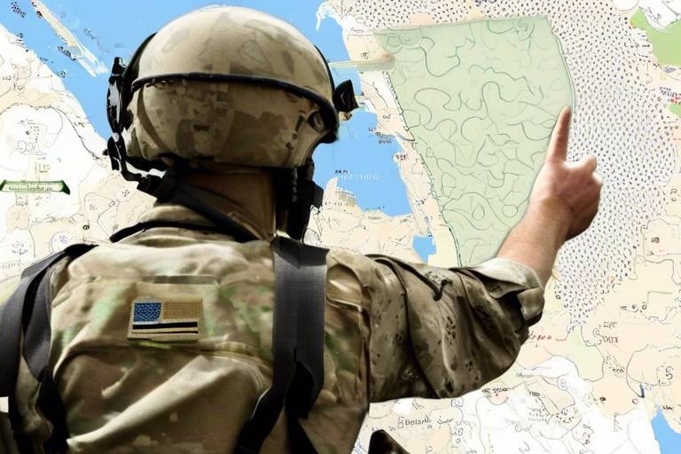
How the Pentagon Uses Satellite Data for Strategic Planning
In today's rapidly evolving world, the Pentagon has become increasingly reliant on satellite data to enhance its strategic planning capabilities. Imagine trying to navigate a vast ocean without a map or compass; that's what military operations would be like without the invaluable insights provided by satellite technology. From monitoring enemy movements to assessing environmental conditions, the role of satellite data is akin to that of a seasoned navigator steering a ship through treacherous waters. This article delves into the various ways the Pentagon leverages satellite data to enhance its operational efficiency and decision-making processes.
Satellite data plays a crucial role in national security by offering real-time information that enables informed decision-making and enhances situational awareness for military operations. Just as a bird's-eye view allows a person to see the bigger picture, satellite imagery provides commanders with a comprehensive overview of the battlefield. This capability is essential for anticipating enemy actions, planning counter-strategies, and ensuring that military forces are deployed effectively. Without the insights gained from satellites, military operations would be akin to playing chess without knowing the position of the opponent's pieces.
The Pentagon utilizes various types of satellite data, including imagery, signals intelligence, and weather data, each serving distinct purposes in military strategy and operational planning. By harnessing a diverse array of data types, military strategists can create a multi-faceted understanding of the operational environment. This comprehensive approach is crucial for developing effective strategies and ensuring mission success.
Imagery intelligence, derived from satellite photos, allows the Pentagon to monitor enemy movements, assess damage, and plan missions with a clear visual understanding of the battlefield. Imagine having the ability to see your opponent's every move from above; that's the power of imagery intelligence. High-resolution imaging and multi-spectral imaging are two key components of this intelligence type.
High-resolution imaging provides detailed views of specific locations, essential for targeting and reconnaissance. This level of detail is crucial for improving the accuracy of military operations. When a commander can see the exact layout of a target area, it’s like having a treasure map that leads directly to the prize.
Multi-spectral imaging captures data across various wavelengths, aiding in the identification of materials and objects. This capability is vital for understanding terrain and enemy capabilities. It’s similar to using different colored lenses to see various features of a landscape; each wavelength reveals unique insights that can significantly influence strategic decisions.
Signals intelligence collected via satellites helps the Pentagon intercept communications and electronic signals, providing insights into enemy strategies and potential threats. This form of intelligence is like having an eavesdropper in the enemy camp, allowing military planners to anticipate moves and counter them effectively.
Satellite data is integrated with ground operations to enhance coordination, improve response times, and ensure that military units are well-informed during missions. The seamless flow of information between satellites and ground forces is akin to a well-orchestrated symphony, where each section plays in harmony to create a powerful performance.
Real-time data sharing between satellites and ground forces allows for immediate updates, ensuring that military personnel are equipped with the latest information during operations. This capability is crucial for adapting to changing situations on the battlefield, much like a quarterback adjusting plays based on the defense's movements.
Joint operations benefit from satellite data by facilitating communication and coordination between different branches of the military. This unified approach to strategic planning ensures that all forces are on the same page, leading to more effective and efficient military actions.
Despite its advantages, the Pentagon faces challenges in satellite data utilization, including data overload, security concerns, and the need for advanced analytical tools to interpret the information effectively. Navigating these challenges is essential for maximizing the benefits of satellite data.
Data overload occurs when vast amounts of information overwhelm analysts, making it difficult to extract actionable insights. This situation can hinder strategic planning, as too much information can be just as detrimental as too little. It's like trying to find a needle in a haystack; the more hay there is, the harder it becomes to find that needle.
Security risks associated with satellite data include potential cyber threats and espionage. These risks necessitate robust measures to protect sensitive information from adversaries. Just as a fortress needs strong walls to defend against attacks, the Pentagon must implement stringent security protocols to safeguard its satellite data.
The future of military strategy will increasingly rely on advancements in satellite technology, including artificial intelligence and machine learning. These innovations will enhance data analysis and improve decision-making processes, paving the way for a new era of military operations.
Integrating AI and machine learning with satellite data analysis will enable faster processing and more accurate predictions. This revolution in strategic planning is comparable to upgrading from a horse-drawn carriage to a high-speed train; the pace and efficiency of military operations will dramatically increase.
Emerging satellite technologies, such as small satellites and constellations, will provide enhanced capabilities for real-time monitoring and improved resilience against potential threats. As these technologies evolve, they will offer military planners even more tools to navigate the complexities of modern warfare.
- How does satellite data impact military decision-making? Satellite data provides real-time insights that enhance situational awareness, allowing military leaders to make informed and timely decisions.
- What types of satellite data are most commonly used by the Pentagon? The Pentagon primarily uses imagery intelligence, signals intelligence, and weather data to inform its strategies.
- What challenges does the Pentagon face in utilizing satellite data? Key challenges include data overload, security risks, and the need for advanced analytical tools to interpret the vast amounts of information collected.
Importance of Satellite Data
In today's fast-paced world, satellite data has emerged as a cornerstone of national security and military strategy. Imagine trying to navigate a complex maze without a map; that's how military operations would feel without the insights provided by satellite data. This technology plays a crucial role in enhancing situational awareness, allowing military planners and decision-makers to visualize the battlefield in real-time. By harnessing this data, the Pentagon can make informed decisions that could mean the difference between success and failure in critical operations.
One of the primary advantages of satellite data is its ability to provide real-time information. Whether it’s monitoring troop movements or assessing the impact of a natural disaster, having access to timely data allows military leaders to respond swiftly and effectively. In situations where every second counts, this capability is invaluable. Moreover, satellite data enhances operational efficiency by enabling the military to plan missions with a level of precision that was previously unimaginable. It’s like having a high-tech GPS that not only shows you the way but also tells you about the roadblocks ahead.
Furthermore, the integration of satellite data into military operations enhances decision-making processes. By analyzing various types of data—ranging from imagery to signals intelligence—military strategists can develop a comprehensive understanding of the operational environment. This multifaceted approach allows for better resource allocation, ensuring that troops are deployed where they are most needed. In essence, satellite data transforms raw information into actionable intelligence, empowering military leaders to make decisions that are not just reactive but also proactive.
To illustrate the importance of satellite data, consider the following table that outlines its key contributions:
| Contribution | Description |
|---|---|
| Real-Time Monitoring | Allows for immediate updates on enemy movements and environmental conditions. |
| Enhanced Situational Awareness | Provides a comprehensive view of the battlefield, improving strategic planning. |
| Resource Allocation | Facilitates better distribution of military assets based on current intelligence. |
| Operational Efficiency | Enables precise mission planning, reducing the risk of errors during operations. |
In conclusion, the importance of satellite data in military strategy cannot be overstated. It acts as the backbone of modern warfare, providing the clarity and insight necessary for effective planning and execution. As technology continues to evolve, the Pentagon's reliance on satellite data will only grow, shaping the future of military operations.
Types of Satellite Data Used
When it comes to strategic planning and military operations, the Pentagon leverages a diverse array of satellite data. This data is not just a collection of numbers and images; it’s a vital resource that shapes national security strategies and operational effectiveness. The types of satellite data utilized can be broadly categorized into three main types: imagery intelligence, signals intelligence, and weather data. Each of these categories serves a unique purpose, contributing to the overarching goal of maintaining situational awareness and enhancing decision-making processes.
Imagery intelligence is perhaps the most well-known type of satellite data. It encompasses high-resolution images captured from space, providing a bird’s-eye view of the battlefield. These images allow military strategists to monitor enemy movements, assess the damage from previous engagements, and plan future missions with a clear visual understanding. The clarity and detail offered by satellite imagery are indispensable for effective reconnaissance. For instance, high-resolution imaging can reveal the exact location of enemy assets, while multi-spectral imaging can identify materials and objects based on their spectral signatures, thus aiding in the analysis of terrain and enemy capabilities.
On the other hand, signals intelligence plays a crucial role in intercepting communications and electronic signals transmitted by enemy forces. This type of data provides insights into enemy strategies and potential threats, allowing military planners to anticipate moves and counteract them effectively. Signals intelligence is not just about listening in; it’s about piecing together a puzzle that reveals the enemy's intentions and capabilities. By analyzing these signals, the Pentagon can gain a clearer picture of the operational landscape and make informed decisions that could mean the difference between success and failure in military engagements.
Lastly, weather data is another integral component of satellite data utilized by the Pentagon. Understanding the weather conditions can significantly influence military operations. For example, satellite-based weather data can provide real-time updates on storm systems, visibility, and temperature fluctuations, which are essential for planning airstrikes or ground maneuvers. The importance of timely and accurate weather information cannot be overstated; it can enhance the safety and effectiveness of military missions. By integrating weather data with other types of satellite intelligence, military planners can optimize their strategies and ensure that operations are conducted under the most favorable conditions.
In summary, the Pentagon’s use of satellite data is multifaceted and dynamic. By employing imagery intelligence, signals intelligence, and weather data, military strategists can enhance their situational awareness and make informed decisions that are critical for national security. Each type of satellite data contributes to a comprehensive understanding of the operational environment, enabling the military to act decisively and strategically.
- What is imagery intelligence? Imagery intelligence involves the collection and analysis of images captured by satellites, providing critical visual information for military operations.
- How does signals intelligence benefit the Pentagon? Signals intelligence helps intercept enemy communications and electronic signals, offering insights into their strategies and movements.
- Why is weather data important for military operations? Weather data provides real-time information about environmental conditions, which can significantly impact the success of military missions.
Imagery Intelligence
Imagery intelligence is a powerful tool that the Pentagon employs to gain a comprehensive understanding of the battlefield. Think of it as having a bird's-eye view of the action, allowing military strategists to monitor enemy movements, assess damage, and plan missions with precision. This type of intelligence is derived from satellite photos and plays a critical role in enhancing situational awareness, which is essential for successful military operations.
One of the standout features of imagery intelligence is its ability to provide high-resolution imaging. This technology captures detailed views of specific locations, which is vital for targeting and reconnaissance. Imagine trying to hit a bullseye in a dart game; without a clear view, your chances of success diminish significantly. High-resolution images allow military planners to make informed decisions that can mean the difference between mission success and failure.
Moreover, the Pentagon also utilizes multi-spectral imaging. This advanced technique captures data across various wavelengths, which helps in identifying materials and objects that may not be visible in standard images. For example, it can detect hidden bunkers or discern between different types of vehicles based on their thermal signatures. This capability is crucial for understanding the terrain and assessing enemy capabilities. By leveraging both high-resolution and multi-spectral imaging, the Pentagon can create a detailed operational picture that informs strategic planning.
To illustrate the importance of imagery intelligence, consider the following table that highlights some key applications:
| Application | Description |
|---|---|
| Targeting | Identifying and locating enemy assets for precision strikes. |
| Damage Assessment | Evaluating the impact of military operations on enemy infrastructure. |
| Reconnaissance | Gathering intelligence on enemy troop movements and deployments. |
In conclusion, imagery intelligence serves as a backbone for the Pentagon's strategic planning efforts. By utilizing high-resolution and multi-spectral imaging, military leaders can make data-driven decisions that enhance operational effectiveness. As technology continues to evolve, the capabilities of imagery intelligence will only strengthen, providing the Pentagon with even greater insights into the complexities of modern warfare.
- What is imagery intelligence? Imagery intelligence refers to the analysis of satellite images to gather information about enemy positions, movements, and capabilities.
- How does high-resolution imaging improve military operations? High-resolution imaging provides detailed views of specific locations, allowing for precise targeting and effective reconnaissance.
- What is multi-spectral imaging? Multi-spectral imaging captures data across various wavelengths, helping to identify materials and objects that are not visible in standard images.
- Why is imagery intelligence important for the Pentagon? It enhances situational awareness, informs strategic planning, and improves the accuracy of military operations.
High-Resolution Imaging
High-resolution imaging is a game changer for the Pentagon, providing an eye in the sky that offers detailed views of specific locations on the battlefield. Imagine trying to find a needle in a haystack; now, picture having a powerful magnet that not only locates that needle but also shows you its exact condition and surroundings. That's what high-resolution imaging does for military strategists. It allows them to monitor enemy movements, assess damage after an engagement, and plan missions with a clarity that was unimaginable just a few decades ago.
This technology captures images with incredible detail, often down to just a few centimeters. Such precision is crucial when determining the best course of action in complex operational scenarios. For instance, if a military unit is planning a strike on a target, high-resolution images can help identify not only the target itself but also the surrounding infrastructure, potential civilian presence, and even the types of vehicles or equipment that may be stationed nearby.
Moreover, high-resolution imaging is not just about clarity; it also enhances the speed and efficiency of military operations. By providing real-time or near-real-time imagery, commanders can make quick decisions based on the most current data available. This immediacy can mean the difference between success and failure in a mission. In many cases, high-resolution imaging is integrated with other forms of intelligence, creating a comprehensive picture that informs strategic planning.
To illustrate the impact of high-resolution imaging, consider the following benefits:
- Enhanced Targeting Accuracy: With detailed imagery, military planners can pinpoint exact coordinates for strikes, minimizing collateral damage and increasing mission success rates.
- Improved Situational Awareness: Commanders can gain insights into enemy positions and movements, allowing for better tactical decisions.
- Damage Assessment: After an operation, high-resolution images can help assess the effectiveness of strikes and inform future strategies.
In summary, high-resolution imaging not only enhances the Pentagon's ability to gather intelligence but also plays a pivotal role in shaping the outcomes of military operations. As technology continues to evolve, the clarity and detail provided by these imaging techniques will only improve, offering even greater advantages in the realm of strategic planning.
Q: What is high-resolution imaging?
A: High-resolution imaging refers to satellite or aerial imagery that captures detailed pictures of the Earth's surface, allowing for precise analysis of specific locations.
Q: How does the Pentagon use high-resolution imaging?
A: The Pentagon uses high-resolution imaging for various purposes, including monitoring enemy movements, planning military operations, and assessing damage after engagements.
Q: What are the benefits of high-resolution imaging?
A: The benefits include enhanced targeting accuracy, improved situational awareness, and effective damage assessment, which contribute to better strategic planning and operational success.
Multi-Spectral Imaging
Multi-spectral imaging is a game-changer in the realm of military strategy, offering the Pentagon a unique lens through which to view the battlefield. By capturing data across various wavelengths of light, this technology enables analysts to discern details that would otherwise go unnoticed. Imagine looking at a painting with only one color; it would be beautiful, but you'd miss the depth and intricacies that come from the full spectrum. Multi-spectral imaging does just that—it unveils the hidden layers of information, allowing military strategists to make informed decisions based on a comprehensive understanding of their environment.
One of the most significant advantages of multi-spectral imaging is its ability to identify different materials and objects. For instance, it can differentiate between types of vegetation, detect camouflage, and even reveal the presence of hidden structures. This capability is vital for understanding the terrain, assessing enemy capabilities, and planning effective military operations. In essence, it transforms the way the Pentagon gathers intelligence, providing a clearer picture of potential threats and opportunities.
Moreover, the integration of multi-spectral imaging with other data sources enhances its effectiveness. When combined with imagery intelligence and signals intelligence, it creates a multi-dimensional view of the battlefield, enabling military planners to develop strategies that are not only reactive but also proactive. The synergy of these technologies can lead to improved situational awareness, allowing for quicker and more decisive actions.
To illustrate the impact of multi-spectral imaging, consider the following table that outlines its key applications:
| Application | Description |
|---|---|
| Terrain Analysis | Identifies different land types and conditions, aiding in mission planning. |
| Camouflage Detection | Reveals hidden enemy positions by distinguishing between natural and artificial materials. |
| Damage Assessment | Evaluates the impact of military operations on infrastructure and the environment. |
| Resource Identification | Locates valuable resources, such as water sources or mineral deposits, that may impact operational logistics. |
As technology continues to advance, the capabilities of multi-spectral imaging will only improve. The Pentagon is already exploring ways to integrate artificial intelligence and machine learning into this technology, which could lead to even more sophisticated analysis and quicker insights. It's an exciting time for military strategy, as the fusion of these technologies promises to enhance operational effectiveness and maintain a strategic edge over adversaries.
- What is multi-spectral imaging? Multi-spectral imaging is a technology that captures data across multiple wavelengths of light, allowing for the identification of materials and objects that are not visible to the naked eye.
- How does multi-spectral imaging benefit military operations? It enhances situational awareness by providing detailed information about terrain, enemy positions, and potential threats, leading to more informed decision-making.
- What advancements are being made in multi-spectral imaging? The integration of artificial intelligence and machine learning is expected to revolutionize data analysis, improving the speed and accuracy of intelligence gathering.
Signals Intelligence
Signals intelligence, often referred to as SIGINT, is an indispensable tool for the Pentagon, providing a window into the communications and electronic signals of potential adversaries. Imagine having the ability to eavesdrop on enemy conversations or intercept critical data transmissions; that's the power of SIGINT. This intelligence not only offers insights into the strategies and movements of opposing forces but also plays a vital role in shaping military operations and strategic planning.
One of the most compelling aspects of signals intelligence is its ability to gather information from a variety of sources. This can include everything from phone calls and emails to radar and satellite signals. By analyzing this data, military analysts can piece together a comprehensive picture of enemy activities and intentions. For instance, if a particular unit is communicating frequently about a specific operation, it may indicate an imminent attack or a shift in strategy. The Pentagon can then adjust its own operations accordingly, ensuring that they are always one step ahead.
Moreover, SIGINT is not just about gathering information; it's also about protecting one's own communications. As adversaries become more sophisticated, the need for secure communication channels becomes paramount. The Pentagon employs advanced encryption methods to safeguard its own signals, ensuring that sensitive information does not fall into the wrong hands. This cat-and-mouse game between military intelligence and enemy forces is a crucial aspect of modern warfare.
To enhance the effectiveness of signals intelligence, the Pentagon utilizes a range of advanced technologies and methodologies. These include:
- Advanced Algorithms: Machine learning algorithms are employed to sift through vast amounts of data, identifying patterns and anomalies that human analysts might miss.
- Geolocation: By pinpointing the source of a signal, military strategists can track enemy movements and predict their next steps.
- Data Fusion: Combining SIGINT with other intelligence sources, such as imagery and human intelligence (HUMINT), provides a more holistic view of the battlefield.
However, the utilization of signals intelligence is not without its challenges. The sheer volume of data can lead to what is known as data overload, where analysts struggle to filter out the noise and focus on actionable insights. Additionally, as technology evolves, so do the techniques employed by adversaries to counteract SIGINT efforts. This ongoing arms race necessitates continuous innovation and adaptation within military intelligence frameworks.
In conclusion, signals intelligence is a critical component of the Pentagon's strategic planning arsenal. By effectively harnessing the power of SIGINT, military leaders can make informed decisions that enhance operational effectiveness and national security. As technology continues to advance, the role of signals intelligence will only become more significant, ensuring that the United States remains prepared to address emerging threats in an ever-changing global landscape.
- What is signals intelligence (SIGINT)? SIGINT refers to the collection and analysis of electronic signals and communications for intelligence purposes.
- How does the Pentagon use SIGINT? The Pentagon uses SIGINT to monitor enemy communications, assess threats, and inform strategic military planning.
- What technologies are used in SIGINT? Advanced algorithms, geolocation techniques, and data fusion methods are commonly used to enhance SIGINT capabilities.
- What challenges does the Pentagon face with SIGINT? Data overload and adversarial countermeasures are significant challenges in effectively utilizing signals intelligence.
Integration with Ground Operations
When it comes to military operations, the integration of satellite data with ground operations is nothing short of revolutionary. Imagine a chess game where every move is monitored in real-time, allowing you to anticipate your opponent's strategies. That's how the Pentagon leverages satellite data to enhance coordination and efficiency on the battlefield. This integration ensures that military units are not just acting on gut feelings but are equipped with the most current and relevant information available.
One of the key advantages of this integration is real-time data sharing. Ground forces can receive immediate updates from satellites, which is crucial during fast-paced operations. For example, if a unit encounters unexpected enemy movement, satellite imagery can provide instant reconnaissance, allowing commanders to make informed decisions on the fly. This capability significantly reduces response times and enhances situational awareness, ensuring that troops are always one step ahead.
Moreover, joint operations across different military branches benefit immensely from satellite data. Picture a symphony orchestra where each musician plays their part in harmony; this is how various military branches coordinate their efforts using satellite information. By facilitating communication and collaboration, satellite data enables a unified approach to strategic planning. Whether it’s the Army, Navy, or Air Force, all branches can access the same data, ensuring that everyone is on the same page and working towards a common goal.
However, the integration of satellite data with ground operations is not without its challenges. The volume of data generated can sometimes be overwhelming, making it essential for military analysts and personnel to have the right tools and training to interpret this information effectively. Additionally, ensuring secure communication channels is vital to protect sensitive data from potential adversaries. Despite these challenges, the benefits of integrating satellite data into ground operations are clear.
In conclusion, the integration of satellite data with ground operations is transforming military strategy in profound ways. By enhancing real-time data sharing and facilitating joint operations, the Pentagon is better equipped to respond to threats and execute missions with precision. As technology continues to evolve, we can only expect this integration to become even more sophisticated, further solidifying the role of satellite data in modern warfare.
- How does satellite data improve military operations? Satellite data provides real-time information, ensuring that military units are informed about enemy movements and environmental conditions, thereby enhancing decision-making.
- What types of satellite data are most useful for ground operations? Imagery intelligence and signals intelligence are particularly valuable, as they provide visual and electronic insights that inform tactical strategies.
- Are there challenges associated with using satellite data? Yes, challenges include data overload, security risks, and the need for advanced analytical tools to interpret the information effectively.
- What is the future of satellite data in military strategy? The future will likely see increased reliance on artificial intelligence and machine learning to enhance data analysis and improve decision-making processes.
Real-Time Data Sharing
In the fast-paced world of military operations, is not just a luxury; it's a necessity. Imagine being in a high-stakes game of chess where every move counts, and your opponent is constantly changing strategies. This is the reality for military personnel on the ground, where timely information can mean the difference between success and failure. The Pentagon has recognized this need and has implemented sophisticated systems that allow for seamless communication between satellites and ground forces.
When a satellite captures critical data, whether it’s a snapshot of enemy troop movements or a sudden change in weather conditions, that information needs to be relayed to the troops on the ground immediately. This is where advanced technology comes into play. Utilizing secure communication channels and cutting-edge data transmission methods, the Pentagon ensures that every soldier is equipped with the latest intelligence. This real-time connectivity not only enhances situational awareness but also boosts the confidence of military units, knowing they are backed by the most current data available.
Furthermore, the integration of mobile applications and data visualization tools allows ground commanders to access satellite data on their devices, making the information more accessible and actionable. For instance, if a ground unit encounters unexpected resistance, they can quickly consult satellite imagery to identify alternative routes or support locations. This level of agility in decision-making is critical in modern warfare, where situations can evolve in the blink of an eye.
To illustrate the impact of real-time data sharing, consider the following table which outlines the benefits:
| Benefit | Description |
|---|---|
| Enhanced Situational Awareness | Provides troops with up-to-date information about enemy positions and movements. |
| Improved Coordination | Facilitates communication among different military branches, ensuring a unified response. |
| Faster Decision-Making | Allows commanders to make informed decisions quickly, adapting to changing battlefield conditions. |
| Increased Operational Efficiency | Reduces delays in information transfer, leading to more effective military operations. |
In conclusion, empowers military forces by providing them with the information they need when they need it. This capability not only enhances operational effectiveness but also ensures that troops are better prepared to face the complexities of modern combat. As technology continues to evolve, we can expect even greater advancements in how the Pentagon utilizes satellite data for strategic planning and execution.
- What is real-time data sharing? Real-time data sharing refers to the immediate transmission of information between satellites and ground forces, allowing for timely decision-making in military operations.
- How does real-time data sharing improve military operations? By providing up-to-date information, it enhances situational awareness, improves coordination among military branches, and allows for faster decision-making.
- What technologies are used for real-time data sharing? The Pentagon utilizes secure communication channels, mobile applications, and data visualization tools to facilitate real-time data sharing.
- Why is real-time data sharing critical in modern warfare? In modern warfare, situations can change rapidly, and having immediate access to the latest intelligence can significantly impact the success of military operations.
Joint Operations
Joint operations are the backbone of modern military strategy, and the Pentagon has mastered the art of leveraging satellite data to enhance these collaborative efforts. Imagine a symphony orchestra, where each musician plays a vital role in creating a harmonious piece of music. In the military context, each branch of the armed forces—Army, Navy, Air Force, and Marines—must work in unison to achieve a common goal. Satellite data acts as the conductor, ensuring that every unit is in sync and aware of the larger operational picture.
When different military branches come together for joint operations, the integration of satellite data becomes crucial. This data provides a comprehensive overview of the battlefield, allowing commanders to make informed decisions based on real-time information. For instance, satellite imagery can reveal the positions of enemy forces, while signals intelligence can intercept communications that provide insight into enemy plans. By having access to such critical information, military leaders can coordinate their strategies effectively and allocate resources where they are needed most.
Moreover, the real-time data sharing facilitated by satellite technology ensures that all units are operating with the latest intelligence. This immediacy is vital; in military operations, delays can lead to missed opportunities or, worse, catastrophic failures. For example, if ground troops encounter unexpected resistance, satellite data can provide immediate updates on enemy movements, allowing commanders to adjust their tactics swiftly. This level of responsiveness is what separates successful operations from those that fall short.
Additionally, joint operations benefit from the ability to share satellite data across platforms and branches. This capability not only enhances communication but also fosters a culture of collaboration. When different branches can access the same information, it breaks down silos and encourages teamwork. The Pentagon has invested heavily in systems that allow for seamless integration of satellite data into joint operations. These systems enable commanders to visualize the battlefield from multiple perspectives, leading to a more cohesive and effective operational plan.
In summary, joint operations are significantly enhanced by the integration of satellite data. The ability to share real-time intelligence across military branches ensures that everyone is on the same page, leading to improved coordination and operational success. As technology continues to evolve, the Pentagon's reliance on satellite data for joint operations will only grow, making it an indispensable tool in the arsenal of modern warfare.
- What is the role of satellite data in joint operations?
Satellite data provides real-time intelligence that enhances coordination and decision-making among different military branches during joint operations. - How does satellite data improve military strategy?
By offering a comprehensive overview of the battlefield, satellite data allows military leaders to make informed decisions and allocate resources effectively. - What challenges does the Pentagon face with satellite data?
Challenges include data overload, security risks, and the need for advanced analytical tools to interpret the vast amounts of information collected.
Challenges in Satellite Data Utilization
Despite the myriad benefits that satellite data brings to the Pentagon, there are significant challenges that hinder its full potential. One of the most pressing issues is data overload. With the sheer volume of information being collected from various satellite sources, analysts often find themselves inundated with data, making it difficult to sift through and extract actionable insights. Imagine trying to find a needle in a haystack; that's what it feels like for military analysts grappling with terabytes of satellite imagery and signals. This overwhelming flood of information can lead to critical delays in decision-making processes, which can be detrimental in high-stakes situations.
Another considerable challenge is the security risks associated with satellite data. As the reliance on technology increases, so does the potential for cyber threats and espionage. Adversaries are constantly looking for ways to intercept communications and exploit vulnerabilities within the satellite systems. This necessitates the implementation of robust cybersecurity measures to protect sensitive information from falling into the wrong hands. The Pentagon must constantly evolve its security protocols to stay one step ahead of potential threats, which can be a daunting task.
Additionally, the need for advanced analytical tools cannot be overstated. The complexity of satellite data requires sophisticated algorithms and systems capable of processing and interpreting vast amounts of information quickly and accurately. Without these tools, the risk of misinterpretation or oversight increases, which can lead to flawed strategic planning. The Pentagon is actively investing in the development of these advanced technologies; however, the pace of innovation must keep up with the growing demands of military operations.
In summary, while satellite data is a game-changer for the Pentagon's strategic planning, overcoming the challenges of data overload, security risks, and the need for advanced analytical tools is crucial for maximizing its effectiveness. Addressing these issues head-on will pave the way for a more informed and responsive military strategy, ensuring that the U.S. remains prepared to face any challenges that arise.
- What is data overload in satellite operations?
Data overload occurs when analysts are faced with an overwhelming amount of information from satellite sources, making it difficult to extract useful insights. - How does the Pentagon ensure the security of satellite data?
The Pentagon employs advanced cybersecurity measures and protocols to protect sensitive satellite data from potential cyber threats and espionage. - What role do advanced analytical tools play in satellite data utilization?
Advanced analytical tools help process and interpret complex satellite data, allowing for quicker and more accurate decision-making in military operations.
Data Overload
The concept of is becoming increasingly relevant in today's fast-paced digital world, especially for organizations like the Pentagon that rely heavily on satellite data. Imagine standing in front of a firehose, trying to drink water; that’s how analysts feel when faced with an avalanche of information pouring in from various satellite sources. With the ability to collect vast amounts of data, the challenge lies not in acquiring information but in effectively processing and interpreting it.
This overwhelming influx of data can lead to several issues that hinder strategic planning:
- Information Overwhelm: Analysts may find themselves buried under layers of data, making it difficult to focus on what’s truly important. The sheer volume can lead to confusion and misinterpretation.
- Delayed Decision-Making: When faced with too much information, the time taken to analyze and derive actionable insights can significantly increase, potentially delaying critical military decisions.
- Resource Allocation: With limited personnel available to sift through the data, there may be a misallocation of resources, where some analysts are overloaded while others are underutilized.
To combat this issue, the Pentagon is exploring various strategies, including the development of advanced analytical tools and software that leverage artificial intelligence (AI) and machine learning. These technologies can help filter out noise from the data, highlighting only the most relevant information for military strategists. By automating the initial stages of data analysis, human analysts can focus their attention on interpreting insights and making informed decisions rather than getting bogged down in data collection.
Moreover, training programs aimed at enhancing data literacy among military personnel are also being implemented. This ensures that everyone involved in strategic planning can efficiently navigate the complex landscape of satellite data, thus reducing the chances of data overload impacting military operations. As we move forward, addressing the challenge of data overload will be crucial in ensuring that the Pentagon remains agile and responsive in an ever-evolving battlefield.
- What is data overload?
Data overload refers to the situation where an individual or organization is inundated with more information than they can process, leading to confusion and inefficiency. - How does the Pentagon handle data overload?
The Pentagon employs advanced analytical tools, AI, and machine learning to filter and prioritize satellite data, ensuring that critical information is readily accessible to decision-makers. - What are the consequences of data overload in military operations?
Consequences can include delayed decision-making, misallocation of resources, and a potential increase in errors due to confusion over the vast amounts of data available.
Security Risks
The use of satellite data by the Pentagon, while immensely beneficial, is not without its . As technology continues to advance, so do the tactics employed by adversaries aiming to exploit vulnerabilities in satellite systems. One of the most pressing concerns is the potential for cyber threats. Hackers and state-sponsored cyber operatives can target satellite communications, potentially gaining access to sensitive information or even disrupting operations. Imagine a scenario where enemy forces intercept crucial data, altering the course of a military operation; this is not just a hypothetical situation but a real risk that the Pentagon must address.
Moreover, the risk of espionage looms large. Adversaries may employ various tactics to gather intelligence on the Pentagon's satellite capabilities, including the deployment of their own surveillance technologies. This cat-and-mouse game of intelligence gathering can lead to significant strategic disadvantages if not managed effectively. The Pentagon must constantly innovate and enhance its security protocols to safeguard against these threats, ensuring that sensitive data remains protected from prying eyes.
To illustrate the various security risks associated with satellite data, here is a table summarizing key concerns:
| Security Risk | Description |
|---|---|
| Cyber Threats | Potential attacks on satellite communications that could lead to data breaches or operational disruptions. |
| Espionage | Adversaries attempting to gather intelligence on satellite capabilities and operations. |
| Data Integrity Issues | The risk of data being altered or corrupted during transmission, leading to misinformation. |
Additionally, the sheer volume of data generated by satellites can lead to data integrity issues. If an adversary can manipulate or corrupt data, it could mislead military planners, resulting in poor decision-making. The Pentagon must implement robust measures to ensure that data remains accurate and reliable. This involves not only advanced encryption techniques but also continuous monitoring for anomalies in data transmission.
In summary, while satellite data is a game changer for military strategy, the associated security risks necessitate a proactive approach. The Pentagon must remain vigilant, investing in cutting-edge technologies and strategies to mitigate these threats effectively. As the landscape of warfare evolves, so too must the methods used to protect vital information.
Future of Satellite Data in Military Strategy
The future of military strategy is poised for a seismic shift, primarily fueled by the rapid advancements in satellite technology. As we look ahead, it's clear that the Pentagon will increasingly rely on these innovations to enhance their strategic capabilities. Imagine a world where decision-making is not only quicker but also more precise, thanks to the integration of artificial intelligence and machine learning with satellite data analysis. This is not just a dream; it's becoming a reality.
One of the most exciting prospects is the ability to process vast amounts of satellite data at lightning speed. With AI and machine learning algorithms, analysts can sift through layers of information and extract actionable insights that were previously buried under data overload. This means that military leaders can make informed decisions in real-time, adapting to evolving situations on the battlefield with unprecedented agility.
Moreover, emerging satellite technologies, such as small satellites and satellite constellations, are set to revolutionize military operations. These smaller, more agile satellites can be deployed more rapidly and can work in tandem to provide comprehensive coverage of critical areas. They offer enhanced capabilities for real-time monitoring, allowing for a more resilient approach to potential threats. Imagine a network of satellites working together like a flock of birds, each one contributing to a greater understanding of the environment and the dynamics at play.
However, with these advancements come challenges. The increasing reliance on satellite data necessitates robust cybersecurity measures to protect sensitive information from adversaries. The Pentagon must stay one step ahead of potential cyber threats and espionage attempts, ensuring that their data remains secure. This is akin to building a fortress around a treasure; the more valuable the information, the more protection it requires.
In summary, the future of satellite data in military strategy is bright, filled with potential for enhanced operational efficiency and strategic planning. As technology continues to evolve, the Pentagon’s ability to harness these advancements will determine the effectiveness of its military operations. The integration of AI, machine learning, and emerging satellite technologies will not only change how data is analyzed but will also redefine what it means to be prepared in an ever-changing global landscape.
- What role does AI play in satellite data analysis?
AI assists in processing large volumes of data quickly, enabling faster and more accurate decision-making. - How do small satellites enhance military operations?
Small satellites provide rapid deployment and real-time monitoring capabilities, improving situational awareness. - What are the security risks associated with satellite data?
Potential risks include cyber threats and espionage, which require robust cybersecurity measures to mitigate. - How does satellite data integration improve military coordination?
It facilitates real-time data sharing, ensuring all military branches have access to the latest information during joint operations.
AI and Machine Learning Integration
The integration of artificial intelligence (AI) and machine learning (ML) into satellite data analysis is set to revolutionize how the Pentagon approaches military strategy. Imagine having the ability to sift through mountains of data in mere seconds, extracting actionable insights that would typically take human analysts days, if not weeks, to uncover. This capability is not just a dream; it's becoming a reality as AI algorithms evolve and improve.
One of the most significant advantages of incorporating AI and ML is their ability to identify patterns and anomalies in data that might go unnoticed by human eyes. For instance, AI can analyze satellite imagery to detect subtle changes in terrain or unusual movements of enemy troops, providing military planners with a crucial edge. This is akin to having a super-sleuth on your team, tirelessly scanning every pixel for vital clues.
Moreover, the application of machine learning algorithms allows for predictive analytics, which can forecast potential threats based on historical data and current trends. By analyzing past conflicts and their outcomes, AI can help strategists anticipate enemy actions and prepare accordingly. In essence, it transforms the chaotic battlefield into a more predictable environment, allowing for better resource allocation and mission planning.
However, the integration of AI and ML isn't without its challenges. The algorithms must be trained on vast datasets to be effective, which requires time and significant computational resources. Additionally, there are ethical considerations surrounding the use of AI in military applications that must be addressed to ensure compliance with international laws and norms.
In conclusion, the fusion of AI and machine learning with satellite data not only enhances the Pentagon's analytical capabilities but also paves the way for a more strategic and informed military approach. As these technologies continue to advance, we can expect an even more profound transformation in how military operations are conducted, making the battlefield smarter and more responsive than ever before.
- What is the role of AI in satellite data analysis? AI helps in processing large volumes of satellite data quickly, identifying patterns, and providing predictive analytics for military strategy.
- How does machine learning enhance military operations? Machine learning algorithms can predict potential threats and analyze historical data to improve decision-making processes.
- What challenges does the Pentagon face with AI integration? Challenges include the need for extensive training data, computational resources, and ethical considerations regarding military use.
Emerging Satellite Technologies
The landscape of military strategy is rapidly evolving, and at the forefront of this change are . These innovations are not just enhancing capabilities; they are reshaping how the Pentagon approaches its strategic planning. As we delve into this topic, it’s essential to understand how these technologies are revolutionizing military operations.
One of the most significant advancements is the development of small satellites. Unlike traditional satellites, which can be large and costly, small satellites are more affordable and can be deployed in larger numbers. This allows for the creation of satellite constellations, which provide continuous coverage and real-time data collection. Imagine a network of tiny eyes in the sky, constantly monitoring the battlefield and delivering critical information back to commanders on the ground. This capability not only enhances situational awareness but also enables quicker response times in dynamic environments.
Moreover, these small satellites can be launched more frequently, providing a flexible and resilient approach to satellite operations. This means that, in the face of potential threats or adversarial actions, the military can quickly adapt and replace lost satellites, ensuring that their surveillance capabilities remain intact. The ability to maintain a robust satellite presence in the sky is akin to having a well-stocked arsenal ready for any situation.
Another exciting development is the integration of artificial intelligence (AI) and machine learning into satellite data processing. These technologies can analyze vast amounts of data far more efficiently than human analysts. By employing AI algorithms, the Pentagon can sift through the noise and focus on actionable intelligence, making strategic planning more effective. For instance, AI can identify patterns in enemy movements or predict potential threats based on historical data, allowing military leaders to stay one step ahead.
Additionally, advancements in hyperspectral imaging are emerging as game-changers. This technology allows satellites to capture data across numerous wavelengths, providing detailed insights into the composition of materials on the ground. This capability can be crucial for identifying hidden enemy assets or assessing the environmental impact of military operations. The depth of information gained from hyperspectral imaging is like having a magnifying glass that reveals the unseen, offering a clearer view of potential obstacles and opportunities.
As we look to the future, the Pentagon’s reliance on these will only grow. The combination of small satellites, AI, and advanced imaging techniques will create a more interconnected and responsive military strategy. It’s an exciting time for technology in the defense sector, and the implications for national security are profound.
- What are small satellites?
Small satellites are compact, cost-effective satellites that can be launched in large numbers, providing real-time data and continuous coverage. - How does AI enhance satellite data analysis?
AI processes vast amounts of satellite data quickly, identifying patterns and actionable intelligence that human analysts might miss. - What is hyperspectral imaging?
Hyperspectral imaging captures data across multiple wavelengths, allowing for detailed analysis of materials and terrain, crucial for military operations. - Why are satellite constellations important?
Satellite constellations provide persistent coverage and resilience, ensuring that military operations can adapt quickly to changing situations.
Frequently Asked Questions
- What role does satellite data play in national security?
Satellite data is crucial for national security as it provides real-time information, enabling informed decision-making and enhancing situational awareness for military operations. This helps military planners understand the battlefield dynamics better and respond effectively to threats.
- What types of satellite data does the Pentagon utilize?
The Pentagon uses various types of satellite data, including imagery intelligence, signals intelligence, and weather data. Each type serves distinct purposes, such as monitoring enemy movements, intercepting communications, and understanding environmental conditions that affect military operations.
- How does imagery intelligence benefit military operations?
Imagery intelligence, derived from satellite photos, allows the Pentagon to visually assess enemy positions, monitor movements, and plan missions more accurately. High-resolution and multi-spectral imaging are particularly valuable for targeting and reconnaissance, giving military planners a clear picture of the battlefield.
- What is the significance of real-time data sharing?
Real-time data sharing between satellites and ground forces is vital for immediate updates during operations. It ensures that military personnel are equipped with the latest information, which can significantly improve response times and operational effectiveness.
- What challenges does the Pentagon face with satellite data?
Despite its advantages, the Pentagon faces challenges such as data overload, where vast amounts of information can overwhelm analysts, making it hard to extract actionable insights. Additionally, security risks like cyber threats pose significant challenges that require robust protective measures.
- How will AI and machine learning impact satellite data analysis?
Integrating AI and machine learning with satellite data analysis will revolutionize strategic planning by enabling faster processing and more accurate predictions. This advancement will enhance the Pentagon's ability to make informed decisions based on real-time data.
- What emerging technologies are shaping the future of satellite data?
Emerging technologies such as small satellites and satellite constellations are set to enhance real-time monitoring capabilities. These technologies promise improved resilience against potential threats, ensuring that military operations remain effective in a rapidly changing environment.