How Satellites Aid in Anti-Piracy Operations
In an era where global trade is more interconnected than ever, the threat of maritime piracy looms large over our seas. You might think of pirates as relics of history, but the reality is that piracy is a modern-day menace that affects shipping routes and economies worldwide. So, how do we combat this growing threat? Enter satellites—our unsung heroes in the fight against piracy. These high-tech marvels orbiting our planet play a crucial role in enhancing anti-piracy measures, improving maritime security, and fostering international cooperation. In this article, we’ll explore the multifaceted ways satellites contribute to making our oceans safer.
Maritime piracy is not just a plot twist in a blockbuster movie; it’s a serious issue that poses significant threats to global trade and security. Historically, piracy has roots dating back centuries, but the modern context is quite different. Today’s pirates often operate in organized syndicates, targeting vessels in vulnerable shipping lanes. The impact of piracy is profound, leading to increased shipping costs, insurance premiums, and even the loss of lives. With the stakes this high, understanding the nature of piracy is essential for developing effective countermeasures.
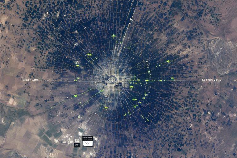
Imagine trying to find a needle in a haystack—the vastness of the ocean can feel just as daunting. This is where satellites come into play, providing comprehensive surveillance capabilities that are vital for monitoring maritime activities. By utilizing advanced satellite technology, authorities can detect and track suspicious vessels in piracy-prone areas, turning the tide in favor of maritime security. With satellites, we can cover enormous stretches of ocean that would otherwise be impossible to monitor effectively. The result? A more proactive approach to preventing piracy before it happens.
When we talk about satellite technology, it’s important to recognize the various types that contribute to maritime surveillance. Two of the most significant technologies include Synthetic Aperture Radar (SAR) and Optical Imaging. Each of these technologies plays a unique role in enhancing our ability to monitor the seas. For instance, SAR can penetrate clouds and work in darkness, making it invaluable for operations in adverse weather conditions. On the other hand, optical imaging provides high-resolution images that allow for the identification of ships and their activities. Together, these technologies form a powerful toolkit for anti-piracy efforts.
Synthetic Aperture Radar (SAR) is a game-changer in maritime monitoring. Its ability to operate under challenging weather conditions means that even when the skies are gray and the seas are rough, surveillance continues unabated. SAR can detect vessels, even those attempting to hide beneath the cover of clouds or darkness. This capability significantly improves the effectiveness of maritime monitoring and anti-piracy operations. By providing real-time data, SAR helps authorities respond quickly to potential threats, ensuring that pirates have fewer opportunities to strike.
On the flip side, optical imaging satellites offer an entirely different set of advantages. These satellites capture stunningly detailed images of the ocean surface, allowing for the identification of ships and their activities. Imagine being able to see a pirate ship lurking in the shadows of a cargo vessel—optical imaging makes this possible. The intelligence gathered from these high-resolution images is crucial for understanding piracy trends and identifying potential pirate vessels before they can launch an attack.
One of the most critical aspects of anti-piracy operations is the ability to share data in real-time among international naval forces. Satellites facilitate this communication, allowing different countries’ maritime agencies to coordinate their efforts effectively. Imagine a network of ships, all equipped with satellite technology, sharing information about suspicious activities as they happen. This level of collaboration not only enhances situational awareness but also improves response times, making it harder for pirates to evade capture.
Effective anti-piracy operations require collaboration among nations. Satellites play a pivotal role in fostering international partnerships and joint operations to combat piracy on a global scale. The ocean knows no borders, and neither should our efforts to secure it. Countries are increasingly recognizing the importance of working together, pooling resources and intelligence to tackle this shared threat.
Joint task forces are a prime example of how coordinated efforts among countries can improve operational efficiency. By leveraging satellite technology, these task forces can enhance their response times and effectiveness in addressing piracy incidents. Picture a multinational fleet working in tandem, each vessel equipped with satellite data that informs them of potential threats in real-time. This collaboration not only deters piracy but also builds a sense of unity among nations working towards a common goal.
Information sharing platforms are another vital component in the fight against piracy. These platforms enable countries to exchange critical data on piracy threats, creating a more comprehensive understanding of the challenges at hand. By strengthening collective maritime security efforts, nations can respond more effectively to emerging threats. The result is a more robust framework for combating piracy, ensuring that no ship sails alone in the fight against this modern-day scourge.
- How do satellites detect pirate ships? Satellites utilize technologies like Synthetic Aperture Radar and Optical Imaging to monitor maritime activities and identify suspicious vessels.
- Can satellites operate in bad weather? Yes, Synthetic Aperture Radar can function effectively even in adverse weather conditions, providing crucial surveillance capabilities.
- Why is international cooperation important in anti-piracy efforts? Piracy is a global issue that transcends national borders; cooperation enhances the effectiveness of operations and improves response times.
Understanding Maritime Piracy
This article explores the critical role satellites play in enhancing anti-piracy measures, improving maritime security, and facilitating international cooperation to combat piracy on the high seas.
Maritime piracy is not just a relic of history; it is a modern-day menace that threatens global trade and security. Imagine a vast ocean, teeming with ships laden with goods, yet lurking in the shadows are pirates ready to pounce. This age-old crime has evolved significantly, adapting to the complexities of contemporary maritime operations. Historically, piracy has roots that stretch back to ancient times, with infamous figures like Blackbeard and Captain Kidd capturing the imagination of many. However, in today’s world, piracy manifests in various forms, from hijacking vessels for ransom to stealing cargo, and it poses a significant threat to shipping routes and global economies.
In 2020 alone, the International Maritime Bureau reported over 200 piracy incidents worldwide, with hotspots in regions like the Gulf of Aden, the Strait of Malacca, and West Africa. These areas are often characterized by a lack of effective governance and law enforcement, making them prime targets for pirate activities. The impact of piracy extends beyond immediate financial losses; it disrupts trade routes, increases shipping costs, and raises insurance premiums, ultimately affecting consumers worldwide. The ripple effect of piracy can lead to inflated prices on everyday goods, affecting everyone from manufacturers to consumers.
To combat this growing threat, understanding the nature and dynamics of maritime piracy is crucial. It involves recognizing the motives behind piracy, which can range from economic desperation to organized crime syndicates seeking profit. Moreover, the methods employed by pirates have become increasingly sophisticated, utilizing small, fast boats to evade traditional naval forces. This evolution necessitates a robust response, one that leverages modern technology and international cooperation.
As we delve deeper into the role of satellites in anti-piracy operations, it's essential to grasp how these technologies can monitor and mitigate the risks associated with piracy. By employing advanced surveillance capabilities, satellites can provide real-time data that is critical for tracking suspicious vessels. This capability is not just a technical advancement; it is a game-changer in the fight against piracy, enabling nations to respond swiftly and effectively.
In summary, maritime piracy is a complex issue that requires a multifaceted approach. Understanding its historical context, current trends, and economic implications is vital for developing effective strategies to combat it. The next sections will explore how satellite technology plays a pivotal role in enhancing maritime security and facilitating international cooperation in anti-piracy efforts.
- What is maritime piracy? Maritime piracy refers to criminal acts committed at sea, including hijacking vessels, stealing cargo, and threatening crews.
- Why is piracy a significant threat to global trade? Piracy disrupts shipping routes, increases shipping costs, and raises insurance premiums, which can lead to higher prices for consumers.
- How do satellites help in anti-piracy operations? Satellites provide real-time surveillance and tracking of vessels, enabling quicker responses to piracy incidents.
- What are the hotspots for maritime piracy? Key areas include the Gulf of Aden, the Strait of Malacca, and West Africa, where piracy is most prevalent due to weak governance.
The Role of Satellites in Surveillance
When it comes to maritime security, satellites play a pivotal role that cannot be overstated. Imagine the vastness of the oceans, where countless vessels traverse the waters, some with legitimate purposes and others with nefarious intentions. The challenge of distinguishing between the two is immense, but that's where satellite technology steps in like a superhero swooping in to save the day. By providing comprehensive surveillance capabilities, satellites enhance the detection and tracking of suspicious vessels in piracy-prone areas, making them an essential tool in the fight against piracy.
Satellites equipped with advanced technology can monitor large swaths of ocean in real-time, giving maritime agencies the ability to keep a watchful eye over the high seas. This capability is especially crucial in regions notorious for piracy, such as the Gulf of Aden and the waters off the coast of Somalia. With the ability to cover vast distances, satellites can detect unusual patterns of movement, alerting authorities to potential threats before they escalate into serious incidents.
But how do these satellites actually work in surveillance? They utilize a combination of technologies that allow them to gather and relay critical information. For instance, satellites can track vessels using Automatic Identification Systems (AIS), which enable ships to broadcast their location, speed, and course. However, not all vessels comply with these systems, especially those engaged in illegal activities. This is where satellite imagery comes into play, providing visual evidence of maritime activities. The ability to capture images from space can reveal the presence of unidentified ships, helping authorities to make informed decisions quickly.
Moreover, the integration of satellite data with other sources, such as maritime patrol aircraft and ships, enhances the overall surveillance framework. This multi-layered approach allows for a more comprehensive understanding of maritime activities, enabling quicker and more effective responses to potential piracy threats. In essence, satellites act as the eyes in the sky, providing a bird's-eye view of the ocean and facilitating a coordinated response among various maritime forces.
In summary, the role of satellites in surveillance is not just about monitoring; it's about creating a safer maritime environment. By improving the detection of suspicious vessels and facilitating communication among international naval forces, satellites are revolutionizing anti-piracy operations. They are the backbone of modern maritime security, ensuring that the high seas remain safe for legitimate trade and travel.
- How do satellites detect piracy? Satellites use a combination of Automatic Identification Systems (AIS) and imaging technology to monitor vessel movements and identify suspicious activities.
- What are the benefits of using satellites for maritime surveillance? Satellites provide real-time data, cover vast areas, and enhance communication among naval forces, making them crucial in combating piracy.
- Can satellites operate in bad weather? Yes, certain satellite technologies, like Synthetic Aperture Radar (SAR), can effectively monitor maritime activities even in challenging weather conditions.
Types of Satellite Technologies
When it comes to enhancing maritime security and combating piracy, the types of satellite technologies employed play a pivotal role. These technologies are not just fancy gadgets orbiting the Earth; they are the backbone of modern anti-piracy operations. Two primary types of satellite technologies stand out in this domain: Synthetic Aperture Radar (SAR) and Optical Imaging. Each of these technologies brings unique strengths to the table, making them indispensable in the fight against piracy.
Synthetic Aperture Radar (SAR) is particularly noteworthy for its ability to operate in challenging weather conditions. Imagine trying to spot a needle in a haystack during a rainstorm—that's what traditional optical systems face when monitoring the ocean. SAR, on the other hand, uses radar waves to create high-resolution images of the sea surface, regardless of the weather. This capability is crucial because piracy often occurs in less-than-ideal conditions, whether that means stormy weather or the cover of night. With SAR, naval forces can detect suspicious vessels even when visibility is poor, significantly enhancing surveillance capabilities.
On the flip side, we have Optical Imaging, which excels in providing stunningly clear images of maritime activities. Think of it as having a high-definition camera focused on the ocean. Optical satellites capture images in various spectral bands, allowing operators to identify vessels, assess their size, and even determine their activities. For example, if a ship is behaving suspiciously, analysts can zoom in on its hull and discern whether it’s equipped for fishing or if it’s possibly engaged in illegal activities. The clarity of these images is invaluable for intelligence gathering and helps in making informed decisions during anti-piracy operations.
Both SAR and Optical Imaging technologies complement each other beautifully. While SAR can penetrate clouds and darkness, Optical Imaging provides the detail needed to analyze the situation further. This synergy is what makes modern maritime surveillance so effective. In fact, many maritime agencies are now integrating data from both types of satellites to create a comprehensive picture of the ocean landscape. By doing so, they can not only detect piracy but also understand broader maritime trends, such as shipping traffic patterns and potential threats.
To put it into perspective, consider the following table that summarizes the key features of SAR and Optical Imaging technologies:
| Feature | Synthetic Aperture Radar (SAR) | Optical Imaging |
|---|---|---|
| Weather Resistance | Excellent (operates in all weather) | Poor (limited by weather conditions) |
| Image Resolution | High-resolution radar images | High-resolution optical images |
| Night-time Capability | Yes | No |
| Use Case | Detection and tracking of vessels | Identification and activity assessment |
In conclusion, the integration of both Synthetic Aperture Radar and Optical Imaging technologies represents a significant leap forward in maritime surveillance. By leveraging the strengths of each, naval forces can enhance their operational capabilities and respond more effectively to piracy threats. The future of anti-piracy operations looks promising, thanks to these advanced satellite technologies.
Benefits of Synthetic Aperture Radar
Synthetic Aperture Radar (SAR) has revolutionized the way we monitor maritime activities, especially in the realm of anti-piracy operations. One of the most significant advantages of SAR technology is its ability to operate effectively under a variety of challenging weather conditions. Unlike optical imaging systems that rely on sunlight and clear skies, SAR can penetrate clouds, fog, and even heavy rain. This capability is crucial for maintaining continuous surveillance over piracy-prone waters, where weather can often obscure visibility. Imagine trying to spot a needle in a haystack; now picture doing that while it’s pouring rain. SAR is like having a super-powered flashlight that cuts through the storm, illuminating hidden dangers.
Furthermore, SAR is not just about seeing through bad weather; it also delivers high-resolution images that can distinguish between different types of vessels. This level of detail is vital for identifying suspicious activities, such as ships that might be engaging in piracy. For instance, SAR can help authorities differentiate between a legitimate cargo ship and a potential pirate vessel based on size, shape, and movement patterns. This capability enhances the efficiency of maritime patrols, allowing naval forces to focus their resources on genuine threats rather than wasting time on false alarms.
Additionally, SAR technology operates on a principle known as interferometry, which allows it to measure the movement of vessels with remarkable accuracy. This means that not only can SAR detect a ship's presence, but it can also track its speed and direction. This information is invaluable for predicting potential piracy incidents before they occur. By understanding the behavior of vessels in real-time, maritime agencies can deploy resources more strategically, ensuring a quicker response to any suspicious activities.
Moreover, SAR systems can be deployed on various platforms, including satellites, aircraft, and even unmanned aerial vehicles (UAVs). This versatility means that SAR can provide comprehensive coverage over vast ocean areas, which is essential in the fight against piracy. The ability to gather data from multiple sources enhances the overall intelligence available to anti-piracy operations, creating a more robust defense against maritime threats.
In summary, the benefits of Synthetic Aperture Radar in anti-piracy measures are profound. Its ability to operate in adverse weather, deliver high-resolution imagery, track vessel movements accurately, and be deployed across various platforms makes it an indispensable tool in safeguarding our seas. As technology continues to evolve, the role of SAR in maritime surveillance will undoubtedly expand, further enhancing our capabilities to combat piracy effectively.
- What is Synthetic Aperture Radar?
SAR is a type of radar that uses the motion of the radar antenna over a targeted region to provide finer spatial resolution than conventional beam-scanning radars.
- How does SAR work in bad weather?
SAR can penetrate clouds and operate in poor visibility conditions, making it ideal for maritime surveillance in all weather situations.
- Can SAR differentiate between types of vessels?
Yes, SAR can provide detailed images that help authorities distinguish between different types of ships based on their size, shape, and movement.
- What platforms can SAR be deployed on?
SAR can be mounted on satellites, aircraft, and UAVs, allowing for extensive coverage of maritime areas.
Optical Imaging Capabilities
When it comes to maritime surveillance, optical imaging satellites are like the eyes in the sky, providing high-resolution images that are crucial for identifying ships and their activities. These satellites capture detailed pictures of the ocean's surface, allowing maritime agencies to monitor vessel movements and detect any suspicious behavior. Imagine trying to find a needle in a haystack; that's what tracking pirate vessels is like without the clarity that optical imaging brings. With these advanced imaging capabilities, the chances of spotting potential threats significantly increase.
Optical imaging works by utilizing sunlight reflected off the Earth's surface, capturing images that reveal not just the vessels but also their characteristics. This technology is particularly effective during clear weather conditions, where the visibility is optimal. The images produced can be analyzed to determine the type of vessel, its size, and even its cargo, which is vital information when assessing whether a ship poses a piracy risk. In regions where piracy is rampant, having this kind of intelligence can mean the difference between a successful interception and a lost opportunity.
Moreover, the integration of optical imaging data with other satellite technologies enhances the overall effectiveness of anti-piracy operations. For instance, when combined with synthetic aperture radar (SAR), which can operate in poor weather conditions, the two technologies create a robust surveillance system. This synergy allows maritime authorities to maintain a constant watch over piracy-prone areas, ensuring that they are always one step ahead of potential threats.
One notable example is the use of optical imaging in the Gulf of Aden, a hotspot for piracy. Here, satellites have successfully identified suspicious vessels even before they engage in hostile actions. This proactive approach not only helps in deploying naval forces more effectively but also acts as a deterrent for would-be pirates who know they are being watched. The impact of optical imaging extends beyond immediate surveillance; it also contributes to long-term strategies in combating piracy by providing valuable data that can be used in policy-making and international maritime regulations.
In conclusion, the capabilities of optical imaging satellites are indispensable in the fight against piracy. They provide clarity and detail that enhance situational awareness, enabling maritime agencies to respond swiftly and effectively. As technology continues to evolve, we can expect even more sophisticated imaging capabilities that will further bolster our defenses against piracy on the high seas.
- What are optical imaging satellites? Optical imaging satellites are spacecraft that capture high-resolution images of the Earth's surface using sunlight. They are essential for monitoring maritime activities.
- How do optical imaging satellites help in anti-piracy operations? They provide detailed visual data that helps identify vessels, assess their activities, and detect potential piracy threats before they escalate.
- Can optical imaging work in bad weather? Optical imaging is most effective in clear weather. However, when combined with synthetic aperture radar (SAR), it can provide comprehensive surveillance even in challenging conditions.
- What is the importance of real-time data sharing? Real-time data sharing allows for immediate communication between different countries' maritime agencies, facilitating quicker response times to piracy incidents.
Real-Time Data Sharing
In the ever-evolving landscape of maritime security, stands out as a game-changer in anti-piracy operations. Imagine a vast ocean where ships traverse the waters, and lurking beneath the surface are the threats of piracy. Now, picture a network of satellites orbiting the Earth, constantly monitoring these waters and relaying critical information to naval forces across the globe. This is not just a fantasy; it’s the reality brought about by advanced satellite technology. By enabling instantaneous communication between different countries' maritime agencies, satellites ensure that vital information is shared quickly and efficiently, allowing for rapid response to potential piracy threats.
The significance of real-time data sharing cannot be overstated. When a suspicious vessel is detected, the clock starts ticking. Naval forces need to act swiftly to prevent piracy incidents from escalating. With satellite systems in place, information about the vessel's location, speed, and trajectory can be transmitted in real-time to relevant authorities. This rapid dissemination of data allows for coordinated efforts, ensuring that multiple naval units can converge on the threat without delay. It’s akin to a well-orchestrated symphony where each musician knows their part, leading to a harmonious and effective response.
Moreover, the integration of satellite technology into anti-piracy operations fosters a culture of collaboration among nations. Countries that may have previously operated in silos are now sharing intelligence and resources, creating a united front against piracy. This collective approach not only enhances operational efficiency but also builds trust among nations, paving the way for future collaborations. For instance, during a recent operation in the Gulf of Aden, multiple countries utilized real-time data sharing to intercept a pirate skiff, showcasing the power of teamwork bolstered by satellite technology.
To illustrate the impact of real-time data sharing, consider the following table that highlights key benefits:
| Benefit | Description |
|---|---|
| Speed of Response | Allows naval forces to act quickly to emerging threats. |
| Enhanced Coordination | Facilitates joint operations among multiple countries. |
| Increased Intelligence | Provides comprehensive situational awareness for better decision-making. |
| Building Trust | Encourages collaboration and information sharing among nations. |
In conclusion, the role of real-time data sharing in anti-piracy operations cannot be overlooked. It serves as the backbone of a modern maritime security strategy, enabling nations to work together seamlessly to combat piracy. As technology continues to advance, we can expect even more sophisticated systems that will further enhance our ability to protect shipping routes and ensure the safety of maritime trade.
- What is the primary role of satellites in anti-piracy operations? Satellites provide surveillance capabilities and facilitate real-time data sharing among naval forces to enhance maritime security.
- How does real-time data sharing improve response times? By enabling instant communication of critical information, naval forces can quickly coordinate their efforts to address piracy threats.
- What types of data are shared in real-time? Information such as vessel location, speed, and trajectory are commonly shared to assess potential threats.
- Why is international cooperation important in combating piracy? Piracy is a global issue that requires a united front; cooperation enhances operational efficiency and builds trust among nations.
International Cooperation in Anti-Piracy Efforts
When it comes to combating piracy on the high seas, no single nation can go it alone. The vastness of the oceans and the complexity of maritime routes mean that effective anti-piracy operations rely heavily on international cooperation. Countries around the world have recognized that piracy is not just a local issue; it’s a global challenge that requires a unified response. Just like a well-coordinated sports team, where each player has a specific role, nations must come together to share resources, intelligence, and strategies to tackle this menace effectively.
One of the primary ways that countries collaborate in anti-piracy efforts is through the establishment of joint task forces. These task forces consist of naval forces from multiple nations working together to patrol piracy-prone waters. By pooling their resources, they can cover more ground and respond more quickly to incidents. For example, if a pirate attack occurs off the coast of Somalia, a coalition of naval forces from the United States, European nations, and regional partners can coordinate their efforts to intercept the pirates and protect commercial shipping. This kind of teamwork is crucial, especially in regions where piracy is rampant.
Moreover, the role of information sharing platforms cannot be overstated. These platforms enable countries to exchange critical data about piracy threats, suspicious vessels, and recent incidents. Imagine a digital map where countries can update real-time information on pirate activities. This transparency allows for quicker responses and better preparedness. Countries can leverage satellite technology to monitor maritime activities and share that data with their allies, creating a comprehensive picture of the situation at sea. The result is a more robust maritime security framework that benefits everyone involved.
To illustrate the importance of international cooperation, let’s look at a few key benefits:
- Enhanced Surveillance: By combining satellite data and naval intelligence, nations can improve their surveillance capabilities, making it harder for pirates to operate undetected.
- Rapid Response: Joint task forces can respond more swiftly to piracy incidents, significantly reducing the time it takes to provide assistance to vessels under threat.
- Shared Resources: Countries can share naval assets, technology, and logistics, leading to more efficient anti-piracy operations.
In conclusion, the fight against piracy is a classic example of how unity is strength. As nations continue to collaborate through joint task forces and information-sharing platforms, they not only enhance their operational effectiveness but also foster a sense of global solidarity. The oceans may be vast, but with combined efforts, the threat of piracy can be diminished significantly, ensuring safer shipping routes and a more secure maritime environment for all.
- Why is international cooperation essential in anti-piracy efforts?
Because piracy is a global issue that transcends national boundaries, collaborative efforts enhance surveillance, response times, and resource sharing. - What role do joint task forces play?
Joint task forces allow nations to combine their naval forces for more effective patrols and rapid responses to piracy incidents. - How does information sharing improve maritime security?
Information sharing enables countries to stay informed about piracy threats and suspicious activities, leading to better preparedness and quicker action.
Joint Task Forces
The fight against maritime piracy is not a solo endeavor; it requires a symphony of nations working together in harmony. Joint task forces are the backbone of these collaborative efforts, utilizing the power of satellite technology to enhance operational efficiency. Imagine a well-orchestrated team where each member plays a crucial role, sharing information and resources to combat a common enemy. This is precisely what joint task forces achieve in the realm of anti-piracy operations.
These multinational coalitions leverage satellite capabilities to monitor vast ocean expanses, allowing them to respond swiftly to piracy threats. When a suspicious vessel is detected, the information is relayed in real-time to all task force members. This rapid communication is akin to a relay race where each runner passes the baton seamlessly, ensuring that the response is not just quick, but also coordinated. By sharing satellite imagery and data, these forces can identify potential pirate ships and track their movements, making it easier to intercept and neutralize threats before they escalate.
Furthermore, joint task forces often conduct joint exercises, where they simulate piracy scenarios to test their readiness. These exercises are invaluable, as they allow countries to refine their strategies and improve their response times. For instance, if a task force from several nations is involved in a training exercise, they can evaluate how effectively they can deploy resources and coordinate their actions in a real-world piracy situation. Such preparation is crucial, as it builds trust and familiarity among the forces, making them more effective when actual threats arise.
| Country | Task Force Contribution | Key Satellite Technology Used |
|---|---|---|
| United States | Leading intelligence sharing | Optical Imaging |
| United Kingdom | Naval presence and patrols | SAR |
| India | Regional surveillance | Hybrid Satellite Systems |
| Japan | Logistical support | Communication Satellites |
In addition to enhancing operational efficiency, joint task forces also foster a sense of unity among nations. They serve as a platform for countries to share not just intelligence but also best practices in maritime security. This collaboration is essential for building a comprehensive approach to tackling piracy, as it allows nations to learn from each other's experiences and adapt their strategies accordingly. The synergy created by these partnerships can lead to innovative solutions that might not have been possible if countries operated independently.
Ultimately, the success of joint task forces in anti-piracy operations is a testament to the power of collaboration. By pooling resources, sharing information, and coordinating efforts, nations can create a formidable front against piracy. As we continue to navigate the complexities of global maritime security, the role of joint task forces will only become more critical. They are not just a response to piracy; they represent a proactive stance toward securing our oceans for future generations.
- What are joint task forces? Joint task forces are collaborative groups formed by multiple nations to address specific challenges, such as maritime piracy, through shared resources and intelligence.
- How do satellites aid joint task forces? Satellites provide real-time data and surveillance capabilities, enabling task forces to monitor maritime activities and respond quickly to piracy threats.
- What types of satellite technology are used? Various technologies, including Synthetic Aperture Radar (SAR) and optical imaging, are utilized to enhance surveillance and intelligence-gathering efforts.
- Why is international cooperation important? International cooperation allows for a unified response to piracy, sharing of best practices, and improved overall maritime security.
Information Sharing Platforms
In the fight against maritime piracy, play a pivotal role by acting as the backbone for collaboration among nations. Imagine a vast web connecting various countries, each contributing vital intelligence to a collective pool. This synergy not only enhances situational awareness but also enables rapid responses to emerging threats. With piracy being a global issue, the need for real-time data exchange is more critical than ever. Countries can no longer afford to operate in silos; they must work together to ensure the safety of their waters and trade routes.
These platforms facilitate the exchange of crucial data, including the location of suspicious vessels, recent pirate activity reports, and even predictive analytics that help forecast potential piracy hotspots. For instance, when a vessel is reported missing or suspected of being hijacked, information can be disseminated swiftly across borders, allowing naval forces to mobilize quickly and effectively. This is akin to having a neighborhood watch where everyone is on alert, sharing information to protect their community.
One of the most significant advantages of these platforms is their ability to integrate various types of data. They can combine satellite imagery, vessel tracking information, and intelligence reports into a single, comprehensive view that enhances decision-making. For example, a naval officer can access satellite data showing a vessel's last known location alongside reports of pirate sightings in the area, enabling a more informed and timely response.
Moreover, these platforms often include sophisticated analytical tools that help identify patterns and trends in piracy. By analyzing historical data, countries can pinpoint areas where piracy is most likely to occur, allowing them to allocate resources more strategically. This proactive approach is essential in staying one step ahead of pirates, who are constantly adapting their tactics.
To illustrate the effectiveness of information sharing platforms, consider the following table that summarizes key features:
| Feature | Description |
|---|---|
| Real-Time Data Exchange | Facilitates immediate sharing of intelligence among nations. |
| Integrated Analysis Tools | Combines various data sources for enhanced situational awareness. |
| Predictive Analytics | Forecasts potential piracy hotspots based on historical data. |
| Collaboration Framework | Establishes protocols for joint operations and information sharing. |
In conclusion, information sharing platforms are indispensable in the global fight against piracy. They not only enhance communication among nations but also empower them with the tools and intelligence needed to act decisively. As piracy continues to evolve, so too must our strategies, and these platforms will be at the forefront of that evolution, ensuring that nations can unite against a common threat.
- What are information sharing platforms? They are systems that enable countries to exchange intelligence and data related to maritime piracy.
- How do these platforms improve anti-piracy efforts? They enhance situational awareness and enable rapid response by providing real-time data and analytics.
- Can any country access these platforms? Access is typically restricted to participating nations and their maritime agencies to ensure security and confidentiality.
Frequently Asked Questions
- What is maritime piracy?
Maritime piracy refers to criminal acts committed at sea, including hijacking ships, stealing cargo, and taking hostages. It poses a significant threat to global trade and maritime security, impacting shipping routes and economies worldwide.
- How do satellites enhance anti-piracy operations?
Satellites provide vital surveillance capabilities that help monitor maritime activities. They enable the detection and tracking of suspicious vessels in piracy-prone areas, improving the effectiveness of anti-piracy measures and enhancing maritime security.
- What types of satellite technologies are used in anti-piracy efforts?
Various satellite technologies are employed, including Synthetic Aperture Radar (SAR) and optical imaging. SAR is particularly effective in challenging weather conditions, while optical imaging provides high-resolution images for identifying ships and their activities.
- What are the benefits of Synthetic Aperture Radar (SAR)?
SAR offers unique advantages for detecting vessels, especially in poor visibility or adverse weather. Its ability to penetrate clouds and provide detailed images makes it an invaluable tool in monitoring maritime activities and enhancing anti-piracy operations.
- Why is real-time data sharing important in anti-piracy operations?
Real-time data sharing among international naval forces is crucial for effective anti-piracy operations. It facilitates communication and coordination, enabling countries to respond quickly to piracy incidents and improve overall maritime security.
- How do joint task forces operate in combating piracy?
Joint task forces leverage satellite technology to enhance operational efficiency. By coordinating efforts among nations, they improve response times and effectiveness in addressing piracy incidents, making it a collaborative global effort.
- What role do information sharing platforms play in anti-piracy efforts?
Information sharing platforms allow countries to exchange critical data on piracy threats. These platforms are essential for strengthening collective maritime security efforts and ensuring that all involved parties are informed and prepared to act against piracy.