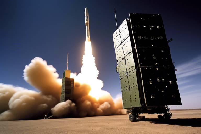
How Satellites Aid in Tactical Air Operations
The role of satellites in modern warfare cannot be overstated, especially when it comes to tactical air operations. These high-tech marvels orbiting our planet are like the eyes and ears of military forces, providing essential support that enhances mission effectiveness and operational efficiency. Imagine trying to navigate a complex maze without a map or a guide; that’s what air operations would be like without satellite technology. From communication to surveillance, satellites are the backbone of tactical air support, ensuring that every mission is executed with precision and clarity.
In the heat of battle, communication is everything. Satellites provide secure and reliable channels for military aircraft, ensuring that pilots can maintain real-time connectivity with command centers. This is not just a luxury; it's a necessity. Imagine a pilot flying through hostile territory without the ability to communicate with their team. It could lead to disastrous consequences. With satellite communication, military forces can relay crucial information instantly, allowing for effective decision-making during tactical operations. This real-time communication can mean the difference between success and failure on the battlefield.
Utilizing advanced satellite imagery and reconnaissance capabilities, military forces can gather vital intelligence on enemy positions and movements. This significantly enhances situational awareness and strategic planning for air operations. Think of satellites as the ultimate surveillance drones, providing a bird's-eye view of the battlefield. With the ability to monitor vast areas in real-time, military analysts can assess threats and adjust tactics accordingly. This capability is crucial for mission success, as it allows for a proactive approach to potential dangers.
One of the most impressive features of satellite technology is its ability to process vast amounts of data in real-time. This means that military analysts can quickly assess threats and make informed decisions on the fly. It's like having a supercomputer in the sky that can analyze enemy movements and predict their next steps. The speed at which this information is gathered and analyzed is crucial for maintaining the upper hand in tactical air operations.
Satellite imagery provides detailed visuals of terrain and enemy installations, supporting tactical air operations by identifying potential targets and assessing battlefield conditions before and during missions. The clarity and detail of these images allow military planners to devise strategies that take full advantage of the landscape, ensuring that every move is calculated and effective.
In addition to imagery, satellites are equipped to intercept electronic communications. This capability, known as Signal Intelligence (SIGINT), gathers critical information on enemy activities. By understanding what the adversary is planning, military forces can anticipate and counter threats effectively. It’s like having a spy in the enemy camp, providing insights that can turn the tide of battle.
Satellites also facilitate seamless integration with unmanned aerial vehicles (UAVs). This enhances their operational capabilities, allowing for coordinated missions that leverage both satellite data and UAV reconnaissance. The combination of satellite technology and UAVs creates a powerful synergy that maximizes the effectiveness of air operations. It’s akin to a well-choreographed dance, where each participant knows their role and timing, leading to flawless execution.
Global Navigation Satellite Systems (GNSS) provide precise positioning data for aircraft, ensuring accurate navigation during complex missions. This accuracy is vital for both safety and mission success. Without precise navigation, pilots would be flying blind, risking not only their lives but also the success of their missions.
The Global Positioning System (GPS) plays a critical role in tactical operations by offering real-time location tracking for aircraft. This capability enables precise targeting and effective coordination of multi-aircraft operations. Imagine trying to coordinate multiple vehicles in a race without knowing their exact locations; it would be chaotic. GPS eliminates that chaos, allowing for smooth and efficient operations.
Satellite data also aids pilots in understanding terrain features, helping them navigate challenging environments and avoid obstacles. This is particularly important in tactical air operations where every second counts. By utilizing satellite information, pilots can make informed decisions that enhance operational safety and mission effectiveness.
- How do satellites improve communication in air operations?
Satellites provide secure and reliable communication channels that allow pilots to maintain real-time connectivity with command centers. - What role does satellite imagery play in military operations?
Satellite imagery offers detailed visuals of enemy positions and terrain, which aids in strategic planning and target identification. - Can satellites assist in navigation for military aircraft?
Yes, Global Navigation Satellite Systems (GNSS) provide precise positioning data, ensuring accurate navigation during missions.
Enhanced Communication
In the high-stakes world of tactical air operations, communication is key. Imagine a scenario where a pilot is navigating through hostile territory, and suddenly, they lose contact with their command center. Panic sets in, and decision-making becomes a gamble. This is where satellites step in as a game changer. They provide secure and reliable communication channels that ensure real-time connectivity between pilots and their command centers. This connectivity is not just a luxury; it’s an essential lifeline that allows for effective decision-making during critical tactical operations.
Satellites facilitate a myriad of communication methods, including voice, data, and video transmissions, all of which are crucial for modern military operations. With the evolution of technology, the integration of satellite communication systems has transformed the way air forces operate. For instance, with satellites, pilots can receive instant updates on enemy movements or changes in mission parameters, allowing them to adapt their strategies on the fly. This kind of agility can be the difference between mission success and failure.
Moreover, the ability to communicate securely is paramount. In the chaos of battle, the last thing a pilot needs is to worry about enemy interception of their communications. Satellite systems are designed with advanced encryption protocols that shield sensitive information from prying eyes. This ensures that tactical plans remain confidential and that the element of surprise is preserved.
Additionally, the integration of satellite communication with advanced technologies such as Artificial Intelligence (AI) and machine learning is paving the way for even more robust communication systems. These technologies can analyze communication patterns and detect anomalies, alerting commanders to potential security breaches or operational issues before they escalate. The result? A more secure and responsive communication network that enhances overall mission effectiveness.
To further illustrate the impact of satellite communication, consider the following table that outlines the key benefits:
| Benefit | Description |
|---|---|
| Real-Time Updates | Instant communication allows for rapid adjustments to mission plans based on current intelligence. |
| Secure Channels | Advanced encryption ensures that communications are protected from enemy interception. |
| Enhanced Coordination | Facilitates teamwork among air, ground, and naval forces for synchronized operations. |
| Data Sharing | Allows for the transmission of critical data, including imagery and reconnaissance reports. |
In summary, the role of satellites in enhancing communication during tactical air operations cannot be overstated. They provide a critical infrastructure that supports real-time decision-making, secure communications, and coordination among various military branches. As technology continues to advance, we can only expect these systems to become even more integral to operational success.
Surveillance and Reconnaissance
In the realm of modern warfare, are the backbone of successful tactical air operations. Imagine being a chess player, always needing to see the entire board to make the best moves. This is precisely what satellites provide to military forces—an expansive view of the battlefield. By utilizing cutting-edge satellite imagery and reconnaissance capabilities, armed forces can gather crucial intelligence on enemy positions, movements, and even their logistical capabilities. This enhanced situational awareness is not just a luxury; it's a necessity that significantly informs strategic planning and execution of air operations.
One of the most significant advantages of satellite surveillance is the ability to gather real-time data. This is akin to having a live feed of your opponent's strategy, allowing military analysts to quickly assess threats and adjust tactics on the fly. The ability to process vast amounts of data in real-time transforms the battlefield into a more manageable environment where decisions can be made swiftly. Imagine trying to navigate a maze blindfolded; now imagine having a bird’s eye view of that maze. This is the power that satellite technology brings to the table.
With satellites in orbit, military analysts can leverage advanced algorithms and artificial intelligence to sift through the mountains of data collected. This real-time data analysis allows for the rapid identification of potential threats, which is crucial for mission success. The speed at which this information is processed can mean the difference between victory and defeat. For instance, if a satellite detects an enemy convoy moving in a specific direction, analysts can quickly disseminate that information to pilots in the field, allowing them to adjust their flight paths or prepare for an engagement.
Satellite imagery, often referred to as Imagery Intelligence (IMINT), provides detailed visuals of terrain and enemy installations. This capability supports tactical air operations by identifying potential targets and assessing battlefield conditions before and during missions. The clarity and detail in these images can reveal not just the location of enemy forces but also the type of equipment they are using, their readiness levels, and even their supply routes. Such intelligence is invaluable in planning airstrikes and troop movements.
Another critical component of satellite surveillance is Signal Intelligence (SIGINT). By intercepting electronic communications, satellites can gather vital information on enemy activities. This intelligence helps inform air operations, enabling forces to anticipate and counter threats effectively. For example, if a satellite picks up chatter about an impending attack, military planners can take preemptive measures to thwart the enemy's plans. This proactive approach is essential in maintaining the upper hand in tactical situations.
The synergy between satellite technology and unmanned aerial vehicles (UAVs) is another game-changer in surveillance and reconnaissance. Satellites facilitate seamless integration with UAVs, enhancing their operational capabilities. Imagine a UAV flying over enemy territory, gathering data while simultaneously receiving satellite feeds that provide context and direction. This coordinated effort allows for more effective and targeted reconnaissance missions, ensuring that military forces can act on the most accurate and timely information available.
| Type of Intelligence | Description |
|---|---|
| Imagery Intelligence (IMINT) | Detailed visuals of terrain and enemy installations. |
| Signal Intelligence (SIGINT) | Intercepted electronic communications providing insight into enemy activities. |
In conclusion, the role of satellites in surveillance and reconnaissance cannot be overstated. They provide a comprehensive view of the battlefield, enable real-time data analysis, and facilitate the integration of advanced technologies like UAVs. This combination not only enhances situational awareness but also ensures that military forces can make informed decisions swiftly, ultimately leading to greater mission effectiveness.
- How do satellites enhance communication during air operations?
Satellites provide secure and reliable communication channels that allow for real-time connectivity between pilots and command centers, essential for effective decision-making. - What types of intelligence do satellites gather?
Satellites gather Imagery Intelligence (IMINT) and Signal Intelligence (SIGINT), providing vital information on enemy positions and communications. - How do satellites integrate with UAVs?
Satellites enable UAVs to receive real-time data, enhancing their operational capabilities and allowing for coordinated reconnaissance missions.
Real-Time Data Analysis
In the fast-paced world of tactical air operations, has become a game changer. Imagine being in the cockpit of a fighter jet, soaring through the skies with the weight of a mission resting on your shoulders. The ability to receive and analyze data instantaneously can mean the difference between success and failure. This is where satellites come into play, acting as the backbone of information flow. They collect vast amounts of data from various sources, including ground sensors, other aircraft, and even civilian satellites, and relay this information back to military analysts.
One of the most significant advantages of having real-time data at your fingertips is the ability to quickly assess threats. For example, if a military aircraft detects an enemy radar signal, satellite systems can analyze the data to determine the location and type of the threat. This rapid analysis allows commanders to adjust tactics on the fly, ensuring that air operations remain flexible and responsive to changing battlefield dynamics.
To illustrate this point further, consider the following key components of real-time data analysis:
- Data Fusion: Satellites integrate information from multiple sources, creating a comprehensive picture of the operational environment. This fusion of data enhances situational awareness and enables better decision-making.
- Predictive Analytics: By utilizing algorithms and machine learning, analysts can predict potential enemy movements or actions based on historical data. This foresight allows military planners to stay one step ahead.
- Instant Feedback: Real-time data provides immediate feedback to pilots and ground forces, allowing them to adapt their strategies as situations evolve. This responsiveness is crucial in high-stakes environments.
Moreover, the integration of satellite data with advanced software tools enables military analysts to visualize complex data sets. They can create interactive maps that display real-time troop movements, enemy positions, and even weather conditions. This visual representation helps in making informed decisions quickly, which is essential when every second counts.
In summary, real-time data analysis powered by satellite technology is not just a luxury; it is a necessity in modern tactical air operations. The ability to process and interpret data swiftly enhances mission effectiveness and operational efficiency, ultimately leading to successful outcomes in the field. As technology continues to evolve, the role of satellites in real-time data analysis will only become more critical, paving the way for even more sophisticated air operations in the future.
- How do satellites improve communication in tactical air operations?
Satellites provide secure channels for real-time communication between pilots and command centers, crucial for effective decision-making. - What types of intelligence do satellites gather?
Satellites collect various types of intelligence, including imagery intelligence (IMINT) and signal intelligence (SIGINT), which are vital for mission planning. - Can satellites assist unmanned aerial vehicles (UAVs)?
Yes, satellites facilitate the integration of UAVs into missions, enhancing their capabilities and effectiveness. - What is the role of GPS in tactical air operations?
GPS provides precise positioning data, enabling accurate navigation and coordination during complex missions.
Imagery Intelligence (IMINT)
Imagery Intelligence, commonly referred to as IMINT, plays a pivotal role in modern tactical air operations. With the ability to capture high-resolution images from space, satellites provide military forces with critical visual information that is essential for operational success. Imagine being able to see the battlefield from above, where every detail is laid bare; this is the power of IMINT. It allows commanders to make informed decisions based on the most current and accurate data available.
One of the key advantages of IMINT is its capability to offer a comprehensive view of the terrain and enemy installations. This includes identifying potential targets, assessing battlefield conditions, and understanding the geographical context of operations. The imagery captured can reveal not just the positions of enemy troops, but also their logistical routes and supply lines, which is invaluable for planning effective air strikes. For instance, by analyzing satellite images, military analysts can pinpoint areas where enemy forces are concentrated, allowing for targeted operations that maximize impact while minimizing collateral damage.
Moreover, IMINT is not a one-time event; it is a continuous process. Satellites can revisit the same area multiple times, providing updates that reflect changes on the ground. This real-time monitoring capability enables military planners to adapt their strategies dynamically, responding to shifts in enemy movements or alterations in the battlefield landscape. The integration of IMINT with other intelligence forms, such as Signal Intelligence (SIGINT), further enhances the effectiveness of tactical operations. By combining visual data with electronic communications, military forces can build a comprehensive picture of the operational environment.
To illustrate the impact of IMINT, consider the following table that summarizes its key benefits:
| Benefit | Description |
|---|---|
| Target Identification | Pinpoints enemy positions and assets for precise air strikes. |
| Terrain Analysis | Assesses geographical features to aid navigation and strategy. |
| Operational Updates | Provides continuous monitoring of changes in the battlefield. |
| Integration with Other Intelligence | Enhances situational awareness by combining visual and electronic data. |
In conclusion, Imagery Intelligence is a game-changer in the realm of tactical air operations. It transforms how military forces gather and utilize information, ultimately leading to more effective and efficient missions. As technology advances, the capabilities of IMINT will only continue to grow, further enhancing the strategic advantages it provides in modern warfare.
Q: What is Imagery Intelligence (IMINT)?
A: IMINT refers to the collection and analysis of imagery data from satellites and other sources to support military operations and decision-making.
Q: How does IMINT enhance tactical air operations?
A: IMINT provides detailed visual information about enemy positions, terrain, and battlefield conditions, allowing for informed decision-making and effective targeting.
Q: Can IMINT be used in real-time?
A: Yes, satellites can capture and transmit imagery in real-time, enabling military forces to adapt their strategies based on the most current information available.
Q: How does IMINT integrate with other intelligence types?
A: IMINT can be combined with Signal Intelligence (SIGINT) and other forms of data to create a comprehensive understanding of the operational environment, enhancing situational awareness.
Signal Intelligence (SIGINT)
Signal Intelligence, commonly referred to as SIGINT, plays a pivotal role in modern tactical air operations. This form of intelligence involves the interception and analysis of electronic communications, which can include anything from phone calls to radio transmissions. By tapping into these communications, military forces can gain invaluable insights into enemy plans, movements, and capabilities. Imagine being able to listen in on your opponent's strategy meetings—this is essentially what SIGINT enables.
The importance of SIGINT cannot be overstated. It provides a layer of situational awareness that traditional intelligence methods often cannot match. For instance, by monitoring enemy communications, analysts can detect shifts in tactics or troop movements, which can inform air operations and lead to more effective mission planning. This real-time intelligence allows commanders to make informed decisions that can significantly alter the course of an operation.
Moreover, SIGINT is not just about gathering information; it’s also about understanding the context behind that information. This involves sifting through vast amounts of data to identify patterns and trends. For example, if a particular frequency is being used frequently by enemy units, it may indicate a coordinated effort that needs to be addressed. Analysts can utilize advanced algorithms and machine learning techniques to process this data quickly, turning raw information into actionable intelligence.
In addition to its strategic value, SIGINT also enhances operational security. By understanding enemy communications, forces can anticipate potential threats and adjust their tactics accordingly. For instance, if SIGINT reveals that an enemy unit is preparing for an attack, air support can be deployed to counteract that threat effectively. This proactive approach to warfare can be the difference between mission success and failure.
To illustrate the impact of SIGINT on tactical air operations, consider the following table that outlines key SIGINT capabilities and their benefits:
| Capability | Benefit |
|---|---|
| Real-time interception | Immediate access to enemy communications for timely responses. |
| Pattern recognition | Identifying trends in enemy behavior to predict future actions. |
| Electronic countermeasures | Disrupting enemy communications to hinder their operational effectiveness. |
In conclusion, the integration of Signal Intelligence into tactical air operations is a game-changer. It not only enhances situational awareness but also empowers military forces to make informed decisions on the battlefield. As technology continues to evolve, the capabilities of SIGINT will only grow, further solidifying its critical role in modern warfare.
Frequently Asked Questions
- What is SIGINT? Signal Intelligence (SIGINT) involves the interception and analysis of electronic communications for military purposes.
- How does SIGINT enhance tactical operations? By providing real-time intelligence on enemy movements and communications, allowing for informed decision-making.
- What types of communications are monitored in SIGINT? SIGINT can include phone calls, radio transmissions, and other electronic communications.
Integration with UAVs
The integration of satellites with unmanned aerial vehicles (UAVs) marks a revolutionary advancement in military operations. Imagine a scenario where a pilot is not just flying a plane but is part of a larger, interconnected web of technology that enhances situational awareness and operational effectiveness. This synergy is crucial for modern tactical air operations, allowing for a level of coordination that was previously unimaginable.
Satellites provide the backbone for this integration, offering real-time data that UAVs can use to navigate and engage effectively. When a UAV is deployed, it can receive satellite signals that inform it about enemy positions, changing battlefield dynamics, and even weather conditions. This information is vital, as it allows UAVs to adapt their strategies on-the-fly, ensuring they can execute their missions with precision.
Moreover, the data shared between satellites and UAVs is not just about location; it encompasses a wide range of intelligence types. For instance, UAVs equipped with advanced sensors can gather imagery intelligence (IMINT) and signal intelligence (SIGINT), which can then be relayed back to command centers via satellite communication. This creates a continuous feedback loop that enhances decision-making processes. Think of it as a sports team where every player is aware of each other's positions and actions, leading to a more coordinated and effective performance on the field.
In addition, the integration allows for the execution of complex missions that require multiple UAVs to work in tandem. For example, one UAV could be tasked with surveillance, while another focuses on target acquisition. By leveraging satellite data, these UAVs can operate in a synchronized manner, reducing the risk of friendly fire and increasing the likelihood of mission success.
To illustrate this point further, consider the following table that highlights the key benefits of UAV and satellite integration:
| Benefit | Description |
|---|---|
| Enhanced Situational Awareness | Real-time data sharing allows UAVs to adapt to changing battlefield conditions. |
| Improved Coordination | Multiple UAVs can operate in sync, reducing risks and improving mission outcomes. |
| Data Fusion | Combining different intelligence types provides a comprehensive view of the operational environment. |
| Increased Operational Range | Satellites extend the operational reach of UAVs beyond line-of-sight limitations. |
In conclusion, the integration of satellites with UAVs is not just a technological upgrade; it represents a paradigm shift in how military operations are conducted. As we continue to advance in satellite technology and UAV capabilities, we can expect even greater efficiencies and effectiveness in tactical air operations, paving the way for a future where missions are executed with unparalleled precision and safety.
- How do satellites enhance UAV capabilities?
Satellites provide real-time data and communication that allow UAVs to navigate effectively and execute missions with precision. - What types of intelligence can UAVs gather?
UAVs can collect imagery intelligence (IMINT) and signal intelligence (SIGINT), which are crucial for situational awareness. - Can multiple UAVs operate together using satellite data?
Yes, the integration allows for coordinated missions where multiple UAVs can work in tandem, improving mission success rates. - What is the future of UAV and satellite integration?
As technology advances, we can expect even greater efficiencies and capabilities, transforming military operations.
Navigation and Positioning
When it comes to tactical air operations, are not just important—they are absolutely critical. Imagine trying to navigate a complex maze blindfolded; that’s what military pilots would face without the help of satellites. Global Navigation Satellite Systems (GNSS) play a pivotal role in providing precise positioning data for military aircraft, ensuring that they can execute their missions with accuracy and confidence. The ability to pinpoint their location in real-time allows pilots to make informed decisions, especially in high-stakes situations where every second counts.
One of the most well-known systems contributing to this is the Global Positioning System (GPS). This technology does more than just tell you where you are; it provides a layer of situational awareness that is essential for effective tactical operations. With GPS, aircraft can track their locations with incredible precision, allowing for coordinated maneuvers among multiple aircraft. This is especially important when forces are working together to achieve a common objective. Think of it as a well-choreographed dance, where each participant knows exactly where to be and when to move.
Furthermore, the integration of satellite data into navigation systems enhances pilots' terrain awareness. By understanding the terrain features and potential obstacles, pilots can navigate challenging environments with greater ease. For instance, satellite imagery can provide a detailed overview of geographical features such as mountains, valleys, and urban areas, helping pilots to avoid hazards and choose the safest flight paths. This is akin to having a map before setting out on a road trip; it allows for better planning and reduces the chances of encountering unexpected detours.
To illustrate the importance of navigation and positioning, consider the following table that summarizes the key benefits of using satellite technology in tactical air operations:
| Benefit | Description |
|---|---|
| Real-Time Location Tracking | Allows for precise identification of aircraft positions during missions. |
| Enhanced Coordination | Facilitates teamwork among multiple aircraft, improving operational efficiency. |
| Improved Safety | Helps pilots avoid obstacles and navigate challenging terrains effectively. |
| Mission Success | Increases the likelihood of achieving mission objectives through accurate navigation. |
In conclusion, the role of satellites in navigation and positioning cannot be overstated. They provide the necessary tools for military pilots to navigate complex environments, enhance situational awareness, and improve overall mission effectiveness. Without these advanced technologies, tactical air operations would be significantly hindered, much like trying to find your way in a foreign city without a map or GPS. As technology continues to evolve, we can only expect these systems to become even more integral to the success of air operations.
- How do satellites enhance navigation for military aircraft? Satellites provide real-time positioning data, allowing for precise navigation and coordination among multiple aircraft.
- What role does GPS play in tactical air operations? GPS offers real-time location tracking, which is crucial for effective targeting and coordination during missions.
- Can satellite data improve safety for pilots? Yes, satellite data helps pilots understand terrain features and avoid obstacles, thereby enhancing operational safety.
GPS and Tactical Operations
The Global Positioning System (GPS) has revolutionized the way military operations are conducted, particularly in the realm of tactical air operations. Imagine being in a high-stakes game of chess, where each move can determine victory or defeat. That’s exactly what tactical air operations feel like, and GPS is the key player on the board. By providing real-time location tracking, GPS enables pilots to navigate with pinpoint accuracy, ensuring they can reach their objectives without unnecessary detours or delays.
In tactical missions, where every second counts, the ability to know exactly where you are and where you need to go can mean the difference between success and failure. GPS technology allows for precise targeting of enemy positions, facilitating effective coordination among multiple aircraft in a mission. For instance, during joint operations, different units can share their locations seamlessly, ensuring that everyone is on the same page and minimizing the risk of friendly fire. This level of coordination is crucial when the stakes are high and the environment is chaotic.
Furthermore, GPS enhances the safety of aircrews by providing critical information about their surroundings. Pilots can access data on no-fly zones, restricted areas, and potential hazards, all displayed in real-time on their navigation systems. This situational awareness is akin to having a detailed map in a dense forest; it helps avoid obstacles and navigate challenging terrains effectively. In addition, GPS also supports various other systems, such as targeting pods and weapon systems, ensuring that every strike is as precise as possible.
To illustrate the impact of GPS on tactical operations, consider the following table which outlines the key benefits:
| Benefit | Description |
|---|---|
| Real-Time Tracking | Allows pilots to monitor their exact location and that of their squadron in real-time. |
| Enhanced Coordination | Facilitates effective communication and positioning among multiple aircraft during missions. |
| Increased Safety | Helps pilots avoid obstacles and navigate through complex environments. |
| Precise Targeting | Enables accurate strikes on enemy targets, minimizing collateral damage. |
In summary, the integration of GPS into tactical air operations is not just a technological advancement; it is a game-changer. By providing accurate, real-time positioning, it enhances mission effectiveness and operational safety, allowing military forces to execute their strategies with confidence. As technology continues to evolve, the role of GPS in air operations will undoubtedly become even more critical, paving the way for more sophisticated and efficient military tactics.
- What is GPS?
GPS, or Global Positioning System, is a satellite-based navigation system that provides real-time location and time information to a GPS receiver anywhere on Earth.
- How does GPS improve tactical air operations?
GPS enhances tactical air operations by providing accurate location tracking, facilitating coordination among aircraft, and improving safety through situational awareness.
- Can GPS be used in adverse weather conditions?
Yes, GPS operates independently of weather conditions, making it a reliable navigation tool even in poor visibility situations.
- Is GPS secure for military operations?
While GPS is generally secure, military operations often employ additional encryption and secure communication channels to protect sensitive information.
Terrain Awareness
This article explores the critical role satellites play in enhancing tactical air operations, focusing on communication, surveillance, navigation, and data sharing to improve mission effectiveness and operational efficiency.
Satellites provide secure and reliable communication channels for military aircraft, ensuring real-time connectivity between pilots and command centers, which is essential for effective decision-making during tactical operations.
Utilizing satellite imagery and reconnaissance capabilities, military forces can gather vital intelligence on enemy positions and movements, significantly enhancing situational awareness and strategic planning for air operations.
Satellites enable the processing of vast amounts of data in real-time, allowing military analysts to quickly assess threats and adjust tactics accordingly, which is crucial for mission success.
Satellite imagery provides detailed visuals of terrain and enemy installations, supporting tactical air operations by identifying potential targets and assessing battlefield conditions before and during missions.
By intercepting electronic communications, satellites gather critical information on enemy activities, helping to inform air operations and enabling forces to anticipate and counter threats effectively.
Satellites facilitate seamless integration with unmanned aerial vehicles (UAVs), enhancing their operational capabilities and allowing for coordinated missions that leverage both satellite data and UAV reconnaissance.
Global Navigation Satellite Systems (GNSS) provide precise positioning data for aircraft, ensuring accurate navigation during complex missions, which is vital for both safety and mission success.
The Global Positioning System (GPS) offers real-time location tracking for aircraft, enabling precise targeting and effective coordination of multi-aircraft operations during tactical missions.
Understanding the terrain is crucial for pilots, especially when navigating through challenging environments. Satellite data plays a vital role in enhancing , allowing pilots to visualize and comprehend the geographical features they are flying over. This information is not just about knowing where they are but also about understanding the potential risks and advantages the terrain presents.
For instance, satellite imagery can reveal critical information such as:
- Elevation changes that may affect flight paths
- Natural obstacles like mountains or forests that could impede visibility
- Urban areas that might pose threats or provide cover
With this data at their fingertips, pilots can make informed decisions, ensuring they avoid hazards and utilize the landscape to their advantage. Imagine flying through a mountainous region; without satellite assistance, a pilot might inadvertently fly into a valley, losing altitude rapidly. However, with precise terrain mapping, they can navigate safely and effectively, maintaining optimal altitude and avoiding potential crashes.
Moreover, the integration of terrain awareness with other satellite capabilities enhances operational safety. It allows for better planning of flight paths and mission objectives. This comprehensive understanding of the terrain can be the difference between a successful operation and a catastrophic failure, especially in hostile environments where every second counts.
- How do satellites improve communication in tactical air operations?
Satellites provide secure and real-time communication channels, ensuring pilots and command centers stay connected for effective decision-making. - What role does satellite imagery play in reconnaissance?
Satellite imagery allows military forces to gather vital intelligence on enemy positions, enhancing situational awareness and strategic planning. - How does terrain awareness impact pilot safety?
Terrain awareness, supported by satellite data, helps pilots navigate challenging environments, avoiding obstacles and enhancing operational safety.
Frequently Asked Questions
- How do satellites enhance communication in tactical air operations?
Satellites provide secure and reliable communication channels that allow military aircraft to maintain real-time connectivity with command centers. This is crucial for making informed decisions during tactical operations, ensuring that pilots receive timely updates and instructions.
- What role do satellites play in surveillance and reconnaissance?
Satellites utilize advanced imagery and reconnaissance capabilities to gather vital intelligence on enemy positions and movements. This significantly enhances situational awareness and aids in strategic planning for air operations, allowing military forces to stay one step ahead.
- How does real-time data analysis from satellites benefit military operations?
Satellites process vast amounts of data in real-time, enabling military analysts to quickly assess threats and adjust tactics as needed. This quick decision-making process is crucial for mission success, helping to ensure that operations remain effective and responsive to changing conditions.
- What is Imagery Intelligence (IMINT) and how does it support air operations?
Imagery Intelligence (IMINT) refers to the detailed visuals provided by satellite imagery of terrain and enemy installations. This information is instrumental in identifying potential targets and assessing battlefield conditions before and during missions, thereby supporting tactical air operations.
- Can satellites assist in the integration of UAVs in operations?
Absolutely! Satellites facilitate seamless integration with unmanned aerial vehicles (UAVs), enhancing their operational capabilities. This coordination allows for missions that effectively leverage both satellite data and UAV reconnaissance, leading to improved tactical outcomes.
- How does Global Navigation Satellite Systems (GNSS) help in navigation?
Global Navigation Satellite Systems (GNSS) provide precise positioning data essential for accurate navigation during complex missions. This precision is vital not only for the safety of the aircraft but also for the overall success of the mission.
- What advantages does GPS offer for tactical operations?
The Global Positioning System (GPS) offers real-time location tracking for aircraft, which enables precise targeting and effective coordination of multi-aircraft operations. This capability is especially important during tactical missions where timing and accuracy can determine success or failure.
- How does satellite data improve terrain awareness for pilots?
Satellite data provides pilots with crucial information about terrain features, helping them navigate challenging environments and avoid obstacles. This enhanced awareness not only improves operational safety but also contributes to the overall effectiveness of missions.