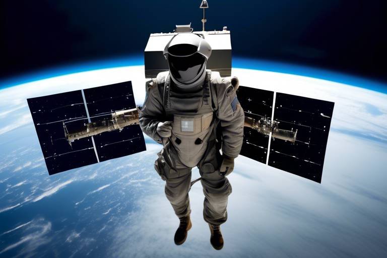
How Satellites Improve Response Times in Crisis Situations
In today's fast-paced world, the ability to respond swiftly and effectively to crises can mean the difference between life and death. Whether it's a natural disaster like a hurricane or an unexpected humanitarian crisis, the role of technology has become increasingly vital. One of the most significant advancements in this realm has been the use of satellite technology. These orbiting marvels not only provide critical data but also enhance communication and coordination during emergencies. In this article, we will delve into how satellites enhance response times in crisis situations, revolutionizing the way we manage disasters and humanitarian efforts.
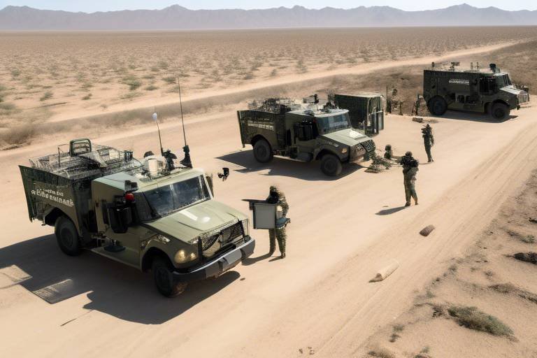
Imagine being a first responder in the aftermath of a devastating earthquake. The ground is shaking, buildings are crumbling, and every second counts. This is where satellite technology steps in as the backbone for real-time communication and data transmission. By providing a continuous stream of information, satellites enable swift decision-making and coordination among response teams. During crises, when traditional communication infrastructures may be compromised, satellites ensure that vital communication links remain intact. This capacity for seamless communication is crucial, as it allows teams to share updates, coordinate efforts, and ultimately save lives.
One of the most remarkable capabilities of satellites is their ability to collect real-time data. This data encompasses a range of essential information, including weather patterns and geographical changes, which are vital for effective crisis management and resource allocation. For example, when a storm is brewing, satellites can provide up-to-the-minute forecasts, enabling responders to prepare adequately and mitigate the impact of natural disasters. The power of real-time data collection cannot be overstated; it is akin to having a crystal ball that allows emergency services to anticipate challenges and respond proactively.
Weather monitoring is one of the primary functions of satellites. These high-tech devices can observe atmospheric conditions from space, offering forecasts that help responders brace for incoming natural disasters. By tracking storm systems and other weather phenomena, satellites contribute significantly to disaster preparedness. For instance, when a hurricane is detected, satellite data can help predict its path and intensity, allowing communities to evacuate if necessary. This early warning system is a game-changer, providing critical time for individuals to prepare and for agencies to mobilize resources.
But it doesn’t stop there. By analyzing satellite data, agencies can employ predictive analytics to forecast potential crisis scenarios. This means that instead of waiting for a disaster to strike, organizations can mobilize resources proactively, enhancing their preparedness. Think of it like a chess game; the best players anticipate their opponent's moves and plan several steps ahead. In crisis management, predictive analytics allows for similar foresight, helping to ensure that when disaster does strike, responders are ready to act.
Moreover, satellite imagery is invaluable for tracking the progression of disasters. As events unfold, satellites provide vital updates that inform response strategies and improve situational awareness for on-ground teams. For example, after a flood, satellite images can reveal the extent of the affected areas, helping responders to prioritize their efforts. This real-time tracking is essential for effective crisis management, as it allows teams to adapt their strategies based on the latest information.
Another fascinating aspect of satellite technology is geospatial mapping. Through satellite imagery, responders can accurately identify affected areas, facilitating the targeted and efficient deployment of aid and resources. This precision ensures that help reaches those who need it most, rather than spreading resources too thinly across a wide area. It’s like having a detailed map in a treasure hunt; it guides responders directly to where their efforts are most needed.
When crises strike, reliable communication is paramount. Satellites provide that assurance by ensuring communication links remain operational even when terrestrial networks fail. This capability is crucial for uninterrupted coordination among responders and affected communities. Imagine a scenario where local phone lines are down, but responders can still communicate via satellite; this connectivity can be a lifeline during emergencies.
Emergency communication systems powered by satellites ensure that critical information reaches both responders and victims. This technology provides essential updates and instructions during crises, enabling individuals to make informed decisions. In a world where misinformation can spread like wildfire, having a reliable source of information is invaluable.
Furthermore, satellites offer global connectivity, allowing international aid organizations to collaborate seamlessly during large-scale emergencies. This interconnectedness means that help can arrive from across the globe, regardless of borders. In times of crisis, this global approach can mobilize resources and expertise that would otherwise be unavailable, creating a united front against disasters.
To truly appreciate the effectiveness of satellite technology in crises, we can look at specific case studies. For instance, during natural disasters like hurricanes and earthquakes, satellite imagery has proven essential in assessing damage and coordinating immediate relief efforts. These real-world applications showcase the potential of satellites to change the landscape of disaster response.
In the aftermath of hurricanes, satellites have been instrumental in providing real-time data on storm paths and damage assessments. This capability allows agencies to prioritize areas for aid and support, ensuring that resources are directed where they are needed most. The lessons learned from these experiences continue to shape future responses, enhancing our overall preparedness.
Similarly, in humanitarian crises, satellites facilitate the monitoring of refugee movements and resource distribution. This ensures that aid reaches those in need swiftly and effectively, making a significant difference in the lives of countless individuals. The ability to track populations and assess needs in real-time is a game-changer in humanitarian efforts.
- How do satellites help in crisis situations? Satellites provide real-time data, communication links, and geospatial mapping, enhancing coordination and response efforts during emergencies.
- What types of data do satellites collect during disasters? Satellites collect data on weather patterns, geographical changes, and damage assessments, which are crucial for effective crisis management.
- Can satellites operate during severe weather? Yes, satellites are designed to function in various weather conditions, providing critical information even during severe storms.
The Role of Satellite Technology
Satellite technology serves as the backbone for real-time communication and data transmission during crises, enabling swift decision-making and coordination among response teams. Imagine a world where natural disasters strike and the chaos ensues; in such moments, satellites act like vigilant eyes in the sky, gathering critical information that can mean the difference between life and death. These technological marvels orbiting our planet provide a comprehensive view that ground teams simply cannot achieve alone.
One of the most significant advantages of satellite technology is its ability to deliver real-time data to emergency response teams. This data includes everything from weather updates to geographical changes, all of which are essential for making informed decisions quickly. For instance, during a hurricane, satellites can track the storm's path and intensity, allowing responders to prepare and evacuate areas in its wake. Without this technology, the response would be less coordinated and more chaotic, potentially leading to greater loss of life and property.
Furthermore, the integration of satellite technology with predictive analytics enhances our ability to forecast potential crisis scenarios. By analyzing satellite data, agencies can mobilize resources proactively, ensuring that they are prepared before a disaster strikes. This kind of foresight is akin to having a weather radar that not only tells you it's going to rain but also predicts how heavy the downpour will be and when it will hit. For example, if a region is at risk of flooding, satellites can help predict how the water levels will rise, allowing for timely evacuations and resource allocations.
Another critical aspect of satellite technology is its role in disaster tracking. Satellite imagery provides vital updates that inform response strategies and improve situational awareness for on-ground teams. When a natural disaster occurs, every second counts. The ability to see a live feed of the situation allows responders to adjust their strategies in real time. For instance, if a wildfire is spreading faster than anticipated, satellite images can show the affected areas, enabling teams to redirect their efforts efficiently.
Additionally, satellite technology facilitates geospatial mapping, which allows for precise identification of affected areas. This capability is crucial for targeted and efficient deployment of aid and resources. By analyzing satellite images, responders can create detailed maps that highlight the most impacted regions, ensuring that help reaches those who need it most. In a world where resources are often limited, this kind of efficiency can save lives.
In summary, the role of satellite technology in crisis situations cannot be overstated. It not only enhances communication and data transmission but also equips responders with the tools needed to make informed decisions swiftly. As we continue to face natural disasters and humanitarian crises, the importance of these technological advancements will only grow, proving that when it comes to saving lives, every second and every bit of information counts.
Real-time Data Collection
In the fast-paced world of crisis management, is not just a luxury; it’s a necessity. Imagine being in the eye of a storm, where every second counts, and the decisions made can save lives. This is where satellites come into play, acting as the eyes in the sky that gather critical information. With the ability to monitor a variety of factors, satellites provide essential data that shapes the response strategies of emergency teams.
One of the most significant contributions of satellite technology is its capability to deliver real-time data on weather patterns and geographical changes. For instance, during a hurricane, satellites can track the storm's path, intensity, and potential impact areas. This data is vital for emergency responders to make informed decisions about evacuations and resource allocations. The quicker they can access this information, the faster they can act, ultimately reducing the risk to human life.
Weather monitoring through satellites is a game-changer when it comes to preparing for natural disasters. These satellites capture high-resolution images that allow meteorologists to predict weather conditions accurately. This predictive capability helps responders prepare for impending disasters by providing forecasts that can range from hours to days in advance. Such foresight enables agencies to mobilize resources effectively, ensuring that aid is available before disaster strikes.
By harnessing the power of predictive analytics, agencies can analyze satellite data to forecast potential crisis scenarios. This approach allows them to anticipate needs and deploy resources proactively. For example, if a satellite detects unusual weather patterns that could lead to flooding, agencies can prepare by pre-positioning supplies and personnel in vulnerable areas. This proactive stance not only enhances preparedness but also significantly reduces the chaos that often accompanies disaster response.
In the aftermath of a disaster, tracking its progression is crucial for effective response. Satellite imagery provides real-time updates on the situation, allowing responders to assess damage and adjust their strategies accordingly. For instance, after an earthquake, satellites can map the affected areas, identifying regions that are most in need of assistance. This information is invaluable for coordinating rescue operations and ensuring that help reaches those who need it the most.
Geospatial mapping, facilitated by satellite imagery, enables precise identification of affected areas. This technology allows responders to visualize the extent of the damage and prioritize their efforts. With detailed maps, teams can efficiently deploy aid and resources where they are needed most. For example, during a flood, geospatial data can highlight regions that are submerged, guiding rescue operations and ensuring that help is directed to the right locations.
In summary, the role of satellites in real-time data collection cannot be overstated. They provide a comprehensive view of the unfolding crisis, enabling responders to act swiftly and effectively. As technology continues to evolve, we can expect even greater advancements in satellite capabilities, further enhancing our ability to manage crises and protect lives.
- How do satellites gather real-time data? Satellites use various sensors and imaging technologies to capture data about weather conditions, geographical changes, and other critical factors.
- What types of disasters can satellites help monitor? Satellites are effective in monitoring natural disasters such as hurricanes, floods, earthquakes, and wildfires, as well as humanitarian crises.
- Can satellite data be accessed in real-time? Yes, many satellite systems are designed to provide near real-time data, allowing emergency responders to make timely decisions.
- How does predictive analytics enhance crisis management? Predictive analytics uses satellite data to forecast potential crisis scenarios, enabling agencies to prepare and allocate resources proactively.
Weather Monitoring
When it comes to crisis management, through satellite technology is like having a crystal ball that reveals the future. Imagine being able to see storm patterns and weather changes from thousands of miles away! Satellites orbiting Earth provide a bird's eye view that is crucial for predicting severe weather events, such as hurricanes, tornadoes, and floods. This data is not just numbers and images; it represents lives that can be saved through timely warnings and preparations.
Satellites equipped with advanced sensors collect data on various atmospheric conditions, including temperature, humidity, wind speed, and precipitation. This information is processed and analyzed to create accurate weather forecasts. For instance, meteorologists use satellite imagery to track the development and movement of storm systems. By doing so, they can issue warnings that help communities brace for impact. Think of it as a weather radar on steroids—capable of detecting changes in real-time and providing updates that are crucial for effective response strategies.
Moreover, satellite weather monitoring plays a pivotal role in disaster preparedness. Before a natural disaster strikes, responders can utilize satellite data to assess the potential risks and impacts on specific regions. This allows for the proactive allocation of resources, ensuring that emergency services are ready to spring into action. For example, during hurricane season, satellites can help determine which areas are at the highest risk, allowing for timely evacuations and resource mobilization.
To illustrate the importance of weather monitoring, consider the following table that summarizes key satellite systems used for weather observation:
| Satellite Name | Purpose | Launch Year |
|---|---|---|
| GOES (Geostationary Operational Environmental Satellites) | Real-time weather monitoring and forecasting | 1975 (first satellite) |
| MODIS (Moderate Resolution Imaging Spectroradiometer) | Earth surface monitoring, including weather patterns | 1999 |
| Sentinel-1 | Radar imaging for monitoring land and water | 2014 |
This table highlights just a few of the satellites that contribute to our understanding of weather phenomena. Each of these systems provides vital information that helps authorities make informed decisions during crises. By leveraging this data, emergency management teams can better prepare for the worst, ensuring that they are one step ahead of nature's fury.
In conclusion, the role of satellites in weather monitoring cannot be overstated. They serve as an essential tool in the arsenal of crisis management, providing data that leads to timely warnings and effective responses. Without these technological marvels, our ability to predict and respond to natural disasters would be significantly hindered, putting countless lives at risk. As we continue to advance satellite technology, the potential for improved crisis response will only grow, making our world a safer place.
- How do satellites monitor weather? Satellites use sensors to collect data on atmospheric conditions, which is then analyzed to create weather forecasts.
- What types of satellites are used for weather monitoring? Geostationary and polar-orbiting satellites are commonly used for real-time weather observation.
- Can satellite data predict natural disasters? Yes, satellite data plays a crucial role in forecasting severe weather events, allowing for timely warnings and disaster preparedness.
Predictive Analytics
Predictive analytics is a game-changer in the realm of crisis management, acting like a crystal ball that offers glimpses into potential future scenarios. By leveraging vast amounts of satellite data, agencies can forecast crises before they escalate, allowing them to mobilize resources and implement preventive measures. Imagine having a weather radar that not only tells you it might rain tomorrow but also predicts the exact areas that will be flooded. This capability is crucial for effective disaster response and resource allocation.
At the heart of predictive analytics lies the ability to analyze historical data and current conditions, creating models that can simulate various crisis scenarios. For instance, during hurricane season, satellite data can be analyzed to predict the storm's trajectory, intensity, and potential landfall locations. This information is invaluable, as it enables emergency services to prepare in advance, ensuring that they have the right resources in the right places.
One of the most significant advantages of predictive analytics is its capacity to enhance preparedness. When agencies can anticipate where a disaster might strike, they can pre-position supplies, such as food, water, and medical aid, in strategic locations. This proactive approach can significantly reduce response times and ultimately save lives. In fact, studies have shown that timely intervention can decrease mortality rates by up to 30% in certain disaster scenarios.
Furthermore, predictive analytics isn't just limited to natural disasters. It can be applied to humanitarian crises as well. For example, by analyzing satellite imagery and demographic data, organizations can predict where refugee movements are likely to occur due to conflict or environmental factors. This foresight allows aid organizations to allocate resources effectively, ensuring that help reaches those in need as quickly as possible.
In summary, predictive analytics transforms satellite data into actionable insights, enabling agencies to stay one step ahead in crisis situations. It's not just about reacting to disasters; it's about anticipating them and acting decisively to mitigate their impacts. As technology continues to evolve, the integration of predictive analytics into crisis management will undoubtedly become more sophisticated, enhancing our ability to protect vulnerable populations and respond effectively when it matters most.
Disaster Tracking
When a disaster strikes, time is of the essence. Satellite imagery plays a crucial role in disaster tracking, allowing responders to monitor the evolution of a crisis in real-time. Imagine being able to see the unfolding events from space; this is exactly what satellites enable us to do. They provide a bird's-eye view of affected areas, revealing not just the extent of damage, but also the changing dynamics of the situation. This information is invaluable for making informed decisions about where to send resources and how to coordinate response efforts effectively.
One of the most significant advantages of satellite tracking is its ability to capture data from areas that are otherwise inaccessible due to destruction or hazardous conditions. For instance, after a major earthquake, traditional ground surveys can be dangerous and time-consuming. However, satellites can quickly assess the damage, providing critical information that helps emergency services prioritize their actions. This capability can drastically reduce response times, saving lives and resources.
Furthermore, satellite technology can be integrated with geospatial analytics to provide detailed insights into the impact of the disaster. By analyzing the imagery, responders can identify key infrastructure that may be compromised, such as bridges, roads, and hospitals. This level of detail allows for a more strategic deployment of aid, ensuring that assistance reaches those who need it most without unnecessary delays.
To illustrate the effectiveness of satellite disaster tracking, consider the following table that summarizes key benefits:
| Benefit | Description |
|---|---|
| Real-time Monitoring | Immediate updates on the disaster's progression, allowing for timely decision-making. |
| Access to Inaccessible Areas | Ability to gather data from regions that are dangerous or difficult to reach. |
| Resource Allocation | Informed decisions on where to deploy resources based on precise damage assessments. |
| Enhanced Coordination | Improved communication among various response teams through shared satellite data. |
In addition to these benefits, satellite tracking can also assist in predictive modeling. By analyzing past data and current conditions, agencies can forecast potential future scenarios and prepare accordingly. This proactive approach not only enhances the efficiency of response efforts but also helps communities build resilience against future disasters.
In summary, disaster tracking through satellite technology is a game-changer in crisis management. It empowers responders with vital information, enabling them to act swiftly and effectively. As we continue to face an increasing number of natural disasters globally, the importance of leveraging satellite capabilities will only grow, making it an essential component of modern emergency response strategies.
- How do satellites track disasters? Satellites use advanced imaging technology to capture real-time images and data of affected areas, allowing responders to assess damage and coordinate efforts effectively.
- What types of disasters can satellites help track? Satellites can track a wide range of disasters, including natural disasters like hurricanes, earthquakes, floods, and wildfires, as well as humanitarian crises.
- Can satellite data be accessed by anyone? While some satellite data is publicly available, specialized data may require access through governmental or private organizations involved in disaster response.
- How quickly can satellite data be obtained after a disaster? Satellite imagery can often be captured and processed within hours of a disaster, providing timely information to responders.
Geospatial Mapping
Geospatial mapping is a transformative tool that has revolutionized how we respond to crises. Imagine being able to pinpoint the exact location of a disaster's impact with just a few clicks. This technology allows emergency responders to visualize affected areas in real-time, leading to quicker and more efficient deployment of resources. By harnessing satellite imagery, responders can create detailed maps that highlight critical infrastructure, population density, and accessibility routes, ensuring that aid reaches those who need it most.
In the aftermath of a disaster, every second counts. Geospatial mapping provides a clear picture of the situation on the ground, enabling teams to make informed decisions. For example, during a flood, satellite images can show which areas are submerged, allowing responders to prioritize rescue operations in the hardest-hit regions. This level of precision is vital in preventing further loss of life and property.
Additionally, geospatial mapping is not just about identifying affected areas; it also plays a crucial role in planning. By analyzing historical data and current satellite imagery, agencies can predict how a disaster might evolve. This predictive capability allows for the development of strategic response plans that can be activated as soon as a crisis occurs.
To illustrate the impact of geospatial mapping, consider the following table that highlights its key benefits in crisis situations:
| Benefit | Description |
|---|---|
| Rapid Assessment | Quickly identifies affected areas and assesses damage. |
| Resource Allocation | Facilitates efficient distribution of aid and resources. |
| Strategic Planning | Enables proactive planning based on predictive analytics. |
| Collaboration | Enhances coordination among various response teams and agencies. |
In conclusion, geospatial mapping is a critical component of modern crisis management. It not only enhances situational awareness but also ensures that every decision made is backed by accurate data. As technology continues to advance, we can expect even more sophisticated geospatial tools that will further improve our response capabilities in the face of disasters.
Communication Networks
In times of crisis, when every second counts, the reliability of can mean the difference between life and death. Traditional communication systems like mobile networks often falter under the pressure of overwhelming demand or physical damage caused by disasters. This is where satellites step in as a game-changer. They provide a robust alternative, ensuring that vital information flows seamlessly between responders and the communities they serve. Imagine being in a situation where the ground is shaking, and your cell service drops. Panic sets in, but then you remember that satellites are there, beaming down data and communication signals from above, cutting through the chaos.
Satellites create a network that is less susceptible to the disruptions that often plague terrestrial systems. This global communication network enables emergency responders to coordinate efforts efficiently, even in the most remote areas where traditional infrastructure may be non-existent. For instance, during a natural disaster, responders can utilize satellite phones and internet connections to establish a reliable line of communication, allowing them to share crucial updates and resources. This technology not only enhances operational efficiency but also fosters a sense of security among affected communities, knowing that help is on the way.
Moreover, satellite communication systems are designed to be highly resilient. They can operate under extreme conditions, ensuring that emergency messages get through when they are needed the most. This capability is particularly important for emergency communication systems that provide real-time updates and instructions to both responders and victims. For example, in the aftermath of a hurricane, satellite technology can facilitate the dissemination of evacuation orders, safety information, and the locations of shelters, all of which are crucial for saving lives.
The ability to maintain global connectivity is another significant advantage of satellite communication. During large-scale emergencies, international aid organizations often need to collaborate and share information across borders. Satellites enable this by providing a common platform for communication, making it easier for various agencies to coordinate their efforts. This is particularly evident in situations where multiple countries respond to a humanitarian crisis, as they can quickly share intelligence and resources to maximize their impact.
In summary, the role of satellites in establishing reliable communication networks during crises cannot be overstated. They not only provide a lifeline for responders but also empower communities to stay informed and connected in the face of adversity. The next time you hear about a disaster response, remember that above the chaos, satellites are silently working to ensure that help arrives swiftly and efficiently.
- How do satellites improve communication during emergencies?
Satellites provide reliable communication links that are less affected by physical damage or high demand, ensuring that vital information can be shared quickly among responders and affected communities.
- What types of satellite communication systems are used in crises?
Emergency communication systems often include satellite phones, internet connections, and data transmission services that facilitate real-time updates and coordination.
- Can satellites operate in extreme weather conditions?
Yes, satellite communication systems are designed to be resilient and can function effectively even in adverse weather conditions, making them reliable during crises.
- How do satellites help in international disaster response?
Satellites enable global connectivity, allowing international aid organizations to collaborate and share information seamlessly across borders during large-scale emergencies.
Emergency Communication Systems
In the chaotic moments of a crisis, when the world seems to spin out of control, effective communication becomes the lifeline that connects responders with those in need. Emergency communication systems powered by satellites are like the unsung heroes of disaster management. They ensure that critical information flows seamlessly, even when traditional communication networks falter. Imagine a hurricane barreling down on a coastal town; as the winds howl and the power flickers, satellite communications remain steadfast, providing updates and instructions to both responders and affected residents.
One of the most remarkable features of these systems is their ability to operate independently of ground-based infrastructure. When terrestrial networks are compromised—whether due to physical damage from a disaster or overwhelming traffic from panicked citizens—satellites step in to fill the gap. This capability is crucial for maintaining real-time coordination among emergency teams. For instance, during a large-scale earthquake, responders can use satellite links to communicate with each other, share vital information about the situation on the ground, and allocate resources effectively.
Moreover, satellite communication systems are equipped with various technologies that enhance their functionality. These include:
- Mobile Satellite Services (MSS): These services provide portable satellite communication devices that can be deployed quickly in the field.
- Satellite Phones: In areas where cellular networks are down, satellite phones allow responders to connect with command centers and other teams.
- Data Transmission Systems: These systems enable the sharing of images, videos, and other critical data, enhancing situational awareness.
The importance of these systems cannot be overstated. They not only facilitate communication among responders but also ensure that vital information reaches the affected populations. For instance, emergency alerts can be disseminated via satellite to inform residents about evacuation routes, safety measures, and available resources. This is particularly crucial in remote areas where other forms of communication may be limited or non-existent.
Furthermore, the integration of satellite communication systems with other technologies, such as drones and ground sensors, creates a comprehensive response framework. This synergy allows for more effective monitoring of the situation and can significantly improve the overall response time. In essence, these systems act as the nervous system of disaster response, transmitting signals that guide actions and decisions.
As we look to the future, the evolution of satellite communication technology continues to promise even greater advancements. Innovations such as high-throughput satellites and low Earth orbit (LEO) satellite constellations are set to enhance bandwidth and reduce latency, making communication even more reliable during emergencies. In a world where every second counts, these advancements could mean the difference between life and death.
In summary, emergency communication systems powered by satellites are not just a convenience—they are a necessity in today’s disaster response landscape. They provide the critical link needed to ensure that help can reach those who need it most, transforming chaos into coordinated action.
- How do satellite communication systems work during a crisis? Satellite communication systems operate by relaying signals between satellites in orbit and ground stations, ensuring connectivity even when terrestrial networks are down.
- What types of devices are used in emergency communication systems? Devices such as satellite phones, portable satellite terminals, and data transmission systems are commonly used to facilitate communication during emergencies.
- Can satellite communications be used in remote areas? Yes, satellite communications are particularly effective in remote areas where traditional communication infrastructure is limited or unavailable.
- How do satellite systems improve response times? By providing reliable communication links and real-time data sharing, satellite systems enable faster decision-making and coordination among responders, ultimately improving response times.
Global Connectivity
In today's interconnected world, the role of satellites in ensuring during crises cannot be overstated. When disasters strike, traditional communication networks often crumble under the pressure, leaving affected communities in the dark. This is where satellites shine, providing a lifeline by maintaining communication links across vast distances. Imagine being in a remote area where the ground infrastructure has been obliterated—satellite technology becomes the beacon of hope that connects rescue teams with those in need.
Satellites enable real-time communication that is crucial for effective crisis management. They allow emergency responders to coordinate their efforts seamlessly, even when they are continents apart. For instance, during a natural disaster, satellite communications can relay vital information such as the location of survivors, the status of shelters, and the needs of the affected population. This instant exchange of information can be the difference between life and death, as it allows for quick decision-making and resource allocation.
Furthermore, satellites facilitate international collaboration among various aid organizations. In large-scale emergencies, multiple agencies often come together to provide assistance. Satellites allow these organizations to share data and updates in real-time, ensuring that everyone is on the same page. For example, during the recent humanitarian crisis in a conflict zone, satellite communication systems enabled NGOs from different countries to coordinate their efforts effectively, maximizing the impact of their aid.
To illustrate the importance of global connectivity through satellites, consider the following key benefits:
- Uninterrupted Communication: Satellites provide a stable communication network that is not reliant on local infrastructure, making them invaluable during crises.
- Rapid Deployment: With satellite technology, responders can quickly set up communication systems in affected areas, ensuring that help can be dispatched without delay.
- Data Sharing: Satellites allow for the sharing of crucial data across borders, enabling international collaboration and support.
In summary, the significance of global connectivity through satellite technology cannot be underestimated. It not only enhances the efficiency of crisis response but also fosters a sense of unity among nations in the face of disasters. As we continue to face challenges like climate change and geopolitical tensions, the role of satellites in connecting the world will become increasingly vital.
- How do satellites maintain communication during a crisis?
Satellites operate independently of ground infrastructure, providing a reliable communication link that can withstand the impacts of disasters. - Can satellites be used in remote areas?
Yes, satellites are particularly useful in remote locations where traditional communication networks are unavailable or damaged. - What types of information can satellites transmit during a crisis?
Satellites can transmit various types of information, including location data, weather updates, and resource needs, which are essential for effective crisis management.
Case Studies of Satellite Use
Examining specific case studies highlights the effectiveness of satellite technology in various crises, showcasing successful applications and lessons learned for future responses. One of the most compelling examples is the response to the devastating Hurricane Katrina in 2005. In the aftermath of this catastrophic event, satellite imagery played a crucial role in assessing the extent of damage across the Gulf Coast. The ability to capture detailed images of flooded areas allowed emergency responders to prioritize their efforts, ensuring that resources were deployed where they were most needed. This not only saved time but also lives, as the data provided a clear picture of the disaster's impact.
Another significant case study is the use of satellites during the 2010 Haiti Earthquake. Within hours of the earthquake, satellite imagery was used to map the affected regions, allowing humanitarian organizations to identify the hardest-hit areas. The images provided insights into the destruction of infrastructure, which was vital for coordinating rescue operations and delivering aid. Moreover, the use of geospatial mapping helped in tracking the movements of displaced populations, ensuring that assistance reached those in need swiftly.
Furthermore, during the ongoing humanitarian crisis in Syria, satellites have been instrumental in monitoring refugee movements and resource distribution. By utilizing satellite data, organizations like the United Nations can assess the flow of refugees and identify areas that require immediate aid. This real-time information allows for a more effective allocation of resources, ensuring that food, medical supplies, and shelter are provided to those who need it most.
In addition to these examples, satellites have also been used in response to environmental crises, such as wildfires and floods. For instance, during the California wildfires, satellite technology provided critical information on fire spread and intensity. This data enabled firefighters to strategize their response effectively, minimizing damage to property and protecting lives. The ability to monitor changes in real-time is invaluable in such fast-paced situations.
Overall, these case studies illustrate not only the versatility of satellite technology in various crisis scenarios but also its essential role in enhancing situational awareness and improving response times. As we continue to face challenges posed by natural disasters and humanitarian crises, the integration of satellite technology into emergency management strategies will undoubtedly become more pivotal.
- How do satellites collect data during crises? Satellites utilize advanced sensors to capture images and gather data on various environmental conditions, which are transmitted back to ground stations for analysis.
- Can satellite communication work in remote areas? Yes, satellite communication can provide connectivity in remote locations where traditional communication infrastructure may be unavailable or damaged.
- What are the limitations of satellite technology in crisis management? While satellites provide valuable data, they may not always capture real-time changes, and their effectiveness can be limited by weather conditions or satellite coverage.
- How can organizations access satellite data during emergencies? Many organizations collaborate with agencies like NASA or private satellite companies to access real-time data and imagery for crisis response.
Natural Disasters
Natural disasters are unpredictable and often devastating events that can disrupt lives, economies, and the environment. From hurricanes and floods to earthquakes and wildfires, the impact can be catastrophic. However, the integration of satellite technology into disaster response strategies has revolutionized how we manage these crises. Imagine a bird's-eye view of the Earth that provides real-time data, enabling responders to make informed decisions swiftly. This capability is not just a luxury; it's a necessity in today's world.
Satellites play a crucial role in assessing damage and coordinating immediate relief efforts following a natural disaster. For instance, after a hurricane has made landfall, satellite imagery can quickly reveal the extent of flooding and destruction. This information is invaluable for emergency services as they strategize their response. By analyzing satellite data, agencies can identify which areas are most affected and prioritize their resources accordingly. The speed at which this data is collected and disseminated can mean the difference between life and death.
Moreover, satellite technology allows for the continuous monitoring of natural disasters as they unfold. For example, during an earthquake, satellites can detect ground movement and provide real-time updates on aftershocks. This information helps emergency responders to adjust their strategies on the fly, ensuring that they can provide assistance where it is needed most. The ability to track the progression of a disaster offers vital updates that improve situational awareness for on-ground teams, allowing them to act decisively.
In addition to immediate response, satellites also contribute to long-term recovery efforts. By comparing pre- and post-disaster images, organizations can assess the damage and plan for rebuilding. This geospatial mapping capability not only helps in understanding the impact of the disaster but also aids in future preparedness efforts. By analyzing patterns and outcomes from past disasters, agencies can develop better strategies that utilize satellite data for risk assessment and mitigation.
Ultimately, the integration of satellite technology into disaster response is a game-changer. It empowers responders to act quickly, efficiently, and effectively, minimizing the impact of natural disasters on communities. As we continue to face the challenges posed by climate change and increasing natural disasters, the reliance on satellite technology will only grow stronger. It's like having a superhero in the sky, ready to provide critical information when it's needed most.
- How do satellites help in predicting natural disasters?
Satellites collect data on weather patterns and geological activity, which can be analyzed to predict potential natural disasters like hurricanes or earthquakes. - What types of satellite imagery are used in disaster response?
High-resolution optical and radar imagery are commonly used to assess damage, monitor changes in the environment, and plan relief efforts. - Can satellite communication work during a disaster?
Yes, satellite communication systems are often more reliable than terrestrial networks during disasters, ensuring that responders can communicate effectively. - How quickly can satellite imagery be obtained after a disaster?
In many cases, satellite imagery can be captured and made available within hours of a disaster occurring, allowing for rapid assessment and response.
Humanitarian Crises
Humanitarian crises are often characterized by sudden and overwhelming needs that arise from conflicts, natural disasters, or systemic failures. In such chaotic environments, the role of satellite technology becomes not just beneficial, but absolutely essential. Imagine a situation where thousands of people are displaced overnight due to a natural disaster. Communication lines are down, roads are blocked, and local resources are stretched thin. This is where satellites come into play, acting as the lifeline that connects aid organizations to those in need.
Satellites facilitate the monitoring of refugee movements and the distribution of resources, ensuring that aid reaches the most vulnerable populations swiftly and effectively. Through high-resolution satellite imagery, humanitarian agencies can assess the scale of displacement and identify the most affected areas. This information is crucial for planning effective interventions. For example, when a large influx of refugees occurs, organizations can use satellite data to:
- Identify Safe Routes: Satellites help in mapping out safe pathways for refugees to reach shelters or aid stations.
- Assess Resource Needs: By analyzing imagery, agencies can determine what resources—food, water, medical supplies—are urgently required.
- Monitor Conditions: Continuous satellite surveillance ensures that conditions in refugee camps are safe and adequate.
Moreover, the ability to gather real-time data allows for a faster response. When humanitarian organizations have access to up-to-date information, they can mobilize resources more efficiently. For instance, during the Syrian refugee crisis, various NGOs leveraged satellite data to track movements and assess needs, which enabled them to provide timely assistance. The integration of satellite technology into humanitarian efforts not only enhances the speed of response but also improves the overall effectiveness of aid delivery.
In addition to tracking and resource allocation, satellites also play a pivotal role in collaboration among international aid organizations. With global connectivity, different agencies can share critical information seamlessly, regardless of geographical barriers. This is vital in crises where coordination is key to saving lives. The synergy created through shared satellite data can lead to innovative solutions and a more unified response strategy.
In conclusion, the impact of satellite technology in humanitarian crises cannot be overstated. By providing essential data and communication capabilities, satellites empower organizations to act swiftly and effectively, ensuring that help reaches those who need it most. As we look to the future, the continued evolution of satellite technology will undoubtedly enhance our ability to respond to humanitarian challenges around the globe.
Q: How do satellites help in humanitarian crises?
A: Satellites provide real-time data and imagery that help organizations assess needs, track movements, and coordinate aid delivery efficiently.
Q: Can satellite technology be used in conflict zones?
A: Yes, satellite technology can monitor conflict zones, providing crucial information while ensuring the safety of aid workers and affected populations.
Q: What types of data do satellites collect during crises?
A: Satellites collect various types of data, including weather patterns, geographical changes, and population movements, which are essential for effective crisis management.
Frequently Asked Questions
- How do satellites improve response times during crises?
Satellites enhance response times by providing real-time data and communication capabilities. They enable quick decision-making and coordination among emergency response teams, ensuring that help reaches those in need as swiftly as possible.
- What type of data do satellites collect during emergencies?
Satellites collect various types of data, including weather patterns, geographical changes, and damage assessments. This information is crucial for effective crisis management and helps responders allocate resources efficiently.
- Can satellites predict natural disasters?
Yes, satellites can aid in predictive analytics by analyzing data to forecast potential crisis scenarios. This proactive approach allows agencies to mobilize resources in advance, enhancing overall preparedness for natural disasters.
- How do satellites facilitate communication during a crisis?
Satellites provide reliable communication networks that remain operational even when terrestrial networks fail. This ensures that critical information can be shared among responders and affected communities without interruption.
- What role do satellites play in humanitarian crises?
In humanitarian crises, satellites help monitor refugee movements and resource distribution. They ensure that aid reaches those in need quickly and effectively, improving the overall response to such situations.
- Can you give examples of satellite use in past disasters?
Absolutely! For instance, during hurricanes and earthquakes, satellite imagery has been instrumental in assessing damage and coordinating immediate relief efforts. These case studies highlight the effectiveness of satellite technology in real-world scenarios.
- How do satellites assist with weather monitoring?
Satellites continuously monitor weather conditions and provide forecasts that help responders prepare for impending natural disasters. This capability is vital for mitigating the impact of such events on affected populations.
- What is geospatial mapping, and how is it used in crisis management?
Geospatial mapping involves using satellite imagery to identify affected areas precisely. This allows for targeted and efficient deployment of aid and resources, ensuring that help reaches the right places promptly.