The Role of Satellites in Monitoring Global Conflict Zones
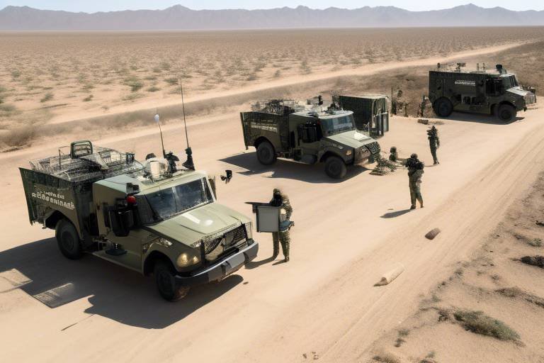
In today's fast-paced world, where conflicts can ignite overnight and humanitarian crises can escalate in the blink of an eye, understanding the dynamics of global conflict zones has never been more crucial. Satellites play a pivotal role in this understanding, serving as the eyes in the sky that provide invaluable insights into military movements, humanitarian needs, and environmental impacts. Imagine a bird's-eye view of a battlefield or a disaster-stricken area; satellites offer that perspective, allowing governments, organizations, and researchers to make informed decisions based on real-time data.
With advanced technologies, satellites enable us to monitor conflict zones from thousands of miles away, offering a level of detail that was once unimaginable. They capture high-resolution images, track movements, and even communicate vital information across vast distances. This capability is not just a technological marvel; it is a lifeline for those affected by conflict and disaster. By harnessing the power of satellite technology, we can gain a deeper understanding of the complexities of global conflict zones, ultimately paving the way for more effective responses to crises.
Moreover, the implications of satellite monitoring extend beyond immediate military concerns. They also encompass humanitarian aid efforts, environmental monitoring, and international cooperation. For instance, when a natural disaster strikes or a conflict erupts, satellite imagery can reveal the extent of damage and help organizations prioritize their responses. This ability to visualize the situation on the ground not only enhances the efficiency of aid distribution but also ensures that resources are allocated where they are needed most.
As we delve deeper into the various aspects of satellite technology and its applications in monitoring conflict zones, we will uncover fascinating insights that highlight the transformative power of these tools. From historical contexts to future trends, the role of satellites is multifaceted and ever-evolving, reflecting the dynamic nature of global conflicts and the urgent need for effective monitoring solutions.
- How do satellites collect data in conflict zones? Satellites collect data through imaging technologies, such as optical and radar sensors, which capture high-resolution images and monitor changes over time.
- What types of conflicts can satellites help monitor? Satellites can monitor various conflicts, including military engagements, civil unrest, and humanitarian crises resulting from natural disasters.
- How does satellite monitoring impact humanitarian aid? Satellite monitoring provides crucial information that helps organizations assess damage, identify affected populations, and direct aid efforts effectively.
- Are there any regulations governing satellite use in conflict zones? Yes, there are international treaties and regulations that govern the use of satellite technology to ensure responsible monitoring and data sharing.
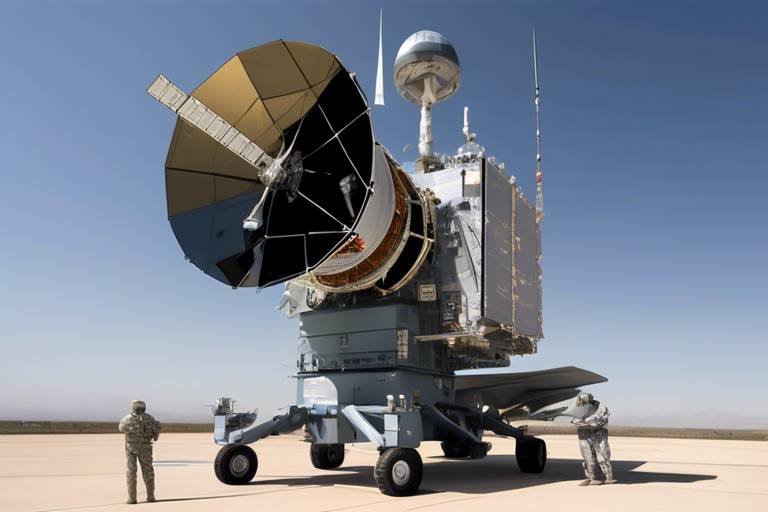
Satellite Technology Overview
In today's world, satellites play a crucial role in monitoring conflict zones, providing invaluable insights that help governments, NGOs, and humanitarian organizations make informed decisions. The evolution of satellite technology has transformed the way we observe and understand global conflicts. From high-resolution imaging to advanced communication systems, the capabilities of satellites have expanded significantly. This section will delve into the various types of satellite technologies that are instrumental in conflict monitoring.
At the heart of satellite technology is remote sensing, which involves capturing images and data from space. This technology allows for the observation of large areas without the need for physical presence on the ground. For instance, optical satellites can capture stunningly detailed images, revealing troop movements, infrastructure damage, and even the presence of displaced populations. The resolution of these images can be so high that they can distinguish between different types of vehicles or even individuals in some cases.
Another key player in the satellite technology arena is synthetic aperture radar (SAR). Unlike optical imaging, SAR can penetrate cloud cover and operate day or night, making it invaluable for monitoring conflict zones where weather conditions may be unpredictable. By sending out radar signals and analyzing the reflected waves, SAR can create detailed images of the Earth's surface, identifying changes in terrain or infrastructure that could indicate military activity.
Furthermore, communication satellites are essential for relaying information from remote areas to decision-makers. These satellites enable real-time communication, allowing for quick responses to emerging crises. For instance, during a conflict, ground teams can transmit data and images back to command centers, ensuring that those in charge have the latest information at their fingertips. This capability is vital for coordinating humanitarian efforts and military operations alike.
In addition to imaging and communication, geospatial analysis tools are employed alongside satellite data to enhance understanding of conflict dynamics. By analyzing the spatial relationships between various elements in a conflict zone—such as troop movements, refugee flows, and resource distribution—analysts can identify patterns that may predict future escalations. This combination of satellite technology and geospatial analysis creates a powerful toolkit for conflict monitoring and response.
To sum it up, the integration of various satellite technologies—ranging from optical imaging and synthetic aperture radar to advanced communication systems—provides a comprehensive view of conflict zones. This multifaceted approach not only enhances our understanding of military movements but also aids in humanitarian efforts, ensuring that help reaches those who need it most. As technology continues to advance, we can expect even greater capabilities in monitoring and responding to global conflicts.
Historical Context of Satellite Use
When we think about the evolution of technology, it's hard not to marvel at how far we've come, especially in the realm of satellite technology. The journey of satellites began during the Cold War, a time when nations were racing to outdo each other in terms of military prowess and technological advancements. The launch of the Soviet satellite Sputnik 1 in 1957 marked the dawn of the space age and opened the floodgates for the use of satellites in various fields, including military surveillance and reconnaissance.
Initially, satellites were primarily used for military purposes. Their ability to capture high-resolution images of enemy territories provided critical intelligence that shaped military strategies. For example, during the Vietnam War, the United States relied heavily on satellite imagery to monitor troop movements and supply routes, which significantly influenced its military decisions. This reliance on satellite technology demonstrated its potential not only for warfare but also for peacekeeping and humanitarian efforts.
As the technology advanced, so did the applications of satellites. By the 1970s and 1980s, the introduction of remote sensing satellites allowed for the collection of data that was not just limited to military use. These satellites began to play crucial roles in environmental monitoring, disaster response, and even urban planning. The ability to observe changes in land use, deforestation, and natural disasters provided valuable insights for governments and organizations worldwide.
In the 1990s, the end of the Cold War shifted the focus of satellite technology from military dominance to global cooperation. This era saw the establishment of various international treaties aimed at regulating satellite use and promoting peaceful applications. Notably, the United Nations initiated programs that encouraged the use of satellite data for humanitarian aid and disaster relief, recognizing that satellites could serve as tools for good.
Fast forward to the 21st century, and we find ourselves in an age where satellite technology is more advanced than ever. Today, satellites are equipped with sophisticated imaging capabilities that allow for near real-time monitoring of conflict zones. For instance, the WorldView-3 satellite can capture images with a resolution of just 31 centimeters, enabling detailed assessments of ground conditions. This capability is invaluable for understanding the dynamics of conflict, assessing humanitarian needs, and planning effective responses.
Moreover, the rise of commercial satellite companies has democratized access to satellite imagery, allowing NGOs, researchers, and even private individuals to leverage this technology. This shift has led to a more informed global community, where anyone can analyze satellite data to understand the complexities of conflict zones and contribute to solutions.
In summary, the historical context of satellite use is a tale of transformation—from military surveillance during the Cold War to a multifaceted tool for humanitarian aid, environmental monitoring, and global cooperation. As we look to the future, the role of satellites in monitoring conflict zones will undoubtedly continue to evolve, shaped by advancements in technology and the pressing needs of our world.
- What was the first satellite launched into space? The first satellite was Sputnik 1, launched by the Soviet Union in 1957.
- How do satellites collect data? Satellites collect data using various sensors, including optical, radar, and infrared imaging systems.
- Can anyone access satellite imagery? Yes, many commercial satellite companies offer access to satellite imagery for various applications, including research and humanitarian efforts.
- What role do satellites play in humanitarian efforts? Satellites help assess damage, monitor environmental changes, and direct aid to areas in need during and after conflicts.
Real-time Data Collection
In today's fast-paced world, the ability to collect and analyze data in real-time has become crucial, especially in conflict zones where every second counts. Satellites equipped with sophisticated sensors and imaging technology are at the forefront of this revolution, allowing for the immediate gathering of critical information. Imagine a bird's-eye view of a conflict area, capturing movements and changes as they happen. This capability not only enhances situational awareness but also facilitates informed decision-making for governments and humanitarian organizations alike.
Satellites operate in various orbits, each serving distinct purposes that contribute to real-time data collection. For instance, Low Earth Orbit (LEO) satellites orbit the planet at altitudes between 180 to 2,000 kilometers, providing high-resolution imagery that can reveal troop movements, infrastructure damage, or even the displacement of populations. In contrast, Geostationary satellites maintain a fixed position relative to the Earth's surface, which allows them to monitor weather patterns and environmental changes continuously. This dual capacity of satellites means that they can address both immediate military concerns and longer-term humanitarian needs.
The data collected by satellites can be categorized into several types, including optical imagery, synthetic aperture radar (SAR), and multispectral data. Each type serves a unique purpose:
- Optical Imagery: Captures detailed images of the Earth's surface, useful for assessing damage and monitoring troop movements.
- Synthetic Aperture Radar (SAR): Penetrates cloud cover and can operate day or night, making it invaluable for tracking changes in terrain and infrastructure.
- Multispectral Data: Analyzes various wavelengths of light, enabling the identification of vegetation health, land use changes, and even the presence of pollutants.
Moreover, the integration of satellite data with ground-based sensors and social media analytics enhances the breadth of information available. For example, during a humanitarian crisis, satellite imagery can be cross-referenced with reports from field workers or data from local social media channels to paint a more comprehensive picture of the situation. This synergy allows organizations to respond more effectively, ensuring that aid reaches those who need it most.
Furthermore, the speed at which satellite data can be processed and disseminated is remarkable. With advancements in machine learning and artificial intelligence, data analysis can occur almost instantaneously. Algorithms can sift through vast amounts of data to identify patterns or anomalies, alerting decision-makers to potential crises before they escalate. This proactive approach can be the difference between timely intervention and a missed opportunity to save lives.
In conclusion, the role of satellites in real-time data collection cannot be overstated. As technology continues to evolve, the potential for these tools to provide critical insights into conflict zones will only increase. By leveraging real-time data, we can better understand the complexities of conflicts, respond to humanitarian needs swiftly, and ultimately work towards a more peaceful world.
- How do satellites collect real-time data?
Satellites collect real-time data through advanced imaging technologies, sensors, and communication systems that transmit information back to Earth. - What types of satellites are used for monitoring conflict zones?
Both Low Earth Orbit (LEO) and Geostationary satellites are used, each providing unique advantages for different monitoring tasks. - How does satellite data help in humanitarian efforts?
Satellite data aids in assessing damage, identifying affected populations, and directing aid to areas in need during and after conflicts.
Impact on Humanitarian Aid
The impact of satellite technology on humanitarian aid is nothing short of revolutionary. Imagine being able to see the aftermath of a natural disaster or conflict from space, pinpointing where help is needed most. This is the power of satellite imagery, which provides critical insights that can save lives and streamline aid efforts. By offering a bird's-eye view of affected areas, satellites allow humanitarian organizations to assess damage quickly and effectively, ensuring that resources are allocated where they are needed the most.
One of the most significant advantages of using satellites in humanitarian aid is their ability to provide real-time data. For instance, during crises like the Syrian civil war or the aftermath of Hurricane Katrina, satellite imagery has been instrumental in mapping out destruction and identifying displaced populations. This kind of information is vital for organizations like the United Nations and NGOs, as it enables them to create targeted response strategies. Without such data, aid could be misdirected, resulting in wasted resources and delayed assistance to those in dire need.
Furthermore, satellite data enhances the coordination of humanitarian efforts. When multiple organizations are involved in a crisis response, having access to the same satellite imagery can help prevent overlap and ensure that aid reaches all affected areas. For example, a recent collaboration among various NGOs in Yemen utilized satellite data to track food shortages and prioritize delivery routes. This not only improved efficiency but also helped in reducing costs associated with aid distribution.
Additionally, satellites play a crucial role in monitoring ongoing conflicts and their humanitarian implications. By analyzing changes over time, organizations can identify trends, such as the movement of refugees or the destruction of infrastructure, which can inform their strategies. This continuous monitoring is essential for adapting to the evolving needs of conflict-affected populations.
To illustrate the effectiveness of satellite technology in humanitarian aid, consider the following table that outlines key applications:
| Application | Description | Example |
|---|---|---|
| Damage Assessment | Identifying the extent of destruction in affected areas. | Post-earthquake damage mapping in Haiti. |
| Population Tracking | Monitoring movements of displaced individuals. | Tracking refugee flows during the Syrian crisis. |
| Resource Allocation | Determining where aid is most needed. | Directing food and medical supplies in conflict zones. |
In conclusion, the integration of satellite technology into humanitarian aid efforts has transformed how we respond to crises. It empowers organizations to make informed decisions quickly, ensuring that help reaches those who need it most. As technology continues to advance, we can only expect these capabilities to grow, further enhancing our ability to respond to humanitarian needs around the globe.
- How do satellites collect data for humanitarian aid? Satellites use various imaging technologies to capture high-resolution images of the Earth's surface, which are then analyzed to assess damage and monitor populations.
- What organizations use satellite data for humanitarian purposes? Many organizations, including the United Nations, Red Cross, and various NGOs, utilize satellite data to inform their humanitarian efforts.
- Can satellite imagery help during natural disasters? Yes, satellite imagery is crucial for assessing damage and coordinating aid efforts during and after natural disasters.
Environmental Monitoring
In today's world, the intersection of conflict and environmental degradation is more pronounced than ever. As tensions rise in various regions, the impact on the environment can often be overlooked, yet it plays a crucial role in exacerbating conflicts. Satellites serve as our eyes in the sky, providing invaluable data that helps monitor these changes, ensuring that we understand not just the immediate effects of conflict but also the long-term implications on the environment.
One of the most significant contributions of satellite technology is its ability to monitor deforestation, land degradation, and pollution levels in conflict zones. For instance, when armed conflicts break out, forests are often cleared for military operations or to create makeshift camps. This not only destroys habitats but also releases stored carbon into the atmosphere, contributing to global warming. Satellites equipped with multi-spectral imaging can track these changes over time, allowing us to quantify the extent of deforestation and assess its impact on local ecosystems.
Moreover, pollution is another critical area where satellites shine. They can detect changes in water quality, air pollution levels, and even soil contamination. During conflicts, industrial facilities may be damaged or abandoned, leading to hazardous spills or emissions that threaten nearby communities. By utilizing satellite data, humanitarian organizations can identify affected areas swiftly and prioritize their interventions. For example, satellite imagery can reveal oil spills in rivers or lakes, enabling rapid responses to mitigate environmental and health risks.
Furthermore, the monitoring of land use changes through satellites can help predict potential humanitarian crises. When agricultural land is damaged due to conflict, it can lead to food shortages and displacement of populations. By analyzing satellite data, we can observe shifts in land use patterns and identify regions that might face food insecurity. This proactive approach allows governments and NGOs to mobilize resources and support before a crisis escalates.
To illustrate the effectiveness of satellite monitoring in environmental contexts, consider the following table that summarizes key environmental issues detected by satellite technology in conflict zones:
| Environmental Issue | Satellite Technology Used | Impact on Conflict |
|---|---|---|
| Deforestation | Multi-spectral imaging | Habitat loss, increased carbon emissions |
| Water Pollution | Hyperspectral sensors | Health risks, humanitarian crises |
| Soil Degradation | Radar imaging | Food insecurity, displacement |
In summary, the role of satellites in environmental monitoring during conflicts cannot be overstated. They provide essential data that informs decision-making, guides humanitarian efforts, and helps predict future conflicts. As technology continues to evolve, the integration of satellite data with artificial intelligence and machine learning will likely enhance our ability to monitor and respond to environmental changes in real time. This synergy between technology and humanitarian action is crucial for fostering a more sustainable and peaceful future.
- How do satellites monitor environmental changes?
Satellites use various imaging technologies to capture data about land use, vegetation health, water quality, and pollution levels. This data is analyzed to identify changes and trends over time. - What are the main environmental issues in conflict zones?
Key issues include deforestation, soil degradation, and water pollution, all of which can exacerbate humanitarian crises and contribute to further conflict. - How can satellite data help humanitarian organizations?
Satellite data allows organizations to assess damage, prioritize areas in need, and respond more effectively to emerging crises.
Geospatial Analysis Techniques
Geospatial analysis techniques are pivotal in understanding the dynamics of conflict zones. By leveraging satellite data, analysts can visualize and interpret complex spatial relationships that emerge during conflicts. This is akin to piecing together a jigsaw puzzle; each piece of data contributes to a clearer picture of the situation on the ground. For instance, satellite imagery can reveal troop movements, changes in infrastructure, and shifts in population density, all of which are critical for assessing potential conflict escalation.
One of the primary techniques used in geospatial analysis is spatial data visualization. This involves creating maps and models that represent various data layers, such as military installations, refugee camps, and humanitarian aid distribution points. These visualizations not only help in immediate decision-making but also in long-term strategic planning. By understanding where resources are concentrated or where conflicts are likely to flare up, organizations can allocate their efforts more effectively.
Another essential technique is temporal analysis, which examines how conditions in a conflict zone change over time. By comparing satellite images from different periods, analysts can detect trends such as the expansion of conflict areas or the deterioration of living conditions. This method is particularly useful for predicting future conflicts or humanitarian crises. For example, if a region shows a consistent increase in military activity over several months, it may indicate an imminent escalation, prompting preemptive action.
Moreover, predictive modeling is increasingly being integrated with geospatial analysis. This technique uses historical data and current trends to forecast potential conflict scenarios. By inputting various factors—such as economic conditions, political instability, and environmental stressors—analysts can create models that suggest where and when conflicts are likely to occur. This is vital for international organizations and governments aiming to implement preventive measures before situations spiral out of control.
Additionally, geospatial analysis often employs remote sensing technologies. These technologies allow for the collection of data without direct contact, making it possible to monitor inaccessible or dangerous areas. For example, radar and infrared imaging can penetrate cloud cover and provide insights into ground conditions, even during adverse weather. This capability is crucial for real-time monitoring of conflict zones, where traditional data collection methods may be too risky or impractical.
To illustrate the effectiveness of these techniques, consider the following table that summarizes some key geospatial analysis methods and their applications in conflict monitoring:
| Technique | Description | Application |
|---|---|---|
| Spatial Data Visualization | Mapping and modeling of data layers | Identifying resource allocation and conflict hotspots |
| Temporal Analysis | Examining changes over time using satellite images | Detecting trends in military activity and humanitarian needs |
| Predictive Modeling | Forecasting potential conflict scenarios | Implementing preventive measures |
| Remote Sensing Technologies | Collecting data without direct contact | Monitoring inaccessible areas |
In conclusion, geospatial analysis techniques are transforming the landscape of conflict monitoring. By utilizing advanced satellite data and analytical methods, stakeholders can gain invaluable insights into the complex interplay of factors that drive conflicts. The ability to visualize, analyze, and predict conflict dynamics not only enhances situational awareness but also empowers decision-makers to take informed actions that could save lives and resources.
- What is geospatial analysis? Geospatial analysis involves the examination of spatial data to understand relationships and patterns within a geographic context.
- How do satellites contribute to geospatial analysis? Satellites provide high-resolution images and data that can be analyzed to monitor changes in conflict zones over time.
- What are some common applications of geospatial analysis in conflict zones? Applications include monitoring troop movements, assessing humanitarian needs, and predicting potential conflict escalation.
- Can geospatial analysis be used for disaster response? Yes, it is widely used to assess damage and coordinate relief efforts in the aftermath of natural disasters and conflicts.
International Cooperation and Regulation
In today's interconnected world, the use of satellite technology in monitoring conflict zones has become a vital aspect of international security. The need for international cooperation and regulation is more pressing than ever, as nations recognize that the challenges posed by conflicts often transcend borders. By working together, countries can leverage satellite data to enhance their understanding of global conflicts, leading to more effective responses and strategies.
The regulation of satellite technology is crucial in ensuring that its use is ethical and responsible. Various international treaties and agreements have been established to govern the deployment and operation of satellites. For instance, the Outer Space Treaty of 1967 lays the groundwork for the peaceful use of outer space, emphasizing that space exploration should benefit all humankind. This treaty sets a precedent for how satellite technology can be utilized in monitoring conflict zones without infringing on national sovereignty.
Moreover, organizations like the United Nations play a pivotal role in fostering cooperation among nations. Through initiatives such as the UN Office for Outer Space Affairs (UNOOSA), countries are encouraged to share satellite data and collaborate on projects aimed at conflict resolution. This not only helps in monitoring military movements but also assists in identifying humanitarian needs in areas affected by conflict.
However, with the rise of private satellite companies, the landscape of satellite monitoring has shifted significantly. These companies often operate independently of government regulations, which raises questions about accountability and the potential misuse of satellite data. To address these concerns, there is an ongoing dialogue about establishing a regulatory framework that includes private entities in the conversation. This framework would ensure that all satellite operations adhere to international standards, promoting transparency and ethical practices.
To illustrate the importance of international cooperation in satellite monitoring, consider the following table that highlights key treaties and organizations involved:
| Treaty/Organization | Purpose |
|---|---|
| Outer Space Treaty (1967) | Establishes guidelines for the peaceful use of outer space. |
| United Nations Office for Outer Space Affairs (UNOOSA) | Facilitates international cooperation in space exploration and satellite data sharing. |
| Inter-Agency Space Debris Coordination Committee (IADC) | Promotes international efforts to mitigate space debris and enhance satellite safety. |
In addition to treaties, bilateral agreements between countries can further enhance cooperation in satellite monitoring. These agreements often focus on sharing intelligence and data related to conflict zones, allowing nations to respond more effectively to emerging threats. For example, countries may collaborate on joint satellite missions, pooling resources to improve data collection and analysis capabilities.
Ultimately, the future of satellite monitoring in conflict zones hinges on the ability of nations to work together. As technology continues to evolve, so too must our approaches to regulation and cooperation. By fostering a collaborative environment, we can ensure that satellite technology is used not only to monitor conflicts but also to promote peace and stability worldwide.
- What is the Outer Space Treaty? The Outer Space Treaty is an international agreement that governs the peaceful use of outer space, ensuring that space exploration benefits all humankind.
- How do satellites help in monitoring conflict zones? Satellites provide real-time data on military movements, humanitarian needs, and environmental changes, enabling quicker and more informed responses to crises.
- What role do private companies play in satellite monitoring? Private companies contribute to satellite monitoring by providing advanced technology and data, but their operations raise questions about regulation and accountability.
Future Trends in Satellite Monitoring
As we gaze into the crystal ball of technology, the future of satellite monitoring is nothing short of exciting. With rapid advancements in artificial intelligence (AI) and machine learning, we are on the brink of a revolution in how we observe and understand global conflict zones. Imagine a world where satellites not only capture stunning images of Earth but also analyze and interpret data in real-time, providing actionable insights almost instantaneously. This is not science fiction; it's the direction in which satellite technology is heading.
One of the most significant trends is the integration of AI algorithms into satellite data processing. These algorithms can sift through vast amounts of imagery and data at lightning speed, identifying changes and anomalies that would take human analysts days or even weeks to detect. For instance, AI can help pinpoint troop movements, changes in infrastructure, or even the emergence of new conflict zones by analyzing patterns over time. This capability will not only enhance situational awareness but also enable quicker responses to humanitarian crises.
Moreover, the advent of smaller, more cost-effective satellites—often referred to as nanosatellites or CubeSats—will democratize access to satellite data. In the past, only a handful of countries and organizations could afford to deploy and operate large, sophisticated satellites. However, with the reduction in costs, even smaller nations and NGOs can launch their own satellites, leading to a more comprehensive and diverse set of data sources. This shift will enhance global collaboration and transparency in monitoring conflict zones.
In addition to AI and smaller satellites, the future will likely see enhanced imaging technologies such as hyperspectral imaging. This technology captures data across various wavelengths, allowing for a more detailed analysis of environmental changes, resource management, and even the detection of military installations. When combined with traditional imaging methods, hyperspectral data can provide a richer context for understanding the complexities of conflict zones.
Furthermore, the rise of real-time data sharing platforms will facilitate international cooperation. These platforms will allow governments, NGOs, and researchers to access satellite data and analysis in real-time, fostering collaboration and enhancing the effectiveness of humanitarian aid efforts. Imagine a scenario where multiple organizations can coordinate their responses based on live data, ensuring that aid reaches those most in need without delay.
Lastly, as we become more reliant on satellite technology, the need for regulatory frameworks will become increasingly important. International treaties and agreements will need to evolve to address the ethical implications of satellite surveillance and data sharing. Striking the right balance between security and privacy will be crucial as we navigate this new landscape.
In conclusion, the future of satellite monitoring is poised for transformative changes that will enhance our understanding of global conflict zones. With AI advancements, the proliferation of smaller satellites, improved imaging technologies, and collaborative data-sharing platforms, we are entering a new era of monitoring that promises to be more efficient, insightful, and impactful.
- What role does AI play in satellite monitoring? AI enhances data processing capabilities, allowing for real-time analysis and quicker identification of changes in conflict zones.
- How do smaller satellites impact global monitoring? They reduce costs and increase accessibility, enabling more countries and organizations to participate in satellite monitoring efforts.
- What is hyperspectral imaging? It is an advanced imaging technology that captures data across multiple wavelengths, providing detailed insights into environmental and military changes.
- Why is international cooperation essential in satellite monitoring? It ensures that data is shared effectively and ethically, fostering collaboration in humanitarian aid and conflict resolution efforts.
Frequently Asked Questions
- What types of satellites are used to monitor conflict zones?
Satellites equipped with imaging, communication, and reconnaissance capabilities are primarily used to monitor conflict zones. These technologies allow for real-time data collection, providing critical insights into military movements, humanitarian needs, and environmental impacts.
- How has satellite technology evolved over time?
Satellite technology has significantly evolved since its inception. Initially used for basic communication, it has transformed into a sophisticated tool for monitoring global security, with advancements in imaging resolution, data processing, and real-time analytics playing a crucial role in understanding conflict dynamics.
- How do satellites collect real-time data?
Satellites collect real-time data through various sensors that capture images and other data types from conflict zones. This information is transmitted back to ground stations, where it can be analyzed and utilized by governments and organizations to respond swiftly to crises.
- What role do satellites play in humanitarian aid?
Satellites play a vital role in directing humanitarian aid by providing detailed imagery that helps assess damage, identify areas in need, and facilitate the efficient distribution of resources during and after conflicts.
- Can satellites monitor environmental changes in conflict zones?
Yes, satellites are instrumental in monitoring environmental changes in conflict zones. They track deforestation, pollution, and land degradation, which can exacerbate tensions and humanitarian crises, providing crucial data for intervention efforts.
- What are geospatial analysis techniques?
Geospatial analysis techniques involve the use of satellite data to identify patterns and predict potential conflict escalation in vulnerable regions. These techniques help analysts understand the geographical context of conflicts and inform strategic decisions.
- How does international cooperation affect satellite monitoring?
International cooperation is essential for effective satellite monitoring. Treaties and regulations govern the use of satellite technology, ensuring that data is shared responsibly and that monitoring efforts are coordinated among nations to enhance global security.
- What future trends can we expect in satellite monitoring?
Future trends in satellite monitoring may include advancements in artificial intelligence and enhanced imaging capabilities. These developments could lead to more precise data collection and analysis, improving our ability to respond to conflicts and humanitarian needs.