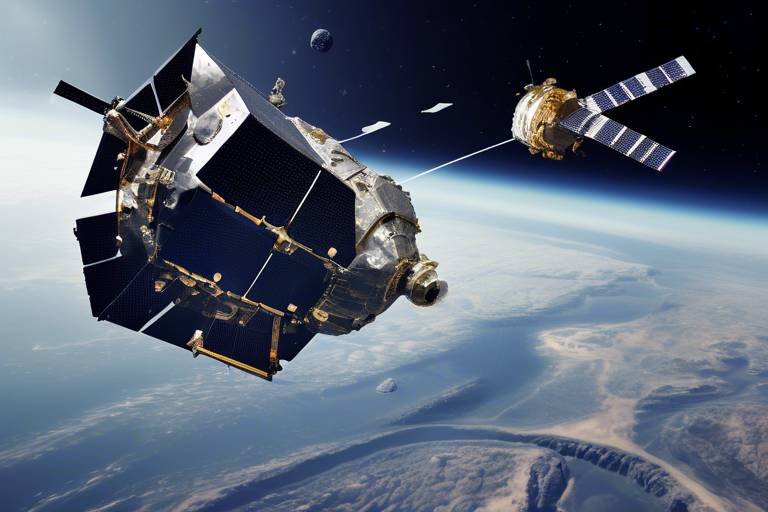
The Role of Military Satellites in Humanitarian Assistance
In times of crisis, when the world feels like it’s turned upside down, military satellites emerge as unsung heroes, playing a crucial role in humanitarian assistance. These technological marvels are not just tools of warfare; they are lifelines that connect us to those in dire need. Imagine a natural disaster striking—earthquakes, hurricanes, or floods. The chaos that follows can be overwhelming, but with the help of military satellites, we can navigate through the storm. They enhance disaster response, streamline coordination among various organizations, and optimize resource management, ensuring that aid reaches the affected populations swiftly and efficiently.
Military satellites are equipped with advanced technologies that allow them to gather and transmit critical data in real-time. This capability is vital during emergencies, where every second counts. By providing high-resolution imagery and accurate geographical information, these satellites enable humanitarian agencies to assess the situation on the ground, identify the most affected areas, and prioritize their response. Without this technology, the task of providing aid would be like trying to find a needle in a haystack—impossible and time-consuming.
Moreover, the integration of military satellite data into humanitarian operations has revolutionized the way we respond to disasters. It's akin to having a bird's-eye view of the battlefield, where you can see not just the chaos but also the paths that lead to safety and recovery. This perspective is invaluable for planning and executing effective relief efforts. It allows organizations to allocate resources where they are needed most, ensuring that no one is left behind.
As we delve deeper into the specifics, we will explore the various satellite technologies employed in military and humanitarian contexts, the challenges faced in data integration, and the future developments that promise to enhance these capabilities even further. Stay tuned as we uncover how these satellites are changing the landscape of humanitarian assistance, making our world a little safer and more connected, even in the darkest times.
When we talk about military satellites, we’re not just referring to a single type of technology. There’s a whole array of satellite systems, each designed with unique functionalities to serve different purposes. From Earth observation satellites that provide high-resolution images of disaster-stricken areas to communication satellites that ensure connectivity for aid workers in remote locations, the spectrum is vast. These satellites operate in different orbits, including Low Earth Orbit (LEO) and Geostationary Orbit (GEO), which further enhances their capabilities in various scenarios.
One of the most significant advantages of military satellites is their ability to operate independently of terrestrial networks. In the aftermath of a disaster, traditional communication systems often fail, leaving ground teams stranded without vital information. This is where military satellites shine, providing a robust communication framework that keeps humanitarian agencies connected. They enable real-time updates and facilitate coordination among responders, ensuring that everyone is on the same page.
Coordination is key in any humanitarian effort, and military satellites play a pivotal role in this regard. They act as a central hub for information sharing, allowing various humanitarian organizations to collaborate effectively. Imagine a scenario where multiple agencies are trying to deliver aid in a chaotic environment. Without a coordinated effort, the response can become fragmented, leading to duplicated efforts or, worse, critical gaps in assistance. Military satellites help mitigate these issues by providing a clear picture of the situation on the ground.
One of the most powerful features of military satellites is their ability to share data in real-time. This capability allows responders to assess disaster situations rapidly, making informed decisions that can save lives. For instance, during a major earthquake, satellites can quickly map the affected areas, highlighting regions that require immediate attention. This information is crucial for deploying resources efficiently and ensuring that aid reaches those who need it most.
There have been numerous instances where military satellite data has played a crucial role in successful humanitarian missions. For example, during the 2010 Haiti earthquake, military satellites provided critical imagery that helped aid organizations identify the hardest-hit areas, allowing them to prioritize their response effectively. Such case studies showcase the effectiveness of satellite technology in action and reinforce the importance of integrating these systems into humanitarian strategies.
Despite the advantages, integrating satellite data with ground-level operations is not without its challenges. Technical issues, such as data compatibility and bandwidth limitations, can hinder effective response. Furthermore, logistical challenges, such as the need for trained personnel to interpret satellite data, can also pose significant obstacles. Addressing these challenges is essential for maximizing the potential of military satellites in humanitarian assistance.
Mapping affected areas and conducting surveillance are essential components of disaster response. Military satellites excel in providing detailed maps that help humanitarian organizations understand the scope of the damage. This information is critical for planning effective relief efforts. It’s like having a treasure map that shows you where to dig for gold—without it, you might waste time and resources searching in the wrong places.
In remote areas where traditional communication networks may be down, military satellites provide vital communication support. This ensures that humanitarian teams can maintain connectivity, share updates, and coordinate their efforts effectively. The ability to stay connected in challenging environments is crucial for the success of any humanitarian mission.
Military satellites support specific emergency communication systems that enable real-time updates among responders. These systems are designed to operate in harsh conditions, ensuring that communication remains uninterrupted even when everything else fails. This resilience is key to maintaining operational efficiency during crises.
Looking ahead, the future of satellite technology in humanitarian assistance is promising. Innovations in data analytics and satellite resilience are on the horizon, which could further enhance military support for humanitarian efforts. As technology continues to evolve, we can expect even greater efficiencies and capabilities that will help us respond to crises more effectively.
- How do military satellites differ from civilian satellites? Military satellites are often equipped with advanced technology and capabilities that allow for secure communication and high-resolution imaging, which are not typically available in civilian satellites.
- Can military satellites be used in non-military situations? Absolutely! Military satellites play a crucial role in humanitarian assistance and disaster response, providing vital data and communication support.
- What are the main challenges faced in integrating satellite data? Challenges include technical issues, data compatibility, bandwidth limitations, and the need for trained personnel to interpret satellite data.
Satellite Technology Overview
In today’s world, satellite technology plays a pivotal role in both military and humanitarian contexts. These high-tech marvels orbiting our planet are not just tools for communication or navigation; they are essential lifelines during crises. Military satellites, in particular, are equipped with advanced functionalities that allow them to gather, analyze, and transmit critical data, especially in emergency situations. Imagine a bird's-eye view of a disaster-stricken area, where every detail is captured in real-time—this is the power of satellite technology.
There are several types of satellites that contribute to humanitarian efforts, each serving a unique purpose:
- Communication Satellites: These are crucial for maintaining connectivity in remote areas where ground communication systems may fail. They ensure that humanitarian teams can coordinate effectively, share information, and receive updates.
- Earth Observation Satellites: These satellites provide high-resolution imagery of affected areas, allowing organizations to assess damage and plan relief efforts efficiently. They can monitor changes over time, which is vital for understanding the evolving situation on the ground.
- Navigation Satellites: These help in pinpointing exact locations for delivering aid, ensuring that resources reach the intended recipients without delay.
Understanding how these satellites operate is essential for appreciating their impact on humanitarian assistance. For instance, Earth observation satellites utilize remote sensing technology to collect data about the Earth's surface. This technology involves capturing images and other data from space and processing them to provide valuable insights. This can include everything from mapping flood zones to identifying areas in need of medical assistance.
Moreover, the ability to transmit data in real-time cannot be overstated. When a natural disaster strikes, every second counts. Military satellites enable rapid data transfer, which allows for quick decision-making and efficient deployment of resources. The integration of satellite data with ground operations can significantly enhance the effectiveness of humanitarian responses.
As we delve deeper into the role of military satellites in humanitarian assistance, it's essential to recognize that these technologies are not just about gathering information; they are about creating a network of support that can respond swiftly to human needs. In the next sections, we will explore how these satellites facilitate disaster response coordination, provide communication support, and what the future holds for satellite technology in humanitarian efforts.
Disaster Response Coordination
When disaster strikes, the clock is ticking, and every second counts. This is where the remarkable capabilities of military satellites come into play, acting as a lifeline in chaotic situations. Imagine a natural disaster, like an earthquake or a hurricane, ripping through a community. Amidst the destruction, military satellites soar high above, providing a bird's-eye view that is crucial for effective disaster response coordination. These satellites enable various humanitarian organizations to communicate seamlessly, ensuring that aid reaches those in need as quickly and efficiently as possible.
One of the primary functions of military satellites in disaster response is their ability to facilitate real-time communication and data sharing among different agencies. For instance, organizations such as the Red Cross, local government bodies, and international aid groups can access satellite imagery that depicts the affected areas. This imagery allows them to assess the damage, identify the most affected regions, and prioritize their efforts accordingly. In a world where every moment matters, the ability to share information instantly can mean the difference between life and death.
Moreover, military satellites provide a comprehensive overview of the disaster area, which is essential for effective planning and resource allocation. They can track the movement of displaced populations, monitor the status of critical infrastructure, and even assess environmental hazards that may arise post-disaster, such as flooding or landslides. By having access to such vital information, humanitarian organizations can deploy their resources more strategically, ensuring that help is not only timely but also targeted.
However, coordinating disaster response is not without its challenges. The integration of satellite data into ground-level operations can sometimes be a complex process. Technical issues, such as data compatibility and transmission delays, can hinder the effectiveness of response efforts. Additionally, logistical challenges, including the need for trained personnel to interpret satellite data and the infrastructure to support these operations, can complicate matters further. Despite these hurdles, the advantages of using military satellites for disaster response coordination far outweigh the challenges.
In summary, military satellites play a pivotal role in disaster response coordination by providing essential data and communication support. Their ability to facilitate real-time information sharing and offer a comprehensive view of disaster-stricken areas empowers humanitarian organizations to act swiftly and efficiently. As we continue to face increasingly frequent natural disasters, the importance of these technological marvels will only grow.
- How do military satellites gather data during a disaster? Military satellites utilize advanced imaging technology to capture high-resolution images of affected areas, which are then analyzed to assess damage and coordinate response efforts.
- Can military satellites operate in extreme weather conditions? Yes, military satellites are designed to function in various weather conditions, providing crucial data even during storms or other adverse environments.
- What are some examples of organizations that use military satellite data? Organizations like the Red Cross, United Nations, and various governmental disaster response teams utilize military satellite data to enhance their humanitarian efforts.
Real-Time Data Sharing
In the chaotic aftermath of a disaster, every second counts. Imagine a scenario where a powerful earthquake strikes a densely populated area. The immediate challenge is not just to provide aid but to understand the extent of the damage and the needs of the affected population. This is where facilitated by military satellites becomes a game-changer. These satellites are equipped with advanced sensors and imaging capabilities that allow them to capture and transmit vital information almost instantaneously.
Military satellites can provide high-resolution images of the affected areas, allowing responders to assess the situation from above. This capability is crucial for identifying damaged infrastructure, locating survivors, and determining the most effective routes for delivering aid. Without this real-time data, humanitarian organizations would be operating in the dark, making decisions based on outdated or incomplete information, which could lead to wasted resources and delayed assistance.
One of the most compelling aspects of military satellite technology is its ability to integrate various data streams. For instance, when a disaster strikes, satellites can collect data on weather conditions, population movements, and infrastructure damage. This data can then be shared with multiple organizations involved in the response effort, ensuring that everyone is on the same page. The result? A coordinated and efficient response that maximizes the impact of humanitarian aid.
To illustrate, let's consider a recent disaster response scenario where military satellites played a pivotal role. Following a devastating hurricane, satellite imagery was used to create detailed maps that outlined the hardest-hit areas. This information was shared in real-time with various NGOs and government agencies, allowing them to prioritize their efforts effectively. Instead of sending teams to areas that were less affected, resources were directed to where they were needed most, significantly speeding up the recovery process.
However, the integration of real-time data sharing isn't without its challenges. There are technical hurdles, such as ensuring that the data is accessible to all parties involved, regardless of their technological capabilities. Moreover, there's the issue of data overload; with so much information coming in, it can be challenging to sift through it all and identify what’s most pertinent. This is why ongoing advancements in data analytics and visualization tools are essential. They help responders make sense of the data, turning raw information into actionable insights.
In conclusion, real-time data sharing enabled by military satellites is a critical component of effective disaster response. It transforms the way humanitarian organizations operate, allowing them to respond swiftly and efficiently to crises. As technology continues to evolve, we can expect even greater improvements in how data is collected, shared, and utilized in the field, ultimately saving more lives and ensuring that aid reaches those who need it most.
Case Studies of Success
Throughout history, military satellites have played a critical role in humanitarian missions, demonstrating their immense value in times of crisis. One notable example is the response to the devastating earthquake that struck Haiti in 2010. In the aftermath of this catastrophe, military satellites provided crucial data that allowed relief organizations to assess the damage and coordinate their efforts effectively. High-resolution imaging from these satellites enabled responders to identify the most affected areas, ensuring that aid was directed where it was needed most. This case not only highlights the capabilities of satellite technology but also underscores the importance of timely information in saving lives.
Another compelling instance occurred during the Typhoon Haiyan disaster in the Philippines in 2013. Military satellites were instrumental in mapping the extent of the destruction caused by the typhoon. By utilizing advanced imaging techniques, responders could visualize the changes in the landscape and track the movement of displaced populations. This facilitated a more organized approach to delivering food, water, and medical supplies, allowing humanitarian agencies to work in harmony rather than in chaos. The data provided by military satellites was a game-changer, allowing for a strategic response that ultimately saved countless lives.
To further illustrate the effectiveness of military satellites in humanitarian assistance, consider the ongoing challenges faced during the Syrian refugee crisis. As millions of people fled conflict zones, military satellites helped monitor border crossings and assess the conditions of temporary camps. By providing real-time surveillance and mapping capabilities, these satellites allowed aid organizations to identify areas of need and allocate resources more efficiently. This case exemplifies how military satellite technology can adapt to various contexts, ensuring that humanitarian efforts remain responsive and effective.
In summary, the integration of military satellite data into humanitarian operations has led to numerous success stories, showcasing how technology can be leveraged to enhance disaster response. The ability to gather and analyze data from space not only improves coordination among agencies but also empowers them to make informed decisions swiftly. These case studies serve as a testament to the transformative impact that military satellites can have in humanitarian missions, paving the way for future advancements in technology that will continue to save lives and provide relief in times of need.
Challenges in Data Integration
Integrating data from military satellites into humanitarian operations is not as straightforward as one might think. Despite the advanced technology and capabilities these satellites offer, there are several challenges that can hinder effective response during crises. One of the primary issues is the technical complexity of the data itself. Military satellite data is often highly detailed and requires specialized knowledge to interpret. Humanitarian organizations, which may not always have access to such expertise, can struggle with understanding the nuances of the data they receive.
Additionally, logistical challenges can arise when trying to incorporate satellite data into ground-level operations. For instance, coordinating between multiple organizations can lead to discrepancies in data interpretation and usage. Imagine trying to assemble a jigsaw puzzle where each piece comes with its own set of rules—this is what humanitarian teams often face when working with various data sources. The lack of standardized protocols for data sharing and integration can create confusion and delay the response time, ultimately impacting the effectiveness of the aid provided.
Moreover, the timeliness of data is crucial in disaster scenarios. Satellites can provide real-time information, but if this data is not quickly processed and disseminated, it loses its value. Humanitarian organizations must have systems in place that can rapidly analyze and relay this information to field teams. This necessitates not only advanced technology but also trained personnel who can act swiftly and decisively based on the satellite data received.
Another significant challenge is the interoperability of systems. Different organizations may use different software and platforms for data analysis and communication. This can create barriers that prevent seamless integration of satellite data into existing workflows. To illustrate, consider a scenario where one organization uses a specific mapping software that cannot read the formats provided by military satellites. In such cases, vital information may be lost, or worse, misinterpreted, leading to ineffective or even harmful decisions in the field.
Lastly, data security is a considerable concern. Military satellite data is sensitive and often classified, raising questions about who has access to this information and how it can be used. Humanitarian organizations need to navigate these security protocols carefully to ensure they can utilize the data without breaching any regulations. This balancing act can complicate the integration process, requiring careful planning and collaboration between military and civilian entities.
In conclusion, while military satellites provide invaluable support in humanitarian efforts, the challenges associated with data integration cannot be overlooked. Addressing these hurdles is essential for enhancing the effectiveness of disaster response operations and ensuring that aid reaches those in need in a timely and efficient manner.
- What are the main challenges in integrating military satellite data into humanitarian efforts?
The main challenges include technical complexity, logistical issues, timeliness of data, interoperability of systems, and data security concerns. - How can humanitarian organizations improve data integration from military satellites?
By investing in training, developing standardized protocols, and fostering collaboration between military and civilian organizations. - Why is real-time data important in disaster response?
Real-time data allows for rapid assessment and informed decision-making, which is crucial in emergencies. - What role do military satellites play in communication during crises?
They provide vital communication support, especially in remote areas where traditional networks may be down.
Mapping and Surveillance
When disaster strikes, the chaos that ensues can be overwhelming. How do we make sense of the destruction? This is where military satellites come into play, acting as our eyes in the sky. They provide crucial mapping and surveillance capabilities that are indispensable during humanitarian crises. Imagine trying to navigate through a dense fog without a compass; that's what disaster response teams face without accurate data to guide their efforts. Military satellites help cut through that fog by offering a bird's-eye view of affected areas, allowing responders to assess damage and plan their actions effectively.
These satellites utilize advanced imaging technologies, such as Synthetic Aperture Radar (SAR) and electro-optical sensors, to capture high-resolution images of the ground. This data is invaluable for identifying the most severely impacted regions, understanding the extent of damage, and prioritizing areas that require immediate assistance. For instance, after a major earthquake, satellites can help map out collapsed buildings, blocked roads, and displaced populations, giving humanitarian organizations a clearer picture of what needs to be done.
Moreover, military satellites are equipped with the ability to monitor changes over time. This means that they can provide ongoing surveillance of disaster zones, tracking how the situation evolves and how effective relief efforts are. Consider a wildfire spreading across a forest; satellites can monitor the fire's perimeter, allowing teams to deploy resources more strategically. This kind of real-time information is critical for making informed decisions that can save lives.
To illustrate the impact of mapping and surveillance, let's look at a few key functionalities:
- Damage Assessment: Satellites can quickly assess the extent of destruction, providing a visual representation that aids in resource allocation.
- Infrastructure Monitoring: Continuous surveillance can help identify which roads, bridges, and facilities are still operational, aiding logistics for aid delivery.
- Population Tracking: By analyzing movement patterns, responders can locate displaced individuals and communities that need help the most.
However, it's not all smooth sailing when it comes to utilizing satellite data. There are challenges, such as data integration with ground-level operations, that can complicate the response process. For example, while satellites can provide a wealth of information, if that data isn't effectively communicated to on-the-ground teams, it may not be utilized to its full potential. This highlights the need for robust systems that can translate satellite imagery into actionable insights for humanitarian responders.
In summary, military satellites play a pivotal role in mapping and surveillance during humanitarian efforts. They provide the critical data needed to navigate the complexities of disaster response, ensuring that help reaches those who need it most. As technology continues to advance, we can only expect these capabilities to improve, further enhancing our ability to respond to crises with speed and precision.
Communication Support
In the midst of a crisis, communication is often the lifeline that connects humanitarian aid workers with the people they are trying to help. Military satellites play a crucial role in providing this essential communication support, especially in remote areas where traditional networks may be down or completely non-existent. Imagine being in a disaster-stricken region where roads are impassable and local communication systems are out of commission. In such scenarios, military satellites swoop in like a superhero, ensuring that aid teams can maintain contact, share updates, and coordinate their efforts effectively.
These satellites enable vital communication links that allow humanitarian organizations to relay critical information back to their command centers. This includes updates on the needs of affected populations, logistical challenges, and the status of ongoing operations. For instance, during the aftermath of a natural disaster, teams on the ground can use satellite communication systems to send real-time data about the condition of infrastructure, the availability of local resources, and the immediate needs of the community. This information is invaluable for making informed decisions and deploying resources where they are most needed.
One of the standout features of military satellite communication is its ability to provide emergency communication systems that can be rapidly set up in the field. These systems often include portable satellite terminals that can be transported easily, allowing teams to establish a communication link within hours of arriving at a disaster site. The speed and reliability of these systems are critical when every minute counts. For example, during the 2010 Haiti earthquake, military satellites were instrumental in supporting communications for humanitarian organizations, enabling them to coordinate rescue and relief efforts effectively.
Moreover, military satellites offer a range of communication services, from voice calls to data transmission, ensuring that humanitarian teams can stay connected regardless of their location. This capability is particularly important in areas where ground-based communication infrastructure has been destroyed or is overwhelmed. The ability to send and receive messages, share location data, and access vital information can make a significant difference in the success of humanitarian missions.
However, it’s important to acknowledge that while military satellites provide robust communication support, they are not without their challenges. The integration of satellite communication with existing ground operations can sometimes be cumbersome. Humanitarian teams must be trained to use these systems effectively, and there can be logistical hurdles in setting up the necessary equipment in the field. Nevertheless, the advantages of having a reliable communication network far outweigh these challenges, making military satellites an indispensable asset in humanitarian assistance.
As we look to the future, advancements in satellite technology promise to enhance communication capabilities even further. Innovations such as smaller, more efficient satellite systems and improved data analytics will likely lead to even more effective communication solutions in the field. Overall, the role of military satellites in providing communication support during humanitarian crises cannot be overstated—they are a game changer in how aid is delivered and coordinated.
- How do military satellites improve communication during disasters?
Military satellites provide reliable communication links in areas where traditional infrastructure is damaged or non-existent, enabling real-time updates and coordination among aid teams. - What types of communication systems do military satellites support?
They support various systems, including voice communication, data transmission, and emergency communication networks that can be rapidly deployed in the field. - Are there challenges in using military satellite communication?
Yes, challenges include the need for proper training, logistical issues in setting up equipment, and integration with ground operations, but the benefits often outweigh these difficulties.
Emergency Communication Systems
The role of supported by military satellites cannot be overstated, especially in the wake of a disaster. When traditional communication networks fail—often the case during severe natural disasters—military satellites step in to provide a lifeline. These systems allow humanitarian teams to maintain continuous connectivity, enabling them to coordinate efforts, share vital information, and ultimately save lives.
Imagine a scenario where a devastating earthquake strikes a remote region. Roads are blocked, and local communication infrastructure is obliterated. In such dire circumstances, military satellites can facilitate communication through a variety of systems, ensuring that aid can be dispatched promptly. The technology utilized includes satellite phones, data links, and internet connectivity, all of which are crucial for real-time updates and coordination among responders.
One of the most significant advantages of these systems is their ability to operate independently of local infrastructure. For instance, military satellites can provide high-speed internet access to remote command centers, allowing humanitarian organizations to share situational reports, logistics updates, and resource needs without delay. This capability is vital for ensuring that the right aid reaches the right people at the right time. Moreover, the use of mobile satellite units allows teams to establish communication hubs right at the disaster site, further enhancing their operational efficiency.
To give you a clearer picture, let's break down the primary components of these emergency communication systems:
| Component | Description |
|---|---|
| Satellite Phones | Devices that allow voice communication via satellite, essential for remote areas. |
| Data Links | Systems that facilitate the transmission of data, including images and reports. |
| Internet Connectivity | Provides access to online resources and communication platforms, crucial for coordination. |
| Mobile Satellite Units | Portable units that can be deployed to disaster zones for immediate communication. |
In addition to their operational benefits, these communication systems also bolster the morale of responders. Knowing that they can communicate effectively, even in the most challenging environments, allows teams to focus on the task at hand—helping those in need. The psychological aspect of having reliable communication cannot be overlooked; it fosters a sense of security and efficiency among humanitarian workers.
As we look to the future, advancements in satellite technology promise even more robust emergency communication systems. Innovations in data analytics and artificial intelligence are expected to enhance the speed and accuracy of information sharing. Imagine a system that not only connects responders but also analyzes data in real-time to predict needs and allocate resources more effectively. This evolution will undoubtedly transform how humanitarian assistance is delivered in times of crisis.
In conclusion, military satellites and their associated emergency communication systems are indispensable in humanitarian efforts. They provide a crucial backbone that supports coordination, enhances situational awareness, and ultimately leads to more effective disaster response. As technology continues to evolve, we can only anticipate even greater improvements in how we connect and communicate during emergencies.
Future Developments in Satellite Technology
The landscape of satellite technology is constantly evolving, and the future holds remarkable possibilities that could revolutionize how military satellites contribute to humanitarian assistance. Imagine a world where satellites are not just tools for observation, but dynamic systems that can adapt in real-time to the needs of disaster-stricken areas. One of the most exciting advancements on the horizon is the integration of artificial intelligence (AI) with satellite systems. This technology could enable satellites to analyze data autonomously, identifying patterns and predicting the needs of affected populations even before ground teams arrive.
Moreover, the development of miniaturized satellites, often referred to as CubeSats, is gaining traction. These smaller, more affordable satellites can be deployed in swarms, providing comprehensive coverage of disaster zones with enhanced imaging capabilities. Imagine hundreds of tiny satellites working in unison to create a detailed, real-time picture of a crisis area, allowing responders to pinpoint where aid is needed most urgently. The agility and scalability of these systems can drastically improve response times and resource allocation.
Another promising advancement is the enhancement of data analytics capabilities. As satellite technology continues to improve, the ability to process and analyze vast amounts of data will become more sophisticated. This means that humanitarian organizations will not only receive images and data but also actionable insights that can guide their operations. For instance, advanced algorithms could analyze satellite imagery to assess damage levels, identify safe routes for aid delivery, and even forecast potential future disasters based on environmental changes.
Furthermore, the future of satellite technology also emphasizes resilience. As we have seen in recent years, natural disasters can disrupt communication systems, making it challenging for aid organizations to coordinate their efforts. Future satellites are expected to be equipped with enhanced communication systems that can operate in harsh environments, ensuring that connectivity remains intact even when traditional networks fail. This resilience will be critical in maintaining a continuous flow of information, which is vital for effective humanitarian response.
To summarize, the future developments in satellite technology are poised to significantly enhance military support for humanitarian assistance. With advancements in AI, miniaturized satellites, improved data analytics, and resilient communication systems, the capabilities of military satellites will expand, enabling them to play an even more crucial role in disaster response. As these technologies come to fruition, we can expect a more efficient, coordinated, and effective humanitarian response to the challenges posed by natural disasters.
- What are military satellites used for in humanitarian assistance? Military satellites are used for real-time data gathering, mapping affected areas, and providing communication support to ensure effective disaster response.
- How do satellites help in disaster response coordination? They facilitate communication and data sharing among various humanitarian organizations, allowing for quick and efficient delivery of aid.
- What advancements are expected in satellite technology? Future developments include AI integration, miniaturized satellites, enhanced data analytics, and improved communication resilience.
- Can satellites operate in remote areas? Yes, military satellites are designed to provide connectivity and support in remote areas where traditional communication networks may be down.
Frequently Asked Questions
- What are military satellites used for in humanitarian assistance?
Military satellites are crucial for enhancing disaster response and coordination efforts during humanitarian crises. They provide real-time data, mapping, and communication support, enabling organizations to assess situations quickly and deliver aid efficiently.
- How do military satellites improve disaster response coordination?
These satellites facilitate communication and data sharing among various humanitarian organizations, ensuring that resources are allocated effectively and aid reaches those in need as quickly as possible during natural disasters.
- What types of data do military satellites provide during emergencies?
Military satellites gather critical information such as weather patterns, damage assessments, and population displacement, which helps responders make informed decisions and prioritize their efforts in real-time.
- Can military satellites operate in remote areas with poor connectivity?
Yes! One of the key advantages of military satellites is their ability to maintain communication in remote locations where traditional networks may be down, ensuring that humanitarian teams can stay connected and coordinate their efforts effectively.
- What challenges do organizations face when using satellite data?
Integrating satellite data with ground-level operations can be challenging due to technical issues, data interpretation complexities, and logistical hurdles, which can hinder timely and effective response efforts.
- Are there any recent success stories involving military satellites in humanitarian missions?
Absolutely! There have been numerous instances where military satellite data has significantly contributed to successful humanitarian missions, helping organizations respond more effectively to crises and save lives.
- What future advancements can we expect in satellite technology for humanitarian assistance?
Future developments may include enhanced data analytics capabilities, improved satellite resilience, and better integration with ground operations, all aimed at making humanitarian responses even more effective and efficient.