How Satellites Enhance Search and Rescue Missions
In today's world, where emergencies can strike at any moment, the role of technology in saving lives has never been more critical. Satellites have emerged as a game-changer in search and rescue operations, providing vital support that can mean the difference between life and death. Imagine being stranded in a remote area, with no way to communicate your location. This is where satellites come into play, creating a lifeline that connects those in distress with rescue teams ready to help. Their ability to provide real-time data, imagery, and communication capabilities is revolutionizing how we respond to emergencies.
But how exactly do these orbiting marvels work? Well, satellites are equipped with advanced technology that enables them to gather and transmit information across vast distances. They can provide real-time updates on weather conditions, track movements, and even relay distress signals from individuals in need. This capability is especially crucial in situations where traditional communication methods fail. For instance, during natural disasters like hurricanes or earthquakes, when ground infrastructure is often compromised, satellites maintain a reliable line of communication.
Moreover, the impact of satellites on search and rescue missions extends beyond mere communication. They offer high-resolution imagery that can help rescue teams assess situations from above, identifying safe routes and potential hazards. The integration of satellite technology into rescue operations not only enhances the speed of response but also improves accuracy, ensuring that help reaches those who need it most as quickly as possible.
As we delve deeper into the specifics of how satellites enhance these missions, we'll explore the various types of satellites used, the technology that powers them, and some remarkable case studies that highlight their effectiveness. From natural disasters to maritime rescues, the capabilities of satellites are truly impressive and continue to evolve, promising an even brighter future for search and rescue missions worldwide.
Understanding the technology that enables satellites to communicate effectively is crucial. This section delves into the functions of satellite systems and their role in enhancing real-time information exchange during rescue missions.
Different types of satellites serve various functions in search and rescue operations. This section categorizes these satellites and explains their specific contributions to locating and aiding individuals in distress.
Geostationary satellites maintain a fixed position relative to the Earth, providing continuous coverage. This section discusses how they are utilized for communication and monitoring during search and rescue efforts.
Geostationary satellites offer numerous advantages, such as constant visibility over specific areas. This subsection examines how these benefits enhance the efficiency of rescue operations.
Despite their advantages, geostationary satellites have limitations, including coverage gaps in polar regions. This subsection explores these challenges and their implications for search and rescue missions.
Low Earth Orbit (LEO) satellites provide rapid data transmission and global coverage. This section highlights their role in improving the speed and accuracy of search and rescue operations.
Satellite imagery is a vital tool in search and rescue missions. This section discusses how high-resolution images assist rescue teams in identifying locations and assessing situations effectively.
Real-time monitoring through satellite data collection is essential for timely responses. This subsection explains how continuous data streams enhance situational awareness during emergencies.
Analyzing satellite data is crucial for effective decision-making in rescue operations. This subsection discusses methods and technologies used to interpret satellite imagery for actionable insights.
Examining real-life case studies illustrates the effectiveness of satellite technology in search and rescue missions. This section highlights notable examples where satellites significantly contributed to saving lives.
Natural disasters pose unique challenges for search and rescue operations. This subsection explores how satellites have been instrumental in coordinating responses during events like hurricanes and earthquakes.
In maritime scenarios, satellites play a crucial role in locating distressed vessels. This subsection discusses specific instances where satellite technology has successfully aided maritime rescue efforts.
The future of satellite technology holds exciting possibilities for enhancing search and rescue missions. This section discusses emerging innovations that could further improve efficiency and effectiveness in crisis situations.
Innovations in satellite sensors promise to enhance data accuracy and responsiveness. This subsection explores how these advancements can revolutionize search and rescue operations.
The integration of satellites with drones and other technologies is a growing trend. This subsection discusses how this synergy can create more effective search and rescue strategies.
Q: How do satellites communicate with rescue teams?
A: Satellites use radio waves to transmit data to ground stations, which then relay information to rescue teams in real-time.
Q: Can satellites operate during bad weather?
A: Yes, satellites are designed to function in various weather conditions, although extreme weather may affect signal quality.
Q: What are the limitations of satellite technology in rescue missions?
A: Limitations include potential coverage gaps in certain areas, such as polar regions, and reliance on ground infrastructure for data interpretation.
Q: How has satellite technology improved over the years?
A: Advancements include higher resolution imagery, faster data transmission, and improved sensors that enhance situational awareness during emergencies.
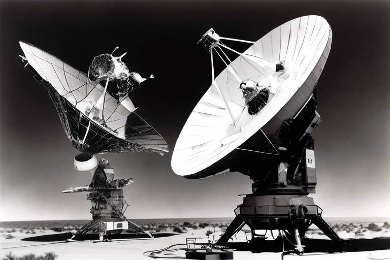
The Technology Behind Satellite Communication
Understanding the technology that enables satellites to communicate effectively is crucial in grasping their role in enhancing search and rescue operations. At its core, satellite communication relies on a complex interplay of various systems and technologies, all designed to facilitate real-time information exchange. These systems are comprised of satellites, ground stations, and user terminals, each playing a vital role in the overall communication process.
Satellites orbiting the Earth are equipped with advanced transponders that receive signals from ground stations, amplify them, and then retransmit them back to designated areas on the planet. This process ensures that information can be sent and received from remote locations, which is particularly important during emergencies when traditional communication networks may be compromised. The technology behind this communication can be categorized into several key components:
- Transponders: These are the heart of satellite communication, as they handle the reception and transmission of signals.
- Ground Stations: These facilities serve as the link between satellites and users, managing the flow of data to and from satellites.
- User Terminals: These are the devices used by rescue teams and individuals to send and receive information.
Moreover, the frequency bands used for satellite communication are critical for determining the quality and reliability of the signal. Different bands, such as L, C, Ku, and Ka, offer varying levels of bandwidth and coverage. For instance, the Ka-band is known for its high data rates, making it ideal for applications requiring large amounts of data, such as high-resolution satellite imagery used in search and rescue missions.
In addition to the hardware, software plays a significant role in satellite communication. Advanced algorithms and protocols ensure that data is transmitted efficiently and securely. These technologies enable real-time monitoring and data collection, which are essential for timely responses during emergencies. For example, when a distress signal is received, the system can quickly analyze the location and provide rescue teams with critical information, such as the nearest available resources and potential hazards in the area.
As technology continues to evolve, we are witnessing the emergence of new satellite communication methods, such as laser communication and software-defined satellites. Laser communication offers the potential for faster data transmission and higher bandwidth, while software-defined satellites can be reconfigured to adapt to changing mission requirements, making them more versatile in emergency scenarios.
In conclusion, the technology behind satellite communication is a sophisticated blend of hardware and software that enables effective and reliable communication during search and rescue missions. By leveraging these technologies, rescue teams can enhance their situational awareness and response times, ultimately leading to more successful outcomes in life-threatening situations.
- How do satellites communicate with each other?
Satellites communicate using radio frequencies, where one satellite transmits a signal that another satellite can receive and relay back to Earth. - What is the role of ground stations in satellite communication?
Ground stations serve as the interface between the satellite and the users, managing data transmission and reception. - Can satellite communication work in remote areas?
Yes, satellite communication is particularly beneficial in remote areas where traditional communication networks are unavailable or unreliable.
Types of Satellites Used in Search and Rescue
When it comes to search and rescue missions, not all satellites are created equal. Each type of satellite brings unique capabilities to the table, enhancing the effectiveness of rescue operations in various environments. Understanding these different types is crucial for appreciating how they contribute to saving lives during emergencies. Let's dive into the primary categories of satellites that play pivotal roles in these life-saving missions.
First up, we have Geostationary Satellites. These satellites orbit the Earth at a height of approximately 35,786 kilometers and maintain a fixed position relative to a specific point on the Earth's surface. This constant visibility allows them to provide uninterrupted communication and monitoring capabilities. They are particularly useful in scenarios where continuous coverage is necessary, such as during large-scale disasters where real-time data is critical.
However, geostationary satellites do have their limitations. For instance, they struggle to cover areas near the poles due to their fixed position. This can create gaps in communication and monitoring capabilities in those regions, which poses challenges during search and rescue missions. Despite these limitations, their advantages often outweigh the drawbacks, especially in equatorial and mid-latitude regions.
Next, we have Low Earth Orbit (LEO) Satellites. These satellites orbit much closer to the Earth, typically at altitudes ranging from 160 to 2,000 kilometers. This proximity allows them to transmit data rapidly, making them ideal for time-sensitive operations such as search and rescue missions. LEO satellites can provide global coverage, meaning they can reach remote areas that might be difficult for ground-based systems to access.
One of the standout features of LEO satellites is their ability to relay high-resolution imagery and data quickly. This capability is essential when every second counts, such as in maritime rescue operations or during natural disasters. The speed and accuracy of data transmission from LEO satellites can significantly enhance the situational awareness of rescue teams on the ground.
To summarize, both geostationary and low Earth orbit satellites play crucial roles in search and rescue operations. While geostationary satellites excel in providing constant coverage, LEO satellites offer rapid data transmission and global reach. Understanding the strengths and weaknesses of these satellites allows rescue teams to deploy the right technology for the situation at hand.
In the next sections, we will explore how satellite imagery and data analysis further enhance the efficiency of search and rescue missions, showcasing the synergy between technology and life-saving efforts.
- What is the primary function of satellites in search and rescue? Satellites provide critical communication, monitoring, and data collection capabilities that enhance situational awareness and response times during emergencies.
- How do geostationary satellites differ from low Earth orbit satellites? Geostationary satellites maintain a fixed position and provide continuous coverage of specific areas, while low Earth orbit satellites offer rapid data transmission and global coverage.
- Can satellites operate in extreme weather conditions? Yes, satellites are designed to withstand various weather conditions, but their effectiveness can be impacted by severe storms or atmospheric disturbances.
Geostationary Satellites
Geostationary satellites are a remarkable feat of engineering and technology, positioned approximately 35,786 kilometers (22,236 miles) above the Earth's equator. These satellites maintain a fixed position relative to the Earth's surface, allowing them to provide continuous coverage of specific regions. This unique capability is particularly beneficial in search and rescue operations, where constant monitoring and communication are crucial. Imagine having a bird's-eye view of a vast area, providing real-time data and information that can make all the difference in saving lives during emergencies.
One of the most significant advantages of geostationary satellites is their ability to facilitate uninterrupted communication. They are equipped with powerful transponders that can relay signals over large distances, ensuring that rescue teams can stay connected even in remote locations. This connectivity is essential when coordinating efforts among various agencies and organizations involved in search and rescue missions. For instance, during a natural disaster, these satellites can help relay information about affected areas, allowing teams to plan their response effectively.
Moreover, geostationary satellites play a vital role in monitoring environmental conditions. They can track weather patterns, detect changes in land use, and even monitor ocean currents. This data is invaluable in predicting potential disasters and preparing for them. For example, if a hurricane is brewing in the ocean, geostationary satellites can provide early warnings, giving communities time to evacuate and prepare. This proactive approach can significantly reduce casualties and enhance the overall effectiveness of rescue operations.
However, it's essential to acknowledge the limitations of geostationary satellites. While they offer constant visibility over specific areas, they have coverage gaps, particularly in the polar regions. This limitation can hinder search and rescue efforts in those areas, highlighting the need for a diverse satellite network that includes other types of satellites, such as Low Earth Orbit (LEO) satellites. By understanding both the strengths and weaknesses of geostationary satellites, we can better appreciate their role in the broader context of search and rescue operations.
In conclusion, geostationary satellites are indispensable tools in the arsenal of search and rescue missions. Their ability to provide continuous coverage, facilitate communication, and monitor environmental conditions makes them a cornerstone of modern emergency response strategies. As technology continues to advance, we can expect even greater enhancements in the capabilities of these satellites, ultimately leading to more lives saved during critical situations.
- What are geostationary satellites? Geostationary satellites are satellites that orbit the Earth at a fixed position above the equator, allowing them to provide continuous coverage of specific regions.
- How do geostationary satellites assist in search and rescue operations? They facilitate uninterrupted communication, monitor environmental conditions, and provide real-time data that is crucial for coordinating rescue efforts.
- What are the limitations of geostationary satellites? Their primary limitation is coverage gaps in polar regions, which can hinder search and rescue operations in those areas.
Advantages of Geostationary Satellites
Geostationary satellites are like the vigilant guardians of our planet, hovering over specific areas to provide continuous coverage. One of their most significant advantages is their ability to maintain a fixed position relative to the Earth. This unique characteristic allows them to offer uninterrupted communication and monitoring capabilities during critical search and rescue operations. Imagine being able to keep an eye on a specific region without having to worry about the satellite drifting out of range; that’s the beauty of geostationary satellites!
Another key benefit is the constant visibility they provide over large areas. This is particularly advantageous in emergencies where every second counts. With a geostationary satellite, rescue teams can receive real-time data and updates, ensuring that they are always informed about the situation on the ground. For example, in the aftermath of a natural disaster, these satellites can relay vital information about affected areas, helping teams prioritize their response efforts.
Furthermore, geostationary satellites enable efficient coordination among various rescue agencies. By providing a centralized communication hub, they facilitate the sharing of information and resources, allowing different organizations to work together seamlessly. This collaborative approach is crucial in emergencies where multiple agencies are involved, as it minimizes confusion and maximizes the effectiveness of rescue operations.
Here’s a quick overview of the key advantages of geostationary satellites:
- Fixed Positioning: Provides continuous coverage over specific regions.
- Real-Time Data: Enables immediate communication and updates during emergencies.
- Efficient Coordination: Acts as a central hub for information sharing among rescue agencies.
In summary, the advantages of geostationary satellites make them indispensable tools in search and rescue missions. Their ability to maintain a steady watch over critical areas ensures that help can be dispatched quickly and effectively, ultimately saving lives in times of crisis. As technology continues to evolve, the role of these satellites in enhancing our emergency response capabilities will only grow stronger.
Q: What is a geostationary satellite?
A: A geostationary satellite is one that orbits the Earth at the same rotational speed as the Earth, allowing it to remain fixed over a specific geographic location.
Q: How do geostationary satellites help in search and rescue operations?
A: They provide continuous monitoring, real-time data transmission, and facilitate coordination among various rescue agencies, enabling faster and more efficient response efforts.
Q: Are there any limitations to using geostationary satellites?
A: Yes, they have coverage gaps in polar regions and can be affected by weather conditions, which may limit their effectiveness in certain scenarios.
Limitations of Geostationary Satellites
While geostationary satellites offer remarkable advantages in providing continuous coverage and reliable communication, they are not without their limitations. One of the most significant drawbacks is their inability to cover the entire globe uniformly. For instance, these satellites orbit at approximately 35,786 kilometers above the Earth's equator, which means their signals are concentrated over specific regions. Consequently, areas located near the poles often experience coverage gaps, making it challenging to conduct search and rescue operations in those regions.
Another limitation is the inherent delay in signal transmission. Although the delay is minimal, it can impact real-time communication during critical rescue operations. When every second counts, even a slight delay can hinder the effectiveness of rescue teams trying to coordinate their efforts. Furthermore, geostationary satellites can be affected by atmospheric conditions. Heavy rain, storms, or even solar activities can disrupt signals, leading to potential communication breakdowns when they are needed most.
Moreover, geostationary satellites typically have a fixed field of view. This means that if a rescue operation occurs outside their designated coverage area, teams may need to rely on other satellite systems, such as Low Earth Orbit (LEO) satellites, which can complicate the overall process. The need for a multi-satellite approach can increase operational costs and logistical challenges.
In summary, while geostationary satellites play a crucial role in search and rescue missions, their limitations necessitate a comprehensive strategy that incorporates various types of satellites to ensure effective coverage and communication during emergencies. Understanding these limitations is essential for planning and executing successful rescue operations.
- What are geostationary satellites? Geostationary satellites are positioned at a fixed point above the Earth's equator, allowing them to maintain a constant position relative to the Earth's surface.
- Why do geostationary satellites have coverage gaps? Their high altitude means they cannot cover polar regions effectively, leading to gaps in communication and monitoring capabilities.
- How do weather conditions affect satellite communication? Atmospheric phenomena like storms or heavy rain can disrupt signals, potentially impacting real-time communication during rescue missions.
- What alternatives exist for areas not covered by geostationary satellites? Low Earth Orbit (LEO) satellites can provide coverage and real-time data for regions where geostationary satellites fall short.
Low Earth Orbit Satellites
Low Earth Orbit (LEO) satellites are revolutionizing the way we approach search and rescue operations. Positioned at altitudes ranging from about 180 to 2,000 kilometers above the Earth's surface, these satellites offer a unique combination of speed and coverage that is essential during emergencies. Unlike their geostationary counterparts, which can be limited in their reach, LEO satellites orbit the Earth at much faster speeds, allowing them to provide near-instantaneous data transmission. This capability is crucial when every second counts in a rescue scenario.
One of the standout features of LEO satellites is their ability to gather high-resolution imagery and data. This can be particularly useful in identifying distressed individuals or vehicles in remote areas. Imagine a situation where a hiker is lost in a dense forest; LEO satellites can capture detailed images of the terrain, helping rescue teams pinpoint the location more accurately. The rapid revisit times of these satellites mean that they can monitor the same area multiple times within a short period, enhancing the likelihood of detecting changes that could indicate a distress signal.
Moreover, LEO satellites are often part of larger constellations, which work together to provide seamless coverage over vast areas. For instance, companies like SpaceX have launched thousands of satellites as part of their Starlink project, which not only aims to provide global internet coverage but also enhances search and rescue capabilities. This extensive network allows for continuous monitoring and communication, ensuring that rescue teams have access to real-time information even in the most challenging environments.
Another significant advantage of LEO satellites is their ability to operate effectively in various weather conditions. Unlike traditional communication systems that may be hampered by atmospheric disturbances, LEO satellites can maintain connections, ensuring that critical information is relayed without delay. This reliability is vital during natural disasters when traditional ground-based communication may be disrupted.
In summary, Low Earth Orbit satellites play a pivotal role in modern search and rescue operations. Their speed, high-resolution data capabilities, and resilience in adverse conditions make them invaluable assets in saving lives during emergencies. As technology continues to advance, we can expect even more innovative applications of LEO satellites, further enhancing their contributions to emergency response efforts.
- What are Low Earth Orbit satellites used for?
LEO satellites are primarily used for communication, Earth observation, and enhancing search and rescue operations by providing real-time data and imagery. - How do LEO satellites differ from geostationary satellites?
LEO satellites orbit the Earth at lower altitudes and provide faster data transmission, while geostationary satellites remain fixed over a specific location. - Can LEO satellites operate in bad weather?
Yes, LEO satellites are designed to function effectively in various weather conditions, maintaining communication links even when ground-based systems fail.
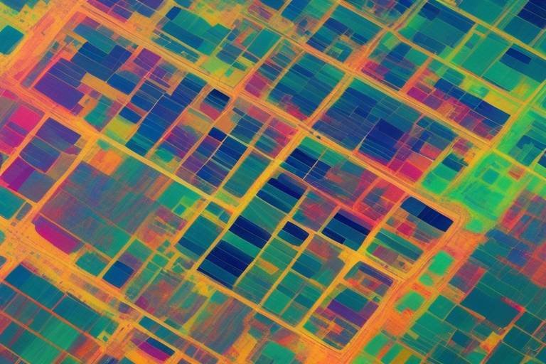
The Role of Satellite Imagery in Search and Rescue
Satellite imagery plays a critical role in search and rescue missions, acting as the eyes in the sky that provide crucial data to rescue teams on the ground. Imagine being lost in a vast wilderness or stranded at sea; the ability to see the terrain from above can make all the difference in locating individuals in distress. High-resolution satellite images allow rescue teams to assess situations quickly and accurately, leading to more effective operations.
The power of satellite imagery lies in its ability to deliver real-time information. This means that as events unfold, satellite systems can capture and relay images almost instantaneously. This real-time monitoring is essential for timely responses, especially during emergencies where every second counts. For instance, during a natural disaster, satellites can identify affected areas and provide vital information about accessibility, infrastructure damage, and even the movement of people.
Furthermore, satellite imagery enables rescue teams to conduct comprehensive assessments of the environment. By utilizing advanced imaging technology, such as synthetic aperture radar (SAR) and optical imaging, teams can gather data on various conditions, including weather patterns, land use, and potential hazards. This information is invaluable when planning rescue operations, as it helps teams make informed decisions based on the current situation.
One of the most significant advantages of satellite imagery is its ability to cover vast areas that may be difficult to access on foot or by vehicle. For example, in the aftermath of a hurricane, satellite images can help identify flooded regions and blocked roads, allowing rescue teams to prioritize areas that need immediate assistance. In many cases, this capability can be the difference between life and death.
To illustrate the impact of satellite imagery, consider the following table that summarizes key benefits of using satellite technology in search and rescue missions:
| Benefits | Description |
|---|---|
| Real-Time Data | Provides immediate information on changing conditions during emergencies. |
| Wide Coverage | Can monitor large areas, including remote and inaccessible locations. |
| Environmental Assessment | Helps in understanding terrain, weather, and potential hazards. |
| Improved Coordination | Facilitates better communication and planning among rescue teams. |
In addition to these benefits, the analysis and interpretation of satellite data are crucial for effective decision-making. By employing advanced technologies such as machine learning and artificial intelligence, rescue teams can extract actionable insights from the data collected. This allows them to prioritize resources and strategize effectively, ensuring that help reaches those in need as swiftly as possible.
In conclusion, satellite imagery is not just a tool; it is a lifeline that enhances the capabilities of search and rescue operations. By providing critical information and enabling real-time monitoring, satellite technology empowers rescue teams to act decisively and efficiently, ultimately saving lives in some of the most challenging situations imaginable.
- How does satellite imagery help in search and rescue missions?
Satellite imagery provides real-time data and visual assessments of affected areas, enabling rescue teams to make informed decisions quickly. - What types of satellite technology are used in these operations?
Various technologies, including synthetic aperture radar (SAR) and optical imaging, are used to gather detailed information about terrain and conditions. - Can satellite imagery be used in natural disasters?
Yes, satellite imagery is crucial during natural disasters as it helps identify affected regions, assess damage, and coordinate rescue efforts efficiently. - How fast can satellite data be accessed?
Satellite data can often be accessed in real-time or near real-time, allowing for immediate responses to emergencies.
Real-Time Monitoring and Data Collection
When it comes to search and rescue missions, real-time monitoring and data collection are absolutely vital. Imagine being in a situation where every second counts, and having access to live data can be the difference between life and death. This is where satellites shine, providing a constant stream of information that helps rescue teams make informed decisions quickly.
Satellites equipped with advanced sensors can capture a variety of data, including weather conditions, topographical changes, and even movement patterns of individuals in distress. This data is transmitted back to Earth in real-time, allowing rescue teams to assess the situation as it unfolds. For instance, during a natural disaster like a hurricane, satellites can monitor wind speeds, rainfall, and flooding levels, helping teams to strategize their rescue efforts efficiently.
Moreover, the ability to monitor areas continuously means that rescue teams can track changes over time. For example, if a landslide occurs, satellites can provide updated images showing the new landscape, which helps teams navigate the area safely. This continuous flow of information is crucial for maintaining situational awareness and ensuring that rescue operations are conducted as effectively as possible.
To illustrate the power of real-time monitoring, consider the following table that outlines the types of data collected by satellites during rescue missions:
| Data Type | Description | Importance in Rescue Missions |
|---|---|---|
| Weather Data | Information about current weather conditions, including temperature, wind speed, and precipitation. | Helps teams plan operations around severe weather and avoid dangerous conditions. |
| Geospatial Data | Detailed maps and imagery showing terrain, obstacles, and changes in the environment. | Assists in route planning and identifying safe zones for rescue operations. |
| Movement Tracking | Real-time tracking of individuals or vehicles, often using GPS technology. | Enables teams to locate distressed individuals quickly and efficiently. |
In addition to these capabilities, satellite technology allows for the integration of data from various sources, including drones and ground-based sensors. This multi-layered approach enhances the overall picture of the situation, enabling rescue teams to respond more effectively. The synergy of different technologies means that as soon as an emergency is detected, a wealth of information can be accessed almost instantaneously, providing a solid foundation for decision-making.
Ultimately, the importance of real-time monitoring and data collection in search and rescue missions cannot be overstated. As technology continues to evolve, we can expect even more sophisticated systems that will enhance the capabilities of rescue teams, ensuring that they can respond to emergencies with greater speed and accuracy than ever before.
- How do satellites communicate with rescue teams?
Satellites use radio waves to transmit data back to Earth, which can be received by ground stations and mobile devices used by rescue teams. - What types of emergencies benefit most from satellite technology?
Natural disasters, maritime incidents, and remote area rescues are among the emergencies that benefit significantly from satellite technology. - Can satellites provide live video feeds?
Yes, some advanced satellites are equipped with high-resolution cameras that can provide live video feeds for real-time monitoring.
Data Analysis and Interpretation
In the world of search and rescue operations, the ability to analyze and interpret data collected from satellites plays a critical role in ensuring timely and effective responses. When a distress signal is received, the first step is often to gather as much information as possible about the situation on the ground. This is where satellite imagery comes into play, providing high-resolution images that can reveal crucial details about the environment and the conditions surrounding the incident.
Data analysis involves several stages, starting with the collection of satellite images. These images can be processed using advanced software to enhance visibility and highlight areas of interest. For instance, algorithms can be applied to detect changes in land use, identify obstacles, or even locate individuals in distress. The interpretation of this data is equally important, as it transforms raw images into actionable insights.
One of the key methods used in data interpretation is machine learning. By training algorithms on historical data, rescue teams can improve their ability to predict outcomes based on current satellite images. This predictive capability can be a game changer, allowing teams to prioritize their resources effectively. For example, if a satellite detects a large area of flooding, the system can automatically flag it for immediate attention, ensuring that rescue teams are dispatched to the most critical locations first.
Moreover, the integration of various data sources enhances the overall analysis. Satellite data can be combined with information from ground sensors, drones, and even social media feeds to create a comprehensive picture of the situation. This multi-faceted approach allows rescue teams to respond with a greater understanding of the challenges they face. For instance, during a natural disaster, real-time updates from satellites can inform teams about changing weather conditions, enabling them to adjust their strategies accordingly.
To further illustrate the importance of data analysis and interpretation, let's take a look at a hypothetical case study:
| Scenario | Data Collected | Analysis Techniques | Outcome |
|---|---|---|---|
| Flooding in a Remote Area | Satellite imagery, ground sensor data | Machine learning, change detection algorithms | Successful identification of affected zones, timely rescue operations |
| Maritime Distress | Satellite tracking of vessels, AIS data | Pattern recognition, anomaly detection | Quick location of distressed ship, efficient deployment of rescue teams |
In conclusion, the analysis and interpretation of satellite data are not merely technical processes; they are the backbone of effective search and rescue missions. By leveraging cutting-edge technologies and integrating multiple data sources, rescue teams can make informed decisions that ultimately save lives. As technology continues to evolve, we can expect even greater advancements in how data is analyzed and utilized, paving the way for more efficient and effective rescue operations in the future.
- How do satellites gather data for search and rescue missions?
Satellites collect data through various sensors that capture high-resolution images and other environmental information, which is then transmitted to ground stations for analysis. - What role does machine learning play in data interpretation?
Machine learning algorithms help analyze patterns in satellite data, allowing rescue teams to make predictions and prioritize their responses based on real-time information. - Can satellite data be used in all types of emergencies?
Yes, satellite data is versatile and can be used in various emergencies, including natural disasters, maritime incidents, and even urban search and rescue operations.
Case Studies of Successful Satellite-Assisted Rescues
When it comes to search and rescue missions, the real-world applications of satellite technology are nothing short of miraculous. Let's explore some remarkable case studies that showcase how satellites have been pivotal in saving lives during emergencies. These stories not only highlight the effectiveness of satellite technology but also illustrate how critical timely data can be in high-stakes situations.
One notable example occurred during the devastating earthquake in Haiti in 2010. Following the quake, the situation on the ground was chaotic, with communication lines down and many areas completely inaccessible. Satellite imagery played a crucial role in assessing the damage and identifying where help was needed most. Organizations like the United Nations and NASA utilized high-resolution satellite images to map out the affected regions, enabling rescue teams to prioritize their efforts and allocate resources effectively. This swift action significantly improved the response time and ultimately saved countless lives.
Another compelling case is the 2015 Nepal earthquake. After the quake struck, the Nepalese government, alongside international aid organizations, faced immense challenges in coordinating rescue efforts. Satellites provided critical data, including real-time monitoring of landslides and other hazards. The European Space Agency (ESA) deployed the Sentinel-1 satellite, which captured radar images that helped identify areas where roads were blocked and where people might be trapped. This information was vital for directing rescue teams to the most affected locations, showcasing the importance of satellite technology in crisis management.
In maritime scenarios, satellites have proven equally effective. For instance, in 2014, the disappearance of Malaysia Airlines Flight MH370 became one of the most perplexing mysteries in aviation history. While the search was extensive, it was satellite data that provided the first clues about the plane's final location. The Inmarsat satellite network tracked the aircraft's last pings, allowing search teams to narrow down the search area in the Indian Ocean. This case illustrates how satellites can assist even in the most challenging search operations, providing critical guidance where traditional methods fail.
Moreover, during natural disasters like hurricanes, satellites have been instrumental in search and rescue missions. For example, during Hurricane Harvey in 2017, satellites were used to monitor flood patterns and identify areas that were most affected. The National Oceanic and Atmospheric Administration (NOAA) utilized satellite imagery to provide real-time data on the storm's path and intensity, aiding rescue operations and ensuring that help reached those in dire need as quickly as possible.
These case studies underscore the profound impact that satellite technology has on search and rescue missions. By providing real-time data, high-resolution imagery, and critical insights, satellites enhance the ability of rescue teams to respond effectively to emergencies. As technology continues to evolve, the potential for even greater advancements in satellite-assisted rescues is on the horizon, promising to save even more lives in the future.
- How do satellites help in search and rescue operations?
Satellites provide real-time data, high-resolution imagery, and communication capabilities that enhance situational awareness and aid rescue teams in locating individuals in distress. - What types of satellites are used for search and rescue?
Both geostationary and low Earth orbit (LEO) satellites are used, each serving different functions in monitoring, communication, and data collection. - Can satellite technology work in remote areas?
Yes, satellites can reach remote areas where traditional communication methods may be unavailable, making them invaluable during emergencies. - What advancements are being made in satellite technology for rescue missions?
Future innovations include enhanced satellite sensors and integration with drones, which could improve data accuracy and responsiveness in search and rescue operations.
Natural Disasters and Satellite Support
Natural disasters strike without warning, leaving destruction in their wake and challenging search and rescue teams to respond swiftly and effectively. In these chaotic moments, the role of satellites becomes not just important, but pivotal. Satellites provide a bird's-eye view of disaster-stricken areas, allowing rescue teams to assess the situation from above and make informed decisions quickly. Imagine trying to find a needle in a haystack; now picture having a drone that can scan the entire haystack in seconds. That’s the power of satellite technology!
During events like hurricanes, earthquakes, and floods, satellites offer real-time data that can significantly enhance response efforts. For instance, when Hurricane Katrina hit in 2005, satellites were instrumental in mapping the extent of the flooding and damage. By analyzing satellite imagery, rescue teams could identify the hardest-hit areas and prioritize their efforts accordingly. This capability not only saves time but also increases the chances of saving lives.
Moreover, satellites equipped with advanced sensors can monitor environmental changes and predict potential disasters. For example, satellites can detect shifts in tectonic plates, which may indicate an impending earthquake, or monitor weather patterns that could lead to severe storms. This predictive capability allows for proactive measures, giving communities the chance to evacuate or prepare before disaster strikes.
Here are some key ways satellites support search and rescue operations during natural disasters:
- Real-Time Imagery: Satellites provide high-resolution images that help in assessing damage and identifying safe routes for rescue teams.
- Communication: In areas where traditional communication lines are down, satellites can still provide vital connectivity for rescue operations.
- Data Collection: Continuous monitoring helps gather critical data that can be analyzed to improve future response strategies.
In essence, satellites serve as the backbone of modern disaster response efforts. They not only help in locating survivors but also assist in coordinating rescue operations across vast and often inaccessible terrains. The impact of satellite support in natural disasters is profound, transforming the way we approach emergencies and ultimately saving lives.
Q: How do satellites help in disaster prediction?
A: Satellites can monitor environmental changes, such as weather patterns and tectonic activity, allowing for early warnings of potential disasters.
Q: What types of satellites are used in disaster response?
A: Both geostationary and low Earth orbit satellites are used. Geostationary satellites provide continuous coverage, while low Earth orbit satellites offer rapid data transmission.
Q: Can satellites operate in bad weather conditions?
A: Yes, many satellites are equipped to operate in various weather conditions, although heavy cloud cover can sometimes affect imaging capabilities.
Q: How quickly can satellites provide data during a disaster?
A: Depending on the satellite and its orbit, data can be transmitted within minutes of an event, allowing for rapid assessment and response.
Maritime Search and Rescue Operations
When it comes to maritime search and rescue operations, the stakes are incredibly high. Imagine a vessel lost at sea, its crew battling the elements, desperately hoping for a lifeline. In these critical moments, satellites become the unsung heroes, playing a pivotal role in locating and assisting those in distress. Their ability to provide real-time data and imagery transforms the way rescue missions are conducted, ensuring that help arrives as swiftly as possible.
Satellites, particularly those in Low Earth Orbit (LEO), offer rapid data transmission capabilities that are essential for maritime operations. They can track the movement of ships and detect distress signals, allowing rescue teams to pinpoint the exact location of those in need. For instance, the Global Maritime Distress and Safety System (GMDSS) relies heavily on satellite communication to relay emergency messages from vessels to rescue coordination centers. This technology ensures that even in the most remote oceanic regions, help can be dispatched without delay.
Moreover, satellite imagery provides a visual context that is invaluable during rescue missions. High-resolution images can reveal the condition of a vessel, the surrounding environment, and even the weather patterns that may affect the rescue operation. For example, during a recent maritime rescue operation in the Pacific, satellite imagery helped responders assess the damage to a capsized fishing boat, allowing them to strategize effectively and deploy resources where they were most needed.
In addition to imagery, satellites also facilitate the use of Automatic Identification Systems (AIS), which track the movement of ships in real-time. This technology is crucial for identifying vessels that have deviated from their course or are in distress. By analyzing AIS data, rescue teams can quickly determine which vessels are in the vicinity and may require assistance. The integration of AIS with satellite technology has revolutionized how maritime rescues are conducted, creating a more efficient and responsive system.
Furthermore, the coordination of rescue operations often involves multiple agencies, including coast guards, naval forces, and non-governmental organizations. Satellites enable seamless communication between these entities, ensuring that everyone is on the same page. This collaborative approach is essential, especially during large-scale disasters such as hurricanes, where numerous vessels may be affected simultaneously. The ability to share data and updates in real-time can mean the difference between life and death.
In summary, the integration of satellite technology in maritime search and rescue operations is a game-changer. From tracking vessels to providing critical situational awareness, satellites enhance the efficiency and effectiveness of rescue efforts. As we look to the future, the potential for further advancements in satellite technology promises even greater improvements in saving lives at sea.
- How do satellites help in maritime search and rescue?
Satellites provide real-time data, imagery, and communication capabilities that are essential for locating distressed vessels and coordinating rescue operations. - What is the Global Maritime Distress and Safety System (GMDSS)?
GMDSS is an international system that uses satellite communication to relay emergency messages from vessels to rescue coordination centers. - Can satellites track all vessels at sea?
While satellites can track many vessels using systems like AIS, there may be limitations in tracking smaller, non-commercial boats that do not have transponders.
Future Innovations in Satellite Technology for Rescue Missions
The future of satellite technology is brimming with potential, especially in the realm of search and rescue missions. As we stand on the brink of a technological revolution, innovations are emerging that promise to enhance the efficiency and effectiveness of rescue operations. Imagine a world where satellites can provide real-time, high-resolution images of disaster zones, enabling rescue teams to assess situations with unparalleled accuracy. This is not just a dream; it is rapidly becoming a reality.
One of the most exciting advancements is in the field of satellite sensors. These sensors are being developed to provide enhanced data accuracy and responsiveness. For instance, new multispectral and hyperspectral imaging technologies can capture a wider range of wavelengths, allowing for better identification of materials and conditions on the ground. This means that rescue teams can quickly determine the state of infrastructure, locate survivors, and assess environmental hazards with greater precision. The integration of artificial intelligence (AI) into these systems is also set to revolutionize data processing, enabling faster decision-making during critical moments.
Furthermore, the synergy between satellites and drones is a game-changer. Drones equipped with satellite connectivity can cover vast areas quickly, providing real-time video feeds and data back to command centers. This combination allows for a comprehensive overview of search and rescue operations, enabling teams to coordinate their efforts more effectively. For example, in a maritime rescue scenario, a drone can be deployed to locate a distressed vessel, while satellite imagery provides the broader context of weather conditions and sea currents, ensuring that rescue operations are both safe and efficient.
As we look ahead, the integration of Internet of Things (IoT) technology with satellite systems is another frontier. Imagine a network of connected devices that can relay critical information back to satellites, which then disseminate this data to rescue teams in real-time. This could include everything from personal locator beacons used by hikers to environmental sensors that monitor conditions in disaster-prone areas. By harnessing the power of IoT, we can create a more interconnected and responsive rescue ecosystem.
In conclusion, the innovations in satellite technology are paving the way for a future where search and rescue missions can be conducted with unprecedented efficiency and precision. As these technologies continue to evolve, we can expect a new era of emergency response that not only saves lives but also minimizes the risks to rescuers themselves. The possibilities are endless, and the impact on global safety could be monumental.
- How do satellites improve search and rescue operations?
Satellites provide real-time data and imagery, enabling rescue teams to assess situations accurately and coordinate their efforts effectively. - What types of satellites are used in rescue missions?
Both geostationary and low Earth orbit satellites play crucial roles, offering different advantages such as continuous coverage and rapid data transmission. - What is the role of drones in satellite-assisted rescues?
Drones can quickly cover large areas and provide real-time feeds to rescue teams, enhancing situational awareness and operational efficiency. - How will advancements in satellite sensors impact rescue missions?
New sensor technologies will allow for better data accuracy and faster processing, leading to more informed decision-making during emergencies.
Advancements in Satellite Sensors
In recent years, the field of satellite technology has witnessed remarkable , significantly improving the capabilities of search and rescue missions. These innovations are not just minor upgrades; they represent a leap forward in how we gather and interpret data from space. Imagine having the ability to see finer details from thousands of miles above the Earth, like spotting a stranded hiker in a dense forest or detecting a distressed vessel in the vast ocean. This is the power of modern satellite sensors.
One of the most exciting developments is the integration of multispectral and hyperspectral imaging technologies. These sensors can capture data across various wavelengths, allowing rescue teams to analyze different materials and surfaces. For example, they can identify water bodies, vegetation types, and even the heat signatures of individuals. This level of detail is crucial in emergency situations where every second counts. By providing critical information about the environment, these sensors enhance situational awareness and help responders make informed decisions.
Another significant advancement is the improvement in sensor resolution. Today’s satellites are equipped with high-resolution cameras that can capture images with incredible clarity. This means that rescue teams can receive real-time images that are not only detailed but also timely. For instance, during a natural disaster, high-resolution satellite imagery can reveal the extent of damage, allowing for targeted rescue operations. The ability to zoom in on specific areas without losing clarity is a game-changer for emergency responders.
Moreover, the deployment of synthetic aperture radar (SAR) technology has transformed how we monitor and respond to emergencies. Unlike optical sensors that rely on sunlight, SAR can penetrate clouds and operate during the night, providing continuous coverage regardless of weather conditions. This is especially vital in scenarios like hurricanes or floods, where visibility can be severely compromised. SAR allows for the detection of changes in the landscape, such as flooded areas or landslides, enabling quicker response times.
As we look towards the future, the integration of artificial intelligence (AI) with satellite sensor technology is poised to revolutionize search and rescue operations even further. AI algorithms can analyze vast amounts of satellite data, identifying patterns and anomalies that human analysts might miss. This capability not only speeds up the data processing time but also enhances the accuracy of identifying individuals in distress. Imagine a system where, within minutes of a distress signal, AI can pinpoint the location and relay that information to rescue teams on the ground.
In summary, the advancements in satellite sensors are paving the way for more efficient and effective search and rescue operations. With improved imaging technologies, higher resolutions, and the integration of AI, we are on the brink of a new era in emergency response. As these technologies continue to evolve, the potential to save lives in dire situations grows exponentially, making the world a safer place for everyone.
- What is the role of satellite sensors in search and rescue missions? Satellite sensors provide critical data that helps locate individuals in distress, assess situations, and enhance situational awareness during emergencies.
- How do advancements in satellite sensors improve rescue operations? Advancements such as higher resolution imaging, multispectral capabilities, and AI integration allow for faster and more accurate data analysis, leading to quicker response times.
- What types of satellite sensors are most commonly used in emergencies? Common types include optical sensors, synthetic aperture radar (SAR), and multispectral/hyperspectral sensors, each serving unique functions in data collection.
Integration with Drones and Other Technologies
As technology continues to evolve, the integration of satellites with drones and other cutting-edge technologies is revolutionizing search and rescue missions. Imagine a scenario where a drone equipped with advanced sensors can fly over a disaster area, while a satellite provides real-time data on the environment and weather conditions. This synergy not only enhances the speed of operations but also improves the accuracy of data collected during rescue missions.
Drones, also known as unmanned aerial vehicles (UAVs), can be deployed quickly and are capable of reaching areas that are difficult for human rescuers to access. By using satellite communication, these drones can relay information back to rescue teams on the ground, ensuring they have the most up-to-date situational awareness. This real-time data exchange is crucial in emergencies, where every second counts.
Furthermore, the combination of satellite imagery and drone technology allows for a comprehensive understanding of the affected area. For instance, the satellite can provide a broad overview, while drones can zoom in on specific locations, capturing high-resolution images and videos. This combination is particularly useful in scenarios such as:
- Natural Disasters: Drones can assess damage and locate survivors in challenging terrains like collapsed buildings or flooded areas.
- Maritime Operations: Drones can be deployed from ships to search for missing vessels or individuals in distress, guided by satellite data.
- Remote Areas: In wilderness rescues, drones can scout large areas quickly, identifying locations where ground teams should focus their efforts.
Moreover, the integration of artificial intelligence (AI) with both satellites and drones is paving the way for even greater advancements. AI algorithms can analyze data collected from drones and satellites, identifying patterns and making predictions about where individuals might be located. This predictive capability can dramatically increase the effectiveness of search and rescue operations.
In conclusion, the integration of satellites with drones and other technologies is not just a trend; it is a transformative approach that enhances the efficiency and effectiveness of search and rescue missions. As these technologies continue to advance, we can expect even more innovative solutions that will save lives and streamline rescue operations in the face of emergencies.
- How do satellites and drones work together in search and rescue missions? Satellites provide real-time data and imagery, while drones can access hard-to-reach areas and relay information back to rescue teams.
- What advantages do drones offer in rescue operations? Drones can quickly survey large areas, assess damage, and locate survivors, making them invaluable in emergencies.
- Can AI enhance the effectiveness of satellite and drone integration? Yes, AI can analyze data from both sources to identify patterns and predict where individuals might be located, improving search efficiency.
Frequently Asked Questions
-
How do satellites improve search and rescue operations?
Satellites enhance search and rescue operations by providing real-time communication, high-resolution imagery, and continuous monitoring of affected areas. This technology allows rescue teams to quickly assess situations, locate individuals in distress, and coordinate rescue efforts effectively.
-
What types of satellites are used in search and rescue missions?
There are primarily two types of satellites used in search and rescue missions: geostationary satellites and low Earth orbit (LEO) satellites. Geostationary satellites offer constant coverage over specific regions, while LEO satellites provide rapid data transmission and global coverage, making them ideal for quick responses.
-
What are the advantages of using geostationary satellites?
Geostationary satellites maintain a fixed position relative to the Earth, providing uninterrupted coverage of specific areas. This constant visibility is crucial during emergencies, as it allows for consistent communication and monitoring, which enhances the efficiency of rescue operations.
-
What limitations do geostationary satellites have?
While geostationary satellites have many advantages, they also face limitations, such as coverage gaps in polar regions. These gaps can hinder rescue efforts in those areas, making it essential to complement them with other satellite types for comprehensive coverage.
-
How does satellite imagery assist in search and rescue missions?
Satellite imagery provides high-resolution images that help rescue teams identify locations and assess situations during emergencies. This visual data is crucial for making informed decisions and coordinating effective responses, ultimately saving lives.
-
What role does real-time monitoring play in rescue operations?
Real-time monitoring through satellite data collection is vital for timely responses during emergencies. Continuous data streams enhance situational awareness, enabling rescue teams to adapt quickly to changing conditions and make decisions based on the most current information.
-
Can you provide examples of successful satellite-assisted rescues?
Yes! There are numerous case studies where satellite technology has significantly contributed to saving lives. For instance, during natural disasters like hurricanes and earthquakes, satellites have been instrumental in coordinating rescue operations and assessing damage to facilitate effective responses.
-
What future innovations can we expect in satellite technology for rescue missions?
The future holds exciting possibilities, including advancements in satellite sensors that promise to enhance data accuracy and responsiveness. Additionally, the integration of satellites with drones and other technologies is likely to create more effective search and rescue strategies, improving overall efficiency in crisis situations.