The Role of Satellites in Disaster Relief Operations
When disaster strikes, whether it’s a devastating earthquake, raging wildfire, or catastrophic flood, every second counts. In these critical moments, the role of satellites becomes paramount. They act as the eyes in the sky, providing essential data that can dramatically enhance disaster relief efforts. Imagine trying to navigate a maze without a map; that’s what emergency responders face without satellite technology. With the ability to deliver real-time information, satellites help assess damage, improve response times, and facilitate coordination among various agencies working tirelessly to save lives and restore order.
One of the most striking aspects of satellite technology is its ability to bridge the gap between chaos and order during emergencies. By capturing high-resolution images and monitoring environmental conditions, satellites provide a comprehensive view of the affected areas. This information is not just numbers on a screen; it’s a lifeline for those in need. For instance, when a hurricane approaches, meteorological satellites can predict its path and intensity, allowing communities to evacuate in time. This foresight can mean the difference between life and death.
Moreover, satellites play a crucial role in the coordination of relief efforts. During a disaster, multiple agencies—governmental and non-governmental—are involved in the response. Satellites provide a common platform for these entities to share information, ensuring that resources are allocated efficiently. Without this level of coordination, efforts can become fragmented, leading to delays and confusion. Think of it as a symphony; each agency plays its part, but without a conductor, the music can quickly turn into chaos.
In summary, the role of satellites in disaster relief operations is multifaceted and indispensable. From real-time data collection to facilitating communication among agencies, satellites are at the forefront of modern emergency response. As technology continues to evolve, the potential for satellites to enhance disaster management will only grow, paving the way for more effective and swift responses to the challenges posed by natural disasters.
- How do satellites provide real-time data during disasters? Satellites use various sensors to capture images and data about the Earth’s surface, which are transmitted to ground stations for immediate analysis.
- What types of satellites are most commonly used in disaster relief? Weather satellites, reconnaissance satellites, and communication satellites are the primary types used during disaster relief operations.
- Can satellite data help in long-term recovery after a disaster? Yes, satellite data is invaluable for assessing damage and planning rebuilding efforts, ensuring that resources are used effectively.
Importance of Satellite Technology
Satellite technology plays a crucial role in modern disaster management, acting as the backbone of effective response strategies. Imagine being in a situation where every second counts—whether it's a hurricane barreling down on a coastal town or an earthquake shaking a densely populated city. In these moments, having access to real-time data and imagery can mean the difference between life and death. Satellites orbiting our planet provide essential information that helps authorities assess damage, plan evacuations, and implement rescue operations swiftly.
One of the most significant advantages of satellite technology is its ability to deliver real-time data from areas that may be inaccessible due to natural disasters. For instance, when a flood occurs, ground-based communication systems may fail, but satellites can still capture images and data, allowing responders to understand the extent of the flooding. This capability is further enhanced by the use of remote sensing, which employs specialized sensors to gather information about the Earth's surface. This technology provides a bird’s-eye view of the situation, allowing for a comprehensive assessment of affected regions.
Furthermore, satellite technology supports the integration of data from various sources, which is vital for accurate forecasting. By combining information from multiple satellites, emergency responders can create a more precise picture of impending disasters. This means they can issue warnings sooner, potentially saving countless lives. In essence, the importance of satellite technology in disaster management cannot be overstated; it equips agencies with the tools they need to respond effectively and efficiently.
To illustrate the impact of satellite technology, consider the following table that highlights some key benefits:
| Benefit | Description |
|---|---|
| Real-Time Data | Provides immediate information about disaster conditions, enabling quick decision-making. |
| Remote Sensing | Captures high-resolution images for damage assessment and resource allocation. |
| Data Integration | Combines information from various satellites for enhanced forecasting accuracy. |
| Global Coverage | Offers a worldwide perspective, ensuring no area is left in the dark during crises. |
In conclusion, the role of satellite technology in disaster relief cannot be underestimated. It not only enhances our ability to respond to emergencies but also fosters a collaborative environment among various agencies. By utilizing the data and imagery provided by satellites, we can ensure that aid reaches those in need, making a significant impact during critical moments.
- How do satellites help during natural disasters? Satellites provide real-time data and imagery that assist in assessing damage, predicting weather events, and facilitating communication among emergency responders.
- What types of satellites are used in disaster relief? Various types, including weather satellites, reconnaissance satellites, and communication satellites, all play a critical role in disaster management.
- Can satellite imagery be used for long-term recovery planning? Yes, satellite data is invaluable for long-term recovery planning, offering insights into rebuilding efforts and infrastructure development.
Types of Satellites Used
When it comes to disaster relief, the variety of satellites employed is as diverse as the challenges they help address. Each type of satellite plays a unique role, providing critical information that enhances our ability to respond effectively to emergencies. In this section, we will explore the different types of satellites utilized in disaster management, highlighting their specific functions and contributions.
First and foremost, we have weather satellites. These technological marvels are designed to monitor atmospheric conditions and predict severe weather events. They act like the sentinels of the sky, watching over us and providing timely warnings that can save lives and protect property. Imagine being able to foresee a hurricane's path days in advance—this is the power of weather satellites. They capture real-time data and imagery, which is essential for emergency responders to prepare for impending disasters.
Next up are reconnaissance satellites. These satellites are like the eyes in the sky, offering a bird's-eye view of affected areas. They provide high-resolution images that allow us to assess damage and understand the scale of destruction after a disaster strikes. By capturing detailed images, reconnaissance satellites help authorities prioritize their response efforts and allocate resources where they are needed most. The information they provide is crucial for effective planning and recovery.
Then we have communication satellites, which ensure that connectivity remains uninterrupted during disasters. Think of them as the lifeline for emergency services, enabling them to coordinate effectively and disseminate information to the public. When traditional communication lines fail, these satellites step in, allowing for seamless communication between agencies and ensuring that critical information reaches those in need. They play a pivotal role in maintaining order and efficiency during chaotic situations.
Lastly, navigation satellites are essential for logistics and aid distribution. They help first responders navigate to affected areas, even in the most challenging terrains. By providing precise location data, navigation satellites ensure that help gets to where it’s needed most without delay. In disaster scenarios, every second counts, and these satellites help save time and lives.
In summary, the types of satellites used in disaster relief operations are varied and specialized, each contributing in its own way to enhance our response capabilities. From weather forecasting to damage assessment and communication, these satellites are indispensable tools in the fight against the devastating effects of disasters. Their ability to provide real-time data and imagery is a game-changer, making them a vital part of modern disaster management strategies.
- What types of satellites are most commonly used in disaster relief? The most commonly used satellites include weather satellites, reconnaissance satellites, communication satellites, and navigation satellites.
- How do weather satellites predict severe weather events? Weather satellites monitor atmospheric conditions and use advanced algorithms to forecast weather patterns, allowing for timely warnings.
- Can satellites help in long-term recovery planning? Yes, satellite data is invaluable for long-term recovery planning as it provides insights into rebuilding efforts and infrastructure development.
- How do communication satellites operate during disasters? Communication satellites maintain connectivity when ground-based communication systems fail, ensuring that emergency services can coordinate effectively.
Weather Satellites
Weather satellites are like the vigilant eyes in the sky, constantly monitoring atmospheric conditions and providing a wealth of information that is crucial for disaster management. These remarkable pieces of technology are equipped with advanced sensors and cameras that capture data about temperature, humidity, wind patterns, and cloud formations. This real-time data plays a vital role in predicting severe weather events, such as hurricanes, tornadoes, and floods, allowing communities to prepare and respond effectively. Imagine being able to see a storm brewing from space; that’s the power of weather satellites!
One of the most significant advantages of weather satellites is their ability to issue timely warnings that can literally save lives. By analyzing data collected from these satellites, meteorologists can forecast extreme weather conditions and alert the public well in advance. This early warning system is crucial, especially in regions that are prone to natural disasters. For instance, during hurricane season, weather satellites can track the formation and trajectory of storms, giving residents the chance to evacuate or take necessary precautions.
Moreover, the remote sensing capabilities of weather satellites allow them to capture high-resolution images of affected areas. This imagery is invaluable for assessing damage after a disaster strikes. For example, after a hurricane, satellite images can show the extent of flooding or destruction, helping emergency responders prioritize their efforts. The ability to visualize the impact of a disaster from above provides a clearer understanding of what resources are needed and where they should be deployed.
Additionally, the integration of data from multiple weather satellites enhances forecasting accuracy. By combining information from various sources, meteorologists can create a more comprehensive picture of weather patterns. This synergy not only improves the precision of forecasts but also aids emergency responders in preparing for impending disasters with better strategies. Think of it like piecing together a puzzle; when all the pieces fit, the picture becomes clearer.
In summary, weather satellites are indispensable tools in the realm of disaster management. They not only help predict severe weather events but also provide critical information for assessing damage and planning recovery efforts. As technology continues to advance, the capabilities of these satellites will only improve, further enhancing our ability to respond to and mitigate the impacts of natural disasters.
- How do weather satellites predict storms? Weather satellites use advanced sensors to monitor atmospheric conditions and provide real-time data to meteorologists, allowing them to forecast severe weather events.
- What types of data do weather satellites collect? Weather satellites collect data on temperature, humidity, wind patterns, and cloud formations, which are essential for weather forecasting and disaster management.
- Can weather satellites help after a disaster? Yes, they provide high-resolution images that assist in assessing damage and planning recovery efforts.
Remote Sensing Capabilities
When we talk about , we're diving into a fascinating world where technology meets real-time observation. Imagine being able to see an entire region from space, capturing intricate details of the landscape and any changes that occur. This is precisely what remote sensing technology does! It allows weather satellites to collect high-resolution images of affected areas, providing crucial information that is invaluable for assessing damage post-disaster.
The ability to capture images from space is akin to having a bird's-eye view of a disaster zone. These images can show everything from the extent of flooding to the destruction caused by wildfires or earthquakes. For example, after a hurricane hits, satellites can quickly provide before-and-after images that reveal the transformation of a landscape, helping authorities understand the scale of destruction and prioritize their response efforts.
Furthermore, the data gathered through remote sensing isn't just about pretty pictures. It’s packed with information that can be analyzed to assess damage and plan recovery strategies. This analysis can include:
- Land Use Changes: Understanding how land has been altered can inform rebuilding efforts.
- Infrastructure Damage: Identifying which roads, bridges, or buildings are compromised helps in planning effective rescue operations.
- Environmental Impact: Assessing the ecological damage can guide future conservation efforts.
The integration of this data into disaster response systems enhances the overall effectiveness of relief operations. It allows emergency responders to not only react quickly but also to make informed decisions based on accurate and timely information. In essence, remote sensing capabilities transform raw data into actionable insights that can save lives and resources during critical times.
As we advance in technology, the potential of remote sensing continues to grow. The incorporation of artificial intelligence and machine learning into satellite data analysis is paving the way for even more precise assessments and predictions. This means that in the future, we might be able to foresee disasters with greater accuracy, enabling preemptive measures that could mitigate the impact of such events.
In conclusion, the role of remote sensing capabilities in disaster relief operations cannot be overstated. It is a game-changer that not only enhances our understanding of disasters but also empowers us to respond more effectively. The next time you hear about a satellite capturing images of a disaster zone, remember that it’s not just technology; it’s a lifeline for those in need.
- What is remote sensing? Remote sensing is the acquisition of information about an object or area from a distance, typically using satellite or aerial imagery.
- How do satellites help in disaster relief? Satellites provide real-time data and imagery that assist in assessing damage, improving response times, and supporting coordination among agencies during emergencies.
- What types of data can be collected through remote sensing? Remote sensing can collect various types of data, including imagery for damage assessment, land use changes, and environmental impact analysis.
- Can satellite imagery be used for long-term recovery planning? Yes, satellite imagery is crucial for long-term recovery planning as it provides insights into rebuilding efforts and infrastructure development in affected areas.
Data Integration for Forecasting
In the realm of disaster management, the integration of data from multiple weather satellites is nothing short of revolutionary. Imagine trying to piece together a jigsaw puzzle with only a few scattered pieces; that’s what forecasting can feel like without the right data. When various satellites work in tandem, they provide a comprehensive picture of atmospheric conditions, which is crucial for accurate forecasting. This synergy allows meteorologists to analyze a wealth of information, including temperature, humidity, wind patterns, and precipitation levels, all of which are critical in predicting severe weather events.
By merging data from different sources, experts can enhance the reliability of their forecasts. For instance, when data from a geostationary satellite, which continuously monitors a specific area, is combined with information from polar-orbiting satellites that capture global data, the result is a more nuanced understanding of weather systems. This multi-faceted approach enables responders to anticipate disasters like hurricanes or floods with greater precision, allowing them to issue timely warnings that can save lives and protect property.
Moreover, the integration of satellite data is not limited to just weather prediction. It also includes the use of advanced algorithms and machine learning techniques to analyze historical data alongside real-time observations. This combination of past and present data creates a powerful forecasting tool, enabling meteorologists to identify patterns and trends that might otherwise go unnoticed. For example, by analyzing past hurricane paths and their impacts on coastal communities, responders can better prepare for future storms, optimizing evacuation routes and resource allocation.
In summary, the integration of satellite data for forecasting not only improves the accuracy of weather predictions but also enhances the overall response to disasters. As technology continues to evolve, the ability to harness and analyze vast amounts of data will only become more refined, leading to even more effective disaster management strategies. The future of disaster response is undoubtedly intertwined with the capabilities of satellite technology, and as we continue to refine these systems, the potential to save lives and mitigate damage will only grow.
- How do satellites predict severe weather?
Satellites use sensors to monitor atmospheric conditions, capturing data on temperature, humidity, and wind patterns. This information is analyzed to forecast severe weather events.
- What types of satellites are involved in disaster management?
Weather satellites, communication satellites, and reconnaissance satellites all play a crucial role in disaster management by providing real-time data and facilitating communication.
- How does satellite imagery assist in damage assessment?
Satellite imagery provides detailed visual data before and after a disaster, enabling authorities to assess damage, prioritize response efforts, and allocate resources effectively.
Communication Satellites
When disaster strikes, every second counts, and that's where come into play. These technological marvels are the backbone of emergency response efforts, ensuring that vital information flows seamlessly between agencies, responders, and the public. Imagine being in the midst of a natural disaster, where roads are blocked, and traditional communication lines are down. Communication satellites provide a lifeline, enabling teams to coordinate their actions effectively, share real-time updates, and mobilize resources where they are needed most.
One of the standout features of communication satellites is their ability to provide uninterrupted connectivity during crises. They operate independently of local infrastructure, which often gets damaged during disasters. This independence allows emergency services to maintain contact and execute their plans without the usual hurdles. For instance, during the aftermath of Hurricane Katrina, communication satellites played a crucial role in connecting various agencies, allowing them to share information and coordinate their efforts efficiently.
Moreover, communication satellites facilitate the dissemination of information to the public. In a situation where misinformation can spread like wildfire, having a reliable source of information is paramount. Emergency alerts, evacuation orders, and safety instructions can be transmitted quickly and effectively through satellite communications. This rapid dissemination of information can mean the difference between life and death for many individuals caught in the chaos of a disaster.
Furthermore, the integration of advanced technologies into communication satellites has significantly enhanced their capabilities. Modern satellites can now support high-speed data transmission, enabling the sharing of large files such as maps, images, and videos. This capability not only helps in assessing the situation on the ground but also assists in planning and executing disaster response strategies. For instance, agencies can send drone footage or high-resolution images of affected areas to field teams, providing them with the information they need to make informed decisions quickly.
In summary, the role of communication satellites in disaster relief cannot be overstated. They provide a critical infrastructure that ensures connectivity, facilitates information sharing, and enhances coordination among various agencies. As we continue to face increasingly severe weather events and natural disasters, the importance of these satellites will only grow, making them an indispensable tool in the fight against the devastating impacts of disasters.
- What are communication satellites?
Communication satellites are space-based devices that transmit and receive signals, enabling communication over long distances. They are crucial during emergencies as they provide connectivity when ground infrastructure fails.
- How do communication satellites work during disasters?
They operate by relaying signals between ground stations and users, allowing emergency services to communicate and share information in real-time, even when local networks are compromised.
- Can communication satellites provide internet access during disasters?
Yes, many modern communication satellites offer internet services, which can be vital for emergency responders and affected populations to stay connected and access critical information.
- Are communication satellites reliable?
Communication satellites are designed to be highly reliable, with redundancy systems in place to ensure they can continue to operate even in adverse conditions.
Satellite Imagery in Damage Assessment
In the wake of a disaster, the first question that arises is often, "What has been affected and how severe is the damage?" This is where satellite imagery plays a crucial role, acting like a bird's eye view that provides detailed visual data of the impacted areas. By capturing high-resolution images from space, satellites serve as the first responders in the assessment phase, enabling authorities to evaluate the extent of destruction and prioritize their response efforts effectively. Imagine trying to find your way in a dense fog; satellite imagery cuts through that fog, illuminating the path ahead with clarity.
One of the most powerful aspects of satellite imagery is its ability to facilitate before-and-after comparisons. By analyzing images captured before a disaster strikes and comparing them to those taken afterward, emergency responders can gain invaluable insights into the specific areas that have suffered the most damage. This comparative analysis helps in understanding the impact of the disaster, guiding resource allocation, and shaping recovery planning based on actual damage. For instance, if a hurricane devastates a coastal town, before-and-after images can reveal which neighborhoods were flooded and which structures were destroyed, allowing for more focused recovery efforts.
Furthermore, the creation of detailed maps from satellite imagery is integral to disaster response. These maps highlight affected regions, showcasing not just the damage but also the geographical context of the disaster. This is particularly useful in logistics and the distribution of aid. With accurate maps, organizations can identify the hardest-hit areas and plan their operations accordingly. For example, if a satellite image shows a large area of flooding, humanitarian organizations can prioritize sending resources to those regions, ensuring that aid reaches those in need quickly and efficiently.
Additionally, the integration of satellite imagery with other data sources enhances the overall assessment process. By combining satellite data with ground reports, weather data, and demographic information, responders can create a comprehensive picture of the situation. This integration allows for better decision-making and resource management, ensuring that every action taken is based on the most accurate and up-to-date information available.
In summary, satellite imagery is not just a tool; it is a lifeline in damage assessment during disasters. By providing critical visual data, it empowers decision-makers to act swiftly and effectively, ultimately saving lives and minimizing the impact of disasters on communities. As technology continues to evolve, the capabilities of satellite imagery will only improve, further enhancing our ability to respond to emergencies with precision and speed.
- How quickly can satellite imagery be obtained after a disaster?
Satellite imagery can often be captured within hours of a disaster event, depending on the satellite's orbit and availability. - Are there any costs associated with using satellite imagery for disaster assessment?
While some satellite imagery is available for free, high-resolution images may come at a cost, depending on the provider. - Can satellite imagery be used for long-term recovery planning?
Yes, satellite imagery is invaluable not only during immediate response but also for long-term recovery efforts, helping to monitor rebuilding and infrastructure development.
Before-and-After Comparisons
When a disaster strikes, the immediate aftermath can be chaotic and overwhelming. This is where the power of satellite imagery truly shines. By utilizing , emergency responders and authorities can gain invaluable insights into the extent of the damage. Imagine being able to visually compare the landscape of a community before a devastating earthquake and then seeing the stark reality after the tremors have subsided. These comparisons not only highlight the destruction but also serve as a powerful tool for strategizing recovery efforts.
One of the most significant advantages of using satellite imagery for before-and-after comparisons is the ability to assess damage in areas that may be difficult to reach due to debris, flooding, or other hazards. For instance, a satellite can capture high-resolution images of a flooded city, allowing responders to identify the most affected neighborhoods without putting themselves in harm's way. This capability is essential for prioritizing rescue operations and allocating resources effectively.
Moreover, these comparisons enable authorities to understand the impact of disasters on infrastructure. By examining changes in key structures such as roads, bridges, and buildings, planners can make informed decisions about where to direct aid and how to begin rebuilding efforts. For example, the table below illustrates a hypothetical analysis of a coastal town before and after a hurricane:
| Location | Before Hurricane | After Hurricane |
|---|---|---|
| Main Street | Clear roads, accessible businesses | Severe flooding, debris blocking access |
| Community Center | Fully operational | Roof damage, unusable |
| Residential Areas | Homes intact | Widespread destruction, many homes uninhabitable |
These visual comparisons not only assist in immediate response but also play a crucial role in long-term recovery planning. By documenting the changes over time, satellite imagery helps to create a historical record that can be referenced in future disaster preparedness initiatives. It allows communities to learn from past events and adapt their strategies accordingly, ultimately leading to more resilient infrastructures.
In conclusion, before-and-after comparisons using satellite imagery provide a comprehensive view of disaster impacts, guiding authorities in their response and recovery efforts. The ability to visualize the changes in a landscape not only informs immediate actions but also supports long-term planning, ensuring that communities can rebuild and recover more effectively.
- How do satellites capture images of disaster areas? Satellites equipped with remote sensing technology use various sensors to capture high-resolution images, which can be analyzed for changes over time.
- Can satellite imagery be accessed by the public? Yes, many satellite images are available to the public through various platforms and organizations, allowing anyone to view the impacts of disasters.
- How quickly can satellite images be obtained after a disaster? Depending on the satellite's orbit and the severity of the disaster, images can often be captured within hours to days after an event.
Mapping Affected Areas
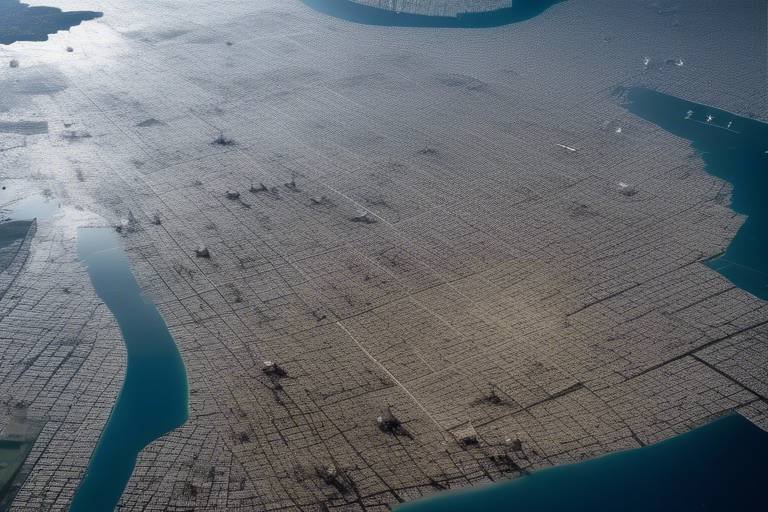
When disaster strikes, one of the most critical tasks is understanding the **extent of the damage** and the specific areas that need immediate attention. This is where the power of satellite imagery comes into play. By capturing high-resolution images from space, satellites provide a **bird's-eye view** of the affected regions, allowing authorities to assess the situation with unprecedented accuracy. Imagine trying to find your way through a dense fog; satellite imagery acts like a lighthouse, guiding responders to the areas that need help the most.
Satellite mapping serves multiple purposes in disaster response. Firstly, it enables the creation of detailed maps that highlight affected regions. These maps are essential for logistics, as they help in planning the distribution of aid and resources. For example, after a hurricane, satellite images can reveal which neighborhoods have been flooded, which roads are impassable, and where shelters are needed. Without this information, relief efforts could be delayed, putting lives at risk.
Moreover, the ability to compare before-and-after images allows responders to visualize the **impact of the disaster**. This comparison is not just about seeing what was lost; it’s about understanding how to allocate resources effectively. For instance, if a particular area shows significant destruction, it may require more personnel, supplies, and equipment than others. By prioritizing these areas based on satellite data, agencies can ensure that **aid reaches those who need it most** in a timely manner.
Additionally, the integration of satellite data with other geographic information systems (GIS) enhances the overall response strategy. By overlaying satellite imagery with demographic data, responders can identify vulnerable populations who may require special assistance, such as the elderly or those with disabilities. This comprehensive approach ensures that no one is left behind in the chaos that follows a disaster.
In summary, mapping affected areas using satellite imagery is not just a technical exercise; it’s a **lifeline** during disaster relief operations. It equips responders with the information they need to make informed decisions, coordinate effectively, and ultimately save lives. The next time you hear about a natural disaster, remember that satellites are working tirelessly above, providing crucial data that helps communities recover and rebuild.
- How quickly can satellite imagery be obtained after a disaster?
Satellite imagery can often be obtained within hours of a disaster, depending on the satellite's orbit and the availability of data. - Are there any costs associated with accessing satellite data?
While some satellite data is freely available, high-resolution imagery may come with a fee, particularly from commercial providers. - How accurate is satellite imagery in assessing damage?
Satellite imagery has proven to be highly accurate, especially when combined with ground-truth data collected by responders on the scene. - Can satellite technology help in long-term recovery efforts?
Yes, satellite data can assist in long-term planning and recovery by providing insights into rebuilding efforts and monitoring changes over time.
Supporting Humanitarian Efforts
In the chaotic aftermath of a disaster, every second counts, and the role of satellites in supporting humanitarian efforts cannot be overstated. These high-tech tools provide a lifeline to those in need, offering critical data that informs relief operations. Imagine a world where aid can be delivered precisely where it’s needed, without the guesswork. That’s the power of satellite technology in action. By supplying real-time information about the affected areas, satellites help ensure that humanitarian organizations can act swiftly and effectively.
One of the most significant ways satellites support humanitarian efforts is through their ability to facilitate coordination among various agencies. During a disaster, countless organizations spring into action, each with its own mission and resources. Without a clear line of communication and data sharing, efforts can become fragmented and inefficient. Satellite data acts as a common language, bridging the gap between these agencies and enhancing collaboration. For instance, when a major earthquake strikes, organizations like the Red Cross, UN agencies, and local governments can access the same satellite imagery to assess the situation. This shared information allows them to plan and execute their response strategies in a synchronized manner.
Furthermore, the integration of satellite data into humanitarian efforts also aids in logistics and resource allocation. When disaster strikes, it’s not just about getting aid to the affected areas; it’s about doing so in a way that maximizes impact. Satellites provide essential insights into the most severely impacted regions, helping organizations prioritize their efforts. For example, a satellite image may reveal that certain neighborhoods are cut off from access roads, indicating where resources are most urgently needed. This ability to pinpoint areas in distress allows for a more targeted approach, ensuring that aid reaches those who need it most.
Additionally, the role of satellites extends beyond immediate disaster response. They are also crucial in long-term recovery planning. After the initial chaos subsides, communities need to rebuild, and satellite data can provide invaluable insights into the rebuilding process. By monitoring changes in the landscape and infrastructure over time, satellites help assess progress, identify ongoing needs, and guide future development efforts. This long-term perspective is essential for creating resilient communities that can withstand future disasters.
To illustrate the impact of satellite technology on humanitarian efforts, consider the following table that highlights key benefits:
| Benefit | Description |
|---|---|
| Real-Time Data Access | Satellites provide immediate information on affected areas, enabling quick decision-making. |
| Improved Coordination | Facilitates collaboration among various humanitarian agencies, ensuring a unified response. |
| Resource Allocation | Helps identify the most affected regions for targeted aid distribution. |
| Long-Term Recovery Insights | Supports planning and monitoring of rebuilding efforts over time. |
In conclusion, the integration of satellite technology into humanitarian efforts revolutionizes how organizations respond to disasters. It transforms chaos into coordinated action, ensuring that aid reaches those in need efficiently and effectively. The future of disaster response is undoubtedly intertwined with the capabilities of satellites, making them an indispensable tool in the fight against the devastating impacts of natural disasters.
- How do satellites gather data during a disaster?
Satellites use various sensors and imaging technologies to capture real-time data, including high-resolution images of affected areas, atmospheric conditions, and more.
- Can satellites operate in extreme weather conditions?
Yes, many satellites are designed to withstand harsh weather conditions and can continue to provide data even during severe storms or other challenging environments.
- How is satellite data shared with humanitarian organizations?
Satellite data is often made available through various platforms and partnerships, allowing organizations to access and utilize the information for their relief efforts.
- What role do communication satellites play in disaster response?
Communication satellites ensure that emergency services maintain connectivity during disasters, enabling effective coordination and information dissemination.
Coordination Among Agencies
In the chaotic aftermath of a disaster, effective is vital for ensuring a swift and organized response. Imagine a symphony orchestra; each musician plays a different instrument, yet they must harmonize to create beautiful music. Similarly, various humanitarian organizations, government agencies, and local authorities must work together, sharing information and resources to address the immediate needs of affected communities. This is where satellite technology comes into play, acting as the conductor of this complex orchestration.
Satellites provide a centralized platform for information sharing, enabling agencies to access real-time data that can inform their actions. For instance, when a natural disaster strikes, such as a hurricane or earthquake, satellite imagery can quickly reveal the most impacted areas. This information allows agencies to prioritize their efforts, ensuring that resources are allocated where they are needed most. Without this level of coordination, response efforts can become fragmented, leading to delays in aid delivery and increased suffering for those in need.
Moreover, the integration of satellite data into communication systems enhances collaboration among agencies. For example, during a major disaster, multiple organizations may be involved in relief efforts, including the Red Cross, local governments, and international NGOs. By utilizing satellite communications, these entities can maintain constant contact, sharing updates and strategizing their next moves. This real-time connectivity is crucial, especially in remote or hard-to-reach areas where traditional communication infrastructure may be compromised.
Furthermore, the use of geospatial data from satellites allows for detailed mapping of affected regions. This mapping is not just about identifying where the damage has occurred; it also helps agencies understand the logistics of aid distribution. By analyzing satellite imagery, organizations can identify the best routes for delivering supplies, ensuring that aid reaches those in need as quickly as possible. The precision of satellite data transforms what could be a chaotic response into a well-orchestrated effort.
In conclusion, the coordination among agencies during disaster relief operations is significantly enhanced by satellite technology. By providing critical data, facilitating communication, and enabling effective resource allocation, satellites help create a unified response that can save lives and accelerate recovery efforts. As we continue to face an increasing number of natural disasters, the role of satellites in fostering collaboration among agencies will undoubtedly become even more vital.
- How do satellites help in disaster relief? Satellites provide real-time data and imagery that assist agencies in assessing damage, planning responses, and coordinating efforts.
- What types of satellites are used in disaster management? Weather, reconnaissance, and communication satellites are commonly used to gather crucial information during disasters.
- Can satellite imagery be used for long-term recovery planning? Yes, satellite imagery aids in understanding the extent of damage and helps in planning infrastructure development in affected areas.
Long-Term Recovery Planning
Long-term recovery planning is a critical phase in the aftermath of a disaster, and satellite data plays a pivotal role in shaping effective strategies for rebuilding and revitalizing affected communities. When the dust settles, the real challenge begins: how do we restore not just what was lost, but also improve resilience against future disasters? This is where the power of satellites comes into play, offering insights that are both broad and deep.
One of the most significant advantages of satellite imagery is its ability to provide a comprehensive view of the affected areas. For instance, high-resolution images captured post-disaster can reveal not only the immediate damage but also the broader environmental changes that may have occurred. This information is vital for urban planners and recovery teams as they assess the extent of destruction and identify the most critical needs of the community.
Moreover, satellite data can help in monitoring recovery progress. By regularly capturing images of the area, authorities can track rebuilding efforts and ensure that resources are being allocated effectively. It’s like having a bird’s-eye view of the recovery process, enabling stakeholders to make informed decisions based on real-time data. This ongoing assessment can help identify areas that require additional support, ensuring that no community is left behind.
Another crucial aspect of long-term recovery planning is infrastructure development. Satellites provide essential information about the existing infrastructure, such as roads, bridges, and utilities, which may have been damaged or destroyed. By analyzing this data, planners can prioritize which infrastructure needs immediate attention and which can wait. This strategic approach not only speeds up the recovery process but also enhances the overall resilience of the community against future disasters.
Furthermore, satellite data can assist in environmental monitoring post-disaster. Understanding the ecological impact of a disaster is vital for ensuring sustainable recovery. For example, satellite imagery can help identify changes in land use, deforestation, or water quality issues that may arise after a disaster. This information is invaluable for environmental agencies and NGOs focused on restoring natural habitats and ensuring that recovery efforts do not inadvertently harm the environment.
In conclusion, long-term recovery planning is not just about rebuilding; it's about creating a stronger, more resilient community. With the help of satellite technology, stakeholders can make data-driven decisions that not only address immediate needs but also lay the groundwork for a sustainable future. The integration of satellite data into recovery planning ensures that we are not merely reacting to disasters but proactively preparing for a better tomorrow.
- How do satellites assist in disaster recovery? Satellites provide real-time data and imagery that help assess damage, monitor recovery progress, and inform infrastructure development.
- What types of satellite imagery are most useful? High-resolution images and multispectral data are particularly useful for understanding the extent of damage and environmental changes.
- Can satellite data help with future disaster preparedness? Yes, by analyzing past disasters and recovery efforts, satellite data can inform strategies to enhance resilience and preparedness for future events.
Frequently Asked Questions
- How do satellites assist in disaster relief operations?
Satellites play a vital role in disaster relief by providing real-time data and imagery that help assess damage, improve response times, and support coordination among various agencies. This information is crucial for effective planning and execution of relief efforts.
- What types of satellites are used in disaster management?
There are several types of satellites utilized in disaster management, including weather satellites, reconnaissance satellites, and communication satellites. Each type serves a specific purpose, from monitoring weather conditions to ensuring reliable communication during emergencies.
- How do weather satellites contribute to disaster preparedness?
Weather satellites monitor atmospheric conditions and predict severe weather events, enabling timely warnings that can save lives. Their remote sensing capabilities provide high-resolution images that help assess damage and plan recovery strategies effectively.
- What is the significance of satellite imagery in damage assessment?
Satellite imagery is crucial for evaluating the extent of destruction after a disaster. By comparing before-and-after images, authorities can understand the impact more clearly, guiding resource allocation and recovery planning based on actual conditions.
- How do satellites enhance coordination among humanitarian agencies?
Satellites facilitate better coordination among humanitarian organizations by providing essential data that informs relief operations. This improved collaboration ensures that aid reaches those affected more efficiently and effectively during disaster response efforts.
- Can satellite data assist in long-term recovery planning?
Absolutely! Post-disaster, satellite data offers insights into rebuilding efforts and infrastructure development in affected areas. This long-term perspective is invaluable for planning sustainable recovery strategies that benefit communities in the future.


