The Importance of Satellite Technology in Maritime Security
In today's interconnected world, maritime security is more crucial than ever. The vast oceans that cover over 70% of our planet serve as highways for global trade, but they also harbor a multitude of threats ranging from piracy to illegal fishing and environmental disasters. Here, satellite technology emerges as a game-changer, providing innovative solutions to enhance the safety and security of our maritime routes. By leveraging advanced surveillance, navigation, and communication systems, we can protect our shipping lanes and coastlines from various threats and ensure the smooth operation of maritime activities.
Imagine a world where ships can navigate treacherous waters with pinpoint accuracy, where authorities can monitor vast ocean areas in real-time, and where emergency responses are swift and effective. This is not a distant dream but a reality made possible by satellite technology. As we delve deeper into the specifics of how satellites bolster maritime security, we will uncover the layers of benefits they provide, not just for shipping companies, but for the environment and international safety as well.
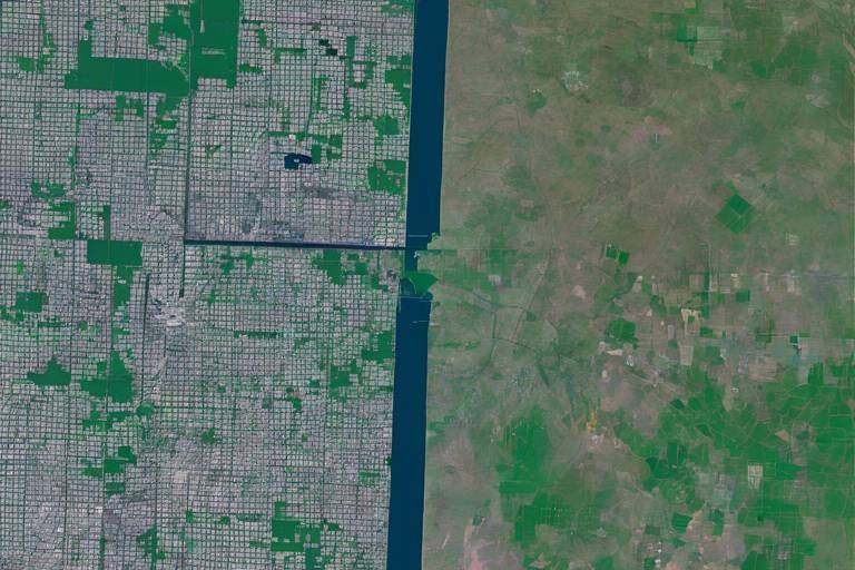
One of the most significant advantages of satellite technology is its enhanced surveillance capabilities. Satellites provide real-time monitoring of vast ocean areas, allowing authorities to track vessels and detect suspicious activities. This capability is essential for preventing piracy, illegal fishing, and other illicit activities that threaten maritime security. For instance, a satellite can spot a vessel behaving erratically or entering a restricted area, triggering an immediate response from coast guard units. This proactive approach can deter potential threats before they escalate.
Advanced satellite navigation systems revolutionize the safety and efficiency of maritime operations. With accurate positioning data, vessels can avoid hazards and optimize their routes, which significantly reduces the risk of accidents. The integration of satellite technology has made navigation more precise than ever before.
The Global Positioning System (GPS) is vital for maritime navigation. It allows ships to determine their exact location and course, ensuring safe travel in congested or hazardous waters. Without GPS, navigating through busy shipping lanes would be akin to sailing blindfolded—dangerous and unpredictable.
Moreover, the integration of GPS data with Electronic Chart Display and Information Systems (ECDIS) enhances situational awareness for mariners. These systems provide comprehensive navigational charts that help in making informed decisions in real-time. Imagine being able to visualize your route, potential hazards, and even weather conditions all in one place—this is the power of modern navigation.
Real-time data from satellites also allows for dynamic route adjustments, which enhances safety and reduces fuel consumption. In an era where environmental concerns are paramount, this efficiency is invaluable for the maritime industry. It's like having a GPS that not only tells you where to go but also finds the most eco-friendly path!
In emergencies, satellite technology significantly enhances search and rescue (SAR) operations by providing accurate location data for distressed vessels. This capability can mean the difference between life and death, improving response times when every second counts. Think of it as having a lifeline that connects you to help, no matter how remote your location.
Another critical aspect of maritime security is communication and coordination. Satellite communication systems facilitate seamless interaction among vessels, port authorities, and maritime agencies. This connectivity is crucial for effective responses to threats and emergencies at sea. When every minute matters, being able to communicate instantly can save lives and protect assets.
In emergencies, satellite communication ensures that vessels can send distress signals and receive assistance, even in remote areas where traditional communication methods may fail. It's like having a safety net that stretches across the oceans, ready to catch those in peril.
Moreover, satellite technology enables data sharing between various maritime agencies, enhancing collaborative efforts in monitoring and responding to security threats. This shared intelligence fosters a more comprehensive approach to maritime safety, ensuring that no stone is left unturned in the quest to protect our waters.
Finally, satellites play a key role in monitoring environmental conditions, such as oil spills and illegal dumping. This capability helps protect marine ecosystems and supports regulatory compliance in maritime activities. By keeping an eye on our oceans from above, satellites act as guardians of the sea, ensuring that we preserve the delicate balance of marine life.
- What is the role of satellites in maritime security? Satellites provide enhanced surveillance, navigation, and communication capabilities, which are essential for monitoring vessels and responding to maritime threats.
- How do satellites improve navigation for ships? Satellites offer precise positioning data that helps vessels avoid hazards and optimize their routes, enhancing safety and efficiency.
- Can satellite technology assist in search and rescue operations? Yes, satellite technology significantly improves search and rescue operations by providing accurate location data for distressed vessels, thus saving lives.
- What are the environmental benefits of satellite monitoring? Satellites help monitor environmental conditions, such as oil spills and illegal dumping, protecting marine ecosystems and ensuring regulatory compliance.
Enhanced Surveillance Capabilities
In the vast expanse of our oceans, the ability to monitor activities is not just a luxury; it's a necessity. Satellite technology provides a robust framework for real-time surveillance, covering immense areas of water that would otherwise be impossible to patrol effectively. Imagine trying to find a needle in a haystack; now, imagine that needle is a suspicious vessel in the middle of the ocean. Without satellite surveillance, detecting such activities would be akin to searching for that needle with your eyes closed.
The surveillance capabilities offered by satellites are crucial for various maritime security challenges. For instance, they play a pivotal role in combating piracy, which remains a significant threat in many regions. By providing real-time data on vessel locations and movements, authorities can quickly identify and respond to potential piracy incidents. Moreover, illegal fishing, which depletes fish stocks and disrupts marine ecosystems, can also be effectively monitored through satellite imagery. This technology allows for the identification of unauthorized fishing vessels, enabling enforcement agencies to take action.
Furthermore, the integration of satellite data with other technologies enhances surveillance even more. By utilizing Automatic Identification Systems (AIS), authorities can track vessel movements and behaviors over time. This combination of satellite imagery and AIS data creates a comprehensive picture of maritime activities, allowing for the detection of patterns that may indicate illicit behavior. For example, if a vessel suddenly changes its course or stops transmitting its AIS signal, it raises a red flag that can prompt immediate investigation.
To illustrate the effectiveness of satellite surveillance, consider the following table:
| Capability | Description | Impact on Maritime Security |
|---|---|---|
| Real-Time Monitoring | Continuous tracking of vessel movements across vast ocean areas. | Immediate detection of suspicious activities. |
| Data Integration | Combining satellite data with AIS and other technologies. | Enhanced situational awareness and quicker response times. |
| Pattern Recognition | Identifying trends and anomalies in vessel behavior. | Proactive measures against potential threats. |
In conclusion, the enhanced surveillance capabilities provided by satellite technology are indispensable in today's maritime security landscape. They not only help in detecting and deterring illegal activities but also contribute to the overall safety of shipping routes and coastal areas. As we continue to develop and refine these technologies, we can expect even greater improvements in our ability to safeguard our oceans.
Improved Navigation Systems
When it comes to maritime operations, having accurate navigation systems is not just a luxury; it's a necessity. The open seas can be unpredictable, and navigating through congested waterways requires precision that only advanced satellite navigation can provide. With technologies like the Global Positioning System (GPS), ships can determine their exact location and course, ensuring safe passage even in the busiest of maritime routes. Imagine trying to find your way through a bustling city without a map or GPS; it would be chaotic, right? The same goes for vessels at sea, where a moment's hesitation can lead to disastrous consequences.
Moreover, the integration of GPS with Electronic Chart Display and Information Systems (ECDIS) enhances navigational capabilities significantly. This combination provides mariners with a comprehensive view of their surroundings, allowing for better situational awareness. Think of it like having a bird's-eye view of a complex puzzle; you can see all the pieces and how they fit together, making it easier to avoid obstacles and make informed decisions. This integration is crucial, especially when navigating through treacherous waters where hazards might not be immediately visible.
One of the standout features of modern navigation systems is their ability to provide real-time data. This is a game changer for maritime operations. With up-to-the-minute information, vessels can adjust their routes dynamically to avoid bad weather or congested shipping lanes. Not only does this enhance safety, but it also optimizes fuel consumption, which is increasingly important in today's environmentally conscious world. After all, who wouldn't want to save costs while also being a little kinder to our planet?
In summary, improved navigation systems powered by satellite technology are reshaping the maritime industry. They not only provide essential data for safe navigation but also enhance operational efficiency. The benefits are clear: fewer accidents, reduced environmental impact, and a more streamlined maritime experience. As we continue to innovate and integrate these technologies, the future of maritime navigation looks brighter than ever.
- How does GPS technology enhance maritime navigation?
GPS technology provides accurate positioning data, allowing vessels to determine their exact location and course, which is vital for safe travel. - What is ECDIS, and how does it work with GPS?
Electronic Chart Display and Information Systems (ECDIS) integrate GPS data with navigational charts, offering mariners comprehensive situational awareness. - Why is real-time data important for maritime operations?
Real-time data allows vessels to make dynamic route adjustments, enhancing safety and reducing fuel consumption.
Global Positioning System (GPS)
The is an indispensable tool in the maritime industry, acting as a lighthouse amidst the vast ocean of uncertainty. Imagine navigating through treacherous waters without knowing your exact location—it's like sailing blindfolded! GPS technology provides ships with precise location data, which is essential for safe travel, especially in congested or hazardous areas. By utilizing a network of satellites orbiting the Earth, vessels can determine their exact coordinates, allowing them to plot their course with remarkable accuracy.
One of the most remarkable aspects of GPS is its ability to function in real-time. This means that as a ship moves, it continuously receives updates about its position, speed, and direction. This dynamic flow of information not only enhances safety but also boosts operational efficiency. For instance, a ship can adjust its route in response to changing weather conditions or navigational hazards, much like a driver recalibrating their GPS when faced with unexpected road closures. Such adaptability is vital for modern maritime operations, where time and safety are paramount.
Moreover, the integration of GPS with other technologies, such as Electronic Chart Display and Information Systems (ECDIS), creates an even more powerful navigational system. ECDIS combines GPS data with navigational charts, providing mariners with a comprehensive view of their surroundings. This integration allows for better situational awareness, enabling captains to make informed decisions quickly. Imagine having a detailed map that updates in real-time as you move—this is exactly what ECDIS offers, turning complex navigation into a more manageable task.
In addition to enhancing safety and efficiency, GPS technology also plays a crucial role in regulatory compliance. Many maritime laws require vessels to maintain accurate navigational records, and GPS provides the necessary data to fulfill these requirements. This not only helps in avoiding legal issues but also promotes responsible and sustainable maritime practices.
As we sail into the future, the role of GPS in maritime navigation will only grow more critical. With advancements in technology, we can expect even greater accuracy and reliability, ensuring that our oceans remain safe and accessible for generations to come. The integration of GPS into everyday maritime operations is not just a technological upgrade; it’s a lifeline that connects seafarers to safety, efficiency, and compliance.
- What is GPS? GPS stands for Global Positioning System, a satellite-based navigation system that provides accurate location and time information anywhere on Earth.
- How does GPS work in maritime navigation? GPS uses a network of satellites that transmit signals to GPS receivers on ships, allowing them to calculate their exact position based on the time it takes for signals to travel from the satellites.
- Why is GPS important for maritime security? GPS enhances maritime security by providing accurate location data, improving navigation safety, and enabling quick responses to emergencies.
- Can GPS work in remote areas? Yes, GPS can function in remote areas where traditional communication methods may fail, making it essential for maritime operations in isolated regions.
- What other technologies work with GPS? Technologies such as Electronic Chart Display and Information Systems (ECDIS) and Automatic Identification Systems (AIS) integrate with GPS to enhance navigational capabilities.
Integration with Electronic Chart Systems
The integration of Electronic Chart Display and Information Systems (ECDIS) with satellite navigation technology marks a significant leap forward in maritime navigation. ECDIS combines real-time GPS data with comprehensive navigational charts, providing mariners with a powerful tool for safe and efficient sea travel. Imagine navigating a bustling highway without a map—daunting, right? That’s how seafarers once felt before ECDIS transformed their journey into a smooth ride.
One of the standout features of ECDIS is its ability to display dynamic information, such as weather conditions, traffic patterns, and navigational hazards. By presenting this information visually on a screen, it allows captains and crew to make informed decisions quickly. For instance, if a sudden storm arises, the system can alert the crew to potential dangers, enabling them to adjust their course in real-time. This is not just about convenience; it’s about safety and efficiency.
Furthermore, the integration of ECDIS with satellite technology enhances situational awareness. Mariners can see their vessel's position relative to other ships, landmasses, and potential threats, all in one unified display. This capability is crucial in congested waters where the risk of collisions is high. The combination of accurate GPS data and detailed electronic charts allows for a level of awareness that was previously unattainable.
Moreover, ECDIS systems are equipped with features that allow for route planning and monitoring. Mariners can pre-plan their voyage, taking into account various factors such as fuel efficiency and environmental regulations. Once the journey begins, the system continuously monitors the vessel's progress, alerting the crew to any deviations from the planned course. This proactive approach not only enhances safety but also contributes to environmental sustainability by reducing unnecessary fuel consumption.
In summary, the integration of ECDIS with satellite navigation systems is a game-changer in maritime operations. It empowers mariners with the tools they need to navigate safely and efficiently, ensuring that they can respond to challenges swiftly and effectively. The future of maritime navigation is undoubtedly tied to these advanced technological systems, paving the way for safer seas and more sustainable practices.
- What is ECDIS? ECDIS stands for Electronic Chart Display and Information System, which integrates GPS data with electronic navigational charts for enhanced maritime navigation.
- How does ECDIS improve safety? ECDIS provides real-time information about navigational hazards, weather conditions, and other vessels, allowing for informed decision-making and proactive route adjustments.
- Can ECDIS help with environmental compliance? Yes, ECDIS aids in route planning and monitoring, helping vessels adhere to environmental regulations and reduce fuel consumption.
- Is ECDIS mandatory? For certain types of vessels, particularly those engaged in international trade, ECDIS is a mandatory requirement under the International Maritime Organization (IMO) regulations.
Benefits of Real-Time Data
When it comes to maritime operations, the phrase “time is money” takes on an entirely new meaning. The in this sector are not just advantageous; they are critical for ensuring safety, efficiency, and environmental responsibility. Imagine a ship navigating through treacherous waters, where every second counts. With real-time data at their fingertips, captains can make informed decisions that directly impact their journey.
One of the most significant advantages of real-time data is the ability to make dynamically adjusted routes. For instance, if a storm suddenly brews on the horizon or if another vessel is detected in a ship's path, real-time data allows for immediate rerouting. This capability not only enhances safety but also helps in reducing fuel consumption. With fuel prices soaring and environmental regulations tightening, optimizing routes can lead to substantial savings and a smaller carbon footprint.
Furthermore, the integration of real-time data with advanced analytics provides maritime operators with insights that were previously unattainable. By analyzing patterns and trends, shipping companies can forecast potential issues before they arise. This proactive approach can be likened to having a weather app that doesn’t just tell you the forecast but also alerts you about sudden changes, allowing you to prepare accordingly.
Consider the following table that illustrates key benefits of real-time data in maritime operations:
| Benefit | Description |
|---|---|
| Enhanced Safety | Immediate access to navigational hazards and weather updates minimizes risks. |
| Fuel Efficiency | Dynamic route adjustments lead to reduced fuel consumption and costs. |
| Operational Efficiency | Real-time data streamlines operations, saving time and resources. |
| Environmental Protection | Quick response to environmental threats helps in compliance and protection of marine ecosystems. |
Moreover, real-time data significantly enhances collaboration among different maritime stakeholders. For example, when a vessel encounters an emergency, the immediate sharing of location and status data can expedite rescue operations. It’s like having a group chat where everyone is instantly updated, ensuring that no one is left in the dark.
In a world increasingly focused on sustainability, the role of real-time data in promoting environmental responsibility cannot be overstated. With the ability to monitor conditions like water quality and marine life movements, shipping companies can ensure that their operations do not harm the delicate balance of marine ecosystems. This not only fulfills regulatory obligations but also enhances a company's reputation as a responsible operator.
In summary, the benefits of real-time data in maritime operations are multifaceted, impacting safety, efficiency, and environmental stewardship. As technology continues to evolve, the reliance on real-time data will only grow, making it an indispensable tool for modern maritime security.
- What is real-time data in maritime operations?
Real-time data refers to information that is delivered immediately after collection, allowing for instant decision-making and response in maritime operations.
- How does real-time data enhance safety at sea?
By providing immediate updates on navigational hazards and weather conditions, real-time data helps vessels avoid dangerous situations, thereby enhancing safety.
- Can real-time data help in environmental monitoring?
Yes, real-time data plays a crucial role in monitoring environmental conditions, helping to identify issues like oil spills and illegal dumping promptly.
- What are the economic benefits of using real-time data?
Real-time data can lead to significant cost savings through optimized routes, reduced fuel consumption, and enhanced operational efficiency.
Search and Rescue Operations
This article explores the critical role satellite technology plays in enhancing maritime security, including surveillance, navigation, and communication systems that protect shipping routes and coastlines from various threats.
Satellite technology provides real-time monitoring of vast ocean areas, enabling authorities to track vessels and detect suspicious activities. This capability is essential for preventing piracy and illegal fishing.
Advanced satellite navigation systems enhance the safety and efficiency of maritime operations. Accurate positioning data helps vessels avoid hazards and optimize routes, reducing the risk of accidents.
GPS technology is vital for maritime navigation, allowing ships to determine their exact location and course. This precision is crucial for safe travel in congested or hazardous waters.
Electronic Chart Display and Information Systems (ECDIS) integrate GPS data with navigational charts, providing mariners with comprehensive situational awareness and improving decision-making in real time.
Real-time data from satellites allows for dynamic route adjustments, enhancing safety and reducing fuel consumption. This efficiency is increasingly important in today's environmentally conscious maritime industry.
When it comes to search and rescue (SAR) operations, satellite technology is nothing short of a lifesaver. Imagine being lost at sea, surrounded by nothing but waves and uncertainty. In these critical moments, having access to accurate location data can make the difference between life and death. With satellites orbiting our planet, emergency responders can pinpoint the exact location of distressed vessels, significantly improving response times during emergencies.
One of the standout features of satellite technology in SAR operations is its ability to provide real-time tracking. This means that as soon as a vessel sends out a distress signal, rescue teams can immediately begin their search, guided by precise coordinates. Moreover, satellites can monitor weather conditions and sea states, allowing for strategic planning of rescue missions. This is especially important in challenging environments where time is of the essence.
Furthermore, the integration of satellite communications ensures that even in the most remote areas, vessels can maintain contact with rescue teams. This connectivity is crucial, as it allows for the sharing of vital information such as the vessel's condition, number of people on board, and any immediate needs for medical assistance.
To illustrate the impact of satellite technology on SAR operations, consider the following table:
| Feature | Impact on SAR Operations |
|---|---|
| Real-time Location Tracking | Enables quick response and accurate rescue coordination. |
| Weather Monitoring | Helps in planning safe rescue missions by avoiding hazardous conditions. |
| Communication Systems | Maintains contact between distressed vessels and rescue teams, ensuring timely assistance. |
In summary, the role of satellite technology in enhancing search and rescue operations is invaluable. It not only saves lives but also bolsters the overall efficiency of maritime safety protocols. As technology continues to advance, we can only expect these systems to become even more sophisticated, further improving our ability to respond to emergencies at sea.
Satellite communication systems facilitate seamless coordination among vessels, port authorities, and maritime agencies. This connectivity is crucial for effective response to threats and emergencies at sea.
In emergencies, satellite communication ensures that vessels can send distress signals and receive assistance, even in remote areas where traditional communication methods may fail.
Satellite technology enables data sharing between various maritime agencies, enhancing collaborative efforts in monitoring and responding to security threats, thereby ensuring a more comprehensive approach to maritime safety.
Satellites play a key role in monitoring environmental conditions, such as oil spills and illegal dumping. This capability helps protect marine ecosystems and supports regulatory compliance in maritime activities.
- How does satellite technology improve maritime security?
It enhances surveillance, navigation, and communication, allowing for better monitoring of vessels and threats. - What is the role of GPS in maritime navigation?
GPS provides precise location data, helping vessels navigate safely through congested or hazardous waters. - How does satellite technology aid in search and rescue operations?
It enables real-time tracking and communication, improving response times and coordination during emergencies. - Can satellites monitor environmental issues?
Yes, they are essential for tracking oil spills, illegal dumping, and other environmental hazards.
Communication and Coordination
In the vast expanse of the ocean, effective communication and coordination are paramount for ensuring maritime safety and security. Imagine a bustling highway filled with vehicles, where each driver must communicate their intentions and be aware of the surrounding traffic to prevent accidents. The same principle applies to the maritime domain, where vessels, port authorities, and maritime agencies must maintain constant communication to navigate the unpredictable waters safely.
Satellite communication systems serve as the backbone of this intricate web of coordination. They enable vessels to stay connected even in the most remote areas of the ocean, where traditional communication methods often fail. This connectivity is not just a luxury; it's a necessity. In emergencies, vessels can send distress signals and receive assistance promptly, significantly reducing response times and potentially saving lives. For instance, when a ship encounters trouble, the ability to communicate its exact location via satellite can mean the difference between life and death.
Furthermore, satellite technology facilitates the seamless exchange of critical data among various maritime agencies. This includes information about vessel movements, weather conditions, and potential threats. When agencies can share data effectively, they can respond to security threats more comprehensively. For example, if a vessel is reported to be behaving suspiciously, agencies can quickly coordinate their efforts to investigate, ensuring that no stone is left unturned.
To illustrate this point, consider the following table that highlights the key benefits of satellite communication in maritime operations:
| Benefit | Description |
|---|---|
| Real-time Communication | Allows vessels to send and receive information instantly, improving response times during emergencies. |
| Data Sharing | Enhances collaboration among maritime agencies, leading to a more unified approach to maritime security. |
| Global Coverage | Ensures connectivity in remote areas, where traditional communication methods may not be available. |
| Enhanced Coordination | Facilitates better planning and execution of maritime operations, reducing the risk of accidents and incidents. |
Moreover, the integration of satellite communication with other technologies, such as Automatic Identification Systems (AIS), further enhances situational awareness. AIS allows vessels to broadcast their position, course, and speed, which can be monitored by other ships and shore-based authorities. This combination of technologies creates a comprehensive safety net for maritime operations, ensuring that everyone is on the same page.
In conclusion, the role of satellite technology in communication and coordination cannot be overstated. It acts as a lifeline for vessels navigating the vast oceans, ensuring that they remain connected and informed. With the ever-increasing challenges faced in maritime security, the continued development and implementation of these technologies will be crucial for safeguarding our seas.
- How does satellite communication improve maritime safety? Satellite communication allows for real-time updates and coordination among vessels and maritime agencies, enhancing overall safety and response times during emergencies.
- What is the role of AIS in maritime operations? AIS provides critical information about vessel movements, improving situational awareness and helping to prevent collisions and other maritime incidents.
- Can satellite technology help in environmental monitoring? Yes, satellites play a significant role in monitoring environmental conditions, such as oil spills and illegal dumping, which is essential for protecting marine ecosystems.
Emergency Communication Systems
When it comes to maritime safety, are nothing short of a lifeline. Imagine being stranded in the middle of the ocean, surrounded by nothing but water and uncertainty. In such dire situations, the ability to communicate can mean the difference between life and death. Satellite communication technology ensures that vessels can send distress signals and receive assistance, even in the most remote areas where traditional communication methods may fail.
One of the standout features of these systems is their global reach. Unlike radio systems that can be limited by geographical obstacles or atmospheric conditions, satellite communications work regardless of where you are on the globe. This capability is crucial for vessels operating in vast and often isolated oceanic expanses. For instance, if a ship encounters mechanical failure or a medical emergency occurs onboard, the crew can quickly contact rescue services, providing them with critical information about their location and situation.
Moreover, the integration of automatic identification systems (AIS) with satellite communications enhances situational awareness. Vessels can transmit their position, course, and speed to other ships and maritime authorities. This data sharing is essential, especially in busy shipping lanes where collisions can happen in the blink of an eye. By having real-time updates, ships can navigate more safely and coordinate with one another to avoid potential hazards.
In addition to distress signals, satellite communication systems also allow for the exchange of vital information during emergencies. For example, during a search and rescue operation, coordination between various agencies is key. Satellite communications facilitate this by enabling different organizations—like the coast guard, naval forces, and local authorities—to share information seamlessly. This collaboration not only speeds up response times but also ensures that every agency involved is on the same page, maximizing the chances of a successful rescue.
To illustrate the impact of these systems, consider the following table that outlines some key features and benefits of emergency communication systems in maritime operations:
| Feature | Benefit |
|---|---|
| Global Coverage | Allows communication from remote locations without geographical limitations. |
| Real-time Data Sharing | Enhances situational awareness and coordination among agencies during emergencies. |
| Automatic Identification Systems (AIS) | Improves safety by allowing vessels to share their position and movement. |
| Rapid Response Capability | Ensures quick dispatch of rescue teams to distressed vessels. |
In conclusion, the significance of emergency communication systems in maritime operations cannot be overstated. They provide a reliable means of communication that is crucial during emergencies, ensuring that help can be summoned quickly and effectively. As technology continues to evolve, we can only expect these systems to become even more sophisticated, further enhancing maritime safety and security.
- What types of satellite communication systems are used in maritime operations?
- How do emergency communication systems work in remote areas?
- Can emergency communication systems be used for non-emergency situations?
There are various systems, including Inmarsat, Iridium, and VSAT, each offering different capabilities suited to specific maritime needs.
These systems rely on satellites orbiting the Earth to relay signals, allowing vessels to communicate regardless of their location.
Yes, they can also be used for routine communications, weather updates, and navigational assistance.
Data Sharing Among Agencies
In the complex world of maritime security, is not just beneficial; it is essential. Imagine a vast ocean where countless vessels traverse, each with its own set of challenges and threats. Without effective communication and data exchange, monitoring these activities becomes a daunting task. This is where satellite technology shines, acting as a bridge that connects various maritime agencies, allowing them to share critical information in real-time.
Through advanced satellite systems, agencies can access and exchange vital data regarding vessel positions, movements, and even environmental conditions. For instance, when a suspicious vessel is detected, data can be quickly shared among coast guards, naval forces, and environmental agencies. This collaboration ensures that everyone is on the same page, leading to a more coordinated response. The ability to share information swiftly can mean the difference between thwarting a potential threat and letting it escalate.
Moreover, the integration of satellite technology with existing communication systems enhances the overall effectiveness of maritime operations. Agencies can utilize a centralized platform to visualize data, making it easier to identify patterns or anomalies. The following table illustrates the key benefits of data sharing among maritime agencies:
| Benefit | Description |
|---|---|
| Improved Response Times | Real-time data sharing allows for quicker decision-making and action in emergencies. |
| Enhanced Situational Awareness | Agencies gain a comprehensive view of maritime activities, improving monitoring and threat detection. |
| Resource Optimization | Collaborative efforts lead to better allocation of resources, reducing redundancy and increasing efficiency. |
| Regulatory Compliance | Shared data helps ensure that all parties adhere to maritime laws and environmental regulations. |
In addition to these benefits, the sharing of data fosters a culture of collaboration among agencies. When different organizations work together, they can leverage each other's strengths, leading to innovative solutions to complex problems. For example, if one agency detects illegal fishing activities through satellite imagery, it can quickly alert other relevant authorities, leading to a coordinated enforcement effort that is much more effective than isolated actions.
However, it's important to note that the success of data sharing hinges on establishing robust protocols and frameworks. Agencies must agree on standards for data formats, communication methods, and security measures to protect sensitive information. As technology continues to evolve, so too must the strategies for data sharing, ensuring that maritime security remains a top priority.
- How does satellite technology improve maritime security?
Satellite technology enhances maritime security by providing real-time surveillance, navigation, and communication capabilities, which help in tracking vessels and detecting suspicious activities. - What role does data sharing play in maritime operations?
Data sharing among agencies improves response times, enhances situational awareness, and ensures better resource optimization, leading to a more effective approach to maritime security. - Can satellite data be used for environmental monitoring?
Yes, satellite technology is crucial for monitoring environmental conditions, such as oil spills and illegal dumping, helping to protect marine ecosystems.
Environmental Monitoring
In today's world, where our oceans are under constant threat from human activities, via satellite technology has become more crucial than ever. Imagine satellites as the vigilant eyes in the sky, tirelessly scanning vast expanses of water to protect our precious marine ecosystems. These technological marvels are not just about keeping an eye on things; they play an essential role in identifying environmental disasters, such as oil spills, illegal dumping, and overfishing.
With the ability to cover large areas quickly, satellites provide real-time data that can alert authorities to potential environmental hazards before they escalate into full-blown crises. For instance, when a tanker spills oil, the quicker the response, the less damage is done to marine life. By utilizing satellite imagery, environmental agencies can pinpoint the exact location of the spill and coordinate an effective cleanup operation.
Furthermore, satellites are equipped with advanced sensors that can detect changes in water quality, temperature, and even the presence of harmful substances. This information is vital for maintaining the health of our oceans and ensuring compliance with environmental regulations. For example, if a satellite detects an increase in water temperature, it could indicate a potential algal bloom, which can devastate local marine life.
To illustrate the impact of satellite technology on environmental monitoring, consider the following table that highlights some key functions and their benefits:
| Function | Benefit |
|---|---|
| Oil Spill Detection | Quick identification and response to minimize ecological damage. |
| Water Quality Monitoring | Ensures compliance with environmental regulations and protects marine life. |
| Illegal Fishing Surveillance | Helps enforce fishing regulations and protect fish populations. |
| Climate Change Monitoring | Tracks changes in ocean temperatures and sea levels, aiding in climate research. |
Moreover, the integration of satellite technology with other systems, such as Geographic Information Systems (GIS), enhances the ability to analyze and visualize environmental data. This combination allows for more informed decision-making and better resource management. By mapping out areas affected by pollution or illegal activities, authorities can prioritize their actions and allocate resources more effectively.
In conclusion, the role of satellite technology in environmental monitoring cannot be overstated. It serves as a critical tool for safeguarding our oceans, ensuring that we can respond swiftly to threats and maintain the health of marine ecosystems for future generations. As we continue to innovate and improve satellite capabilities, we pave the way for a more sustainable and secure maritime environment.
- How do satellites detect oil spills?
Satellites use specialized sensors that can identify the distinct sheen of oil on water, allowing for quick detection and response. - What is the role of satellite data in combating illegal fishing?
Satellites provide real-time tracking of fishing vessels, enabling authorities to monitor and enforce fishing regulations effectively. - Can satellite technology help in climate change research?
Yes, satellites track changes in ocean temperatures and sea levels, which are crucial for understanding climate change impacts. - How does satellite technology improve response times in environmental emergencies?
By providing real-time data and imagery, satellites allow authorities to quickly assess situations and coordinate responses.
Frequently Asked Questions
-
What is the role of satellite technology in maritime security?
Satellite technology plays a crucial role in enhancing maritime security by providing real-time surveillance, improved navigation systems, and effective communication. This technology helps authorities monitor vast ocean areas, track vessels, and detect suspicious activities, which is essential for preventing piracy and illegal fishing.
-
How does satellite technology improve navigation for ships?
Advanced satellite navigation systems, such as GPS, allow vessels to determine their exact location and course. This precision is vital for safe travel in congested or hazardous waters, helping ships avoid obstacles and optimize their routes, ultimately reducing the risk of accidents.
-
What are the benefits of real-time data in maritime operations?
Real-time data from satellites enables dynamic route adjustments, which enhances safety and reduces fuel consumption. In today’s environmentally conscious maritime industry, this efficiency is increasingly important, allowing ships to operate more sustainably while ensuring safety on the seas.
-
How does satellite technology aid in search and rescue operations?
Satellite technology significantly enhances search and rescue (SAR) operations by providing accurate location data for distressed vessels. This capability not only saves lives but also improves response times during emergencies, ensuring that help arrives as quickly as possible.
-
What role does satellite communication play in maritime coordination?
Satellite communication systems facilitate seamless coordination among vessels, port authorities, and maritime agencies. This connectivity is crucial for effective responses to threats and emergencies at sea, ensuring that all parties can communicate efficiently, even in remote areas.
-
How does satellite technology support environmental monitoring?
Satellites are essential for monitoring environmental conditions such as oil spills and illegal dumping. This capability helps protect marine ecosystems and supports regulatory compliance in maritime activities, ensuring that the oceans remain healthy and sustainable for future generations.