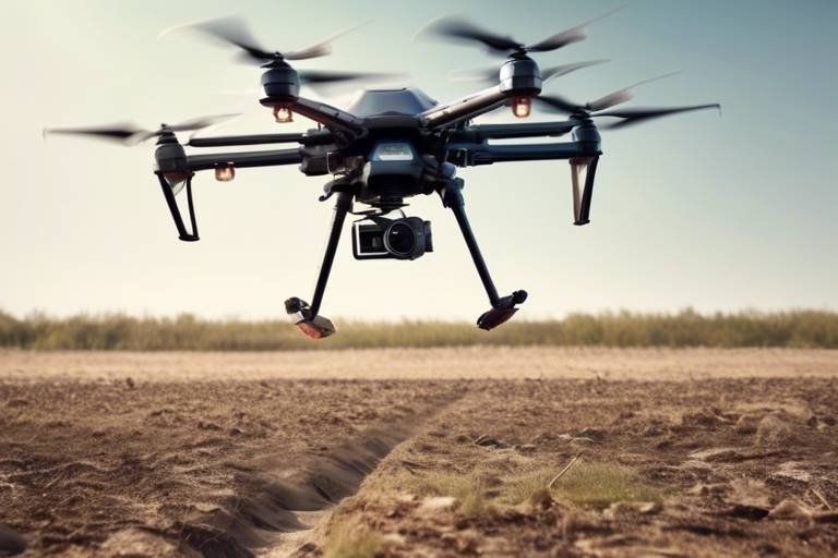
The Use of Autonomous Drones for Monitoring Forest Health
In recent years, the integration of autonomous drones into environmental monitoring has sparked a revolution in how we assess and maintain the health of our forests. These high-tech flying machines are not just toys for tech enthusiasts; they are becoming essential tools for ecologists, conservationists, and forest managers alike. Imagine soaring above the treetops, capturing intricate details of forest ecosystems that were once impossible to see from the ground. This article delves into how these drones are enhancing our ability to monitor forest health, improve data collection, and ultimately bolster conservation efforts.
One of the most significant advantages of using autonomous drones is their cost-effectiveness. Traditional methods of forest monitoring often involve extensive manpower and resources, which can be both time-consuming and expensive. Drones, on the other hand, can cover vast areas in a fraction of the time and at a much lower cost, allowing for more frequent assessments. This not only saves money but also enables forest managers to respond quickly to any emerging threats, such as pest infestations or illegal logging activities.
Moreover, the efficiency of drones is unmatched. They can be programmed to fly specific routes and gather data autonomously, freeing up human resources for more analytical tasks. The ability to fly at various altitudes and access hard-to-reach areas means that no corner of the forest goes unmonitored. This comprehensive coverage is vital for gathering critical data that informs conservation strategies.
As we dive deeper into the technological advancements that have propelled drones into the forefront of forest health monitoring, we find ourselves marveling at the innovations that have made these devices more capable than ever. The integration of advanced sensors and artificial intelligence (AI) has transformed the way we collect and analyze environmental data. With these tools, drones can capture high-resolution images and gather real-time data on various forest parameters.
For instance, remote sensing technologies enable drones to gather detailed information about forest conditions, including vegetation health, moisture levels, and biodiversity. This data is crucial not only for understanding the current state of the forest but also for predicting future changes. By employing technologies like multispectral imaging, drones can detect variations in plant health that may not be visible to the naked eye, allowing for early intervention when necessary.
Furthermore, the use of LIDAR (Light Detection and Ranging) technology on drones provides precise measurements of forest structure, such as tree height and canopy density. This information is invaluable for forest management, helping ecologists understand the intricate relationships within forest ecosystems and make informed decisions regarding conservation practices.
However, collecting data is just the beginning. The raw information gathered by drones requires sophisticated analysis techniques to transform it into actionable insights. This is where machine learning and GIS mapping come into play. By applying these advanced data analysis techniques, researchers can turn complex datasets into clear visualizations and reports that guide forest health assessments and conservation strategies.
As we witness the growing adoption of autonomous drones in conservation efforts, their applications are proving to be both diverse and impactful. From monitoring wildlife habitats to assessing the effects of deforestation, drones are helping to track changes in forest ecosystems over time. For example, drones equipped with high-resolution cameras and sensors are playing a crucial role in wildlife monitoring. They allow researchers to observe animal populations and behaviors without disturbing their natural habitats, thus providing a more accurate picture of wildlife health and diversity.
In addition to monitoring, drones are also instrumental in reforestation projects. They assist in mapping areas suitable for planting and monitoring growth, ensuring that reforestation efforts are effective and sustainable. This capability is particularly important as we face the challenges of climate change and habitat loss, making the restoration of forest ecosystems more critical than ever.
In conclusion, the use of autonomous drones for monitoring forest health is not just a trend; it's a significant leap forward in our ability to protect and manage our natural resources. As technology continues to evolve, so too will the capabilities of these drones, paving the way for more innovative applications in environmental management. The future of forest conservation looks promising, and with the help of autonomous drones, we can ensure that our forests thrive for generations to come.
- What are autonomous drones? Autonomous drones are unmanned aerial vehicles that can fly and collect data without human intervention.
- How do drones monitor forest health? Drones use advanced sensors and imaging technologies to gather data on vegetation health, moisture levels, and biodiversity.
- What are the benefits of using drones for conservation? Drones are cost-effective, efficient, and capable of covering large areas quickly, allowing for timely monitoring and intervention.
- Can drones track wildlife? Yes, drones equipped with cameras and sensors can monitor wildlife populations and behaviors without disturbing their habitats.
- How is data collected by drones analyzed? The data collected is analyzed using machine learning and GIS mapping techniques to provide actionable insights for forest management.
Benefits of Autonomous Drones
Autonomous drones are transforming the landscape of forest health monitoring in ways that were once thought to be the stuff of science fiction. Imagine being able to survey vast expanses of forest quickly and efficiently, gathering critical data without the need for extensive manpower or significant time investment. This is not just a dream; it’s a reality that autonomous drones are making possible. One of the most significant benefits of these high-tech marvels is their cost-effectiveness. Traditional methods of monitoring forest health often involve extensive ground surveys, which can be both time-consuming and expensive. In contrast, drones can cover large areas in a fraction of the time, allowing for quicker assessments and more timely interventions.
Moreover, the efficiency of drones means that data collection can happen in real-time. This immediacy is crucial when it comes to identifying issues such as pest infestations or signs of disease in trees. By using autonomous drones, forest managers can receive instant alerts about potential threats, enabling them to take action before these issues escalate. The ability to gather data from hard-to-reach or rugged terrains also makes drones invaluable. For example, areas that are typically inaccessible due to dense underbrush or steep slopes can be easily surveyed with a drone, ensuring that no part of the forest is left unmonitored.
Another compelling advantage is the enhanced data accuracy that comes with modern drone technology. Equipped with advanced sensors and imaging technology, drones can collect high-resolution images and detailed information about forest conditions. This data can be analyzed to reveal patterns and trends that might not be visible to the naked eye. For instance, drones can detect subtle changes in vegetation health or moisture levels, providing insights that are critical for effective forest management.
To illustrate the benefits further, consider the following table that summarizes the key advantages of using autonomous drones in forest health monitoring:
| Benefit | Description |
|---|---|
| Cost-Effectiveness | Reduces the need for extensive manpower and time in data collection. |
| Efficiency | Enables quick surveys of large areas, providing timely data for decision-making. |
| Data Accuracy | Collects high-resolution images and detailed information for better analysis. |
| Access to Remote Areas | Surveys difficult terrains that are challenging to reach on foot. |
In addition to these benefits, the integration of autonomous drones into forest monitoring practices fosters a more proactive approach to conservation. By continuously monitoring forest health, stakeholders can identify and address potential threats before they become critical issues. This proactive stance not only helps in preserving biodiversity but also supports the overall health of the ecosystem. In essence, autonomous drones are not just tools; they are game-changers in the quest for sustainable forest management.
Technological Innovations in Drone Design
In the rapidly evolving world of environmental management, are playing a pivotal role in enhancing forest health monitoring. These advancements are not just about flying; they encompass a range of sophisticated technologies that make drones more effective and versatile than ever before. Imagine a bird's-eye view of a forest, where every leaf and tree can be analyzed with precision. This is the reality that modern drones bring to the table.
One of the most significant innovations is the integration of advanced sensors that can detect various environmental parameters. These sensors can measure everything from temperature and humidity to soil moisture levels. This data is crucial for understanding the health of a forest ecosystem. For instance, if a drone identifies areas with low moisture levels, conservationists can take proactive measures to address potential drought conditions before they escalate.
Moreover, the incorporation of Artificial Intelligence (AI) into drone technology has transformed the way data is processed and analyzed. AI algorithms can sift through vast amounts of data collected by drones, identifying patterns and anomalies that would be nearly impossible for humans to detect. This allows for real-time assessments of forest health, enabling quicker responses to emerging threats such as pest infestations or disease outbreaks.
Another exciting development is the use of remote sensing technologies, which empower drones to gather detailed information about forest conditions. For example, drones equipped with multispectral imaging can capture data across various wavelengths, revealing insights about plant health and stress levels. This technology is akin to giving a forest a health check-up, where every aspect is scrutinized for signs of distress. Such detailed analysis is essential for effective forest management and conservation strategies.
| Technology | Functionality | Benefits |
|---|---|---|
| Multispectral Imaging | Captures data across various wavelengths | Reveals plant health and stress levels |
| LIDAR Technology | Provides precise measurements of forest structure | Facilitates better understanding of canopy density |
| AI Integration | Processes and analyzes data | Identifies patterns and anomalies quickly |
Furthermore, LIDAR technology has revolutionized the way we understand forest structure. Drones equipped with LIDAR can create three-dimensional maps of forests, measuring tree height, canopy density, and even the ground surface beneath dense foliage. This level of detail is invaluable for researchers and conservationists, as it allows them to monitor changes in forest structure over time, assess biodiversity, and plan effective management strategies.
In summary, the technological innovations in drone design are not just enhancing the capabilities of these flying machines; they are transforming the entire approach to forest health monitoring. With advanced sensors, AI integration, and remote sensing technologies, drones are becoming indispensable tools in the fight to protect and manage our forests. As we continue to harness these innovations, the future of forest conservation looks brighter than ever.
- What types of sensors are commonly used in drones for forest monitoring? Drones often use multispectral, thermal, and LIDAR sensors to gather various environmental data.
- How does AI improve the analysis of data collected by drones? AI algorithms can quickly analyze large datasets, identifying trends and anomalies that aid in timely decision-making.
- Can drones be used for wildlife monitoring as well? Yes, drones equipped with cameras and sensors can monitor wildlife populations without disturbing their habitats.
- What are the benefits of using drones over traditional methods of forest monitoring? Drones are more cost-effective, can cover larger areas quickly, and provide more detailed data than traditional ground surveys.
Remote Sensing Technologies
Remote sensing technologies are at the forefront of revolutionizing how we monitor forest health, providing an innovative approach that combines aerial data collection with advanced analytical techniques. Imagine being able to fly over vast expanses of forest, capturing detailed images and data without ever stepping foot on the ground. This is precisely what autonomous drones equipped with remote sensing capabilities offer. They are like the eyes in the sky, gathering critical information that would otherwise be challenging to obtain.
One of the most exciting aspects of remote sensing is its ability to assess various environmental parameters from a distance. Drones equipped with sophisticated sensors can measure factors such as:
- Vegetation Health: By analyzing the reflectance of light from plants, drones can determine their health status, identifying stressed areas that may require intervention.
- Moisture Levels: Drones can assess soil moisture and canopy water content, which are vital for understanding plant growth and forest resilience.
- Biodiversity: By capturing images and data across different wavelengths, drones can help identify species diversity and distribution within forest ecosystems.
These capabilities are not only efficient but also cost-effective. Traditional methods of forest monitoring often involve labor-intensive ground surveys, which can be time-consuming and expensive. In contrast, drones can cover large areas in a fraction of the time, allowing researchers and conservationists to gather vital data quickly and efficiently.
Moreover, the integration of remote sensing technologies with data analysis tools enhances the overall effectiveness of forest monitoring. For instance, the data collected can be processed using Geographic Information Systems (GIS) to create detailed maps and models of forest conditions. This integration allows for real-time monitoring and long-term assessments, enabling better decision-making in forest management and conservation efforts.
In conclusion, the application of remote sensing technologies through autonomous drones is transforming the way we understand and manage forest ecosystems. With their ability to gather comprehensive data quickly and accurately, these drones are becoming essential tools for researchers and conservationists alike, paving the way for more sustainable environmental practices.
- What types of sensors are commonly used in drones for forest monitoring?
Common sensors include multispectral cameras, thermal imaging sensors, and LIDAR systems, each providing unique data about forest health and structure. - How can drones improve conservation efforts?
Drones can monitor wildlife habitats, assess deforestation impacts, and track ecosystem changes, providing valuable insights that help guide conservation strategies. - Are there any limitations to using drones for forest health monitoring?
While drones are powerful tools, they may face challenges such as battery life, weather conditions, and regulatory restrictions in certain areas.
Multispectral Imaging
Multispectral imaging is a game-changer in the realm of forest health monitoring. Imagine being able to see the invisible; that's what this technology offers! By capturing data across various wavelengths of light, multispectral imaging allows us to delve deep into the health and vitality of forest ecosystems. This advanced technique provides essential insights that traditional methods simply can't match. For instance, it can detect subtle changes in plant health and stress levels, which are critical indicators of the overall well-being of a forest.
But how does it work? Drones equipped with multispectral cameras fly over forested areas, collecting images across different spectral bands. Each band corresponds to a specific wavelength of light, including visible light and infrared. When these images are analyzed, they can reveal a wealth of information about vegetation. For example, healthy plants reflect light differently than stressed or diseased ones. This difference can be quantified and visualized, allowing forest managers to pinpoint areas that may require intervention.
Moreover, the benefits of multispectral imaging extend beyond mere observation. The data collected can be transformed into detailed vegetation indices, such as the Normalized Difference Vegetation Index (NDVI), which provides a clear picture of plant health across large areas. This capability is particularly valuable for:
- Identifying Stress Patterns: Early detection of stress can lead to timely interventions, preventing larger ecological disasters.
- Assessing Biodiversity: Understanding the variety of plant species in a forest helps in maintaining ecological balance.
- Monitoring Growth: Tracking the growth of new plantings in reforestation projects ensures that efforts are on the right track.
In summary, multispectral imaging is not just a technological marvel; it's a vital tool for anyone involved in forest management and conservation. By harnessing this technology, we can ensure that our forests remain healthy and vibrant for generations to come. It's like having a magic window into the forest's soul, revealing secrets that help us protect and nurture these precious ecosystems.
Q: What is multispectral imaging?
A: Multispectral imaging captures images across different wavelengths of light, providing detailed insights into vegetation health and forest conditions.
Q: How does multispectral imaging benefit forest monitoring?
A: It allows for early detection of plant stress, assessment of biodiversity, and monitoring of growth in reforestation efforts, all of which are crucial for effective forest management.
Q: Can multispectral imaging be used in other fields?
A: Yes, it is also used in agriculture, environmental monitoring, and even urban planning to assess land use and vegetation health.
LIDAR Technology
LIDAR, which stands for Light Detection and Ranging, is a groundbreaking technology that has transformed the way we monitor and manage forest ecosystems. Imagine standing in a dense forest, surrounded by towering trees, and trying to understand the intricate relationships between them. Now, picture a drone soaring above, using laser pulses to create a detailed three-dimensional map of the landscape below. This is the magic of LIDAR technology in action. By emitting rapid pulses of laser light and measuring the time it takes for each pulse to bounce back, LIDAR can produce highly accurate measurements of forest structure, including tree height, canopy density, and even the understory vegetation.
One of the most remarkable aspects of LIDAR is its ability to penetrate through foliage, allowing for the collection of data in areas that are otherwise difficult to assess. This capability is particularly valuable in dense forests where traditional surveying methods may struggle. With LIDAR, researchers can obtain a clearer picture of the forest's vertical structure, which is crucial for understanding biodiversity and habitat quality. For instance, higher canopy density often correlates with greater biodiversity, as it provides various niches for different species. By analyzing LIDAR data, conservationists can identify key areas that require protection or restoration.
Moreover, the precision of LIDAR measurements can be illustrated in a simple comparison:
| Measurement Type | Traditional Methods | LIDAR Technology |
|---|---|---|
| Tree Height | ± 2 meters | ± 10 centimeters |
| Canopy Density | Subjective Estimation | Quantitative Analysis |
| Understory Vegetation | Limited Visibility | Detailed Mapping |
As we delve deeper into the applications of LIDAR technology, it becomes clear that its integration into forest management practices is not just a trend; it is essential for sustainable conservation efforts. By providing a comprehensive view of the forest structure, LIDAR enables forest managers to make informed decisions that promote ecological balance. For example, understanding the spatial distribution of trees can inform thinning practices, ensuring that the healthiest trees remain while allowing for new growth.
In conclusion, LIDAR technology is revolutionizing the way we approach forest health monitoring. Its ability to deliver precise, actionable data empowers conservationists and researchers alike, allowing them to tackle the pressing environmental challenges of our time. As we continue to harness the potential of this technology, the future of our forests looks brighter than ever.
- What is LIDAR technology? - LIDAR stands for Light Detection and Ranging; it uses laser pulses to measure distances and create detailed maps of the environment.
- How does LIDAR benefit forest monitoring? - LIDAR provides precise measurements of tree height, canopy density, and understory vegetation, enabling better forest management and conservation strategies.
- Can LIDAR penetrate dense foliage? - Yes, one of the key advantages of LIDAR is its ability to penetrate through leaves and branches, allowing for accurate data collection in dense forests.
- Is LIDAR technology expensive? - While initial costs can be high, the long-term benefits and efficiencies gained from using LIDAR often outweigh the investment.
Data Analysis Techniques
When it comes to analyzing the data collected by autonomous drones, the process is anything but simple. It involves a blend of cutting-edge technology and sophisticated methodologies that transform raw data into insightful information. To put it simply, imagine trying to find a needle in a haystack; now, imagine that haystack is made up of terabytes of data collected from a forest. This is where advanced come into play, making the task not just manageable but also efficient.
One of the most prominent techniques used in analyzing drone-collected data is machine learning. This technology allows drones to not only gather data but also learn from it over time. For instance, algorithms can be trained to identify different species of trees or detect signs of disease in plants. By processing historical data alongside new data, these algorithms improve their accuracy, much like how a student becomes better at math with practice. The ability to predict outcomes based on patterns found in the data is a game-changer for forest management.
Another key component of data analysis is Geographic Information Systems (GIS). GIS technology enables the visualization of data in a spatial context, allowing researchers to see how various factors influence forest health. For example, by overlaying maps of vegetation health with moisture levels, researchers can pinpoint areas that may be at risk of drought. This kind of analysis is crucial for making informed decisions about conservation strategies. To illustrate how GIS works, consider the following table that summarizes its key features:
| Feature | Description |
|---|---|
| Data Integration | Combines various data sources for comprehensive analysis. |
| Spatial Analysis | Examines relationships between different geographical areas. |
| Visualization | Creates maps and models to illustrate data findings. |
Moreover, the integration of remote sensing technologies with these analysis techniques enhances the overall effectiveness of forest monitoring. Drones equipped with multispectral sensors can collect data across various wavelengths, providing insights into plant health that are not visible to the naked eye. This additional layer of information allows for a more nuanced understanding of forest ecosystems. For instance, researchers can assess vegetation stress levels and moisture content, which are critical indicators of forest health.
In summary, the combination of machine learning, GIS, and remote sensing technologies creates a powerful toolkit for analyzing data collected by autonomous drones. This synergy not only enhances the accuracy of forest health assessments but also makes it feasible to monitor vast areas that would be impractical to cover manually. As we continue to refine these techniques, the potential for improving forest management and conservation efforts becomes even more promising.
- What are autonomous drones used for in forest monitoring? Autonomous drones are primarily used for collecting data on forest health, monitoring wildlife, and assessing the impact of environmental changes.
- How does machine learning improve data analysis? Machine learning algorithms learn from historical data, improving their ability to identify patterns and make predictions over time.
- What role does GIS play in forest management? GIS allows for the visualization and spatial analysis of data, helping researchers understand relationships within forest ecosystems.
- Can drones help in reforestation efforts? Yes, drones are used to map areas for planting and monitor the growth of newly planted trees, ensuring effective reforestation.
Applications in Conservation Efforts
Autonomous drones are making significant strides in conservation efforts, acting as the eyes in the sky that help us understand and protect our invaluable natural resources. Imagine being able to monitor vast expanses of forest without ever stepping foot on the ground! These high-tech devices are not just flying cameras; they are sophisticated tools that collect critical environmental data, assess wildlife habitats, and track the impacts of human activities on ecosystems. With their ability to cover large areas quickly and efficiently, drones are revolutionizing the way we approach conservation.
One of the most exciting applications of drones in conservation is wildlife monitoring. Traditional methods often involve extensive ground surveys, which can be time-consuming and disruptive to the animals being studied. However, drones equipped with high-resolution cameras and thermal imaging sensors allow researchers to observe animal populations and behaviors from a distance. This non-invasive approach minimizes disturbance and provides valuable insights into the health of various species. For instance, drones can help track migration patterns, monitor breeding success, and assess the impacts of habitat loss—all while keeping a respectful distance from the wildlife.
In addition to wildlife monitoring, drones are instrumental in reforestation projects. When it comes to restoring degraded landscapes, precise planning is essential. Drones can map out areas that require replanting, ensuring that efforts are targeted and effective. They can even assist in planting seeds in hard-to-reach areas, using specialized seed-dropping mechanisms. This innovative approach not only boosts the efficiency of reforestation efforts but also helps in tracking the growth of newly planted trees over time. By regularly monitoring these areas, conservationists can assess the success of their initiatives and make necessary adjustments to improve outcomes.
Moreover, drones play a crucial role in assessing the impacts of deforestation and other environmental changes. By capturing aerial imagery and utilizing remote sensing technologies, they provide a bird's-eye view of forest health and biodiversity. This data can then be analyzed to identify trends and changes in forest cover, which is vital for developing effective conservation strategies. For example, if a particular area shows signs of stress or decline, conservationists can intervene promptly to mitigate further damage. The ability to gather and analyze such data in real-time is a game-changer for environmental management.
In summary, the applications of autonomous drones in conservation efforts are vast and varied. From wildlife monitoring to reforestation and assessing environmental changes, these aerial allies are proving to be invaluable in our quest to protect and restore our planet's ecosystems. As technology continues to advance, the potential for drones in conservation will only grow, paving the way for more effective and sustainable practices.
- What types of drones are used for conservation efforts?
Various types of drones are used, including quadcopters for aerial photography, fixed-wing drones for long-range surveys, and specialized drones equipped with sensors for environmental monitoring.
- How do drones help in wildlife monitoring?
Drones provide a non-invasive method to observe wildlife, allowing researchers to collect data on animal populations, behaviors, and habitats without disturbing them.
- Can drones be used for reforestation?
Yes! Drones can map areas for planting and even drop seeds in hard-to-reach locations, enhancing the efficiency of reforestation efforts.
- What data can drones collect for forest health monitoring?
Drones can gather data on vegetation health, moisture levels, biodiversity, and structural characteristics of forests using advanced sensors and imaging technologies.
Wildlife Monitoring
In the realm of , autonomous drones are emerging as game-changers, transforming the way researchers and conservationists observe and study animal populations. Imagine being able to survey vast stretches of forest without ever setting foot on the ground. This is precisely what drones enable us to do, offering a bird's-eye view of wildlife habitats while minimizing human disturbance. The ability to capture high-resolution images and videos from the sky allows researchers to collect vital data on species behavior, population dynamics, and habitat use.
One of the most significant advantages of using drones for wildlife monitoring is their stealthy approach. Unlike traditional methods that often involve ground-based surveys, which can be intrusive and stress-inducing for animals, drones can operate quietly and at a safe distance. This non-invasive technique ensures that wildlife can be observed in their natural behaviors, providing a clearer picture of their daily activities. For instance, researchers can monitor nesting sites, feeding patterns, and migration routes without the interference that human presence typically brings.
Moreover, drones are equipped with advanced technologies such as thermal imaging and multispectral sensors, which allow them to detect animals even in dense vegetation or during low-light conditions. This capability is crucial for studying elusive or endangered species that are often difficult to spot. With thermal imaging, for example, researchers can identify the heat signatures of animals at night, providing insights into their nocturnal behaviors and habitat preferences.
To illustrate the impact of drone technology on wildlife monitoring, consider the following table that summarizes key advantages:
| Advantage | Description |
|---|---|
| Non-Invasive | Drones can observe wildlife without disturbing their natural behaviors. |
| Comprehensive Coverage | Ability to cover large areas quickly, capturing data from hard-to-reach locations. |
| Advanced Sensors | Equipped with thermal and multispectral sensors for detailed monitoring. |
| Real-Time Data | Instantaneous data collection allows for timely decision-making in conservation efforts. |
As the technology continues to evolve, the potential for drones in wildlife monitoring will only expand. Researchers are now exploring ways to integrate artificial intelligence (AI) with drone data, allowing for automated species recognition and behavioral analysis. This means that in the near future, drones could not only collect data but also analyze it in real-time, providing immediate insights that can inform conservation strategies.
In conclusion, the integration of autonomous drones into wildlife monitoring represents a significant leap forward in conservation science. With their ability to gather critical data efficiently and non-invasively, drones are not just tools; they are essential partners in our quest to understand and protect the delicate balance of our ecosystems.
- How do drones help in wildlife monitoring? Drones provide a non-invasive method to observe wildlife, allowing researchers to collect data without disturbing animal behaviors.
- What types of sensors are used in wildlife monitoring drones? Drones can be equipped with thermal imaging, multispectral sensors, and high-resolution cameras to capture detailed information about wildlife.
- Are there any limitations to using drones for wildlife monitoring? Yes, factors such as battery life, weather conditions, and regulatory restrictions can limit drone operations.
- Can drones identify specific animal species? With advancements in AI and machine learning, drones are increasingly capable of recognizing and identifying various species based on collected data.
Reforestation Projects
Reforestation is a critical component of global efforts to combat climate change, restore biodiversity, and revitalize ecosystems. With the increasing awareness of environmental issues, the role of autonomous drones in these projects has become a game changer. Imagine having a bird's-eye view of vast landscapes, pinpointing areas that need urgent attention, and efficiently planning reforestation efforts. Drones equipped with advanced technology allow for precise mapping and monitoring, making them indispensable in the fight to restore our forests.
One of the most significant advantages of using drones in reforestation is their ability to cover large areas quickly. Traditional methods of surveying land can be time-consuming and labor-intensive. In contrast, drones can fly over rugged terrains and dense forests, gathering crucial data in a fraction of the time. This rapid data collection allows conservationists to make informed decisions on where to plant new trees, ensuring that resources are allocated effectively.
Moreover, drones can assist in the monitoring of growth after planting. By utilizing high-resolution imagery and sophisticated sensors, they can track the health and progress of newly planted trees. This real-time monitoring enables project managers to identify issues such as disease or inadequate watering early on, allowing for timely interventions. The result? Higher survival rates for saplings and more successful reforestation outcomes.
To illustrate the impact of drones on reforestation projects, consider the following table that highlights some key benefits:
| Benefit | Description |
|---|---|
| Speed | Drones can survey and map large areas in a fraction of the time required by traditional methods. |
| Precision | Advanced sensors provide detailed data on soil conditions and vegetation health. |
| Cost-Effectiveness | Reduced labor costs and increased efficiency lead to significant savings in reforestation budgets. |
| Real-Time Monitoring | Continuous data collection allows for immediate action on any issues that arise. |
In addition to mapping and monitoring, drones are also capable of assisting in the actual planting of trees. Some innovative reforestation projects have started using drones to disperse seeds over large areas. This method, known as drone seeding, allows for a more extensive and diverse range of plant species to be introduced into ecosystems, promoting biodiversity and resilience. Imagine a fleet of drones flying over a barren landscape, sowing seeds that will one day grow into lush forests, transforming the environment and sequestering carbon in the process.
As we look to the future, the integration of drones in reforestation projects is expected to expand further. With ongoing advancements in technology, including improved battery life and enhanced AI capabilities, the potential for drones to revolutionize environmental management is enormous. The future of our forests may very well depend on these high-flying allies, working tirelessly to restore the planet one tree at a time.
- How do drones contribute to reforestation projects?
Drones assist in mapping areas for planting, monitor the health of newly planted trees, and even help in seed dispersal. - What are the advantages of using drones over traditional methods?
Drones are faster, more precise, and cost-effective, allowing for real-time monitoring and better resource allocation. - Can drones monitor wildlife in reforestation areas?
Yes, drones equipped with cameras and sensors can observe wildlife without disturbing their natural habitats, providing valuable data for conservationists.
Frequently Asked Questions
- What are autonomous drones used for in forest health monitoring?
Autonomous drones are revolutionizing forest health monitoring by providing efficient and cost-effective ways to collect data. They can cover large areas quickly, allowing researchers and conservationists to gather critical information about forest ecosystems, such as vegetation health, moisture levels, and biodiversity.
- How do drones collect data about forest ecosystems?
Drones equipped with advanced sensors and remote sensing technologies, such as multispectral imaging and LIDAR, collect detailed data on forest conditions. These technologies enable the drones to capture information across various wavelengths and provide precise measurements of forest structure, enhancing our understanding of ecosystem health.
- What are the benefits of using drones over traditional methods?
Using drones offers several advantages over traditional monitoring methods. They are cost-effective, efficient, and can cover vast areas in a fraction of the time. This means researchers can gather more data, more frequently, leading to better insights and quicker responses to environmental changes.
- Can drones help with wildlife monitoring?
Absolutely! Drones play a crucial role in wildlife monitoring by allowing researchers to observe animal populations and behaviors without disturbing their natural habitats. This non-invasive approach provides valuable data for conservation efforts and helps track changes in wildlife populations over time.
- How is the data collected by drones analyzed?
The data collected by drones goes through sophisticated analysis techniques, including machine learning and GIS mapping. These methods transform raw data into actionable insights, helping researchers assess forest health and make informed decisions for conservation and management strategies.
- What role do drones play in reforestation projects?
Drones are invaluable in reforestation projects as they assist in mapping areas for planting and monitoring growth. By providing detailed information about the terrain and existing vegetation, drones ensure that reforestation efforts are effective and sustainable, ultimately helping to restore forest ecosystems.