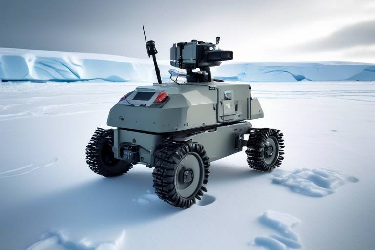
How Autonomous Drones Are Supporting Environmental Conservation Efforts
In a world where environmental challenges are escalating at an alarming rate, the advent of autonomous drones is nothing short of revolutionary. These flying marvels are not just toys for tech enthusiasts; they are powerful tools that are reshaping the way we approach environmental conservation. Imagine soaring above dense forests, capturing real-time data on endangered species, or mapping critical habitats without ever leaving a trace. This isn’t science fiction; it’s happening now, and it’s changing the game for conservationists everywhere. By leveraging advanced technology, autonomous drones are paving the way for a more sustainable future, where protecting our planet becomes not only feasible but also efficient. Let’s dive deeper into how these aerial allies are making a significant impact.
One of the most exciting applications of autonomous drones is in wildlife monitoring. Traditionally, tracking animal populations required extensive ground surveys, which often disrupted the very habitats researchers aimed to protect. Now, drones can fly over these areas, providing researchers with real-time data on animal populations and behaviors without causing disturbances. Think about it: how much more effective can conservation efforts be when we can monitor endangered species from the sky? This technology allows for a more accurate understanding of wildlife dynamics, enabling conservationists to make informed decisions that enhance survival rates for at-risk species.
Another critical function of drones is habitat mapping. With their ability to capture high-resolution images and data, drones help conservationists pinpoint essential ecosystems that require protection. By mapping habitats over time, researchers can track changes and assess the health of these environments. This is crucial for effective conservation planning and management. For instance, the ability to see how a forest is changing due to climate change or human intervention can inform strategies to mitigate these impacts. Imagine a world where we can visually track the health of our planet in real-time, making proactive decisions instead of reactive ones.
The power of drones doesn't stop at just mapping; they utilize various data collection techniques that enhance the accuracy of habitat assessments and biodiversity studies. Two of the most notable technologies include thermal imaging and multispectral sensors, both of which provide unique insights into ecosystem health.
Thermal imaging technology is particularly fascinating. It detects temperature variations in habitats, which can indicate the presence of wildlife and assess their health, especially in nocturnal species. For instance, if a specific area shows a sudden increase in temperature, it might suggest that animals are congregating there, perhaps due to a food source or water availability. This method allows researchers to gather data without intruding on the animals' natural behaviors.
On the other hand, multispectral sensors capture data across different wavelengths, providing insights into vegetation health and land cover changes. This is crucial for understanding ecosystem dynamics. By analyzing the data collected, conservationists can determine the health of plant life, which directly affects the animal populations that depend on it. The ability to monitor these changes visually and quantitatively is a game changer in conservation efforts.
However, with great data comes great responsibility. While drones offer valuable data, interpreting this information can be complex. It requires advanced analytical tools and expertise to draw meaningful conclusions. Conservationists must be equipped not only with the technology to collect data but also with the knowledge to analyze it effectively. This challenge highlights the need for collaboration between tech experts and environmental scientists to ensure the data collected leads to actionable insights.
In addition to wildlife and habitat monitoring, drones are playing a vital role in pollution monitoring. They provide aerial perspectives that help identify sources of contamination and assess the extent of environmental damage. Imagine being able to spot illegal dumping sites or track pollution spread in real-time; drones make this possible.
Utilizing drones for air quality assessment allows for efficient and comprehensive data collection across large areas. By mapping air quality, researchers can identify pollution hotspots and inform policies aimed at reducing pollution levels. This kind of data is invaluable for cities striving to improve air quality and public health.
Similarly, drones equipped with sensors can analyze water quality, measuring parameters such as pH and turbidity. These measurements are essential for maintaining healthy aquatic ecosystems. By continually monitoring water bodies, conservationists can detect changes that could signal environmental distress, allowing for timely interventions.
In disaster scenarios, autonomous drones can quickly assess damage and monitor environmental impacts, supporting emergency response efforts and aiding in recovery planning. Their ability to provide rapid assessments in the wake of natural disasters is crucial for effective resource allocation and recovery strategies.
Drones provide rapid assessment capabilities, allowing responders to gather critical information about affected areas. This real-time data can lead to more effective resource allocation, ensuring that aid reaches those who need it most. Think of drones as the first responders of the sky, providing the information necessary to save lives and restore communities.
Post-disaster, drones can facilitate long-term environmental monitoring to evaluate recovery progress and the effectiveness of restoration efforts. By consistently gathering data, conservationists can ensure that ecosystems are restored to their natural state, allowing for a more resilient environment in the future.
- How do drones collect data for environmental conservation? Drones collect data using various techniques such as thermal imaging and multispectral sensors, providing insights into wildlife behavior, habitat health, and pollution levels.
- Are drones safe for wildlife? Yes, when used correctly, drones can monitor wildlife without disturbing their natural habitats, allowing for more effective conservation efforts.
- What are the limitations of using drones in conservation? While drones provide valuable data, interpreting this information can be complex and requires expertise and advanced analytical tools.
- Can drones help in disaster response? Absolutely! Drones can quickly assess damage and monitor environmental impacts, aiding in emergency response and recovery planning.
Wildlife Monitoring
Autonomous drones are transforming wildlife monitoring in ways that were once thought to be the stuff of science fiction. Imagine soaring above lush forests or sweeping savannas, capturing real-time data on animal populations and their behaviors without ever disturbing their natural habitats. This revolutionary technology allows researchers to track endangered species, monitor migration patterns, and gather invaluable data that was previously difficult or impossible to obtain.
One of the most exciting aspects of drone technology is its ability to cover vast areas quickly and efficiently. Traditional wildlife monitoring methods often involve foot patrols or stationary cameras, which can be time-consuming and disruptive to wildlife. Drones, on the other hand, can fly over these areas, providing a bird's-eye view that can reveal hidden patterns and behaviors. For instance, researchers can observe how animals interact with their environment, such as their feeding habits, breeding grounds, and social structures.
Moreover, the integration of advanced technologies into drones, such as thermal imaging and GPS tracking, enhances their capabilities even further. These tools allow scientists to gather precise data on animal locations and behaviors, leading to more informed conservation strategies. For example, thermal imaging can help detect animals at night, offering insights into the activities of nocturnal species that are often overlooked in daytime surveys.
To illustrate the impact of drone technology on wildlife monitoring, consider the following table that highlights some key benefits:
| Benefit | Description |
|---|---|
| Non-Intrusive | Drones can monitor wildlife without disturbing their natural behaviors, leading to more accurate data. |
| Real-Time Data | Researchers receive immediate feedback on animal populations and movements, allowing for timely interventions. |
| Cost-Effective | Using drones reduces the need for extensive manpower and resources typically required for wildlife surveys. |
| Access to Remote Areas | Drones can reach locations that are difficult or dangerous for humans to access, providing new opportunities for research. |
In addition to these benefits, drones can also assist in managing wildlife-human conflicts. By monitoring animal movements, conservationists can predict potential encounters with human populations, enabling proactive measures to mitigate conflicts. For example, if a herd of elephants is tracked moving toward agricultural land, local farmers can be alerted in advance, allowing them to take precautions to protect their crops.
As we continue to explore the capabilities of autonomous drones in wildlife monitoring, it becomes clear that they are not just a tool but a game-changer in conservation efforts. They represent a new frontier in the way we understand and protect our planet's biodiversity. So, the next time you hear about drones buzzing overhead, remember that they might just be helping to safeguard the future of our precious wildlife.
Habitat Mapping
Autonomous drones are at the forefront of , revolutionizing the way conservationists understand and manage ecosystems. By utilizing cutting-edge technology, these drones offer a bird's-eye view of landscapes, enabling researchers to identify critical habitats with unparalleled precision. Imagine having the ability to survey vast stretches of land in a fraction of the time it would take on foot! This capability is not just a convenience; it's a game-changer for effective conservation planning and management.
One of the most significant advantages of using drones for habitat mapping is their ability to capture high-resolution imagery and data. This data is essential for monitoring changes over time, such as the effects of climate change, urban development, and natural disasters on ecosystems. With drones, conservationists can create detailed maps that highlight areas of concern, such as habitat fragmentation or degradation, which are vital for the survival of many species. By pinpointing these areas, targeted conservation efforts can be implemented more effectively.
Drones also facilitate the collection of diverse types of data, which enhances habitat assessments. For instance, they can be equipped with various sensors that gather information about vegetation cover, soil health, and even wildlife presence. This multi-faceted approach allows for a comprehensive understanding of an ecosystem's health. Here’s a quick look at some of the key data collection techniques employed by drones in habitat mapping:
- High-resolution aerial imagery: Provides detailed views of vegetation types and land use.
- LiDAR technology: Measures distances to the Earth’s surface, creating 3D models of terrain.
- Multispectral imaging: Captures data across various wavelengths to assess plant health and land cover.
Moreover, the integration of thermal imaging into drone technology allows for even more sophisticated habitat mapping. This technology can detect temperature variations in the environment, which can be indicative of wildlife presence. For example, if a drone identifies a specific area with a notable temperature difference, it may suggest the presence of a burrow or nest, providing vital information for wildlife studies. This is particularly useful for nocturnal species that are often difficult to observe during daylight hours.
As conservationists continue to embrace drone technology, they are also facing challenges related to data interpretation. While drones can collect vast amounts of data, making sense of this information requires advanced analytical tools and expertise. Conservationists must be equipped to analyze the data effectively to draw meaningful conclusions that can inform conservation strategies. This is where collaboration with data scientists and ecologists becomes crucial, as they can help translate complex data into actionable insights.
In summary, the role of autonomous drones in habitat mapping cannot be overstated. By providing detailed, real-time data, they empower conservationists to make informed decisions that can positively impact ecosystems. As technology continues to evolve, we can expect even more innovative applications of drones in the field of environmental conservation, paving the way for a more sustainable future.
Q1: How do drones improve habitat mapping compared to traditional methods?
A1: Drones provide high-resolution imagery and data collection over large areas quickly and efficiently, allowing for more precise monitoring of ecosystems than traditional ground surveys.
Q2: What types of sensors can be used on drones for habitat mapping?
A2: Drones can be equipped with high-resolution cameras, LiDAR, thermal imaging, and multispectral sensors to gather comprehensive data about vegetation, wildlife, and land cover.
Q3: Are there any limitations to using drones for habitat mapping?
A3: Yes, while drones can collect vast amounts of data, interpreting this information requires specialized skills and tools. Additionally, weather conditions can impact drone operations.
Data Collection Techniques
When it comes to understanding our environment, employed by autonomous drones are nothing short of revolutionary. These flying marvels are equipped with cutting-edge technology that allows them to gather a plethora of information in ways that were previously unimaginable. Imagine a bird's-eye view of the earth, revealing secrets hidden from the ground, and that's precisely what drones do!
One of the most fascinating aspects of drone technology is its ability to utilize thermal imaging and multispectral sensors. These tools enhance the accuracy of habitat assessments and biodiversity studies, making them invaluable for conservationists. For instance, thermal imaging helps detect temperature variations in habitats, which can indicate the presence of wildlife. This is particularly useful for studying nocturnal species that are often elusive and difficult to observe during daylight hours.
Moreover, multispectral sensors capture data across various wavelengths. This capability provides insights into vegetation health and land cover changes, which are crucial for understanding ecosystem dynamics. By analyzing the data collected from these sensors, researchers can monitor how ecosystems respond to environmental stressors, such as climate change or human activity.
To give you a clearer picture, let's break down how these techniques work:
| Technique | Description | Application |
|---|---|---|
| Thermal Imaging | Detects temperature variations in habitats | Identifying wildlife presence and health |
| Multispectral Sensors | Captures data across different wavelengths | Assessing vegetation health and land cover changes |
However, it's important to note that while drones provide a wealth of data, interpreting this information can be quite complex. It requires advanced analytical tools and expertise to draw meaningful conclusions. Conservationists must sift through vast amounts of data to identify trends and make informed decisions. This is where the collaboration between technology and human expertise truly shines, as experts work alongside these machines to unveil the mysteries of our ecosystems.
In conclusion, the data collection techniques utilized by autonomous drones not only enhance our understanding of wildlife and habitats but also pave the way for more effective conservation strategies. As we continue to refine these technologies and improve our analytical capabilities, the potential for making a significant impact on environmental conservation becomes even more promising.
- What types of data can drones collect for environmental conservation?
Drones can collect various types of data including thermal images, multispectral data, air and water quality measurements, and high-resolution photographs of habitats. - How do drones help in monitoring endangered species?
By providing real-time data on animal populations and behaviors without disturbing their natural habitats, drones enable researchers to track endangered species more effectively. - Are there any challenges in using drones for data collection?
Yes, while drones can gather extensive data, interpreting that data accurately requires advanced analytical tools and expertise.
Thermal Imaging
Thermal imaging technology has emerged as a game-changer in the field of environmental conservation, particularly when it comes to wildlife monitoring. Imagine being able to "see" the invisible; that’s precisely what thermal imaging does by detecting infrared radiation emitted by objects, which translates into heat. This capability allows researchers to identify the presence of wildlife, even in the darkest of nights, without causing any disruption to their natural behaviors. It's like having a superpower that lets you peek into the secret lives of animals while they go about their routines undisturbed.
One of the most significant advantages of thermal imaging is its ability to detect temperature variations in various habitats. For instance, if a particular area is significantly warmer, it may indicate the presence of a nest or a group of animals seeking shelter. This information is crucial for conservationists who are tracking endangered species or studying animal behavior. By understanding where animals are, how they interact with their environment, and even their health status, conservationists can make informed decisions about protection and management strategies.
Moreover, thermal imaging is not just limited to identifying wildlife; it can also provide insights into the health of ecosystems. For example, researchers can assess the thermal signatures of different vegetation types, which may indicate their health and vitality. Healthy plants generally have a different thermal profile compared to stressed or diseased ones. This information can be invaluable for conservationists aiming to monitor the health of entire ecosystems over time.
However, the use of thermal imaging does come with its own set of challenges. The data collected can be complex and may require sophisticated analytical tools to interpret accurately. Conservationists need to be well-versed in both the technology and the ecological principles at play to draw meaningful conclusions from the thermal data. In this sense, while drones equipped with thermal imaging are incredibly powerful tools, they are only as effective as the experts who operate them.
In summary, thermal imaging technology is revolutionizing how we monitor wildlife and assess ecosystem health. Its ability to reveal hidden patterns in animal behavior and habitat conditions makes it an indispensable asset in the fight for environmental conservation. As we continue to refine these technologies and improve our understanding of their applications, the potential for thermal imaging in conservation efforts will only grow, paving the way for more effective and sustainable practices in preserving our planet's biodiversity.
- What is thermal imaging? Thermal imaging is a technology that detects infrared radiation (heat) emitted by objects, allowing for the visualization of temperature differences in the environment.
- How do drones use thermal imaging? Drones equipped with thermal cameras can monitor wildlife and habitats by capturing thermal data, which helps in identifying animal presence and assessing ecosystem health.
- What are the benefits of using thermal imaging in conservation? Thermal imaging provides non-invasive monitoring of wildlife, helps identify critical habitats, and aids in assessing the health of ecosystems without disturbing the natural environment.
- Are there any challenges associated with thermal imaging? Yes, interpreting thermal data can be complex and requires expertise in both the technology and ecological principles to draw meaningful conclusions.
Multispectral Sensors
This article explores the innovative ways autonomous drones are revolutionizing environmental conservation, from monitoring wildlife to assessing ecosystem health, and highlights their potential for future sustainability initiatives.
Autonomous drones are transforming wildlife monitoring by providing real-time data on animal populations and behaviors, enabling researchers to track endangered species without disturbing their natural habitats.
Drones facilitate precise habitat mapping, allowing conservationists to identify critical ecosystems and monitor changes over time, which is essential for effective conservation planning and management.
Various data collection techniques employed by drones, such as thermal imaging and multispectral sensors, enhance the accuracy of habitat assessments and biodiversity studies.
Thermal imaging technology helps detect temperature variations in habitats, which can indicate the presence of wildlife and assess their health, particularly in nocturnal species.
Multispectral sensors are a game-changer in the realm of environmental monitoring. These sophisticated devices capture data across multiple wavelengths of light, allowing researchers to analyze various aspects of the ecosystem in unprecedented detail. By measuring reflected light from surfaces, multispectral sensors provide critical insights into vegetation health, soil conditions, and land cover changes. This information is crucial for understanding ecosystem dynamics and making informed conservation decisions.
For instance, when a multispectral sensor is employed over a forested area, it can differentiate between healthy and stressed vegetation. This capability enables conservationists to pinpoint areas that may require intervention, such as reforestation or pest control. The data gathered can also be used to track changes over time, making it easier to assess the impact of conservation efforts.
To illustrate the importance of multispectral sensors in conservation, consider the following table that summarizes their key applications:
| Application | Description |
|---|---|
| Vegetation Health Monitoring | Identifies stressed plants and monitors overall ecosystem health. |
| Land Use Change Detection | Tracks changes in land cover, helping to identify urban sprawl or deforestation. |
| Biodiversity Assessments | Facilitates the study of species diversity and habitat conditions. |
Moreover, the integration of multispectral sensors with autonomous drones allows for efficient data collection over vast areas, which would be time-consuming and labor-intensive if done manually. This efficiency not only saves time but also reduces costs associated with traditional survey methods. As technology continues to advance, the potential for multispectral sensors to contribute to environmental conservation is boundless, promising a future where we can better protect our planet's precious resources.
Drones play a vital role in pollution monitoring by providing aerial perspectives that help identify sources of contamination and assess the extent of environmental damage.
Utilizing drones for air quality assessment allows for efficient and comprehensive data collection across large areas, informing policies aimed at reducing pollution levels.
Drones equipped with sensors can also analyze water quality, measuring parameters such as pH and turbidity, which are essential for maintaining healthy aquatic ecosystems.
In disaster scenarios, autonomous drones can quickly assess damage and monitor environmental impacts, supporting emergency response efforts and aiding in recovery planning.
Drones provide rapid assessment capabilities, allowing responders to gather critical information about affected areas, leading to more effective resource allocation and recovery strategies.
Post-disaster, drones can facilitate long-term environmental monitoring to evaluate recovery progress and the effectiveness of restoration efforts, ensuring ecosystems are restored to their natural state.
- What are autonomous drones? Autonomous drones are unmanned aerial vehicles that can operate independently, using onboard sensors and software to perform tasks without human intervention.
- How do drones help in wildlife conservation? Drones provide real-time data on wildlife populations and behaviors, allowing researchers to monitor endangered species and their habitats without causing disturbance.
- What is multispectral imaging? Multispectral imaging captures data across different wavelengths, providing insights into vegetation health, land cover, and other ecological indicators.
- Can drones monitor pollution? Yes, drones can assess air and water quality, helping to identify pollution sources and track environmental changes over time.
Challenges in Data Interpretation
While the deployment of autonomous drones has ushered in a new era of data collection for environmental conservation, it's important to recognize that interpreting this data poses significant challenges. Imagine you have a treasure map filled with intricate details, but without the right tools or knowledge, finding the treasure becomes nearly impossible. Similarly, the data gathered by drones can be vast and complex, requiring advanced analytical skills and tools to extract meaningful insights.
One of the primary challenges lies in the sheer volume of data that these drones can collect. For instance, a single flight can generate hundreds of gigabytes of information, including images, thermal readings, and multispectral data. Without proper data management systems in place, sifting through this mountain of information can become a daunting task. Researchers often find themselves overwhelmed, struggling to pinpoint the most relevant data that can inform conservation strategies.
Moreover, the diversity of data types collected adds another layer of complexity. Drones can capture everything from high-resolution images to temperature variations and vegetation indices. Each data type requires different interpretation methods. For example, analyzing thermal images necessitates an understanding of how temperature fluctuations correlate with wildlife presence, while multispectral data demands knowledge of plant health indicators. This multifaceted nature of data requires a multidisciplinary approach, often necessitating collaboration among ecologists, data scientists, and statisticians.
To illustrate this further, consider the following table that outlines some common data types collected by drones and their associated interpretation challenges:
| Data Type | Challenges in Interpretation |
|---|---|
| Thermal Imaging | Requires understanding of thermal properties and wildlife behavior to draw accurate conclusions. |
| Multispectral Data | Needs expertise in remote sensing to interpret vegetation health and land cover changes accurately. |
| High-Resolution Imagery | Analysis can be time-consuming and requires image processing skills to identify relevant features. |
Additionally, the integration of data from multiple sources can complicate the interpretation process. For instance, combining drone data with satellite imagery or ground-based observations can provide a more comprehensive view of an ecosystem. However, aligning these datasets often involves dealing with discrepancies in resolution, timing, and measurement techniques, which can lead to potential misinterpretations.
Finally, the need for continuous training and skill development cannot be overstated. As technology evolves, so too must the skill set of those interpreting the data. Conservationists and researchers must stay updated on the latest analytical techniques and software tools to ensure they can effectively utilize the data collected by drones. This ongoing education is essential to maximize the potential of drone technology in conservation efforts.
- What types of data can drones collect for environmental conservation?
Drones can collect various types of data, including thermal images, multispectral data, and high-resolution photographs, all of which provide valuable insights into wildlife and ecosystem health. - How do drones improve wildlife monitoring?
Drones allow for real-time monitoring of wildlife populations without disturbing their natural habitats, enabling researchers to track endangered species more effectively. - What are the limitations of using drones in conservation?
While drones provide significant advantages, challenges in data interpretation, integration, and the need for specialized skills can limit their effectiveness.
Pollution Monitoring
In today's world, where environmental concerns are at an all-time high, autonomous drones are stepping up to the plate, playing a crucial role in pollution monitoring. Imagine having a bird's-eye view that can spot pollution sources, assess damage, and track changes in the environment—all without the need for human intervention. This innovative technology not only enhances our understanding of pollution but also empowers us to take action before it's too late.
One of the most significant advantages of using drones for pollution monitoring is their ability to cover vast areas quickly and efficiently. Traditional methods of monitoring often involve labor-intensive field studies, which can be time-consuming and costly. In contrast, drones can soar above the landscape, capturing high-resolution images and data that provide invaluable insights into environmental health. For instance, they can identify industrial discharge points, illegal dumping sites, and even track the spread of contaminants in real-time.
Moreover, air quality assessment is one of the primary functions of drones in pollution monitoring. Equipped with advanced sensors, these drones can measure various air quality parameters, including levels of particulate matter, nitrogen dioxide, and ozone. This data is crucial for informing local communities and governments about pollution hotspots and trends. By providing a comprehensive overview of air quality across different regions, drones help drive policies aimed at reducing pollution levels, ultimately leading to healthier environments.
In addition to air quality, drones are also making waves in water quality analysis. By utilizing specialized sensors, drones can analyze water bodies for critical parameters such as pH, turbidity, and dissolved oxygen levels. These measurements are essential for maintaining healthy aquatic ecosystems. For example, if a drone detects a spike in turbidity, it may indicate runoff from construction sites or agricultural fields, prompting immediate investigation and remediation efforts.
To illustrate the impact of drones on pollution monitoring, consider the following table that summarizes the key benefits:
| Benefit | Description |
|---|---|
| Efficiency | Drones can cover large areas quickly, reducing the time and cost associated with traditional monitoring methods. |
| Real-time Data | They provide real-time data, allowing for immediate responses to pollution incidents. |
| Comprehensive Coverage | Drones can access hard-to-reach areas, ensuring comprehensive environmental assessments. |
| Cost-effective | Using drones can significantly lower operational costs compared to manned aircraft or ground surveys. |
In conclusion, the role of autonomous drones in pollution monitoring is not just a trend; it's a significant leap towards a more sustainable future. By harnessing the power of technology, we can better understand and address pollution challenges, ultimately leading to healthier ecosystems and communities. As we continue to innovate and improve these technologies, the potential for drones to aid in environmental conservation will only grow stronger.
- How do drones collect air quality data? Drones are equipped with specialized sensors that measure various air pollutants, providing real-time data on air quality across different areas.
- Can drones monitor water quality? Yes, drones can analyze water bodies for key parameters such as pH and turbidity, helping to maintain healthy aquatic ecosystems.
- What are the advantages of using drones over traditional monitoring methods? Drones are more efficient, provide real-time data, can access hard-to-reach areas, and are generally more cost-effective than traditional methods.
- Are there any limitations to drone technology in pollution monitoring? While drones offer many advantages, data interpretation can be complex and requires advanced analytical tools and expertise.
Air Quality Assessment
In an age where air quality is more crucial than ever, autonomous drones are stepping up to the plate like never before. Imagine soaring high above cities, capturing data that can reveal the invisible threats lurking in the air we breathe. These drones are equipped with cutting-edge sensors that allow them to collect comprehensive air quality data over vast areas, providing insights that were once only attainable through labor-intensive ground surveys. This technological leap not only enhances our understanding of air pollution but also empowers policymakers to take decisive action.
One of the significant advantages of using drones for air quality assessment is their ability to cover large areas quickly and efficiently. Traditional methods often involve setting up stationary monitoring stations, which can be limited in scope and may not capture the variability of air quality across different locations. Drones, on the other hand, can fly over urban environments, industrial sites, and natural landscapes, gathering real-time data on a range of pollutants. This capability is particularly valuable in densely populated areas where air quality can fluctuate dramatically due to traffic, construction, and other human activities.
When it comes to the types of pollutants that drones can monitor, they can measure a variety of harmful substances, including:
- Particulate Matter (PM): Tiny particles that can penetrate deep into the lungs and cause serious health issues.
- Nitrogen Dioxide (NO2): A gas produced by vehicles and industrial processes, contributing to respiratory problems.
- Ozone (O3): While beneficial in the upper atmosphere, ground-level ozone can lead to significant health risks.
- Volatile Organic Compounds (VOCs): Emitted from various sources, including vehicles and industrial processes, these compounds can lead to smog formation.
By utilizing drones for air quality assessments, researchers can create detailed maps that visualize pollution hotspots. These maps serve as invaluable tools for local governments and environmental organizations in their efforts to mitigate pollution. For instance, if a drone identifies a high concentration of nitrogen dioxide near a busy intersection, city planners can prioritize that area for traffic management strategies or green space development to improve air quality.
Furthermore, the data collected by drones can be integrated into predictive models, allowing scientists to forecast air quality trends based on current conditions. This capability is akin to having a crystal ball for environmental health, enabling proactive measures rather than reactive responses. By understanding how weather patterns and human activities influence air quality, communities can better prepare for pollution spikes, safeguarding public health.
In conclusion, the integration of autonomous drones into air quality assessment not only revolutionizes how we monitor pollution but also enhances our ability to protect the environment and public health. As technology continues to evolve, the potential for drones in environmental conservation efforts will only expand, paving the way for a cleaner, healthier future.
- How do drones measure air quality? Drones are equipped with specialized sensors that can detect various pollutants in the air. They fly over targeted areas to collect real-time data on air quality.
- What are the benefits of using drones for air quality assessment? Drones can cover large areas quickly, provide real-time data, and create detailed pollution maps, which help in effective decision-making for air quality management.
- Are there any limitations to drone-based air quality monitoring? Yes, while drones are highly effective, they may face challenges such as battery life, regulatory restrictions, and the need for skilled operators.
Water Quality Analysis
In the realm of environmental conservation, water quality analysis has emerged as a critical area where autonomous drones are making a significant impact. These high-tech flying machines are equipped with advanced sensors that can measure various water quality parameters, such as pH levels, turbidity, dissolved oxygen, and even the presence of harmful contaminants. Imagine hovering above a lake, capturing real-time data that can inform local authorities about the health of aquatic ecosystems. It's like having a bird's-eye view of the underwater world, allowing conservationists to act swiftly and effectively.
One of the most remarkable aspects of utilizing drones for water quality analysis is their ability to cover vast areas quickly. Traditional methods of sampling water can be time-consuming and labor-intensive, often requiring teams to physically access remote locations. Drones, on the other hand, can fly over hard-to-reach water bodies, collecting samples and data without disturbing the environment. This efficiency not only saves time but also provides a more comprehensive overview of the water quality across different regions.
To illustrate the capabilities of drones in water quality analysis, consider the following parameters that can be monitored:
| Parameter | Importance |
|---|---|
| pH Level | Indicates the acidity or alkalinity of water, essential for aquatic life. |
| Turbidity | Measures water clarity; high levels can indicate pollution or sediment runoff. |
| Dissolved Oxygen | Crucial for fish and other aquatic organisms; low levels can lead to dead zones. |
| Contaminants | Identifies harmful substances like heavy metals or pesticides that threaten ecosystems. |
By utilizing drones equipped with specialized sensors, conservationists can monitor these parameters continuously, creating a dynamic picture of water health over time. This ongoing surveillance enables quick responses to changes in water quality, such as pollution events or ecological disturbances. For instance, if a sudden spike in turbidity is detected, it could indicate a nearby construction project causing runoff, prompting immediate action to mitigate the impact.
Moreover, the data collected by drones can be integrated into larger environmental monitoring systems, allowing for comprehensive analysis and reporting. This integration is vital for developing effective conservation strategies and policies. As we continue to face challenges like climate change and urbanization, the role of drones in water quality analysis is becoming increasingly indispensable.
In summary, the advent of autonomous drones in water quality analysis represents a groundbreaking shift in how we monitor and protect our aquatic ecosystems. With their ability to gather critical data efficiently and effectively, drones are not just tools; they are allies in the fight for environmental conservation.
- How do drones collect water samples? Drones can be equipped with specialized containers that collect water samples while flying over water bodies, or they can use sensors to measure water quality parameters directly.
- What are the advantages of using drones for water quality analysis? Drones offer rapid data collection, access to remote locations, reduced manpower needs, and the ability to gather comprehensive data over large areas.
- Can drones detect pollutants in real-time? Yes, drones equipped with the right sensors can monitor water quality in real-time, allowing for immediate action if pollution levels rise.
Disaster Response
In the face of calamity, every second counts. Autonomous drones are emerging as game-changers in disaster response scenarios, providing invaluable support to emergency teams. Imagine a wildfire raging through a forest or a hurricane devastating coastal towns; the ability to quickly assess the damage and monitor ongoing environmental impacts can significantly influence recovery efforts. Drones equipped with advanced imaging technology can fly over affected areas, capturing high-resolution images and real-time data that inform first responders about the extent of the destruction.
One of the standout features of drones in disaster response is their rapid assessment capabilities. Traditional methods of surveying damage often involve extensive man-hours and are limited by accessibility issues. Drones, on the other hand, can easily navigate hazardous environments, flying over debris and obstacles to gather critical information swiftly. This capability allows responders to prioritize areas that need immediate attention, ensuring that resources are allocated effectively. For instance, in the aftermath of an earthquake, drones can quickly identify collapsed structures, blocked roads, and other hazards, providing a comprehensive overview that is crucial for planning rescue operations.
Moreover, the integration of long-term monitoring into disaster response strategies is another area where drones excel. After the immediate crisis has passed, it’s essential to keep an eye on the environment to evaluate recovery progress and the effectiveness of restoration efforts. Drones can be deployed repeatedly over time, capturing data that reveals how ecosystems are recovering. For example, they can monitor vegetation regrowth in areas that were scorched by fire or assess water quality in rivers that may have been contaminated. This long-term data collection is vital for ensuring that ecosystems are restored to their natural state and that communities can rebuild sustainably.
To illustrate the impact of drones in disaster response, consider the following table that summarizes their key contributions:
| Drone Functionality | Benefits |
|---|---|
| Rapid Damage Assessment | Quickly identifies affected areas and prioritizes response efforts |
| Environmental Monitoring | Tracks recovery progress and assesses ecosystem health over time |
| Data Collection | Provides high-resolution imagery and real-time data for informed decision-making |
| Access to Hazardous Areas | Surveys dangerous environments without putting human lives at risk |
In summary, the role of autonomous drones in disaster response cannot be overstated. They are not just tools; they are lifelines that provide critical information in times of crisis. Whether it’s assessing damage, monitoring environmental impacts, or aiding in recovery efforts, these flying marvels are transforming the way we respond to disasters, making our efforts more efficient and effective. As technology continues to evolve, we can only expect their capabilities to grow, further enhancing our ability to protect both people and the planet.
- How do drones help in disaster response?
Drones provide rapid assessments of disaster-affected areas, allowing for quick decision-making and resource allocation. - Can drones operate in hazardous conditions?
Yes, drones are designed to navigate challenging environments, making them ideal for surveying areas that are unsafe for human responders. - What kind of data can drones collect during a disaster?
Drones can collect high-resolution images, thermal data, and environmental metrics, which are essential for understanding the extent of damage and planning recovery efforts. - Are drones used for long-term monitoring after a disaster?
Absolutely! Drones can be deployed over time to monitor recovery progress and assess the health of ecosystems impacted by disasters.
Rapid Assessment Capabilities
When disaster strikes, time is of the essence, and this is where autonomous drones truly shine. Their ability to provide rapid assessment capabilities is a game changer for emergency responders. Imagine a scenario where a natural disaster has just occurred—roads are blocked, communication lines are down, and the extent of the damage is still unknown. In such chaotic situations, deploying drones can offer a bird’s-eye view of the affected areas, allowing responders to quickly gather critical information without risking human lives.
These drones are equipped with advanced imaging technology, enabling them to capture high-resolution aerial footage and detailed data in real-time. This capability allows for immediate analysis of the situation, which can include identifying damaged infrastructure, assessing the state of affected ecosystems, and even locating stranded individuals. The data collected can be processed and shared with emergency teams almost instantaneously, leading to more informed decision-making.
For instance, let’s consider a wildfire scenario. Drones can fly over the blaze, mapping out the fire's perimeter and assessing the areas that have been affected. This information is invaluable for firefighters as it helps them strategize their containment efforts effectively. Additionally, the thermal imaging capabilities of these drones allow them to detect hotspots that might not be visible to the naked eye, ensuring that no potential flare-ups are overlooked.
Here’s a quick breakdown of how drones enhance rapid assessment capabilities:
- Real-time data collection: Drones can transmit data back to command centers as they gather it, allowing for immediate analysis and response.
- Access to hard-to-reach areas: Drones can fly over obstacles like flooded roads or landslides, providing crucial information from places that would be dangerous or impossible for humans to reach.
- Cost-effective solutions: Utilizing drones reduces the need for extensive manpower and equipment, which can be costly and time-consuming.
Moreover, the insights gained from drone assessments are not just for immediate response; they also lay the groundwork for long-term recovery strategies. After the initial chaos subsides, the data captured can be analyzed to evaluate the overall impact of the disaster on the environment. This information is vital for planning restoration efforts, ensuring that ecosystems are rehabilitated effectively and sustainably.
In summary, the rapid assessment capabilities of autonomous drones are revolutionizing disaster response. By providing instant, accurate data, they empower responders to act swiftly and strategically, ultimately saving lives and protecting the environment in the aftermath of disasters.
- How do drones collect data during a disaster? Drones are equipped with various sensors and cameras that capture high-resolution images, thermal data, and other relevant information, which is transmitted back to command centers in real-time.
- Are drones safe to use in disaster scenarios? Yes, drones are designed to operate safely in various conditions, and they can access areas that may be hazardous for humans, thus minimizing risk during assessments.
- What types of disasters can drones assist with? Drones can be utilized in various disaster scenarios, including wildfires, floods, earthquakes, and environmental contamination incidents.
- Can drones help with long-term recovery efforts? Absolutely! The data collected during rapid assessments can inform long-term restoration strategies, ensuring that ecosystems are effectively rehabilitated.
Long-term Monitoring
Long-term monitoring is crucial for understanding the resilience of ecosystems following disasters. Autonomous drones are uniquely positioned to provide ongoing surveillance, allowing conservationists and researchers to gather data over extended periods. Imagine having a bird’s-eye view of a forest recovering from a wildfire or a coral reef bouncing back after bleaching. Drones facilitate this by regularly capturing high-resolution images and data, enabling scientists to track changes in vegetation, wildlife populations, and overall ecosystem health.
One of the most significant advantages of using drones for long-term monitoring is their ability to cover large areas quickly and efficiently. Traditional methods of monitoring, such as ground surveys, can be time-consuming and labor-intensive. Drones, on the other hand, can be deployed rapidly and can operate in environments that may be challenging for human surveyors. This capability allows for more frequent data collection, which is essential for identifying trends and understanding the recovery trajectory of ecosystems.
In the aftermath of a disaster, the data collected by drones can be invaluable. For instance, they can help assess the effectiveness of restoration efforts by comparing pre- and post-disaster conditions. By analyzing this data, conservationists can determine which strategies are working and which ones need adjustment. Moreover, drones can monitor invasive species that may proliferate in disturbed areas, providing timely information that can lead to proactive management strategies.
As we look toward the future, the integration of advanced technologies, such as artificial intelligence and machine learning, will further enhance the capabilities of drones in long-term monitoring. These technologies can analyze vast amounts of data more quickly, identifying patterns and anomalies that human analysts might miss. This means that conservationists can make informed decisions faster, ultimately leading to more effective conservation practices.
To illustrate the impact of long-term monitoring using drones, consider the following table that outlines some key benefits:
| Benefit | Description |
|---|---|
| Efficiency | Drones can cover large areas in a short amount of time, providing timely data collection. |
| Cost-Effectiveness | Reduces the need for extensive ground surveys, saving time and resources. |
| Data Accuracy | High-resolution imagery and advanced sensors lead to precise data collection. |
| Flexibility | Drones can operate in various terrains and conditions, accessing hard-to-reach areas. |
In conclusion, the role of autonomous drones in long-term monitoring is not just a passing trend; it’s a game-changer for environmental conservation. By providing continuous, detailed insights into ecosystem health, drones empower conservationists to make informed decisions that can significantly impact recovery efforts and sustainability initiatives. As technology continues to advance, the potential for drones to contribute to long-term ecological monitoring will only grow, paving the way for a more sustainable future.
- How do drones contribute to long-term environmental monitoring?
Drones provide consistent and efficient data collection over time, allowing for the assessment of ecosystem health and recovery after disturbances.
- What types of data can drones collect for monitoring purposes?
Drones can collect various types of data, including high-resolution images, temperature readings, and vegetation health metrics using multispectral sensors.
- Are drones safe to use in wildlife monitoring?
Yes, when used responsibly, drones can monitor wildlife without disturbing their natural habitats, providing crucial data for conservation efforts.
- What challenges do drones face in long-term monitoring?
Challenges include data interpretation complexities and the need for advanced analytical tools to make sense of the vast amounts of data collected.
Frequently Asked Questions
- What are autonomous drones used for in environmental conservation?
Autonomous drones are utilized for various purposes in environmental conservation, including wildlife monitoring, habitat mapping, pollution monitoring, and disaster response. They provide real-time data and insights that help researchers and conservationists make informed decisions without disturbing natural habitats.
- How do drones assist in wildlife monitoring?
Drones enable researchers to track endangered species and monitor animal populations by capturing real-time data on their behaviors. This technology allows for non-intrusive observation, ensuring that wildlife remains undisturbed while still gathering essential information for conservation efforts.
- What data collection techniques do drones use?
Drones employ various advanced data collection techniques such as thermal imaging and multispectral sensors. Thermal imaging helps detect wildlife through temperature variations, while multispectral sensors analyze vegetation health and land cover changes, providing a comprehensive view of ecosystem dynamics.
- Can drones help in monitoring pollution?
Absolutely! Drones play a crucial role in pollution monitoring by offering aerial perspectives to identify contamination sources and assess environmental damage. They can efficiently collect air and water quality data, which informs policies aimed at reducing pollution levels.
- How do drones aid in disaster response?
In disaster scenarios, drones are invaluable for rapid assessment of damage and environmental impacts. They allow responders to gather critical information quickly, leading to more effective resource allocation and recovery strategies. Additionally, drones can facilitate long-term monitoring post-disaster to track recovery progress.
- What challenges are associated with drone data interpretation?
While drones provide valuable data, interpreting this information can be complex. It often requires advanced analytical tools and expertise to draw meaningful conclusions. Understanding the context and nuances of the data is essential for making informed conservation decisions.