The Use of Autonomous Drones for Enhancing Habitat Restoration
This article explores the innovative application of autonomous drones in habitat restoration, detailing their benefits, technology, and the challenges faced in implementing these advanced tools for environmental conservation.
Autonomous drones are transforming various industries, including environmental conservation. These remarkable machines, often referred to as unmanned aerial vehicles (UAVs), operate without direct human control, relying instead on advanced algorithms and sensors to navigate and perform tasks. Imagine a bird soaring high above, effortlessly capturing data and images while you sit back and watch the magic unfold. This technology is not just a novelty; it plays a crucial role in habitat restoration efforts.
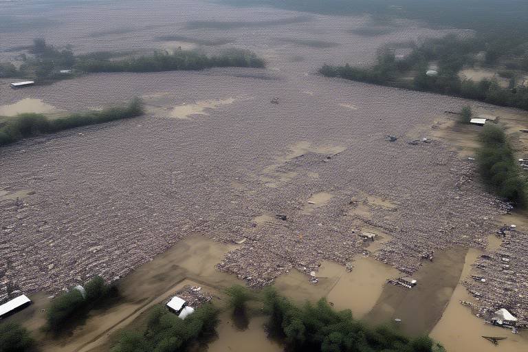
By providing a bird's-eye view of our ecosystems, drones can easily identify areas that need attention, such as degraded landscapes or polluted waterways. They can cover vast areas in a fraction of the time it would take a human team, making them invaluable in the fight against environmental degradation. As we delve deeper into this topic, let's explore the myriad ways these drones enhance conservation strategies.
Drones offer a plethora of advantages in habitat restoration, and their impact is nothing short of revolutionary. First and foremost, they bring efficiency to the table. Traditional methods of surveying land can be labor-intensive and time-consuming. With drones, conservationists can collect data swiftly and accurately, allowing for quicker decision-making.
Moreover, drones are cost-effective. They reduce the need for extensive manpower and expensive equipment, making it feasible for organizations with limited budgets to engage in significant restoration projects. For example, a drone can cover large swathes of land at a fraction of the cost of hiring a helicopter or conducting ground surveys.
Additionally, drones excel in data collection. Equipped with high-resolution cameras and various sensors, they can gather vital information on vegetation health, soil composition, and wildlife populations. This data is crucial for assessing the effectiveness of restoration efforts and making necessary adjustments. In summary, the benefits of using drones in habitat restoration include:
- Increased efficiency in data collection and monitoring.
- Cost savings compared to traditional methods.
- Enhanced data collection capabilities for informed decision-making.
Recent advancements in drone technology have significantly enhanced their functionality and usability in habitat restoration. These innovations are akin to upgrading a smartphone; each new feature opens up a world of possibilities. For instance, the integration of high-resolution imaging capabilities allows drones to capture detailed aerial imagery, which is crucial for assessing ecosystem health.
High-resolution images can reveal subtle changes in vegetation, helping conservationists monitor restoration progress over time. This technology aids in identifying problem areas that require immediate attention, thus ensuring that restoration efforts are both timely and effective.
Imagine being able to see every leaf on a tree from hundreds of feet in the air! High-resolution imaging offers that level of detail, enabling conservationists to make data-driven decisions. This technology not only enhances monitoring but also facilitates the creation of stunning visual reports that can be shared with stakeholders to garner support for restoration initiatives.
Drones equipped with advanced mapping tools provide accurate topographical data for restoration projects. These tools are essential for creating detailed maps that guide restoration efforts. Precise mapping is crucial for planning and executing habitat restoration, as it allows conservationists to understand the lay of the land, identify key areas for intervention, and track changes over time.
In many ways, drones act like modern-day treasure maps, leading us to the hidden gems of our ecosystems that need care and attention.
Despite the numerous advantages, several challenges hinder the widespread use of drones in habitat restoration. Regulatory hurdles can be a significant barrier, as many countries have strict laws governing drone flights. These regulations are often put in place for safety and privacy reasons, but they can also slow down crucial conservation efforts.
Technical issues, such as battery life and payload capacity, can limit the effectiveness of drones in larger projects. Additionally, logistical challenges, including the need for trained personnel to operate these drones, can complicate their implementation. Overcoming these challenges is essential for maximizing the potential of drones in habitat restoration.
Various successful case studies showcase the effective use of drones in habitat restoration. One notable example is the use of drones in the restoration of wetlands in California. By mapping the area and monitoring vegetation growth, conservationists were able to implement targeted interventions that significantly improved the health of the ecosystem.
Another inspiring case involves the use of drones to plant trees in deforested areas. Drones equipped with seed-sowing technology can cover large areas quickly, leading to faster reforestation efforts. These real-world examples illustrate the tangible impact of drones on environmental recovery efforts.
As technology continues to evolve, the role of drones in environmental conservation is expected to expand. Future trends may include the development of drones with enhanced AI capabilities, allowing them to make real-time decisions based on the data they collect. Imagine a drone that can autonomously identify invasive species and take action to mitigate their spread!
Moreover, advancements in battery technology could increase flight times and payload capacities, enabling drones to tackle even larger restoration projects. The future of drones in habitat restoration is bright, and their potential to revolutionize conservation efforts is limitless.
Q: How do drones contribute to habitat restoration?
A: Drones enhance habitat restoration by providing efficient data collection, mapping, and monitoring capabilities, allowing for more informed decision-making.
Q: What are the main challenges of using drones in conservation?
A: Key challenges include regulatory hurdles, technical limitations, and logistical issues related to training and operation.
Q: Can drones be used for tree planting?
A: Yes, drones equipped with seed-sowing technology can effectively plant trees in deforested areas, speeding up reforestation efforts.
Introduction to Autonomous Drones
Autonomous drones, often referred to as unmanned aerial vehicles (UAVs), are revolutionizing the way we approach various challenges in environmental conservation, particularly in habitat restoration. Imagine a bird's-eye view of the world, where technology allows us to observe, analyze, and restore ecosystems from above. These flying machines are equipped with sophisticated sensors and cameras, enabling them to gather valuable data without the need for human intervention. This innovation is not just a technological marvel; it's a game-changer for conservationists who are striving to revitalize damaged habitats.
So, what exactly makes autonomous drones so significant in the realm of habitat restoration? For starters, they can cover vast areas in a fraction of the time it would take traditional methods. This efficiency is crucial when you consider the urgency of many conservation efforts. With the ability to fly over rugged terrains, dense forests, and even remote islands, drones can access hard-to-reach locations that would be challenging for ground crews. Their versatility allows them to operate in various environments, making them indispensable tools for environmentalists.
Moreover, the significance of these drones extends beyond mere convenience. They provide a level of precision that is often unattainable through conventional methods. Equipped with high-resolution cameras and advanced mapping technologies, drones can capture detailed images and data that help assess the health of ecosystems. This capability is vital for identifying areas that require restoration, monitoring changes over time, and evaluating the effectiveness of conservation strategies.
As we delve deeper into the world of autonomous drones, it's essential to recognize the various components that contribute to their functionality. These include:
- GPS Technology: Ensures accurate navigation and positioning.
- Data Analytics: Processes the information collected to yield actionable insights.
- High-Resolution Imaging: Captures detailed visuals for better assessment of habitats.
The integration of these technologies not only enhances the operational capabilities of drones but also significantly improves the outcomes of habitat restoration projects. By leveraging the power of autonomous drones, conservationists can implement more effective strategies, ultimately leading to healthier ecosystems and a more sustainable future.
Benefits of Using Drones in Habitat Restoration
When it comes to habitat restoration, the introduction of autonomous drones has been nothing short of revolutionary. Imagine having a bird's-eye view of the landscape, allowing conservationists to assess and monitor ecosystems more effectively than ever before. Drones provide a unique perspective that traditional methods simply cannot match. They enable us to gather data quickly and accurately, which is crucial for making informed decisions about restoration projects.
One of the most significant benefits of using drones is their efficiency. Traditional methods of surveying and monitoring habitats often involve labor-intensive processes that can take weeks or even months to complete. In contrast, drones can cover large areas in a fraction of the time. For instance, a drone can survey a section of forest or wetland in a matter of hours, capturing invaluable data that would take ground teams days to collect. This rapid data collection accelerates the restoration process, allowing for timely interventions when ecosystems are threatened.
Moreover, drones are incredibly cost-effective. The initial investment in drone technology may seem daunting, but the long-term savings are undeniable. By reducing the need for extensive manpower and minimizing the time spent on surveys, organizations can allocate their resources more efficiently. For example, consider the cost breakdown:
| Method | Time Required | Estimated Cost |
|---|---|---|
| Ground Surveys | Weeks | High |
| Drones | Hours | Low |
In addition to time and cost savings, drones possess remarkable data collection capabilities. They are equipped with advanced sensors and cameras that can capture high-resolution images and gather various types of data, such as thermal imaging and multispectral analysis. This allows scientists to monitor vegetation health, track wildlife populations, and assess the impacts of climate change on different habitats. With drones, we can gather data that is not only comprehensive but also precise, leading to better-informed conservation strategies.
Furthermore, drones enhance the ability to conduct risk assessments. Before undertaking any restoration project, it’s essential to understand the current state of the ecosystem. Drones can quickly identify areas that are at risk of degradation or are already suffering from environmental stressors. By pinpointing these areas, conservationists can prioritize their efforts and allocate resources where they are most needed.
Lastly, the use of drones in habitat restoration fosters greater community engagement. With the stunning visuals captured from the sky, organizations can tell compelling stories about their conservation efforts. This not only raises awareness but also encourages community involvement, whether through volunteer opportunities or fundraising initiatives. When people see the impact of their contributions from a bird's-eye view, it creates a powerful connection that motivates continued support for habitat restoration projects.
In summary, the benefits of using drones in habitat restoration are multifaceted. From efficiency and cost-effectiveness to enhanced data collection and community engagement, these advanced tools are transforming how we approach environmental conservation. With the ability to gather precise data quickly and effectively, drones are paving the way for a more sustainable future.
- How do drones help in monitoring ecosystem health?
Drones capture high-resolution imagery and various data types that allow for detailed assessments of vegetation health, wildlife populations, and environmental changes. - Are drones expensive to operate?
While there is an initial investment, drones are generally more cost-effective than traditional survey methods due to reduced labor costs and time savings. - Can anyone operate a drone for habitat restoration?
While basic drone operation may be accessible, specialized training is recommended for effective data collection and compliance with regulations.
Technological Innovations in Drone Design
In recent years, the landscape of drone technology has undergone a remarkable transformation, particularly in the realm of habitat restoration. These technological innovations are not just enhancing the capabilities of drones; they are revolutionizing the way we approach environmental conservation. Imagine a world where drones are equipped with cutting-edge features that allow them to perform complex tasks with precision and efficiency. This is no longer a distant dream but a reality that is unfolding before our eyes.
One of the most significant advancements in drone design is the integration of high-resolution imaging technology. Drones can now capture stunningly detailed aerial imagery, which plays a crucial role in assessing the health of various ecosystems. This high-resolution capability allows conservationists to monitor changes in vegetation, track wildlife populations, and evaluate the success of restoration efforts over time. With the ability to zoom in on specific areas, these drones act like a pair of binoculars, providing insights that were once only possible through ground surveys.
Moreover, the incorporation of mapping and surveying techniques has taken drone functionality to new heights. Drones equipped with advanced mapping tools can produce accurate topographical data, essential for planning and executing habitat restoration projects. This data not only helps in identifying areas that require intervention but also assists in strategizing the most effective methods for restoration. The precision of these maps can be likened to a detailed roadmap, guiding conservationists through the complex terrain of environmental recovery.
Additionally, drones are becoming increasingly autonomous, thanks to innovations in artificial intelligence (AI) and machine learning. This means they can analyze data in real-time and make decisions without human intervention. For instance, if a drone detects an area that appears to be declining in health, it can automatically adjust its flight path to gather more data or even deploy seeds in that area to encourage regrowth. This level of autonomy not only increases efficiency but also minimizes the risk of human error, making habitat restoration efforts more reliable.
Furthermore, the development of solar-powered drones is a game-changer in the field of environmental conservation. These drones can operate for extended periods without the need for frequent recharging, allowing them to cover larger areas and gather more data. Imagine a drone soaring through the skies, powered by the sun, tirelessly working to restore habitats while contributing to sustainability efforts. This innovation not only enhances the effectiveness of habitat restoration but also aligns with the principles of environmental stewardship.
As we look to the future, the potential for further innovations in drone design is limitless. Researchers and engineers are continuously exploring ways to enhance drone capabilities, including improved battery life, advanced sensor technology, and even the possibility of swarm technology, where multiple drones work together to achieve a common goal. The idea of a swarm of drones collaborating to restore a habitat is as exciting as it is promising, opening up new avenues for conservation.
In summary, the technological innovations in drone design are paving the way for a new era in habitat restoration. From high-resolution imaging to autonomous operations and solar power, these advancements are not just enhancing efficiency but also ensuring that we can tackle the pressing challenges of environmental conservation head-on. The future looks bright, and with drones leading the charge, we are one step closer to restoring our planet's precious ecosystems.
- What are the primary uses of drones in habitat restoration? Drones are used for monitoring ecosystems, mapping terrain, and even planting seeds in restoration projects.
- How do high-resolution images help in conservation? They provide detailed insights into ecosystem health, allowing for better decision-making in restoration efforts.
- Are drones environmentally friendly? Yes, many modern drones are designed to be energy-efficient and can even be powered by renewable energy sources like solar power.
- What challenges do conservationists face when using drones? Challenges include regulatory hurdles, technical limitations, and logistical issues in remote areas.
High-Resolution Imaging
In the realm of habitat restoration, has emerged as a game-changer, revolutionizing the way we monitor and assess ecosystems. Imagine soaring high above a forest, capturing detailed images that reveal the intricate patterns of life below. This technology allows conservationists to obtain a bird's-eye view of the environment, enabling them to identify areas that need attention and track the progress of restoration efforts over time.
High-resolution imaging works by utilizing advanced cameras mounted on autonomous drones. These drones can fly at varying altitudes, providing flexibility in capturing images that are not only clear but also rich in detail. The resulting aerial imagery is crucial for understanding the health of various ecosystems, whether it’s a wetlands area, a forest, or a coastal region. By analyzing these images, conservationists can make informed decisions about where to focus their restoration efforts.
One of the most significant advantages of high-resolution imaging is its ability to detect subtle changes in the environment. For instance, it can reveal shifts in vegetation cover, the emergence of invasive species, or even changes in water quality. With this technology, restoration teams can quickly respond to these changes, adapting their strategies to ensure the success of their projects.
Additionally, high-resolution imaging can be integrated with geographic information systems (GIS) to create detailed maps that enhance planning and execution. These maps allow for precise monitoring of restoration sites, making it easier to evaluate the effectiveness of different approaches. For example, a study conducted in a coastal restoration project demonstrated how drones equipped with high-resolution cameras provided invaluable insights that led to improved planting strategies and better overall outcomes.
Furthermore, the data collected from high-resolution imaging can be shared with stakeholders, including local communities and policymakers. This transparency fosters collaboration and support for restoration initiatives, as people can visually grasp the changes occurring in their environment. By showcasing the impact of habitat restoration efforts through compelling imagery, conservationists can inspire greater community involvement and funding opportunities.
In conclusion, high-resolution imaging is not just a technological advancement; it is a vital tool that enhances habitat restoration efforts. By providing detailed insights into ecosystem health, enabling rapid responses to environmental changes, and fostering collaboration, this technology is paving the way for more effective conservation strategies. The future of habitat restoration is undoubtedly bright, as we continue to harness the power of drones and their imaging capabilities.
Mapping and Surveying Techniques
When it comes to habitat restoration, play a crucial role in ensuring that efforts are both effective and efficient. Drones equipped with advanced mapping tools have revolutionized the way conservationists collect data about ecosystems. These aerial vehicles can cover large areas in a fraction of the time it would take traditional methods, making them invaluable in the fight to restore habitats.
One of the standout features of modern drones is their ability to create high-resolution maps that provide detailed insights into the terrain and vegetation of an area. This is achieved through a combination of photogrammetry and LiDAR (Light Detection and Ranging) technologies. Photogrammetry involves taking multiple overlapping photographs from different angles and using software to stitch them together into a comprehensive map. On the other hand, LiDAR uses laser pulses to measure distances and generate precise 3D models of the landscape. The result? An incredibly detailed topographical representation that can highlight changes in elevation, vegetation density, and even water flow patterns.
These mapping techniques are not just about creating pretty pictures; they serve a practical purpose. For instance, by understanding the lay of the land, conservationists can identify critical areas that need immediate attention. This targeted approach allows for better allocation of resources and efforts, ensuring that every dollar spent on restoration yields maximum impact. Furthermore, the ability to track changes over time means that conservationists can monitor the effectiveness of their strategies and make necessary adjustments.
Moreover, the integration of drone technology with Geographic Information Systems (GIS) adds another layer of sophistication to habitat restoration projects. GIS allows for the analysis and visualization of spatial data, enabling conservationists to make informed decisions based on comprehensive data sets. By layering various types of data—such as soil quality, vegetation types, and wildlife habitats—on a single map, stakeholders can gain a holistic view of the ecosystem and its needs.
In practical terms, the process typically involves several steps:
- Planning: Defining the area of interest and determining the objectives of the mapping project.
- Data Collection: Flying the drone over the designated area to capture images or LiDAR data.
- Data Processing: Using specialized software to analyze the collected data and generate maps.
- Analysis: Interpreting the maps to identify areas that require intervention or monitoring.
As we look to the future, the potential for further advancements in mapping and surveying techniques is immense. Innovations such as real-time data processing and enhanced AI algorithms promise to make drone mapping even more precise and user-friendly. As these technologies evolve, we can expect to see an even greater impact on habitat restoration efforts, paving the way for healthier ecosystems and more sustainable practices.
Q: How do drones improve mapping accuracy in habitat restoration?
A: Drones utilize high-resolution imaging and advanced technologies like LiDAR to create detailed maps that reveal changes in terrain and vegetation, allowing for precise planning and monitoring of restoration efforts.
Q: What are the main benefits of using drones for surveying?
A: Drones offer increased efficiency, cost-effectiveness, and the ability to cover large areas quickly. They provide real-time data and can access hard-to-reach locations, making them invaluable tools for conservationists.
Q: Are there any limitations to using drones for mapping?
A: Yes, challenges include regulatory restrictions, the need for skilled operators, and potential technical issues with the drones themselves. However, ongoing advancements in technology are continually addressing these concerns.
Challenges in Implementing Drone Technology
While the integration of autonomous drones in habitat restoration presents a plethora of opportunities, it is not without its challenges. One of the major hurdles is the regulatory landscape. Many countries have strict laws governing the use of drones, especially in sensitive ecological areas. These regulations often require permits that can be time-consuming to obtain, and they may impose operational limitations that can hinder the effectiveness of drone missions. For instance, no-fly zones around certain wildlife habitats can severely restrict where drones can operate, limiting their utility in restoration projects.
Moreover, the technical challenges associated with drone technology cannot be overlooked. Although drones have come a long way in terms of functionality, they still face limitations regarding battery life and payload capacity. This means that for extensive areas requiring restoration, multiple flights may be necessary, which can complicate logistics and increase costs. Additionally, the weather can significantly impact drone operations. High winds, rain, or snow can render drones inoperable, delaying crucial restoration efforts.
Logistical issues also play a significant role in the challenges faced by conservationists. The deployment of drones often requires a skilled operator, and training personnel to operate these machines safely and effectively can be a daunting task. Furthermore, the need for data management systems to process the large amounts of information collected by drones adds another layer of complexity. Conservationists must not only be adept at flying drones but also at interpreting the data they gather and integrating it into actionable restoration strategies.
To illustrate these challenges more clearly, consider the following table that summarizes the key obstacles faced in implementing drone technology for habitat restoration:
| Challenge | Description |
|---|---|
| Regulatory Issues | Strict laws and permits required for drone operation in sensitive areas. |
| Technical Limitations | Battery life, payload capacity, and weather conditions affecting operations. |
| Logistical Concerns | Need for trained operators and data management systems. |
In conclusion, while the potential for autonomous drones in habitat restoration is vast, these challenges must be addressed to maximize their effectiveness. Understanding the regulatory frameworks, overcoming technical limitations, and streamlining logistics will be crucial steps toward making drone technology a staple in environmental conservation efforts.
Case Studies of Successful Drone Applications
The application of autonomous drones in habitat restoration is not just a futuristic concept, but a reality that has already shown promising results across various ecosystems. One of the most compelling examples comes from the California wildfires, where drones were deployed to assess the damage and aid in reforestation efforts. By utilizing high-resolution imaging, these drones mapped out the severely impacted areas, allowing teams to identify the best locations for planting native species. This targeted approach not only saved time but also increased the survival rates of the newly planted trees.
Another fascinating case study took place in the Amazon Rainforest, where drones equipped with multispectral sensors were used to monitor deforestation. These drones captured data that revealed not only the extent of tree loss but also the health of the remaining vegetation. By analyzing this information, conservationists were able to implement more effective strategies to combat illegal logging and restore the affected areas. The data collected allowed for real-time updates, ensuring that efforts were both timely and impactful.
In a different context, the Great Barrier Reef has seen drones being utilized for coral reef restoration. Researchers used drones to deploy coral larvae over degraded areas of the reef. This innovative method, known as larval seeding, allows for a more efficient distribution of coral larvae, which can enhance the natural recovery processes of the reef. The drones provided precise delivery, ensuring that the larvae reached optimal locations for growth, thereby accelerating the restoration process.
Moreover, a project in New Zealand demonstrated the potential of drones for monitoring bird populations in wetlands. Drones equipped with thermal imaging technology were able to locate and track endangered species without disturbing their habitats. This non-invasive method provided researchers with valuable data on breeding patterns and population dynamics, which is crucial for conservation planning. The success of this project highlighted the versatility of drones in various ecological contexts.
| Location | Application | Outcome |
|---|---|---|
| California | Reforestation after wildfires | Increased survival rates of planted trees |
| Amazon Rainforest | Monitoring deforestation | Effective strategies against illegal logging |
| Great Barrier Reef | Coral larvae deployment | Accelerated coral restoration |
| New Zealand | Bird population monitoring | Valuable data on endangered species |
These case studies demonstrate that the integration of drones into habitat restoration efforts is not merely a trend but a transformative approach that yields tangible results. By leveraging advanced technology, conservationists can enhance their strategies, making them more efficient and effective. As more success stories emerge, the potential for drones in environmental conservation continues to expand, paving the way for innovative solutions to some of the most pressing ecological challenges we face today.
- What types of drones are used in habitat restoration? Drones equipped with high-resolution cameras, multispectral sensors, and thermal imaging technology are commonly used for various restoration tasks.
- How do drones improve the efficiency of restoration projects? Drones can cover large areas quickly, collect detailed data, and facilitate targeted restoration efforts, ultimately saving time and resources.
- Are there any regulations regarding the use of drones for environmental purposes? Yes, regulations vary by country and region, and it's essential for organizations to comply with local laws concerning drone usage.
- Can drones be used for monitoring wildlife? Absolutely! Drones are increasingly being used to monitor wildlife populations without disturbing their natural habitats.
The Future of Drones in Environmental Conservation
As we look ahead, the future of drones in environmental conservation is not just bright; it's positively revolutionary. Imagine a world where habitat restoration is no longer a tedious, manual task but a streamlined process powered by cutting-edge technology. The integration of drones into conservation efforts is expected to evolve dramatically, paving the way for more efficient and effective approaches to environmental challenges.
One of the most exciting prospects is the advancement of artificial intelligence (AI) in drone technology. With AI, drones can analyze vast amounts of data in real-time, enabling them to make informed decisions autonomously. For instance, drones could identify areas that require immediate attention based on health assessments of ecosystems. This level of sophistication not only enhances efficiency but also allows conservationists to focus their efforts where they are needed most.
Moreover, the future will likely see an increase in collaborative drone networks. Picture a scenario where multiple drones work together, sharing data and insights to create a comprehensive picture of a habitat's health. This synergy could lead to unprecedented levels of precision in monitoring and managing ecosystems. As technology continues to advance, the potential for these collaborative systems will only grow, making habitat restoration efforts more coordinated and impactful.
In addition to AI and collaborative networks, the development of solar-powered drones is on the horizon. These eco-friendly drones will not only reduce operational costs but also minimize the carbon footprint of conservation efforts. Imagine drones that can fly longer distances without needing to recharge, allowing them to cover vast areas of land with ease. This innovation could be a game-changer in reaching remote or hard-to-access locations that are crucial for habitat restoration.
Furthermore, the use of biodegradable materials in drone construction is gaining traction. As environmental awareness grows, manufacturers are looking for ways to produce drones that are not only efficient but also sustainable. By using materials that decompose naturally, the impact of drone operations on the environment can be significantly reduced. This shift towards sustainability aligns perfectly with the overarching goals of conservationists.
As we speculate on the future, it’s also essential to consider the regulatory landscape. Governments and organizations are beginning to recognize the potential of drones in conservation, leading to the development of more supportive policies and regulations. This regulatory evolution will facilitate the integration of drones into conservation strategies, allowing for more widespread adoption and innovation.
In conclusion, the future of drones in environmental conservation is filled with possibilities. From AI-driven decision-making to collaborative networks and sustainable materials, the advancements on the horizon promise to enhance habitat restoration efforts significantly. As these technologies continue to evolve, we can expect the impact of drones on environmental conservation to be profound, making our planet a healthier place for future generations.
- How do drones improve habitat restoration? Drones enhance habitat restoration by providing efficient data collection, high-resolution imaging, and mapping capabilities, allowing conservationists to monitor ecosystems effectively.
- What are the main challenges in using drones for conservation? Challenges include regulatory hurdles, technical limitations, and logistical issues that can affect the deployment and operation of drones in various environments.
- What advancements can we expect in drone technology? Future advancements may include AI integration, solar-powered drones, and biodegradable materials, all aimed at improving efficiency and sustainability in conservation efforts.
Frequently Asked Questions
- What are autonomous drones?
Autonomous drones are unmanned aerial vehicles that operate without direct human control. They use advanced technology, including GPS and sensors, to navigate and perform tasks such as surveying land, capturing high-resolution images, and assisting in habitat restoration efforts. Think of them as flying robots that can carry out specific missions efficiently!
- How do drones benefit habitat restoration?
Drones provide several advantages in habitat restoration, such as enhanced efficiency, cost-effectiveness, and superior data collection capabilities. By covering large areas quickly, they allow conservationists to gather critical information about ecosystems, monitor changes over time, and implement targeted restoration strategies more effectively.
- What technological innovations have been made in drone design?
Recent advancements include high-resolution imaging, improved battery life, and advanced mapping tools. These innovations enable drones to capture detailed aerial imagery and provide accurate topographical data, making them indispensable for planning and executing successful habitat restoration projects.
- What challenges do conservationists face when using drones?
Despite their benefits, several challenges exist, including regulatory hurdles, technical limitations, and logistical issues. For instance, navigating airspace regulations can be tricky, and ensuring drones have the necessary capabilities for specific tasks can be a barrier to widespread adoption.
- Can you provide examples of successful drone applications in habitat restoration?
Absolutely! There are numerous case studies where drones have been effectively used, such as monitoring deforestation, mapping wetlands, and assessing wildlife habitats. These real-world examples highlight the significant impact drones can have on environmental recovery efforts.
- What does the future hold for drones in environmental conservation?
The future looks bright! As technology continues to evolve, we can expect more sophisticated drones capable of performing complex tasks in habitat restoration. Innovations like artificial intelligence and machine learning may further enhance their capabilities, making them even more valuable in the fight for environmental conservation.