How Autonomous Drones Are Supporting the Recovery of Endangered Species
This article explores the innovative use of autonomous drones in wildlife conservation, highlighting their role in monitoring, protecting, and aiding the recovery of endangered species across various ecosystems.
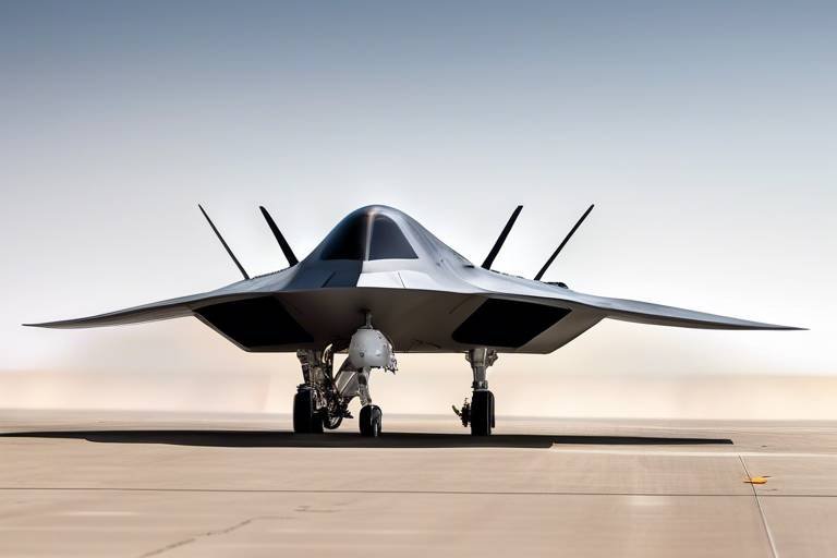
Autonomous drones have revolutionized wildlife conservation by providing efficient monitoring solutions. These unmanned aerial vehicles can cover vast areas, collecting data that is crucial for the protection of endangered species. Imagine having the ability to survey hundreds of square miles of forest or ocean in a matter of hours, all while minimizing human disturbance to the wildlife inhabiting these areas. This is the power of drones in the modern conservation toolkit.
Drones play a pivotal role in monitoring habitats where endangered species reside. Their ability to capture high-resolution images helps conservationists assess habitat conditions and identify threats such as poaching or habitat destruction. For instance, a drone equipped with a camera can fly over a protected area and provide real-time images that reveal changes in land use or the presence of illegal activities.
With advanced sensors, drones collect valuable data on species populations and their environments. This data is analyzed to inform conservation strategies and track the effectiveness of recovery efforts over time. By leveraging technologies like thermal imaging and multispectral sensors, researchers can gain insights into animal behaviors and habitat conditions that were previously difficult to monitor. This wealth of information not only aids in immediate conservation efforts but also contributes to long-term ecological studies.
One of the standout features of drones is their real-time surveillance capabilities. This allows drones to detect illegal activities, such as poaching or logging, in remote areas. Imagine a scenario where a drone captures footage of poachers in action; this immediate response can help protect vulnerable species from imminent threats, essentially acting as a guardian in the sky.
Drones can create detailed maps of ecosystems, providing insights into habitat quality and distribution. This information is essential for targeted conservation efforts and habitat restoration projects. For example, using drone technology, conservationists can create a 3D model of a forest, identifying areas that require intervention, whether it's through reforestation or protection from invasive species.
The use of drones enhances research capabilities by enabling scientists to gather data that was previously difficult to obtain. This leads to a deeper understanding of species behavior and ecology. Drones can be deployed in various environments, from dense jungles to vast oceans, collecting data that informs everything from breeding patterns to feeding habits.
Numerous case studies illustrate the successful application of drones in conservation efforts. These examples highlight the effectiveness of drones in monitoring species and habitats across different regions.
In coastal areas, drones have been used to monitor sea turtle nesting sites. This technology allows researchers to track nesting success and identify threats to these vulnerable populations. By observing nesting activities from above, researchers can gather data without disturbing the turtles, ensuring that their natural behaviors remain intact.
Drones have also been instrumental in tracking endangered bird species. By providing aerial views of nesting sites, researchers can gather critical information on breeding habits and habitat use. This method reduces the need for ground-based observation, which can be intrusive and disruptive. With drones, scientists can collect data efficiently while minimizing their impact on the species being studied.
Despite their advantages, the use of drones in conservation faces challenges. Technical limitations, regulatory issues, and the need for trained personnel can hinder their widespread adoption in wildlife recovery efforts. For instance, navigating the regulatory landscape for drone use can be complex, as conservationists must adhere to local laws and regulations, which can vary significantly between regions.
Conservationists often find themselves navigating a maze of regulations that govern drone usage. These rules can vary widely, impacting how and where drones can be deployed. Understanding these regulations is crucial for ensuring that drone operations are compliant and effective.
Drones may encounter technical challenges, such as battery life and payload capacity. These limitations can affect their operational efficiency and the types of data they can collect during missions. For example, a drone with a limited battery life may only be able to conduct short flights, which could restrict the area it can cover.
The future of drone technology in conservation looks promising, with advancements in AI and sensor technology. These innovations will enhance the capabilities of drones, making them even more effective in supporting endangered species recovery. As technology evolves, so too will the potential applications of drones in monitoring and protecting wildlife.
Integrating AI with drone technology can improve data analysis and decision-making processes. Machine learning algorithms can help identify patterns and trends in wildlife behavior, leading to more effective conservation strategies. Imagine a drone that not only collects data but also analyzes it in real-time, providing immediate insights to conservationists on the ground.
As drone technology evolves, its applications in conservation will expand. Future uses may include automated monitoring systems and enhanced communication networks for real-time data sharing among conservationists. This interconnected approach could revolutionize how conservation efforts are coordinated, making them more efficient and impactful.
- What types of drones are used in wildlife conservation?
Various types of drones are used, including quadcopters for close-range monitoring and fixed-wing drones for covering larger areas.
- How do drones help in poaching prevention?
Drones provide real-time surveillance, enabling immediate detection of poaching activities, which can then be addressed by authorities.
- Are there any risks associated with using drones in conservation?
Yes, there are risks such as regulatory compliance issues and technical challenges, but the benefits often outweigh these concerns.
Introduction to Autonomous Drones
Autonomous drones have truly revolutionized the field of wildlife conservation, offering a fresh approach to monitoring and protecting endangered species. These unmanned aerial vehicles (UAVs) are equipped with advanced technology that allows them to operate independently, covering vast and often inaccessible areas of land and sea. Imagine being able to survey a remote rainforest or a sprawling coastline without ever setting foot on the ground—this is the magic of drones!
The efficiency of these drones is unmatched. Traditional methods of wildlife monitoring often involve extensive ground surveys, which can be time-consuming and labor-intensive. In contrast, drones can capture high-resolution images and collect data in a fraction of the time, allowing conservationists to focus their efforts where they are needed most. With the ability to fly at various altitudes and angles, these drones provide a comprehensive view of habitats, enabling researchers to assess conditions that are critical for the survival of endangered species.
Furthermore, the data collected by drones is not just about numbers; it tells a story. For instance, through aerial imagery, conservationists can identify signs of habitat degradation or potential threats such as illegal logging or poaching. This immediate access to real-time data is a game-changer, as it allows for swift action to mitigate risks. The integration of advanced sensors and cameras means that drones can operate day or night, making them an invaluable tool in the fight against wildlife crime.
In summary, autonomous drones are not just a technological marvel; they are a beacon of hope for endangered species around the globe. By providing efficient and effective monitoring solutions, they empower conservationists to make informed decisions and take meaningful action. As we delve deeper into the various applications of drones in wildlife conservation, it’s clear that this technology is paving the way for a brighter future for our planet's most vulnerable inhabitants.
Monitoring Endangered Habitats
Monitoring endangered habitats is crucial for the survival of many species, and this is where autonomous drones come into play. These high-tech devices can cover vast areas that would be nearly impossible for humans to survey on foot. Imagine a bird's eye view of the landscape, capturing every detail from above! Drones equipped with advanced imaging technology can provide high-resolution images that allow conservationists to assess the health of ecosystems and the species that inhabit them. This capability is like having a superpower in the realm of wildlife conservation, enabling researchers to spot changes in habitat conditions and identify potential threats.
One of the most significant advantages of using drones for monitoring is their ability to detect issues like poaching or habitat destruction in real-time. For instance, if a drone flies over a forest and captures images of illegal logging activities, conservationists can respond almost immediately, potentially saving countless trees and the wildlife that depends on them. This proactive approach is essential in today's world, where the pressures on endangered habitats are increasing at an alarming rate.
Moreover, drones facilitate the mapping of these habitats, creating detailed representations of the landscape. These maps can reveal vital information about:
- Habitat quality
- Species distribution
- Changes over time due to environmental factors
The data collected by drones is not just about capturing pretty pictures; it’s about providing actionable insights. With the integration of advanced sensors, drones can gather information on temperature, humidity, and vegetation health, which are all critical factors in assessing habitat viability. This multi-faceted approach allows scientists to develop a comprehensive understanding of the ecosystems they are studying, ensuring that conservation efforts are based on solid evidence.
In conclusion, the role of drones in monitoring endangered habitats cannot be overstated. They offer a revolutionary way to gather data, respond to threats, and map ecosystems, ultimately contributing to the recovery of endangered species. As technology continues to evolve, we can expect drones to play an even more significant role in wildlife conservation, helping to protect our planet's most vulnerable inhabitants.
Q1: How do drones help in monitoring endangered species?
A1: Drones provide high-resolution images and real-time data that help conservationists assess habitat conditions, track species populations, and identify threats like poaching or habitat destruction.
Q2: What kind of data can drones collect?
A2: Drones can collect various types of data, including images for mapping, temperature, humidity, and vegetation health, which are crucial for understanding habitat viability.
Q3: Are there any challenges in using drones for conservation?
A3: Yes, challenges include regulatory hurdles, technical limitations like battery life, and the need for trained personnel to operate the drones effectively.
Data Collection and Analysis
The advent of autonomous drones has transformed the way we approach wildlife conservation, particularly in the realm of data collection and analysis. These high-tech aerial vehicles are equipped with advanced sensors that allow them to gather a wealth of information about endangered species and their habitats. Imagine being able to fly over vast stretches of land, capturing detailed images and data without disturbing the wildlife below. This capability is not just a technological marvel; it is a game-changer for conservationists.
One of the most significant advantages of using drones for data collection is their ability to cover large and often inaccessible areas quickly. Traditional methods of monitoring wildlife can be time-consuming and labor-intensive, often requiring teams of researchers to trek through dense forests or remote regions. In contrast, drones can soar high above these landscapes, capturing images and data in real-time. This not only saves time but also allows for more frequent monitoring, which is crucial for understanding population dynamics and habitat conditions.
Moreover, the data collected by drones is incredibly diverse. From high-resolution imagery to thermal imaging and multispectral data, these devices can provide insights into various ecological factors. For example, thermal imaging can reveal the presence of animals even in dense foliage, while multispectral sensors can assess vegetation health, helping conservationists understand the broader ecological context of endangered species. This data is then analyzed using sophisticated software, enabling researchers to identify trends and make informed decisions about conservation strategies.
To illustrate the impact of drone technology on data collection, consider the following table that summarizes the types of data drones can collect and their applications:
| Data Type | Application |
|---|---|
| High-resolution imagery | Mapping habitats and assessing land use changes |
| Thermal imaging | Detecting animal presence and monitoring body temperatures |
| Multispectral data | Analyzing vegetation health and habitat quality |
| GPS tracking | Monitoring animal movements and migration patterns |
As data collection becomes more sophisticated, the analysis phase also evolves. Conservationists can now leverage machine learning algorithms to process vast amounts of data, identifying patterns that were previously undetectable. For instance, by analyzing historical data alongside real-time drone data, researchers can predict potential threats to endangered species and devise proactive measures to mitigate these risks. This level of analysis not only enhances our understanding of wildlife but also significantly increases the chances of successful conservation efforts.
In summary, the integration of autonomous drones into wildlife conservation is a groundbreaking development. They enable efficient data collection and analysis, providing vital information that informs conservation strategies. As technology continues to advance, we can expect even more innovative uses for drones in the field of wildlife conservation, ultimately leading to better protection for endangered species.
- What types of data can drones collect in wildlife conservation? Drones can collect high-resolution imagery, thermal images, multispectral data, and GPS tracking information.
- How do drones help in monitoring endangered species? Drones can cover large areas quickly, providing real-time data that helps track species populations and habitat conditions.
- Are there any challenges associated with using drones for conservation? Yes, challenges include regulatory hurdles, technical limitations, and the need for trained personnel to operate the drones effectively.
- What is the future of drone technology in wildlife conservation? The future looks promising with advancements in AI and sensor technology, which will enhance the capabilities of drones in conservation efforts.
Real-time Surveillance
Imagine being able to monitor vast stretches of wilderness in real-time, catching illegal activities as they happen. using autonomous drones is a game changer for wildlife conservation. Equipped with advanced cameras and sensors, these drones can fly over remote areas, capturing high-definition video and images that provide a live feed to conservationists on the ground. This instant access to information allows for quick decision-making, enabling teams to respond to threats like poaching or illegal logging before they escalate.
For instance, when a drone spots suspicious activity, conservationists can mobilize local law enforcement to investigate immediately. This proactive approach not only deters potential poachers but also enhances the safety of endangered species. The effectiveness of real-time surveillance is amplified when combined with data analytics; drones can be programmed to recognize patterns in behavior, alerting conservationists to unusual activities that may indicate a problem.
Moreover, the use of drones for real-time surveillance is not just about monitoring illegal activities. It also plays a crucial role in tracking the movements of endangered species. By observing their behavior from above, researchers can gather insights into their migration patterns, feeding habits, and interactions with their environment. This information is vital for developing effective conservation strategies that cater to the specific needs of different species.
To illustrate the impact of real-time surveillance, consider the following table showcasing the benefits of drone technology in conservation efforts:
| Benefit | Description |
|---|---|
| Immediate Response | Drones provide live feeds that allow for quick action against illegal activities. |
| Data Collection | Real-time data helps in understanding species behavior and habitat conditions. |
| Pattern Recognition | Advanced algorithms can identify unusual activities, prompting further investigation. |
| Enhanced Safety | Protects vulnerable species by deterring poachers through surveillance. |
In conclusion, the incorporation of real-time surveillance through autonomous drones is revolutionizing conservation efforts. By providing immediate insights and facilitating rapid responses to threats, drones are not only protecting endangered species but also paving the way for a more sustainable future. As technology continues to advance, the potential for these aerial allies in wildlife conservation will only grow stronger.
- How do drones help in wildlife conservation?
Drones assist in monitoring habitats, tracking species, and providing real-time data to combat illegal activities. - Are drones safe to use in conservation efforts?
Yes, when operated within regulatory guidelines, drones are safe and effective tools for conservation. - What types of data can drones collect?
Drones can capture high-resolution images, video footage, and environmental data, which are crucial for research and monitoring. - Can drones operate in all weather conditions?
While drones are versatile, their operation can be affected by extreme weather conditions such as heavy rain or strong winds.
Mapping and Habitat Assessment
Mapping and habitat assessment are crucial components of wildlife conservation, particularly when it comes to understanding the environments that endangered species call home. Autonomous drones excel in this area, offering a bird's-eye view that enables conservationists to gather detailed information about various ecosystems. Imagine being able to soar above the treetops, capturing high-resolution images that reveal the intricate patterns of vegetation and the layout of the land below. This capability is not just a luxury; it’s a necessity for effective conservation efforts.
Drones equipped with advanced imaging technology can create 3D maps of habitats, providing insights into terrain features, vegetation density, and potential threats. These maps serve as a foundation for conservation planning, allowing experts to identify areas that require immediate attention. For instance, if a drone reveals a region where deforestation is encroaching on a critical habitat, conservationists can act swiftly to mitigate the damage. The ability to map habitats accurately means that resources can be allocated more effectively, maximizing the impact of conservation efforts.
Furthermore, drones can assess habitat quality by measuring various environmental factors such as temperature, humidity, and soil health. This data is invaluable as it helps scientists understand how changes in climate and human activity affect the ecosystems in which endangered species thrive. By continuously monitoring these habitats, conservationists can track shifts over time and adapt their strategies accordingly. The integration of drone technology into habitat assessment not only enhances the precision of data collection but also fosters a proactive approach to conservation.
To illustrate the significance of drone mapping in conservation, consider the following table that summarizes key benefits:
| Benefit | Description |
|---|---|
| High-Resolution Imaging | Drones capture detailed images that reveal habitat conditions and species distributions. |
| Real-Time Data Collection | Immediate access to data allows for quick decision-making and timely interventions. |
| Cost-Effective | Using drones can reduce the costs associated with traditional survey methods, such as ground-based assessments. |
| Access to Remote Areas | Drones can reach difficult terrains, making it easier to monitor habitats that are otherwise inaccessible. |
In summary, the role of drones in mapping and habitat assessment is transformative. They not only enhance our understanding of the ecological landscape but also empower conservationists to implement targeted interventions. As technology continues to evolve, we can expect even more sophisticated tools that will further aid in the recovery of endangered species. The future looks bright for wildlife conservation, fueled by the innovative use of autonomous drones.
- How do drones collect data for habitat assessment?
Drones use advanced sensors and cameras to gather high-resolution images and environmental data, which can be analyzed for habitat quality and species distribution. - Are there any legal restrictions on using drones for conservation?
Yes, regulations vary by region, and conservationists must comply with local laws regarding drone usage, including permits and flight restrictions. - Can drones help prevent poaching?
Absolutely! Drones provide real-time surveillance capabilities, allowing for the detection of illegal activities in remote areas. - What types of habitats can drones assess?
Drones are versatile and can be used to assess a variety of habitats, including forests, wetlands, coastal areas, and grasslands.
Enhancing Research Capabilities
The integration of autonomous drones into wildlife research is nothing short of revolutionary. These flying marvels have opened up a whole new world of possibilities for scientists and conservationists alike. Imagine being able to hover over dense forests or inaccessible wetlands, gathering data without disturbing the delicate ecosystems below. Drones are equipped with advanced sensors and cameras that can capture high-resolution images and videos, providing insights that were previously unattainable.
One of the most significant advantages of using drones in research is their ability to collect data over large areas in a fraction of the time it would take traditional methods. For instance, a team of researchers can deploy drones to monitor a vast expanse of land, capturing thousands of images that can be analyzed for various ecological parameters. This rapid data collection allows for real-time assessments of wildlife populations, habitat conditions, and even changes due to environmental factors.
Moreover, drones can operate in challenging environments where human access is limited or dangerous. For example, they can fly over rugged terrains, deep forests, or even active volcanoes, collecting critical data without putting researchers at risk. This capability is particularly beneficial for studying elusive or endangered species, as it minimizes human disturbance while maximizing data collection.
In addition to aerial surveying, drones can be utilized for behavioral studies. By capturing footage of animals in their natural habitats, researchers can gain insights into their interactions, feeding habits, and breeding behaviors. This kind of observational data is invaluable for developing effective conservation strategies and understanding how various species adapt to their environments.
To illustrate the impact of drones on research capabilities, consider the following table that highlights some of the key benefits:
| Benefit | Description |
|---|---|
| Time Efficiency | Drones can cover vast areas quickly, allowing for rapid data collection. |
| Access to Inaccessible Areas | They can reach remote locations that are difficult for humans to access safely. |
| Minimized Disturbance | Drones can collect data without significantly disturbing wildlife. |
| High-Resolution Data | Advanced sensors provide detailed images and videos for analysis. |
As we look to the future, the potential for drones in enhancing research capabilities is immense. With ongoing advancements in technology, we can expect even more sophisticated drones that are capable of multi-spectral imaging, thermal sensing, and more. These innovations will not only improve data quality but also allow researchers to monitor changes in ecosystems more effectively.
In summary, the use of autonomous drones in wildlife research is transforming the way we study and conserve endangered species. By providing unique insights and efficient data collection methods, drones are proving to be invaluable tools in the ongoing fight to protect our planet's biodiversity.
- What types of data can drones collect for wildlife research? Drones can capture high-resolution images, videos, and data on species populations, habitat conditions, and environmental changes.
- Are there any regulations regarding the use of drones in conservation? Yes, drone usage is subject to local laws and regulations, which can vary by region.
- How do drones minimize disturbance to wildlife? Drones can operate from a distance and fly at altitudes that reduce their impact on animals, allowing for unobtrusive data collection.
- What advancements can we expect in drone technology for conservation? Future advancements may include improved sensors, AI integration for data analysis, and enhanced operational capabilities for monitoring wildlife.
Case Studies of Successful Drone Use
The innovative use of autonomous drones in wildlife conservation has led to numerous success stories that showcase their effectiveness in monitoring and protecting endangered species. These case studies not only highlight the potential of drone technology but also inspire future conservation efforts. Let's dive into some remarkable examples where drones have made a significant difference in the recovery of endangered species.
One prominent case involves the monitoring of sea turtles along the coastlines. In regions where these magnificent creatures nest, drones have been deployed to survey nesting sites without disturbing the turtles. Researchers can now gather crucial data on nesting success rates and identify potential threats such as coastal development or predation. The aerial perspective provided by drones allows for a comprehensive view of nesting patterns, enabling conservationists to implement targeted protection measures. Notably, a study conducted in Florida demonstrated a 30% increase in successful hatch rates after drone monitoring was introduced, proving that technology can indeed make a tangible impact.
Another fascinating example is the use of drones to track endangered bird species. In the remote forests of New Zealand, conservationists have employed drones to locate and monitor the nests of the critically endangered Kākāpō. This flightless parrot, known for its unique characteristics and low population numbers, has benefitted immensely from drone surveillance. By providing aerial views of nesting sites, researchers can monitor breeding habits and assess habitat use without causing stress to the birds. The data collected has been invaluable, leading to improved habitat management practices and a notable recovery in Kākāpō populations.
Moreover, drones have been instrumental in monitoring large mammals in Africa. For instance, in the savannas of Kenya, drones are used to track the movements of elephants and assess their habitats. This technology allows conservationists to identify migration patterns and potential human-wildlife conflict areas. With the alarming rise in poaching incidents, the ability to monitor these majestic creatures in real-time has become crucial. Drones equipped with thermal imaging can detect poachers at night, providing law enforcement with timely information to prevent illegal activities. This proactive approach has led to a significant reduction in poaching rates in areas where drones are actively used.
In addition to these specific cases, the versatility of drones allows for their application in various ecosystems around the globe. From the dense rainforests of the Amazon to the coral reefs of the Great Barrier Reef, drones are proving to be a game-changer in conservation efforts. They can be equipped with different sensors and cameras tailored to the specific needs of each environment, making them adaptable tools for wildlife monitoring.
As we look to the future, these case studies serve as a testament to the power of technology in wildlife conservation. The successful integration of drones into conservation strategies not only enhances our understanding of endangered species but also empowers us to take action in protecting them. The lessons learned from these examples can guide future initiatives, ensuring that we continue to innovate and improve our efforts in preserving the planet's biodiversity.
- How do drones help in wildlife conservation?
Drones assist in wildlife conservation by providing real-time data collection, habitat monitoring, and surveillance against poaching and illegal activities. They cover large areas efficiently, allowing conservationists to gather information that was previously difficult to obtain.
- What types of data can drones collect?
Drones can collect a variety of data, including high-resolution images, thermal imaging for tracking animals, and environmental data such as vegetation health and habitat conditions.
- Are there any limitations to using drones in conservation?
Yes, there are limitations, including regulatory hurdles, technical challenges like battery life, and the need for trained personnel to operate the drones effectively.
- What is the future of drone technology in conservation?
The future looks bright, with advancements in AI and sensor technology set to enhance drone capabilities, leading to more effective conservation strategies and applications.
Monitoring Sea Turtles
In the quest to protect our planet's magnificent sea turtles, drones have emerged as a game-changing ally. These remarkable creatures, which have roamed the oceans for millions of years, face numerous threats, including habitat loss, poaching, and climate change. By utilizing drones, researchers can monitor sea turtle nesting sites with unprecedented precision and efficiency. Imagine being able to survey vast stretches of coastline without disturbing the delicate ecosystems that these turtles rely on. That's exactly what drones allow us to do!
One of the most significant advantages of using drones for monitoring sea turtles is the ability to gather real-time data on nesting activities. Equipped with high-resolution cameras, drones can capture stunning aerial images of nesting sites, providing researchers with critical insights into the success rates of these vulnerable populations. For instance, by observing the number of nests laid each season, scientists can assess whether conservation efforts are yielding positive results or if further intervention is needed.
Moreover, drones can help identify potential threats to nesting sites, such as human encroachment or natural disasters. With their ability to cover large areas quickly, drones can provide a comprehensive overview of the health of these habitats. This information is vital for conservationists to implement effective strategies to protect these nesting sites. For example, if a drone identifies a rise in human activity near a nesting area, conservationists can take immediate action to mitigate the impact.
Additionally, the data collected by drones can be integrated into larger conservation efforts. By collaborating with local communities and using the information gathered, conservationists can educate the public about the importance of protecting sea turtles and their habitats. This collaborative approach not only raises awareness but also fosters a sense of responsibility among local populations, encouraging them to participate in conservation initiatives.
As we look to the future, the potential for drone technology in monitoring sea turtles is limitless. With advancements in technology, such as improved battery life and enhanced imaging capabilities, drones will continue to play a crucial role in the conservation of these incredible creatures. By combining the power of aerial surveillance with community engagement and scientific research, we can ensure that future generations will have the opportunity to marvel at the beauty of sea turtles in their natural habitats.
- How do drones help in monitoring sea turtles? Drones provide aerial views of nesting sites, allowing researchers to track nesting success and identify threats to sea turtles.
- Are drones safe for wildlife? Yes, when used responsibly, drones can monitor wildlife without disturbing their natural behaviors.
- What kind of data can drones collect? Drones can collect high-resolution images, track nesting patterns, and monitor environmental changes affecting sea turtles.
- How can I get involved in sea turtle conservation? You can support local conservation organizations, participate in beach clean-ups, and spread awareness about the importance of protecting sea turtles.
Tracking Endangered Birds
In the realm of wildlife conservation, has become a crucial focus area, and autonomous drones are leading the charge. Imagine soaring high above the treetops, equipped with cutting-edge technology that allows researchers to monitor bird populations without disturbing their natural habitats. This innovative approach not only minimizes human interference but also provides invaluable data on these vulnerable species.
Drones equipped with high-resolution cameras and specialized sensors can conduct aerial surveys, offering a bird's-eye view of nesting sites and feeding grounds. This capability allows conservationists to gather critical information regarding breeding habits, migration patterns, and habitat utilization. For example, researchers can observe how different species interact with their environments, leading to a deeper understanding of their ecological roles.
One of the most significant advantages of using drones in tracking endangered birds is their ability to cover vast areas quickly and efficiently. Traditional methods of monitoring, such as ground surveys, can be time-consuming and labor-intensive. In contrast, drones can rapidly scan large territories, capturing data that would otherwise take weeks or months to gather. This efficiency is especially vital in regions where endangered birds are at risk from habitat loss or climate change.
Moreover, drones can be equipped with thermal imaging technology, allowing researchers to detect birds even in low-light conditions or dense foliage. This capability is particularly beneficial for nocturnal species or those that nest in hard-to-reach areas. By providing real-time data, drones enable conservationists to respond swiftly to potential threats, such as habitat destruction or illegal poaching.
In a recent case study, drones were utilized to monitor the nesting success of the critically endangered California condor. By tracking the birds' movements and nesting patterns, researchers were able to identify key factors influencing their survival. The data collected not only informed conservation strategies but also helped in the reintroduction efforts of these magnificent birds into their natural habitats.
As we look to the future, the integration of artificial intelligence with drone technology holds immense potential for tracking endangered birds. Machine learning algorithms can analyze flight patterns and behaviors, providing insights that were previously unattainable. This combination of technology not only enhances our understanding of avian species but also strengthens the strategies we employ to protect them.
In summary, the use of autonomous drones in tracking endangered birds represents a significant leap forward in conservation efforts. By harnessing the power of technology, researchers can gather critical data, minimize human impact, and ultimately aid in the recovery of these magnificent creatures. As we continue to innovate and adapt, the future of bird conservation looks brighter than ever.
- How do drones help in bird conservation?
Drones provide a non-intrusive way to monitor bird populations, allowing researchers to gather data on nesting and feeding habits without disturbing the birds. - What types of data can drones collect?
Drones can collect high-resolution images, thermal data, and even sound recordings to analyze bird behavior and habitat usage. - Are there any risks associated with using drones for wildlife monitoring?
While drones are generally safe, they can pose risks if not operated responsibly, such as disturbing wildlife or violating local regulations. - How is AI integrated with drone technology?
AI can analyze the data collected by drones, identifying patterns and trends that inform conservation strategies.
Challenges and Limitations
While the benefits of using autonomous drones in wildlife conservation are profound, there are several that need to be addressed for their effective deployment. One significant hurdle is navigating the complex web of regulations governing drone usage. Each country, and often different regions within a country, have their own laws regarding airspace and drone operation. This variability can create confusion and may limit the ability of conservationists to utilize drones in critical areas. For instance, in some regions, drones are restricted from flying over certain protected areas, which can hinder monitoring efforts.
Another challenge lies in the technical limitations of drone technology itself. Battery life is a crucial factor; most drones can only operate for a few hours before needing a recharge. This limitation restricts the distance and duration of monitoring missions, especially in remote areas where recharging facilities may be unavailable. Additionally, the payload capacity of drones can also pose issues. While some drones are equipped with advanced sensors, they might not be able to carry multiple devices simultaneously, which can limit the type of data collected during each flight.
Moreover, the need for trained personnel cannot be overlooked. Operating drones and interpreting the data they collect requires a specific skill set. Conservation organizations may face difficulties in finding individuals who are both knowledgeable about drone technology and experienced in wildlife conservation. This gap can slow down the implementation of drone programs, particularly in regions where resources are already stretched thin.
To summarize the challenges faced by the integration of drones in conservation efforts, the following table outlines some key points:
| Challenge | Description |
|---|---|
| Regulatory Hurdles | Complex laws governing drone usage vary by region, limiting operational flexibility. |
| Technical Limitations | Battery life and payload capacity restrict mission duration and data collection capabilities. |
| Need for Skilled Personnel | Requires trained individuals to operate drones and analyze data effectively. |
Despite these challenges, the potential of drones to revolutionize wildlife conservation remains high. Addressing these limitations through technological advancements and improved regulatory frameworks will be essential in maximizing the effectiveness of drones in supporting the recovery of endangered species.
- What are the main benefits of using drones in wildlife conservation?
Drones provide efficient monitoring, real-time surveillance, and detailed mapping capabilities that enhance conservation efforts. - How do drones help in monitoring endangered species?
Drones can cover vast areas quickly, capturing high-resolution images and data that help assess species populations and habitat conditions. - What are the limitations of drone technology?
Limitations include regulatory hurdles, technical challenges like battery life, and the need for trained personnel to operate and analyze data from drones. - How is drone technology expected to evolve in the future?
Future advancements may include better battery life, AI integration for data analysis, and expanded applications in conservation efforts.
Regulatory Hurdles
When it comes to deploying autonomous drones for wildlife conservation, one of the most significant challenges conservationists face is navigating a complex web of . Each country—and often each region within a country—has its own set of laws governing drone usage. These regulations can dictate everything from where drones can fly to how high they can go, and they often require permits that can take months to secure. This bureaucratic maze can be frustrating, especially when time is of the essence in protecting endangered species.
Moreover, regulations are often designed with safety and privacy in mind, which is understandable. However, these rules can inadvertently hinder conservation efforts. For instance, in some areas, drones are prohibited from flying over certain habitats, limiting the ability of researchers to monitor critical ecosystems. This restriction can be particularly detrimental in regions where poaching or habitat destruction is rampant, as timely intervention is crucial.
To illustrate the regulatory landscape, consider the following table that summarizes key regulatory aspects affecting drone usage in different regions:
| Region | Regulation Type | Key Restrictions |
|---|---|---|
| North America | Federal Aviation Administration (FAA) | Requires remote pilot certification; restrictions on flying over people |
| Europe | European Union Aviation Safety Agency (EASA) | Strict regulations on drone weight and altitude; no-fly zones near urban areas |
| Africa | Varies by country | Some countries require permits for all drone flights; others have minimal regulation |
In addition to these regulations, there are also ethical considerations. Conservationists must balance the need for data collection with the potential disturbance to wildlife. For example, flying drones too close to nesting sites can lead to stress for the animals and potentially disrupt their breeding patterns. This ethical dilemma adds another layer of complexity to the regulatory challenges.
Ultimately, while drones hold immense potential for enhancing conservation efforts, overcoming regulatory hurdles is essential. Collaboration between conservationists, regulatory bodies, and local communities is vital to create policies that support the responsible use of drone technology in wildlife recovery initiatives.
- What are the main benefits of using drones in wildlife conservation?
Drones offer efficient monitoring, real-time data collection, and the ability to access remote areas without disturbing wildlife.
- How do regulations affect the use of drones in conservation?
Regulations can limit where and how drones can be used, impacting the ability to monitor endangered species effectively.
- Can drones help in combating poaching?
Yes, drones can provide real-time surveillance to detect illegal activities, allowing for quicker responses to poaching threats.
Technical Limitations
While the use of autonomous drones in wildlife conservation is undoubtedly groundbreaking, it is essential to address some of the that can hinder their effectiveness. One of the most significant challenges is battery life. Most drones are equipped with lithium-polymer batteries, which typically offer limited flight times ranging from 20 to 30 minutes under optimal conditions. This short duration can restrict the area covered during a single mission, making it difficult for conservationists to monitor vast habitats effectively.
Moreover, the payload capacity of drones is another crucial factor. Drones must carry various sensors and cameras to collect data, but their ability to do so is limited by weight constraints. This limitation means that researchers often have to choose between different types of equipment, which can impact the quality and quantity of data collected. For instance, a drone may be equipped with a high-resolution camera but may not have the capacity to carry additional sensors for environmental monitoring.
Furthermore, weather conditions can also pose significant challenges. Drones are typically sensitive to strong winds, rain, and extreme temperatures. Adverse weather can lead to flight cancellations or reduced operational efficiency, which can delay critical conservation efforts. For example, flying a drone during a rainstorm may not only damage the equipment but also hinder the quality of the data collected due to poor visibility.
Another technical hurdle is the data processing capabilities required for analyzing the vast amounts of information collected by drones. High-resolution images and sensor data can be overwhelming, necessitating sophisticated software and hardware to process and make sense of the information. This requirement can create a bottleneck in conservation efforts, as timely data analysis is crucial for implementing effective strategies.
To summarize, while autonomous drones offer incredible potential for wildlife conservation, their must be addressed to maximize their impact. The challenges of battery life, payload capacity, weather sensitivity, and data processing capabilities are critical considerations that conservationists must navigate. Understanding these limitations can help in developing better strategies and technologies that enhance the effectiveness of drone usage in protecting endangered species.
- What are the main advantages of using drones in wildlife conservation?
Drones provide a cost-effective and efficient way to monitor large areas, collect high-resolution data, and conduct real-time surveillance. - How do drones help in tracking endangered species?
Drones can capture aerial images and data that help researchers monitor species populations and assess their habitats without disturbing them. - What challenges do conservationists face when using drones?
Challenges include technical limitations such as battery life and payload capacity, regulatory hurdles, and the need for trained personnel. - What is the future of drone technology in conservation?
The future looks promising with advancements in AI and sensor technology, which will enhance the effectiveness and applications of drones in conservation efforts.
The Future of Drone Technology in Conservation
The future of drone technology in conservation is not just bright; it's positively glowing with potential! As we stand on the brink of a technological revolution, the integration of drones into wildlife conservation efforts is evolving rapidly. Imagine a world where autonomous drones equipped with cutting-edge sensors and artificial intelligence can monitor ecosystems and endangered species with unprecedented efficiency. This is not science fiction; it's happening now, and the possibilities are exhilarating!
One of the most exciting advancements on the horizon is the integration of artificial intelligence (AI) into drone operations. By leveraging AI, drones can analyze vast amounts of data in real-time, identifying patterns and anomalies that human eyes might miss. For example, machine learning algorithms can be trained to recognize specific animal behaviors or habitat changes, allowing conservationists to respond swiftly to emerging threats. This level of insight could revolutionize how we approach wildlife management, making conservation efforts more proactive rather than reactive.
Moreover, as drone technology continues to advance, we can expect a significant expansion in its applications. Future drones may feature automated monitoring systems that operate independently, collecting data without the need for constant human oversight. This would allow researchers to focus on data analysis and strategy development rather than the logistics of data collection. Additionally, enhanced communication networks could facilitate real-time data sharing among conservationists, creating a collaborative ecosystem of information that empowers quicker decision-making.
To illustrate the potential of drone technology in conservation, consider the following table that outlines some anticipated advancements:
| Advancement | Description |
|---|---|
| AI Integration | Drones equipped with AI can analyze data to identify wildlife patterns, enhancing monitoring efficiency. |
| Automated Systems | Future drones may operate autonomously, reducing the need for human intervention in data collection. |
| Enhanced Communication | Real-time data sharing networks will allow conservationists to collaborate more effectively. |
| Advanced Sensors | New sensor technologies will improve the accuracy and detail of environmental data collected. |
In addition to these advancements, the future of drone technology in conservation will likely see a shift towards sustainability. As environmental concerns grow, the development of eco-friendly drones powered by renewable energy sources could become a priority. These drones would not only minimize the carbon footprint of conservation efforts but also serve as a model for sustainable technology in other fields.
In conclusion, the future of drone technology in wildlife conservation is brimming with possibilities. The combination of AI, automated systems, and sustainable practices will create a powerful toolkit for conservationists. As we continue to innovate and adapt, drones will undoubtedly play a crucial role in preserving our planet's biodiversity and ensuring that endangered species have a fighting chance for survival. The question is not whether drones will be part of the conservation landscape, but rather how quickly we can harness their full potential!
- What are autonomous drones? Autonomous drones are unmanned aerial vehicles that can operate independently, often equipped with advanced sensors and AI technology for data collection and analysis.
- How do drones help in wildlife conservation? Drones assist in monitoring habitats, collecting data on species populations, detecting illegal activities, and mapping ecosystems, all of which are vital for effective conservation strategies.
- Are there any challenges in using drones for conservation? Yes, challenges include regulatory hurdles, technical limitations like battery life, and the need for trained personnel to operate drones effectively.
- What is the future of drone technology in conservation? The future looks promising with advancements in AI, automated systems, and sustainable practices that will enhance the effectiveness of drones in protecting endangered species.
Integration with AI
Integrating artificial intelligence (AI) with drone technology is a game-changer for wildlife conservation. Imagine a world where drones not only capture stunning aerial images but also analyze them in real-time, providing immediate insights into endangered species and their habitats. This synergy between AI and drones enhances our ability to monitor wildlife effectively, making conservation efforts more precise and impactful.
One of the most exciting aspects of this integration is the use of machine learning algorithms. These algorithms can process vast amounts of data collected by drones, identifying patterns that would be nearly impossible for humans to detect. For instance, AI can analyze flight patterns of birds or track the movements of marine animals, helping researchers understand their behavior and identify critical habitats. This information is crucial for developing targeted conservation strategies that address specific threats to these species.
Moreover, AI can improve the efficiency of data collection. Drones equipped with AI can autonomously navigate complex terrains, adjusting their flight paths based on real-time environmental data. This means they can cover more ground in less time, allowing conservationists to gather comprehensive data sets without the need for extensive manpower. The ability to automate data collection not only saves time but also reduces costs, enabling organizations to allocate resources more effectively.
To illustrate the impact of AI integration, consider the following potential applications:
- Wildlife Population Estimation: AI can analyze images to estimate the number of individuals in a population, helping conservationists understand trends and make informed decisions.
- Habitat Change Detection: By comparing historical data with current images, AI can identify changes in habitat conditions, signaling potential threats.
- Predictive Analysis: AI can forecast future trends in wildlife populations based on current data, allowing for proactive conservation measures.
As we move forward, the integration of AI with drone technology will likely lead to even more innovative solutions in conservation. With advancements in computer vision and data analytics, the potential applications are limitless. This evolution not only enhances our understanding of endangered species but also empowers conservationists to take decisive action in protecting our planet's biodiversity.
- What are autonomous drones? Autonomous drones are unmanned aerial vehicles that can operate without human intervention, using pre-programmed flight paths and advanced sensors to collect data.
- How do drones help in wildlife conservation? Drones assist in monitoring endangered species and their habitats, providing real-time data that helps conservationists make informed decisions.
- What role does AI play in drone technology? AI enhances drone capabilities by enabling real-time data analysis, improving efficiency in data collection, and identifying patterns in wildlife behavior.
- Are there any challenges in using drones for conservation? Yes, challenges include regulatory hurdles, technical limitations, and the need for trained personnel to operate the drones effectively.
Expanding Applications
The potential of drone technology in conservation is not just a fleeting trend; it’s a burgeoning field that continues to evolve at an astonishing pace. As we look to the future, the applications of drones in wildlife conservation are set to expand significantly, paving the way for more innovative and effective strategies. Imagine a world where conservationists can monitor vast landscapes in real-time, gather critical data without disturbing wildlife, and respond to threats almost instantaneously. This is the future that drones promise.
One of the most exciting prospects is the development of automated monitoring systems. These systems could leverage advanced algorithms to operate drones autonomously, conducting regular surveillance of endangered habitats. Instead of relying on human operators, drones could be programmed to follow specific flight paths and schedules, ensuring that critical areas are monitored consistently. This not only saves time and resources but also minimizes human interference in sensitive ecosystems.
Furthermore, the integration of enhanced communication networks will facilitate real-time data sharing among conservationists. Imagine a scenario where data collected by drones is immediately accessible to researchers and field teams, regardless of their location. This could lead to quicker decision-making and more coordinated responses to threats such as poaching or habitat destruction. With the ability to share high-resolution images, population counts, and environmental data instantly, conservation efforts can become more proactive and less reactive.
Additionally, the use of drones in habitat restoration projects is gaining traction. Drones equipped with seed dispersal technology can help in reforesting areas that have been devastated by logging or natural disasters. By covering large areas quickly and efficiently, they can distribute seeds in hard-to-reach locations, promoting biodiversity and ecosystem recovery. This method not only speeds up the restoration process but also reduces the labor costs associated with traditional planting methods.
As we continue to explore these expanding applications, it’s essential to remain aware of the ethical considerations and potential impacts on wildlife. Striking a balance between technological advancement and environmental stewardship will be crucial. Ultimately, the goal is to enhance conservation efforts while respecting the natural behaviors and habitats of the species we aim to protect.
- What types of drones are used in wildlife conservation? Drones can vary from small quadcopters for aerial photography to larger fixed-wing models capable of covering extensive areas. Each type serves different purposes based on the specific needs of the conservation project.
- How do drones help in monitoring endangered species? Drones can capture high-resolution images and video footage, allowing researchers to track animal populations, assess habitat conditions, and identify potential threats without disturbing the wildlife.
- Are there any legal restrictions on using drones for conservation? Yes, drone usage is subject to local regulations, which can vary significantly. Conservationists must comply with these laws to ensure responsible and legal drone operations.
- What advancements are expected in drone technology for conservation? Future advancements may include improved battery life, enhanced payload capacities, and the integration of AI for better data analysis and decision-making processes.
Frequently Asked Questions
- What are autonomous drones?
Autonomous drones are unmanned aerial vehicles that operate without direct human control. They are equipped with advanced technology that allows them to fly predetermined paths, collect data, and perform tasks like monitoring wildlife and habitats efficiently.
- How do drones help in monitoring endangered species?
Drones assist in monitoring endangered species by providing high-resolution aerial imagery and real-time data collection. This allows conservationists to assess habitat conditions, track animal populations, and identify threats such as poaching or habitat destruction.
- Can drones be used for real-time surveillance?
Absolutely! Drones are equipped with real-time surveillance capabilities, enabling them to detect illegal activities, such as poaching or logging, in remote areas. This immediate response can significantly enhance the protection of vulnerable species.
- What challenges do drones face in conservation efforts?
While drones are powerful tools, they do face challenges like regulatory hurdles, technical limitations such as battery life and payload capacity, and the need for trained personnel to operate them effectively. These factors can impact their widespread adoption in conservation.
- How is AI integrated with drone technology for conservation?
Integrating AI with drone technology enhances data analysis and decision-making. Machine learning algorithms can identify patterns in wildlife behavior, leading to more effective conservation strategies. This combination promises to revolutionize how we approach wildlife protection.
- What are some successful case studies of drones in wildlife conservation?
There are several successful case studies, such as using drones to monitor sea turtle nesting sites and track endangered bird species. These examples demonstrate how drones can provide critical insights into species behavior and habitat use, contributing to effective conservation efforts.
- What does the future hold for drone technology in conservation?
The future looks bright! With advancements in AI and sensor technology, drones will become even more effective at supporting endangered species recovery. We can expect to see automated monitoring systems and enhanced communication networks that allow real-time data sharing among conservationists.