How Drones are Revolutionizing Reconnaissance Missions
In recent years, drones have emerged as a game-changing technology in the realm of reconnaissance missions. These unmanned aerial vehicles (UAVs) are no longer just toys for hobbyists; they have become essential tools in various sectors, including the military, disaster response, and environmental monitoring. Imagine being able to survey vast areas of land, gather critical data, and even save lives—all from the comfort of a control room. Drones make this possible, bringing a level of efficiency and effectiveness that traditional methods simply can’t match. In this article, we will explore how drones are transforming reconnaissance missions, the advantages they offer, their applications, and what the future holds for this innovative technology.
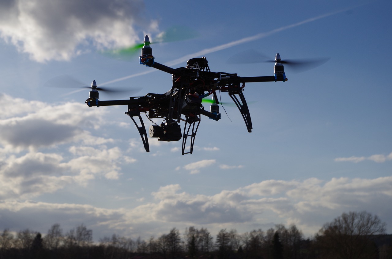
Drones have come a long way since their inception. Initially, they were basic remote-controlled devices, limited in functionality and range. However, their evolution has been nothing short of remarkable. Today's drones are equipped with cutting-edge technologies, including high-resolution cameras, thermal imaging, and advanced sensors. This leap in technology has significantly enhanced their reconnaissance capabilities. For instance, modern drones can fly higher, cover larger areas, and collect data more accurately than ever before. The transformation from simple toys to sophisticated reconnaissance tools is akin to watching a caterpillar become a butterfly—it's a stunning metamorphosis that has opened up a world of possibilities.
One of the most compelling reasons for the widespread adoption of drones in reconnaissance missions is their numerous advantages. First and foremost, they are cost-effective. Traditional reconnaissance methods often involve expensive aircraft and extensive manpower, but drones can achieve similar results at a fraction of the cost. Additionally, drones enable real-time data collection, providing immediate insights that can be critical in fast-paced situations. They also have the ability to access hard-to-reach areas, making them indispensable in scenarios where human access is limited or dangerous.
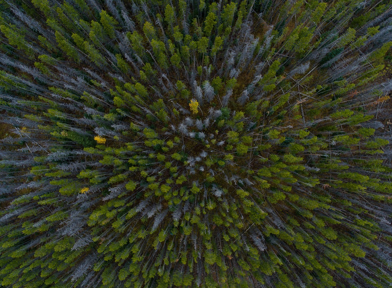
The integration of high-resolution cameras and advanced sensors on drones has revolutionized surveillance capabilities. Unlike traditional methods that may struggle to capture detailed imagery, drones can provide crisp, clear visuals that reveal intricate details of the landscape below. This level of detail is invaluable for various applications, from military operations to environmental monitoring. With drones, operators can gather intelligence that was previously out of reach, allowing for more informed decision-making.
One of the standout features of modern drones is their ability to utilize thermal imaging technology. This capability allows drones to detect heat signatures, making them essential for a variety of missions. For example, during search and rescue operations, drones equipped with thermal cameras can locate missing persons in challenging environments, such as dense forests or disaster-stricken areas. Similarly, they are used in wildlife monitoring to track animals without disturbing their natural habitats. The ability to see in the dark and through obstructions is like having superhuman vision, enabling operators to identify potential threats and opportunities that would otherwise remain hidden.
Another game-changing feature of drones is their real-time data transmission capabilities. This technology allows operators to receive and analyze data instantaneously, facilitating quick decision-making. Imagine being on a reconnaissance mission and receiving live updates about enemy movements or environmental changes. This immediacy can be the difference between success and failure, particularly in high-stakes situations. The ability to adapt and respond swiftly to changing circumstances is one of the key advantages that drones bring to reconnaissance missions.
In military operations, drones have become indispensable for intelligence gathering, target acquisition, and battlefield surveillance. They significantly improve operational efficiency while reducing risks to personnel. By deploying drones, military forces can monitor vast areas without putting soldiers in harm's way. Furthermore, the data collected by drones can be analyzed to create comprehensive situational awareness, allowing commanders to make informed decisions on the battlefield. This shift in strategy is akin to having a bird’s-eye view of the entire battlefield, providing insights that were previously unattainable.
When disaster strikes, time is of the essence. Drones have emerged as vital tools in disaster response efforts, offering aerial assessments of affected areas and assisting in search and rescue operations. Their ability to quickly survey damage and gather critical information can save lives and resources during emergencies. Imagine a hurricane devastating a community; drones can provide real-time images of the destruction, helping responders prioritize their efforts and allocate resources efficiently.
Using drones for mapping and damage assessment allows responders to quickly evaluate the extent of destruction. This rapid assessment is crucial for planning effective recovery strategies. Drones can create detailed maps that highlight damaged infrastructure, enabling teams to focus on the most critical areas first. The efficiency and accuracy of drone mapping are game-changers in disaster response, ensuring that help reaches those who need it most.
Drones also enhance coordination with ground teams by providing real-time situational awareness. During critical disaster scenarios, having a clear picture of the situation is vital for effective rescue efforts. Drones can relay information back to command centers, ensuring that ground teams are well-informed and can act swiftly. This seamless communication is akin to having a well-oiled machine, where each part works together to achieve a common goal.
The future of drone technology in reconnaissance missions looks incredibly promising. With advancements in artificial intelligence, automation, and battery life, the capabilities and applications of drones are expected to expand even further. Imagine drones that can autonomously navigate complex environments, analyze data on the fly, and even make decisions based on pre-set parameters. The potential for drones in reconnaissance is limitless, and as technology continues to evolve, we can expect to see even more innovative uses for these remarkable machines.
- What types of drones are used for reconnaissance?
There are various types of drones used for reconnaissance, including fixed-wing drones for long-range missions and quadcopters for short-range, detailed surveys.
- Are drones safe to use in military operations?
Yes, drones enhance safety by allowing surveillance and intelligence gathering without putting personnel in direct danger.
- How do drones assist in disaster response?
Drones provide aerial views of disaster-stricken areas, enabling quicker assessments and more efficient resource allocation.
- What is the future of drone technology?
Future advancements may include improved AI capabilities, longer battery life, and greater autonomy in navigating complex environments.
The Evolution of Drones in Reconnaissance
Drones have come a long way since their inception, evolving from rudimentary remote-controlled devices into sophisticated aerial platforms that are transforming the landscape of reconnaissance missions. Initially, these flying machines were primarily used for leisure or basic surveillance, but as technology advanced, so did their applications. Today, drones are equipped with cutting-edge sensors, high-resolution cameras, and advanced software, allowing them to perform complex tasks with remarkable precision.
Let's take a moment to appreciate the journey of drones in reconnaissance. In the early days, drones were often seen as toys or simple gadgets. However, as military needs grew, so did the investment in drone technology. The military was one of the first sectors to harness the potential of drones, utilizing them for intelligence gathering and surveillance missions. This shift marked a turning point, showcasing how drones could provide critical information without putting human lives at risk.
As we moved into the 21st century, several key advancements contributed to the evolution of drones:
- Miniaturization of Components: The reduction in size and weight of electronic components has allowed for the creation of smaller, more agile drones.
- Improved Battery Technology: Enhanced battery life means drones can stay airborne longer, covering more ground during reconnaissance missions.
- Integration of AI: Artificial intelligence is now being used to analyze data collected by drones in real-time, making them smarter and more efficient.
- Advanced Navigation Systems: GPS and other navigation technologies have improved the accuracy of drone flights, allowing for precise positioning during operations.
These advancements have not only increased the operational capabilities of drones but also expanded their applications beyond the military. Today, drones are used in various fields, such as disaster response, environmental monitoring, and even agriculture. For instance, in disaster scenarios, drones can quickly assess damage, providing a bird's-eye view that helps responders make informed decisions. In agriculture, they can monitor crop health from above, allowing farmers to optimize their yields.
Moreover, the affordability of drones has made them accessible to a wider audience, including researchers and small businesses. This democratization of technology means that even those without military budgets can leverage drones for reconnaissance, opening up a world of possibilities. As we continue to innovate, the potential applications for drones seem limitless.
In summary, the evolution of drones in reconnaissance has been nothing short of revolutionary. From their humble beginnings to their current status as essential tools across various sectors, drones have proven their worth time and again. As technology continues to advance, we can only imagine what the future holds for these remarkable machines.
- What are the main uses of drones in reconnaissance? Drones are primarily used for surveillance, intelligence gathering, damage assessment, and search and rescue operations.
- How do drones collect data? Drones collect data using high-resolution cameras, thermal imaging sensors, and various other technologies that allow them to capture detailed imagery and information.
- Are drones safe to use? When operated within regulations and guidelines, drones can be safe. However, safety depends on the operator's skill and adherence to local laws.
- What is the future of drones in reconnaissance? The future looks promising with advancements in AI, automation, and battery technology, which will enhance their capabilities and applications.

Advantages of Using Drones
Drones have rapidly emerged as game-changers in reconnaissance missions, and their advantages are nothing short of remarkable. One of the most significant benefits is their cost-effectiveness. Traditional reconnaissance methods often involve extensive manpower, expensive aircraft, and lengthy deployment times. In contrast, drones can be deployed quickly and at a fraction of the cost, making them an attractive option for both military and civilian applications.
Moreover, drones excel in real-time data collection. Imagine being able to gather crucial information as events unfold, rather than waiting for hours or even days to analyze data collected from ground teams or manned aircraft. Drones equipped with advanced sensors and cameras can capture high-definition images and videos, allowing operators to make informed decisions on the spot. This capability is particularly vital in dynamic environments where conditions can change rapidly.
Another significant advantage is their ability to access hard-to-reach areas. Consider the challenges faced during search and rescue operations in rugged terrains or disaster-stricken regions. Drones can effortlessly navigate these obstacles, providing aerial views that would be impossible to obtain otherwise. They can fly over mountains, dense forests, or flooded areas, delivering critical insights that can save lives.
Additionally, the integration of enhanced surveillance capabilities has transformed how reconnaissance is conducted. Drones equipped with high-resolution cameras and various sensors can monitor vast areas with precision. For instance, during military operations, these aerial platforms can gather intelligence on enemy movements, track supply routes, and assess battlefield conditions without putting personnel at risk. This level of detail is often unattainable with traditional reconnaissance methods.
One of the standout features of modern drones is their ability to utilize thermal imaging technology. This technology allows drones to detect heat signatures, making them invaluable for various applications. In search and rescue missions, for example, drones can locate missing persons in dense forests or during nighttime operations by identifying their body heat. Similarly, thermal imaging is crucial for wildlife monitoring, enabling conservationists to track animal movements without disturbing their natural habitats.
Another remarkable feature of drones is their real-time data transmission capabilities. Equipped with advanced communication systems, drones can relay information back to operators instantly. This feature is particularly beneficial during reconnaissance missions, where timely data can influence critical decisions. For instance, military commanders can adjust strategies based on live feeds from drones, ensuring they remain one step ahead of the enemy.
In summary, the advantages of using drones in reconnaissance missions are profound. Their cost-effectiveness, real-time data collection, and ability to access challenging areas make them essential tools in various sectors. As technology continues to advance, we can only expect these benefits to grow, further solidifying drones' place in the future of reconnaissance.
- What types of drones are used for reconnaissance?
There are various types of drones used for reconnaissance, including fixed-wing drones for long-range missions and quadcopters for short-range, detailed surveillance.
- How do drones improve data collection?
Drones collect data in real-time using high-resolution cameras and sensors, enabling immediate analysis and quicker decision-making.
- Are drones safe for military operations?
Yes, drones significantly reduce risks to personnel by conducting surveillance and gathering intelligence without putting soldiers in harm's way.
- Can drones be used in disaster response?
Absolutely! Drones provide aerial assessments, assist in search and rescue operations, and help responders prioritize resources effectively.

Enhanced Surveillance Capabilities
Drones have truly transformed the landscape of surveillance, providing capabilities that were once the stuff of science fiction. Imagine soaring high above a landscape, capturing detailed imagery and data in real-time, all without putting a single person in harm's way. This is the reality of modern reconnaissance, where drones equipped with advanced technology have become indispensable. With high-resolution cameras and sophisticated sensors, these aerial platforms can gather information that traditional methods often miss. For instance, while a satellite may offer a broad view of an area, a drone can zoom in to capture intricate details, such as the condition of infrastructure or the movement of individuals in a specific location.
One of the most exciting aspects of drone surveillance is the integration of thermal imaging technology. This allows drones to detect heat signatures, making them invaluable for various applications, including:
- Search and Rescue: Locating missing persons in challenging terrains.
- Wildlife Monitoring: Tracking animal movements without disturbing their natural habitat.
- Security Operations: Identifying potential threats in urban environments.
Furthermore, the ability to transmit data in real-time is a game changer. Imagine being able to analyze live footage as events unfold, allowing for immediate decision-making. This capability is especially crucial in high-stakes environments where conditions can change rapidly. For example, during a military operation, having instant access to aerial reconnaissance can significantly enhance situational awareness, enabling commanders to adapt their strategies on the fly.
To illustrate the impact of drones on surveillance, consider the following table highlighting the differences between traditional surveillance methods and drone technology:
| Aspect | Traditional Methods | Drone Technology |
|---|---|---|
| Cost | High operational costs | Cost-effective, lower maintenance |
| Accessibility | Limited to accessible areas | Can reach difficult terrains |
| Data Collection Speed | Time-consuming | Real-time data collection |
| Risk to Personnel | High risk | No risk to human life |
In conclusion, the offered by drones are revolutionizing how we gather and analyze information. They provide a level of detail and immediacy that is unmatched by traditional methods, making them an essential tool in various fields, from military operations to environmental monitoring. As technology continues to advance, we can only expect these capabilities to improve, further solidifying drones as the future of reconnaissance.
- What are the main advantages of using drones for surveillance?
Drones provide cost-effectiveness, real-time data collection, and the ability to access hard-to-reach areas, reducing risks to personnel. - How does thermal imaging work in drones?
Thermal imaging technology detects heat signatures, allowing drones to identify living beings or hot spots in various environments. - Can drones be used in emergency situations?
Yes, drones are increasingly used in disaster response to assess damage and assist in search and rescue operations. - What is the future of drone technology in reconnaissance?
Future advancements are expected in AI, automation, and battery life, enhancing their capabilities across various sectors.
Thermal Imaging Technology
In the realm of reconnaissance, has emerged as a game-changer, transforming how we perceive and respond to various situations. Imagine being able to see in complete darkness or through dense foliage; that’s the magic of thermal imaging! By detecting heat signatures emitted by objects, these advanced systems provide a unique perspective that traditional cameras simply cannot offer. This capability is especially vital in scenarios such as search and rescue operations, where every second counts and visibility is often compromised.
One of the most compelling aspects of thermal imaging is its versatility. It finds applications not just in military operations but also in civilian sectors, including wildlife monitoring and environmental assessments. For instance, wildlife conservationists use drones equipped with thermal cameras to track animal movements without disturbing their natural habitats. This non-invasive approach allows for effective monitoring of endangered species, providing crucial data that can inform conservation strategies.
Furthermore, the integration of thermal imaging technology with drones enhances their operational efficiency. In emergency situations, such as a building fire or natural disaster, drones can quickly survey large areas to identify hotspots or locate trapped individuals. The ability to transmit this data in real-time allows first responders to make informed decisions rapidly, ultimately saving lives. Here’s a quick overview of how thermal imaging technology enhances various operations:
| Application | Benefits |
|---|---|
| Search and Rescue | Identifies heat signatures of individuals in distress, even in low visibility conditions. |
| Wildlife Monitoring | Tracks animal movements without disturbing their habitat, providing vital conservation data. |
| Firefighting | Locates hotspots in burning structures, allowing firefighters to target efforts effectively. |
| Infrastructure Inspection | Detects heat anomalies in buildings and machinery, preventing potential hazards. |
As we look to the future, the continuous advancement of thermal imaging technology is expected to further enhance its capabilities. Innovations such as improved resolution, longer battery life, and integration with artificial intelligence will create even more opportunities for effective reconnaissance. The potential applications seem limitless, and as we harness these advancements, the effectiveness of drones in reconnaissance missions will only grow stronger.
- What is thermal imaging technology?
Thermal imaging technology detects heat emitted by objects, allowing users to visualize temperature variations in the environment. - How do drones use thermal imaging?
Drones equipped with thermal cameras can capture real-time images based on heat signatures, which is useful in various applications like search and rescue, wildlife monitoring, and infrastructure inspection. - Can thermal imaging see through walls?
No, thermal imaging cannot see through solid walls, but it can detect heat emanating from objects inside, providing insights into what might be occurring behind those walls. - What are the limitations of thermal imaging?
Thermal imaging can be affected by environmental conditions such as heavy rain, fog, or snow, which may obscure heat signatures. Additionally, it may not provide detailed visual information like traditional cameras.
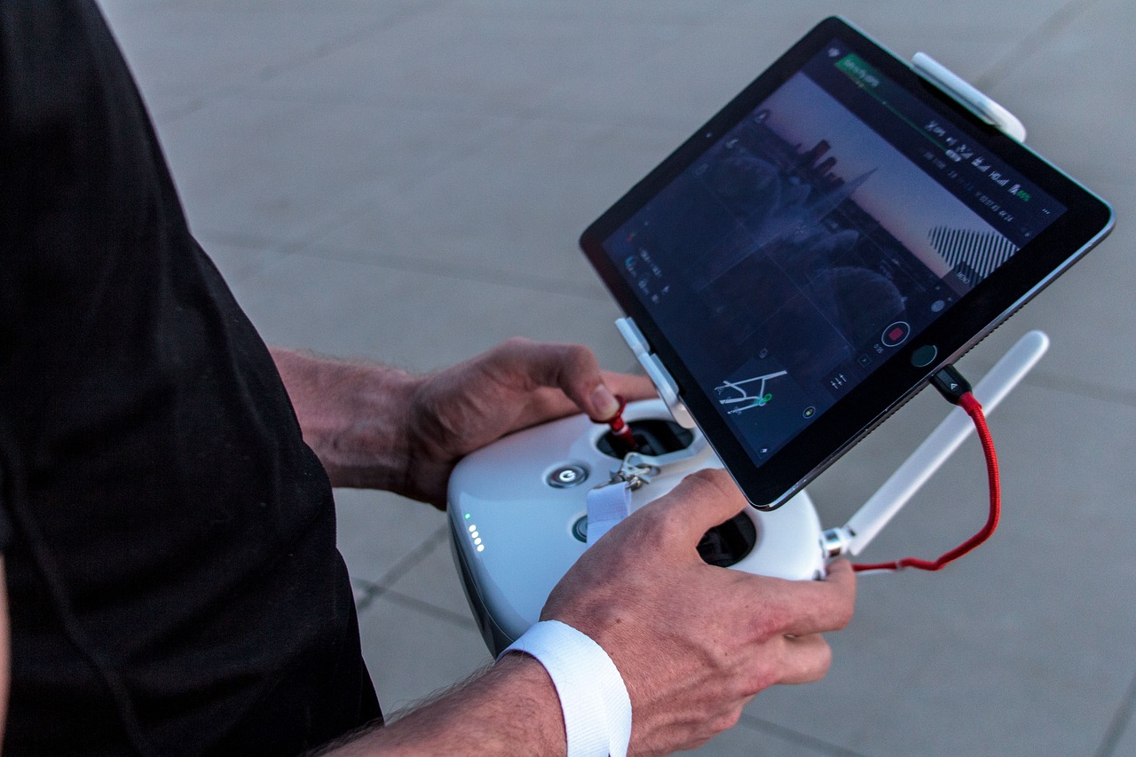
Real-Time Data Transmission
In the realm of reconnaissance missions, the ability to transmit data in real-time has become a game-changer. Imagine being in a situation where every second counts, and you need to make critical decisions based on the most current information available. This is where comes into play, allowing operators to receive live feeds from drones equipped with advanced communication technologies.
With the integration of high-speed communication systems, drones can send back high-resolution images and video footage instantaneously. This capability is not just a luxury; it’s a necessity. For instance, during military operations, commanders can monitor battlefield activities as they unfold, enabling them to adapt strategies on the fly. Similarly, in disaster response scenarios, real-time data can provide crucial insights into the evolving situation, helping teams prioritize their efforts effectively.
Let's take a closer look at how real-time data transmission enhances reconnaissance:
- Immediate Analysis: Operators can analyze data as it comes in, allowing for quick decision-making that can save lives and resources.
- Improved Coordination: Real-time feeds assist in synchronizing efforts between aerial and ground teams, ensuring everyone is on the same page.
- Enhanced Situational Awareness: The ability to see what’s happening live helps in assessing threats and opportunities more accurately.
Moreover, the technology behind real-time data transmission is continuously evolving. Innovations such as 5G networks and satellite communication are paving the way for even faster and more reliable connections. These advancements not only improve the quality of the data being transmitted but also expand the operational range of drones, allowing them to function effectively in remote areas where traditional communication methods may fail.
As we look to the future, the implications of real-time data transmission in reconnaissance missions are profound. It’s not just about collecting data; it’s about transforming that data into actionable intelligence at lightning speed. This capability could redefine how we approach surveillance, disaster response, and military operations, making drones not just tools, but vital partners in ensuring safety and efficiency in various fields.
- What is real-time data transmission in drones? Real-time data transmission refers to the ability of drones to send live video and data feeds back to operators, allowing for immediate analysis and decision-making.
- How does real-time data benefit military operations? It enhances situational awareness, enables quick adjustments to strategies, and improves coordination between aerial and ground units.
- Can drones operate in remote areas with real-time data transmission? Yes, advancements in communication technologies, such as satellite communications, allow drones to transmit data effectively even in isolated locations.
- What are the future trends in drone data transmission? Future trends include the integration of 5G technology, which promises faster data speeds and improved connectivity for drones in various environments.

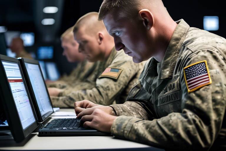
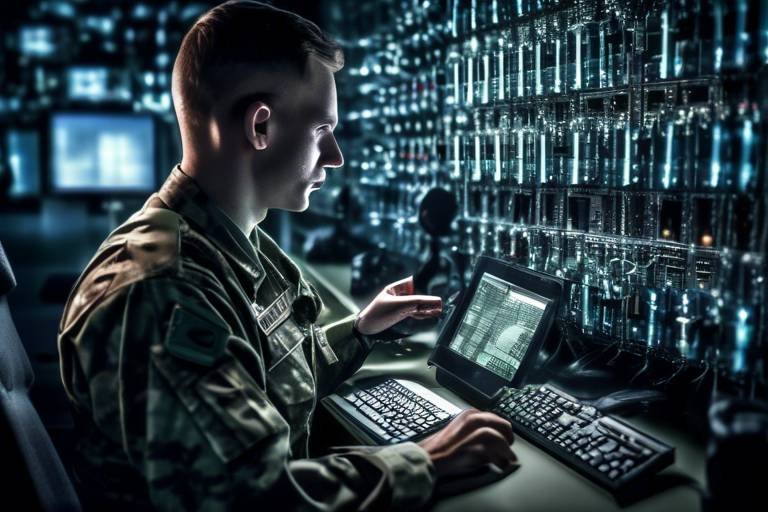
Applications in Military Operations
Drones have become indispensable in modern military operations, transforming the way armed forces gather intelligence, conduct surveillance, and execute missions. Their ability to fly at various altitudes and navigate challenging terrains makes them a game-changer on the battlefield. Imagine having the ability to gather critical information without putting personnel in harm's way—this is the reality that drones offer today.
One of the primary applications of drones in military operations is intelligence gathering. They are equipped with advanced sensors and cameras that can capture high-resolution images and videos, allowing military strategists to assess enemy positions and movements accurately. This real-time data collection enables commanders to make informed decisions swiftly, which is crucial in fast-paced combat scenarios.
Additionally, drones play a vital role in target acquisition. By providing precise coordinates and detailed imagery of potential targets, drones help military forces plan their strikes with remarkable accuracy. This capability not only enhances operational efficiency but also minimizes collateral damage, which is a significant concern in modern warfare.
Furthermore, drones are extensively used for battlefield surveillance. They can monitor troop movements, supply routes, and other critical areas without the need for human presence on the ground. This capability is especially valuable in hostile environments where traditional reconnaissance methods may be too risky. By utilizing drones, military forces can maintain a tactical advantage, keeping eyes on the battlefield while ensuring the safety of their personnel.
To illustrate the various applications of drones in military operations, consider the following table:
| Application | Description |
|---|---|
| Intelligence Gathering | Collecting real-time data on enemy positions and movements. |
| Target Acquisition | Identifying and locating targets with high precision. |
| Battlefield Surveillance | Monitoring troop movements and strategic areas without risking personnel. |
| Reconnaissance Missions | Conducting missions to gather information in hostile environments. |
Moreover, the integration of AI technology into drones is paving the way for even more advanced military applications. With AI, drones can analyze data on-the-fly, identifying patterns and potential threats faster than human operators. This capability allows for proactive measures rather than reactive responses, significantly enhancing the operational effectiveness of military forces.
In conclusion, the applications of drones in military operations are vast and varied, offering numerous advantages that traditional methods simply cannot match. As technology continues to evolve, we can expect drones to play an even more prominent role in ensuring the safety and success of military missions around the globe.
- How do drones enhance military intelligence? Drones provide real-time data collection, allowing for accurate assessments of enemy positions and movements.
- What are the benefits of using drones for target acquisition? Drones can provide precise coordinates and detailed imagery, which helps in planning strikes with minimal collateral damage.
- Can drones operate in hostile environments? Yes, drones are designed to navigate challenging terrains and can conduct reconnaissance missions safely without putting personnel at risk.
- What role does AI play in military drones? AI enhances drones' capabilities by enabling them to analyze data quickly and identify threats, improving operational efficiency.
Impact on Disaster Response
Drones have emerged as vital tools in disaster response efforts, transforming the way we assess and manage crises. Imagine a scenario where a natural disaster strikes—like an earthquake or hurricane. Traditional methods of assessing damage can be slow and risky, but with drones, we can achieve rapid aerial assessments that provide crucial information in real-time.
These unmanned aerial vehicles (UAVs) can quickly cover large areas, capturing high-resolution images that reveal the extent of destruction. For instance, after a major disaster, responders can deploy drones equipped with cameras to gather visual data, allowing them to prioritize their efforts effectively. This capability not only saves time but also ensures that resources are allocated where they are most needed, ultimately saving lives.
One of the standout features of drones is their ability to operate in hazardous environments where it may be unsafe for human responders to go. They can fly into areas that are hard to reach, such as collapsed buildings or flooded regions, providing vital information without putting personnel at risk. This is particularly important during emergencies when every second counts. The integration of thermal imaging technology further enhances their utility, allowing for the detection of heat signatures, which can be crucial in locating survivors trapped under rubble or in remote areas.
Moreover, drones facilitate better coordination with ground teams. By providing real-time situational awareness, they ensure that rescue efforts are efficient and informed. For example, while ground teams are working to rescue individuals, drones can continuously monitor the situation from above, relaying critical information about changing conditions, such as rising floodwaters or aftershocks. This synergy between air and ground operations creates a more effective response strategy.
To illustrate the impact of drones on disaster response, consider the following table that highlights key advantages:
| Advantage | Description |
|---|---|
| Rapid Assessment | Drones provide quick aerial views of affected areas, allowing for immediate evaluation of damage. |
| Access to Hazardous Areas | They can reach locations that are unsafe for human responders, ensuring comprehensive data collection. |
| Real-Time Data Sharing | Drones transmit data live, enabling quick decision-making and resource allocation. |
| Enhanced Coordination | They improve communication between aerial and ground teams, streamlining rescue operations. |
As we look to the future, the role of drones in disaster response will only continue to grow. With advancements in technology, including improved battery life and more sophisticated sensors, we can expect drones to become even more integral in our efforts to respond to disasters swiftly and effectively. The combination of speed, safety, and efficiency makes drones an indispensable asset in our arsenal against emergencies.
- How do drones help in disaster response? Drones provide rapid aerial assessments, access to hazardous areas, and real-time data sharing, which enhances coordination and efficiency during emergencies.
- What types of technology do drones use for disaster response? Drones utilize high-resolution cameras, thermal imaging, and real-time data transmission systems to gather and relay critical information.
- Are drones safe to use in disaster zones? Yes, drones can operate in hazardous environments without putting human responders at risk, making them a safe option for assessing damage.
- Can drones be used for search and rescue operations? Absolutely! Drones are equipped to locate survivors by detecting heat signatures and providing situational awareness to ground teams.
Mapping and Damage Assessment
When disaster strikes, timely and accurate information becomes the lifeline for effective response efforts. Drones have emerged as game-changers in this arena, especially for mapping and damage assessment. Imagine a bird’s-eye view of a disaster zone, capturing real-time data that can be transformed into actionable insights. This capability not only accelerates the assessment process but also enhances the overall efficiency of rescue operations.
One of the most significant advantages of using drones for mapping is their ability to cover vast areas in a fraction of the time it would take ground teams. Equipped with high-resolution cameras and advanced sensors, drones can generate detailed aerial maps that provide critical information about the extent of damage. For instance, after a hurricane, drones can fly over affected neighborhoods, capturing images that reveal which buildings are standing, which are damaged, and where the most severe destruction has occurred.
Furthermore, the data collected by drones can be processed using Geographic Information Systems (GIS) to create 3D models of the affected areas. This not only helps in visualizing the damage but also aids in planning recovery strategies. For example, responders can prioritize areas that need immediate attention based on the severity of the damage depicted in these maps. This systematic approach ensures that resources are allocated effectively, ultimately saving more lives.
Additionally, drones can facilitate real-time mapping during ongoing disasters. By continuously flying over the area and updating maps, they provide up-to-date information that can be crucial for decision-making. This is particularly important in scenarios like wildfires, where conditions can change rapidly. The ability to monitor the fire's spread in real-time allows responders to adapt their strategies quickly and efficiently.
To illustrate the impact of drone technology on mapping and damage assessment, consider the following table that summarizes the key benefits:
| Benefits | Description |
|---|---|
| Speed | Drones can cover large areas quickly, providing timely data for assessments. |
| Accuracy | High-resolution imagery allows for detailed analysis of damage. |
| Real-Time Updates | Continuous mapping provides up-to-date information during ongoing disasters. |
| Resource Allocation | Helps prioritize areas for rescue and recovery efforts based on damage severity. |
In conclusion, the integration of drone technology into mapping and damage assessment is not just a trend; it's a revolution. By providing fast, accurate, and actionable data, drones have become indispensable tools for emergency responders. As technology continues to advance, we can expect even greater enhancements in the capabilities of drones, leading to more efficient disaster response efforts in the future.
- How do drones assist in damage assessment?
Drones provide aerial imagery and data that help responders evaluate the extent of damage quickly and accurately. - What technology do drones use for mapping?
Drones are equipped with high-resolution cameras, GPS, and sensors that allow them to create detailed maps and 3D models of affected areas. - Can drones operate in adverse weather conditions?
While most drones have limitations in extreme weather, advancements are being made to improve their resilience and operational capabilities. - Are drones used only in disaster scenarios?
No, drones are also used in various sectors for monitoring, surveying, and reconnaissance beyond disaster response.
Coordination with Ground Teams
When it comes to disaster response, the synergy between drones and ground teams is nothing short of revolutionary. Imagine a scenario where a natural disaster strikes—a hurricane, earthquake, or wildfire. The chaos is palpable, and every second counts. In such critical situations, drones serve as the eyes in the sky, providing real-time data that can be a game changer for ground teams working tirelessly to save lives and restore order.
Drones equipped with advanced sensors and cameras can quickly gather aerial footage of the affected areas, delivering crucial information that ground teams need to make informed decisions. This capability allows responders to assess damage and identify hazards, such as downed power lines or unstable structures, which might not be visible from the ground. With this data, teams can prioritize their efforts, ensuring that resources are allocated where they are most needed.
Furthermore, the integration of real-time data transmission enhances communication between aerial and ground units. Imagine a drone flying over a devastated neighborhood, sending live video feeds back to command centers. This information can be relayed to ground teams, allowing them to adjust their strategies on the fly. For instance, if a drone identifies a group of people stranded on a roof, ground teams can be dispatched immediately to provide assistance, significantly reducing response times.
Moreover, the use of drones fosters better coordination among various rescue teams. During large-scale disasters, multiple agencies often work together, from local fire departments to national guard units. Drones can serve as a common platform for sharing information, ensuring that all teams are on the same page. This not only streamlines operations but also minimizes the risk of duplicated efforts, which can waste precious resources. For example, a drone can provide a comprehensive overview of the area, allowing different teams to plan their routes and strategies more effectively.
In addition to improving situational awareness, drones can also assist in logistical planning. By mapping out affected areas, they help ground teams understand the landscape, including obstacles and safe pathways. This is especially important in urban environments where debris may block roads or create hazards. With detailed aerial maps, teams can navigate more efficiently, reducing the time it takes to reach those in need.
As technology continues to advance, the role of drones in coordinating with ground teams will only grow. Innovations like AI-driven analytics will allow drones to not only capture data but also analyze it on the spot, providing actionable insights in real-time. This means that drones won't just be passive observers; they'll become active participants in the decision-making process, further enhancing the efficacy of rescue missions.
In conclusion, the coordination between drones and ground teams is a vital component of modern disaster response. By leveraging the unique strengths of both aerial and terrestrial units, responders can operate more efficiently, save more lives, and ultimately bring order to chaos. As we look to the future, the continued evolution of drone technology promises to enhance this collaboration even further, making our response to emergencies faster and more effective than ever before.
- How do drones improve communication during disaster response?
Drones provide real-time data and imagery that can be shared instantly with ground teams, enhancing situational awareness and coordination. - Can drones operate in adverse weather conditions?
While many drones are designed to withstand some weather challenges, extreme conditions like heavy rain or strong winds can limit their effectiveness. - What types of sensors are commonly used in drones for reconnaissance?
Drones often use high-resolution cameras, thermal imaging sensors, and LiDAR technology to gather detailed information about the environment. - Are drones used in civilian disaster response as well?
Yes, drones are increasingly being adopted by civilian organizations, NGOs, and government agencies for various types of disaster response and recovery efforts.
Future Trends in Drone Technology
The future of drone technology is not just bright; it's practically glowing with potential! As we look ahead, we can expect remarkable advancements that will redefine how drones are utilized in reconnaissance missions. From the integration of artificial intelligence (AI) to improvements in battery technology, the capabilities of drones are set to expand exponentially. Imagine drones that can autonomously navigate complex environments or analyze data on the fly, making them not just tools but intelligent assistants in the field.
One of the most exciting trends is the development of AI-driven analytics. Drones equipped with AI can process vast amounts of data in real-time, identifying patterns and anomalies that might go unnoticed by human operators. This capability is particularly beneficial in military operations where split-second decisions can make all the difference. For instance, AI can help in target recognition, distinguishing between friend and foe with high accuracy, thus reducing the risk of collateral damage.
Another trend that is gaining traction is the enhancement of battery life and energy efficiency. Current drones often face limitations due to their flight time, but innovations in battery technology are paving the way for longer missions. Imagine a drone that can stay airborne for hours, covering more ground and gathering more data without needing to land for a recharge. This advancement will be crucial not only in military applications but also in humanitarian efforts, where time is often of the essence.
Furthermore, the integration of swarm technology is on the horizon. This concept involves multiple drones working together to achieve a common goal, much like a flock of birds or a school of fish. By collaborating, these drones can cover larger areas, gather more data, and provide a comprehensive overview of a situation. This is particularly useful in disaster response scenarios, where a swarm of drones can quickly assess damage and coordinate with ground teams to optimize rescue operations.
Moreover, the advent of 5G technology will revolutionize drone communication. With faster data transmission rates and lower latency, drones will be able to send and receive information almost instantaneously. This will enhance real-time decision-making capabilities, allowing operators to respond to changing situations on the ground with unprecedented speed. Imagine a drone that can relay live video feeds and sensor data to a command center, enabling commanders to make informed decisions in the heat of the moment.
As we embrace these advancements, it's essential to consider the implications for regulatory frameworks and ethical guidelines. With great power comes great responsibility, and as drones become more capable, we must ensure that their use is governed by principles that prioritize safety and privacy. Stakeholders, including governments, industries, and communities, need to collaborate to create a balanced approach that fosters innovation while addressing concerns.
In summary, the future of drone technology in reconnaissance missions is poised for an exciting transformation. With AI, improved battery life, swarm technology, and 5G connectivity leading the charge, drones will become even more indispensable in various sectors. The sky is literally the limit!
- What are the main advantages of using drones in reconnaissance?
Drones offer cost-effectiveness, real-time data collection, and access to hard-to-reach areas, making them invaluable for both military and civilian applications. - How does AI enhance drone capabilities?
AI allows drones to analyze data in real-time, improving target recognition and situational awareness, thus enhancing operational efficiency. - What is swarm technology in drones?
Swarm technology involves multiple drones working together to cover larger areas and gather more data, improving the effectiveness of reconnaissance missions. - How will 5G technology impact drone operations?
5G will enable faster data transmission and lower latency, enhancing real-time communication and decision-making capabilities for drone operators.
Frequently Asked Questions
- What are the main advantages of using drones for reconnaissance?
Drones offer a range of advantages, including cost-effectiveness, the ability to gather real-time data, and access to hard-to-reach areas. This makes them invaluable for both military and civilian applications, allowing for more efficient and safer reconnaissance missions.
- How do drones enhance surveillance capabilities?
With high-resolution cameras and advanced sensors, drones can capture detailed imagery and information that traditional reconnaissance methods may miss. This enhanced surveillance capability allows for better situational awareness and informed decision-making.
- What role does thermal imaging play in drone reconnaissance?
Thermal imaging technology enables drones to detect heat signatures, which is crucial for various applications such as search and rescue missions, wildlife monitoring, and identifying potential threats. This capability allows operators to see in low visibility conditions, making drones even more effective.
- How do drones assist in disaster response efforts?
Drones provide aerial assessments of disaster-affected areas, facilitating quick mapping and damage evaluation. This helps responders prioritize resources and plan recovery strategies effectively, ultimately saving lives and resources during emergencies.
- What future trends can we expect in drone technology for reconnaissance?
The future of drone technology looks bright, with advancements in artificial intelligence, automation, and battery life expected to enhance their capabilities. These innovations will likely expand the applications of drones across various sectors, improving efficiency and effectiveness in reconnaissance missions.