How Satellites Monitor Geopolitical Hotspots
The world we live in is a complex tapestry of nations, cultures, and political agendas, and at the center of this intricate web are geopolitical hotspots. These are the regions where tensions run high, conflicts brew, and the stakes are incredibly significant. But how do we keep tabs on these volatile areas? Enter satellites, the unsung heroes of modern intelligence gathering. With their advanced technology, satellites provide a bird's-eye view of the world, allowing us to monitor everything from military movements to environmental changes that could influence political stability.
Imagine being able to see the ground from hundreds of miles up in space. That's precisely what satellites do! They use a variety of sensors and imaging techniques to capture data that can be analyzed for military, humanitarian, and environmental insights. The functionality of these satellites extends beyond mere observation; they serve as critical tools for governments, NGOs, and international organizations striving to maintain peace and security. The ability to gather real-time information is not just a luxury; it’s a necessity in today’s fast-paced world where every second counts.
Satellites come in different shapes and sizes, equipped with various technologies tailored for specific tasks. Some are designed for Earth observation, while others may focus on communications or weather monitoring. The data collected can range from high-resolution images that reveal troop deployments to infrared scans that detect heat signatures, providing a comprehensive understanding of what's happening on the ground. For instance, the use of synthetic aperture radar (SAR) allows for the monitoring of changes in the landscape, which can indicate military activity or even the aftermath of natural disasters.
In essence, satellites have revolutionized the way we perceive and respond to geopolitical events. They not only help in tracking conflicts but also play a significant role in understanding environmental changes that can lead to political unrest. For example, droughts or floods can exacerbate existing tensions over resources, making satellite data invaluable for predicting and mitigating potential crises. As we delve deeper into the specifics of how satellites monitor these hotspots, we’ll uncover the profound implications of their findings on global security and diplomacy.
Understanding the technology that powers satellite surveillance is crucial. This section delves into the various types of satellites, sensors, and imaging techniques used to gather data on geopolitical activities.
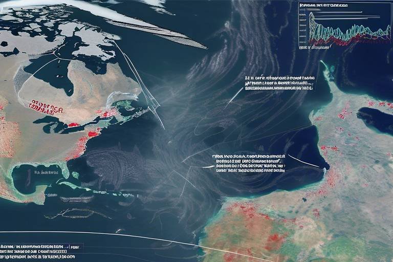
This section highlights specific geopolitical hotspots around the world that are closely monitored by satellites, examining the reasons for their significance and the insights gained from satellite data.
Conflict zones are among the most scrutinized areas. Here, we discuss how satellites track military movements, humanitarian crises, and ceasefire violations in regions experiencing conflict.
An in-depth look at how satellite imagery has provided crucial information regarding the ongoing conflict in Syria, revealing troop movements and the impact on civilian infrastructure.
This subheading examines the use of satellites in monitoring the Ukraine conflict, focusing on troop deployments and the effectiveness of international sanctions through satellite data.
Satellites also monitor environmental changes that can affect geopolitical stability. This section covers how climate change and natural disasters influence political tensions and resource distribution.
The advantages of using satellites for monitoring geopolitical hotspots are numerous. This section outlines the benefits, including real-time data, enhanced accuracy, and the ability to cover vast areas.
Real-time data collection is a game-changer in geopolitics. This subsection discusses how timely information helps governments and organizations make informed decisions regarding international relations and security.
The implications of satellite monitoring for national security are profound. Here, we explore how satellite data influences defense strategies and international diplomacy, shaping the global political landscape.
- How do satellites gather data? Satellites use various sensors and imaging techniques, including optical, radar, and infrared technologies, to collect data from the Earth's surface.
- What are the key benefits of satellite monitoring? The key benefits include real-time data collection, enhanced accuracy, and the ability to monitor vast areas, which is crucial for timely decision-making.
- Can satellites monitor environmental changes? Yes, satellites play a vital role in monitoring environmental changes, such as climate change and natural disasters, which can significantly impact geopolitical stability.
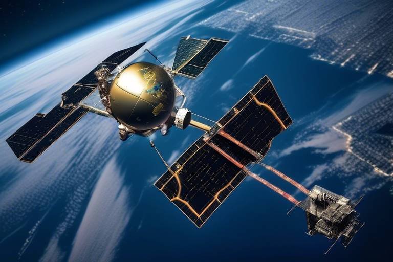
The Technology Behind Satellite Surveillance
Understanding the technology that powers satellite surveillance is crucial for grasping how we monitor geopolitical hotspots around the globe. At the heart of this technology lies a diverse array of satellites, each equipped with specialized sensors and imaging techniques that gather data on various geopolitical activities. These satellites can be broadly categorized into two main types: geostationary satellites and polar-orbiting satellites. Geostationary satellites maintain a fixed position relative to the Earth, allowing them to continuously monitor the same area, which is particularly useful for tracking weather patterns and large-scale events. On the other hand, polar-orbiting satellites travel in a north-south orbit, providing comprehensive coverage of the entire planet over time.
One of the standout features of satellite technology is the range of sensors they carry. These include optical sensors that capture high-resolution images, radar sensors that can see through clouds and darkness, and infrared sensors that detect heat signatures. Each type of sensor serves a unique purpose and is crucial for gathering detailed information. For instance, optical sensors are fantastic for visual surveillance, while radar sensors excel in conditions where visibility is poor. This multifaceted approach ensures that we can collect data under various circumstances, providing a clearer picture of what’s happening on the ground.
Moreover, the imaging techniques employed by these satellites are continually evolving. Advances in machine learning and artificial intelligence have enhanced our ability to analyze satellite data rapidly and accurately. By employing algorithms that can detect patterns and anomalies, analysts can quickly identify significant changes in geopolitical hotspots, such as troop movements or changes in infrastructure. This technological synergy not only increases the efficiency of data analysis but also allows for real-time monitoring, which is invaluable in today’s fast-paced geopolitical landscape.
To illustrate the impact of this technology, consider the following table that summarizes the different types of satellites and their primary functions:
| Type of Satellite | Orbit Type | Primary Function |
|---|---|---|
| Geostationary Satellites | Fixed Position | Weather Monitoring, Communication |
| Polar-Orbiting Satellites | North-South Orbit | Earth Observation, Environmental Monitoring |
| Reconnaissance Satellites | Varied | Military Surveillance, Intelligence Gathering |
In conclusion, the technology behind satellite surveillance is a complex and fascinating interplay of various types of satellites, advanced sensors, and sophisticated imaging techniques. As we continue to refine these technologies, our ability to monitor geopolitical hotspots will only improve, providing critical insights that can influence global security and diplomacy.
Key Geopolitical Hotspots Monitored
The world is a complex tapestry of political dynamics, and certain areas are like hot coals, glowing with tension and potential conflict. These geopolitical hotspots are critical for global stability, and satellites play a pivotal role in monitoring them. By observing these regions from above, we gain invaluable insights into the activities and movements that shape international relations.
Some of the most closely monitored hotspots include regions like the Middle East, Eastern Europe, and the South China Sea. Each of these areas has its own unique set of challenges and tensions, making them focal points for international diplomacy and security strategies. For instance, in the Middle East, the ongoing conflicts and shifting alliances create a volatile environment that requires constant surveillance. Similarly, the South China Sea is a hotspot due to territorial disputes and the strategic importance of maritime routes.
Let’s take a closer look at a few of these key areas:
- Middle East: This region has been a long-standing conflict zone, with countries like Syria and Iraq experiencing significant turmoil. Satellite imagery provides crucial data on troop movements, refugee flows, and humanitarian crises.
- Eastern Europe: The situation in Ukraine has drawn the eyes of the world. Satellite monitoring helps in understanding military deployments and the effectiveness of sanctions imposed on Russia.
- South China Sea: With multiple nations claiming parts of this body of water, satellites help track naval movements and monitor for any potential conflicts over these vital trade routes.
By observing these hotspots, satellites not only provide real-time data but also help in predicting potential escalations. The information gathered can influence diplomatic negotiations and aid in crisis management. For example, if a country is observed amassing troops near a border, it can trigger immediate diplomatic discussions to de-escalate tensions before they boil over into conflict.
Moreover, the insights gained from satellite data are not just limited to military movements. They also encompass social and environmental factors that can lead to instability. For instance, satellite imagery can reveal changes in agricultural land use or natural disasters that may exacerbate existing tensions in a region. Understanding these factors is crucial for policymakers who aim to address the root causes of conflict rather than just the symptoms.
In summary, the monitoring of geopolitical hotspots by satellites offers a comprehensive view of the complex interplay of factors that can lead to conflict. By leveraging advanced technologies, we can better understand the dynamics at play and work towards fostering peace and stability in these critical areas.
Conflict Zones
Conflict zones are among the most scrutinized areas across the globe, and for good reason. These regions are often fraught with tension, violence, and humanitarian crises that demand immediate attention. Satellites play a crucial role in monitoring these hotspots, providing a bird's-eye view of military movements, refugee flows, and even ceasefire violations. Imagine being able to see a battlefield from space; that’s the kind of insight satellites offer. They can capture images and data that help analysts understand the dynamics on the ground, which is essential for timely and effective responses by governments and international organizations.
One of the primary functions of satellite technology in conflict zones is the tracking of military assets. For instance, high-resolution imagery can reveal troop concentrations, equipment deployments, and supply routes. This information is invaluable not only for military strategists but also for humanitarian organizations working to deliver aid. By knowing where the fighting is occurring, these organizations can navigate safely and effectively to deliver much-needed resources. Furthermore, satellites can monitor changes over time, allowing observers to identify trends that might indicate an escalation or de-escalation of conflict.
In addition to military movements, satellites can also provide insights into the humanitarian impact of conflicts. For example, they can track the displacement of populations, revealing how many people have fled their homes due to violence. This data is critical for planning humanitarian responses. It can help organizations allocate resources where they are most needed and ensure that aid reaches those who are suffering the most. The ability to visualize these changes from space adds a layer of urgency to international responses, making it harder for the world to ignore the plight of those affected.
To illustrate the power of satellite imagery in conflict zones, consider the following table that summarizes key capabilities:
| Capability | Description |
|---|---|
| Troop Movement Tracking | Identifies and monitors the movements of military forces in real-time. |
| Humanitarian Impact Assessment | Measures the impact of conflict on civilian populations and infrastructure. |
| Ceasefire Violation Detection | Detects and reports any breaches of ceasefire agreements through visual evidence. |
In summary, satellites are not just tools for military surveillance; they are essential for understanding the broader implications of conflict. They provide a comprehensive view of the situation on the ground, enabling informed decision-making that can save lives and promote peace. As we move forward, the role of satellite technology in monitoring conflict zones will undoubtedly become even more critical, especially as geopolitical tensions continue to rise globally.
- How do satellites collect data in conflict zones? Satellites use various imaging techniques, including optical and radar imaging, to gather data. This data is then analyzed to track movements and changes in the environment.
- What types of satellites are used for monitoring? Both governmental and commercial satellites are used, with some specifically designed for military purposes while others are employed for humanitarian efforts.
- Can satellite data be accessed by the public? Yes, some satellite imagery is available to the public, while other data may be restricted due to national security concerns.
Case Study: Syria
The Syrian conflict has been one of the most complex and devastating crises of the 21st century, and satellite imagery has played a pivotal role in shedding light on the situation. With multiple factions vying for control, the landscape of Syria has been constantly changing, making it essential to monitor military movements and humanitarian conditions from above. Satellite technology provides a unique vantage point, offering insights that ground-level reports might miss.
One of the most significant aspects of satellite monitoring in Syria is its ability to track military movements. Advanced imaging techniques, such as synthetic aperture radar (SAR) and multi-spectral imaging, allow analysts to detect troop concentrations, equipment deployments, and even the establishment of makeshift bases. For instance, satellites can capture images of convoys moving through the desert or identify the construction of fortifications, providing invaluable data for both military strategists and humanitarian organizations.
Moreover, satellite imagery has been instrumental in documenting the impact of the conflict on civilian infrastructure. By comparing images over time, analysts can assess the extent of damage to hospitals, schools, and residential areas. This information is crucial not only for understanding the humanitarian crisis but also for planning reconstruction efforts once peace is restored. For example, a recent analysis revealed that over 50% of hospitals in Aleppo had been rendered inoperable due to bombardments, a statistic that highlights the dire need for humanitarian assistance.
Another critical aspect of satellite monitoring in Syria is its role in identifying ceasefire violations. During negotiations, parties often agree to temporary truces, but satellite data can reveal whether these agreements are being honored. By monitoring troop movements and weapon deployments, satellites can provide real-time evidence of violations, which can then be used by international bodies to hold parties accountable. This transparency is essential for building trust among negotiating factions and ensuring that ceasefires are respected.
In addition to military and humanitarian insights, satellites also help in assessing the environmental impact of the conflict. The destruction caused by bombings and the displacement of populations have led to significant changes in land use and agricultural practices. Satellite data can track deforestation, soil degradation, and water resource depletion, all of which have long-term implications for stability in the region. Understanding these environmental changes is vital, as they can exacerbate existing tensions and lead to further conflict over scarce resources.
In conclusion, satellite monitoring has become an indispensable tool in analyzing the multifaceted crisis in Syria. By providing a comprehensive view of military activities, humanitarian conditions, and environmental changes, satellites offer critical insights that shape both national and international responses to the conflict. As technology continues to advance, the potential for satellite imagery to influence peacekeeping efforts and humanitarian aid will only grow, underscoring the importance of this tool in modern geopolitics.
- How do satellites collect data on conflict zones? Satellites use various imaging techniques, including optical and radar technologies, to capture detailed images of the ground, allowing analysts to monitor changes over time.
- What is the significance of real-time satellite data? Real-time data enables governments and organizations to make informed decisions quickly, which is crucial during rapidly evolving situations like conflicts or natural disasters.
- Can satellite imagery help in humanitarian efforts? Yes, satellite imagery provides essential information about the conditions on the ground, helping humanitarian organizations assess needs and coordinate aid effectively.
- How has satellite technology improved over the years? Advances in technology have led to higher resolution images, faster data processing, and improved analytical tools, enhancing the effectiveness of satellite monitoring.
Case Study: Ukraine
The ongoing conflict in Ukraine has captured global attention, not just for its geopolitical ramifications but also for the innovative ways technology, particularly satellite imagery, has been utilized to monitor the situation. Since the onset of hostilities in 2014, satellites have become indispensable tools for understanding troop movements, assessing damage, and evaluating the effectiveness of international sanctions. Imagine a bird's-eye view that can capture the unfolding drama of conflict—this is precisely what satellites provide, offering a perspective that ground-based intelligence often cannot match.
One of the primary applications of satellite surveillance in Ukraine has been tracking military deployments. High-resolution imaging satellites, such as those operated by companies like Maxar Technologies, have provided critical insights into the locations of military units, supply lines, and even the construction of fortifications. These images allow analysts to assess not only the scale of military presence but also shifts in strategy that might signal impending operations. For instance, when troop concentrations near the border began to swell, satellite imagery offered early warnings that prompted diplomatic discussions and military readiness adjustments among NATO allies.
Additionally, satellite data has been crucial in monitoring the impact of international sanctions imposed on Russia. By observing changes in industrial activity and the movement of goods, analysts can gauge whether these sanctions are effectively constraining the Russian economy. For example, satellite imagery has revealed alterations in shipping patterns and industrial output, providing a clearer picture of how sanctions are influencing the conflict's dynamics. This method of analysis not only aids in assessing the current situation but also helps predict future developments based on economic trends.
Moreover, the humanitarian aspect of the conflict cannot be overlooked. Satellite imagery has played a pivotal role in assessing damage to civilian infrastructure, such as housing, schools, and hospitals. By utilizing before-and-after images, organizations like the United Nations can evaluate the extent of destruction and prioritize aid efforts. This capability is particularly vital in regions where ground access is limited or unsafe, allowing humanitarian agencies to strategize their interventions effectively.
To summarize, the role of satellites in the Ukrainian conflict exemplifies how technology can enhance our understanding of geopolitical tensions. With real-time data and high-resolution imagery, stakeholders—from governments to NGOs—can make informed decisions that might influence the course of international relations. As the situation continues to evolve, satellite monitoring will undoubtedly remain a cornerstone of geopolitical analysis.
- How do satellites capture images of conflict zones? Satellites use advanced imaging technology, including synthetic aperture radar (SAR) and optical sensors, to capture detailed images of the Earth's surface, even in challenging conditions.
- What are the limitations of satellite monitoring? While satellites provide valuable data, they can be limited by weather conditions, satellite resolution, and the ability to interpret complex imagery accurately.
- Can satellite data be used for humanitarian efforts? Absolutely! Satellite imagery is crucial for assessing damage and planning humanitarian aid in conflict-affected areas.
- How do governments use satellite data in diplomacy? Governments utilize satellite data to inform their diplomatic strategies, assess threats, and monitor compliance with international agreements.
Environmental Changes and Geopolitics
In today's world, the intricate dance between environmental changes and geopolitical stability has never been more apparent. As we witness the impacts of climate change, natural disasters, and resource scarcity, it's crucial to understand how these factors can ignite tensions between nations. Imagine a world where rising sea levels threaten coastal cities, or where droughts lead to agricultural failures—these scenarios are not just hypothetical; they are becoming our reality. The role of satellites in monitoring these environmental shifts is pivotal, providing critical data that informs international relations and security strategies.
Satellites equipped with advanced sensors can capture real-time images of changing landscapes, allowing analysts to track deforestation, desertification, and the melting of polar ice caps. This data is essential for understanding how these environmental changes can lead to geopolitical strife. For instance, as water sources dwindle in regions like the Middle East, nations may compete for access to remaining resources, potentially leading to conflict. The ability of satellites to monitor these changes helps governments anticipate crises before they escalate.
Moreover, the implications of environmental changes extend beyond mere resource competition. They can also exacerbate existing political tensions. When natural disasters strike—think of hurricanes, floods, or wildfires—countries often face the challenge of humanitarian crises that require international assistance. In these moments, satellite imagery is invaluable, providing insights into the scale of damage and the needs of affected populations. This data not only aids in disaster response but also shapes diplomatic relations as nations come together (or clash) to provide aid.
Consider the case of the Sahel region in Africa, where environmental degradation has led to increased migration and conflict. As farmers are forced to leave their land due to desertification, they often migrate to urban areas or across borders, leading to tensions with local populations. Satellites help monitor these migration patterns, allowing governments and organizations to understand the scale of the issue and respond accordingly. The data collected can inform policies aimed at mitigating conflict and promoting stability in the region.
In summary, the intersection of environmental changes and geopolitics is a complex web that requires careful navigation. Satellites serve as our eyes in the sky, providing crucial information that can help prevent conflicts and foster cooperation among nations. As we continue to grapple with these pressing issues, the role of satellite technology will only grow in importance, guiding us toward a more stable and secure future.
- How do satellites monitor environmental changes? Satellites use advanced sensors and imaging techniques to capture data on land use, weather patterns, and natural disasters.
- What is the impact of climate change on geopolitics? Climate change can lead to resource scarcity, increased migration, and heightened tensions between nations, all of which can destabilize regions.
- Can satellite data help prevent conflicts? Yes, by providing real-time information on environmental changes and humanitarian crises, satellite data can inform policies that promote stability and cooperation.
Benefits of Satellite Monitoring
When it comes to keeping tabs on our ever-changing world, satellite monitoring is like having a bird's-eye view that offers unparalleled insights. The benefits of using satellites extend far beyond just observing the Earth; they play a critical role in national security, humanitarian efforts, and environmental conservation. Imagine being able to see the movements of troops across borders or monitor the aftermath of a natural disaster in real time. This capability not only enhances our understanding of geopolitical dynamics but also equips decision-makers with the information they need to act swiftly and effectively.
One of the most significant advantages of satellite monitoring is the ability to gather real-time data. In a world where time is often of the essence, having access to immediate information can be a game-changer. For instance, during a conflict, timely satellite imagery can reveal shifts in troop positions or the emergence of humanitarian crises, allowing governments and NGOs to respond promptly. This real-time capability is crucial for maintaining national security and diplomatic relations, as it enables countries to stay one step ahead of potential threats.
Moreover, the accuracy of satellite data is a vital component in its effectiveness. Modern satellites are equipped with advanced sensors and imaging technologies that can capture high-resolution images, providing detailed insights into specific areas of interest. This level of precision means that analysts can discern even minor changes in landscapes or military deployments, leading to better-informed decisions. For example, satellites can track changes in infrastructure, such as the construction of military bases or the destruction of civilian facilities, which are critical for understanding the broader implications of a conflict.
| Benefit | Description |
|---|---|
| Real-Time Data | Immediate access to information for timely decision-making. |
| High Accuracy | Detailed, high-resolution images for precise analysis. |
| Wide Coverage | Ability to monitor vast areas, including remote locations. |
| Cost-Effectiveness | Reduces the need for on-ground intelligence operations. |
Another remarkable benefit is the ability to cover vast areas. Satellites can monitor regions that are difficult to access due to geographical or political barriers. This wide coverage means that even remote conflict zones or disaster-stricken areas can be observed without the risks associated with ground-level reconnaissance. Think of it as having an all-seeing eye that can provide crucial information from the comfort of a control room thousands of miles away.
Lastly, satellite monitoring is also cost-effective. Traditional intelligence-gathering methods, such as deploying troops or sending in reconnaissance teams, can be incredibly expensive and risky. Satellites offer a safer and more economical alternative, allowing nations to allocate their resources more efficiently while still maintaining a robust understanding of global events.
In summary, the benefits of satellite monitoring are vast and varied, making it an indispensable tool in the realm of geopolitics. From providing real-time data to ensuring high accuracy and extensive coverage, satellites empower governments and organizations to make informed decisions that can shape the future of international relations and security.
- How do satellites collect data? Satellites collect data using various sensors and imaging techniques, including optical and radar technologies.
- What are the main uses of satellite monitoring? Satellite monitoring is used for military surveillance, disaster response, environmental tracking, and resource management.
- Can satellite images be used in court? Yes, satellite imagery can serve as evidence in legal cases, particularly in disputes involving land use and environmental damage.
Real-Time Data Collection
The advent of through satellite technology has revolutionized the way we monitor geopolitical hotspots. Imagine being able to witness events unfold from thousands of miles away, as if you were peering through a window into another world. This capability is not just a technological marvel; it’s a vital tool for governments, NGOs, and international organizations striving to maintain global peace and security. With satellites orbiting our planet, we can collect data instantaneously, allowing for swift responses to emerging crises.
One of the most compelling aspects of real-time monitoring is its ability to provide timely information that can influence decision-making processes. For instance, during conflicts, knowing the exact location of troop movements can mean the difference between escalation and de-escalation. Satellite imagery can reveal not just the presence of military units but also the logistics behind their movements, such as supply routes and equipment concentrations. This level of detail is invaluable for strategists and policymakers who need to act quickly and effectively.
Moreover, the data collected is not limited to military activities. Humanitarian organizations also benefit immensely from real-time satellite information. In disaster-stricken areas, satellites can provide crucial insights into the extent of damage, the needs of affected populations, and the best routes for delivering aid. This is particularly important in remote regions where traditional means of communication may be disrupted.
To illustrate the impact of real-time data collection, consider the following table that highlights some key applications:
| Application | Description | Impact |
|---|---|---|
| Military Surveillance | Monitoring troop movements and military installations | Informs defense strategies and diplomatic negotiations |
| Disaster Response | Assessing damage and identifying affected areas | Enhances efficiency of humanitarian aid delivery |
| Environmental Monitoring | Tracking changes in climate and natural resources | Informs policy decisions regarding resource management |
The implications of real-time data collection extend beyond immediate responses. It shapes long-term strategies and policies. For example, by monitoring environmental changes, nations can better prepare for the geopolitical ramifications of climate change. This foresight is crucial in a world where resource scarcity can lead to conflict. By leveraging satellite data, countries can engage in proactive diplomacy and resource management, fostering cooperation instead of confrontation.
In conclusion, real-time data collection through satellites is not just a technological advancement; it’s a critical component of modern geopolitics. It empowers nations and organizations to respond swiftly to crises, make informed decisions, and ultimately shape a more stable world. As we continue to innovate and improve satellite technologies, the potential for positive impact on global security and diplomacy will only grow.
- How do satellites collect real-time data? Satellites use advanced sensors and imaging technologies to capture images and data about the Earth's surface and atmosphere.
- What types of information can satellites provide? Satellites can provide a wide range of information, including military movements, environmental changes, and disaster assessments.
- How does real-time data collection influence international relations? Timely data allows nations to make informed decisions, potentially preventing conflicts and facilitating diplomatic negotiations.
- What are the limitations of satellite monitoring? While satellites provide valuable data, they may not capture every detail on the ground, and interpretation of the data requires expertise.
Implications for National Security
The implications of satellite monitoring for national security are profound and far-reaching. In a world where geopolitical tensions can escalate rapidly, the ability to gather and analyze data from above has become a critical asset for nations. Imagine being able to see the chessboard from a bird's eye view; that's essentially what satellites provide. They allow governments to monitor troop movements, assess threats, and make informed decisions that can prevent conflicts before they escalate.
One of the most significant advantages of satellite data is its real-time nature. This immediacy means that countries can respond to emerging threats almost as soon as they arise. For instance, if a nation observes unusual military activity on its borders through satellite imagery, it can mobilize its forces or engage in diplomatic talks before tensions boil over. This proactive approach is essential in maintaining stability and ensuring national security.
Moreover, satellite monitoring plays a crucial role in understanding the strategic intentions of other nations. By analyzing patterns in military deployments, countries can gauge whether a neighbor is preparing for war or simply conducting routine exercises. This knowledge not only helps in formulating defense strategies but also aids in diplomatic negotiations. After all, having the upper hand in information can be a game-changer in international relations.
Additionally, satellite data can aid in counterterrorism efforts. By monitoring known hotspots and gathering intelligence on potential threats, nations can thwart terrorist activities before they occur. For example, satellites can track movements in regions known for terrorist training camps, providing vital information that can lead to preemptive actions. This capability enhances a nation's security apparatus and helps protect its citizens.
Furthermore, the implications of satellite monitoring extend beyond military applications. They also encompass environmental security. Climate change poses a significant risk to national security, as it can lead to resource scarcity, forced migrations, and increased competition for dwindling supplies. Satellites can monitor changes in land use, water levels, and even deforestation, offering insights that can help governments prepare for and mitigate the impacts of environmental crises.
In summary, the implications of satellite monitoring for national security are extensive. From real-time data collection that aids in swift decision-making to enhancing counterterrorism efforts and addressing environmental challenges, satellites have become indispensable tools in the modern geopolitical landscape. As technology continues to advance, the role of satellites in shaping national security strategies will only grow, making them a vital component in the quest for global stability.
- How do satellites gather data for national security?
Satellites use advanced imaging techniques and sensors to capture high-resolution images and monitor various activities on Earth, providing critical information for national security assessments. - What types of satellites are used for monitoring?
There are several types of satellites, including reconnaissance satellites, weather satellites, and communication satellites, each serving specific roles in national security. - Can satellite data predict future conflicts?
While satellite data cannot predict conflicts with certainty, it can provide insights into troop movements and other indicators that suggest rising tensions. - How does satellite monitoring impact international diplomacy?
By providing transparent data, satellite monitoring can build trust among nations, facilitate dialogue, and help prevent misunderstandings that could lead to conflict.
Frequently Asked Questions
- What types of satellites are used for monitoring geopolitical hotspots?
Satellites used for monitoring geopolitical hotspots include Earth observation satellites, communication satellites, and reconnaissance satellites. Each type is equipped with advanced sensors and imaging technologies that allow them to collect critical data on military activities, environmental changes, and humanitarian situations.
- How do satellites gather real-time data?
Satellites gather real-time data through a combination of high-resolution imaging, radar technology, and remote sensing. These technologies enable satellites to capture images and monitor movements on the ground, providing timely updates that are crucial for decision-making in international relations.
- What are some key geopolitical hotspots monitored by satellites?
Some key geopolitical hotspots include regions like Syria, Ukraine, and areas affected by climate change such as the Arctic. Satellites help track military movements, humanitarian crises, and environmental changes that can escalate tensions between nations.
- What role do satellites play in conflict zones?
In conflict zones, satellites play a pivotal role by monitoring military movements, identifying humanitarian crises, and documenting ceasefire violations. This information is vital for international organizations and governments to respond quickly and effectively to evolving situations.
- How does satellite monitoring impact national security?
Satellite monitoring significantly impacts national security by providing accurate intelligence that informs defense strategies and diplomatic efforts. The data collected helps governments assess threats, allocate resources, and engage in informed discussions with other nations.
- Can satellite data influence international diplomacy?
Absolutely! Satellite data can serve as a powerful tool in international diplomacy by offering objective evidence of actions taken by nations. This transparency can help build trust or justify sanctions and other diplomatic measures, shaping the global political landscape.
- What are the benefits of using satellites for monitoring?
The benefits of satellite monitoring include real-time data collection, enhanced accuracy, and the ability to cover vast areas. This comprehensive view allows for better analysis and understanding of complex geopolitical issues, leading to more effective responses.
- How do satellites help in monitoring environmental changes?
Satellites monitor environmental changes by tracking climate patterns, natural disasters, and resource distribution. This information is crucial as environmental factors can exacerbate political tensions and influence migration patterns, making satellite data invaluable for assessing geopolitical stability.